Castell de Rià: A Medieval Fortress in Catalonia, France


Visitor Information
Google Rating: 4.6
Popularity: Very Low
Google Maps: View on Google Maps
Country: France
Civilization: Unclassified
Remains: Military

History
The Castell de Rià is a medieval fortress located in the village of Rià, within the municipality of Ria-Sirach in modern-day France. Built by the Catalan civilization, this castle was part of the County of Cerdanya and belonged to the network of comital fortifications in the region known historically as Conflent.
The village of Rià has been known since at least the year 855, and its early existence was closely tied to the Abbey of Saint-Michel de Cuixà, which exercised religious and administrative influence over the area. The castle itself first enters written records in 1194 when King Alfonso I entrusted it to the abbey. At that time, the fortress was recognized primarily as a place of refuge for local residents during times of conflict, indicating its importance in regional defense.
Local legend adds an earlier layer to the castle’s history by associating it with Guifré el Pilós, a notable Catalan nobleman traditionally believed to have been born there around 840. While this story lacks contemporary documentary proof, it suggests the castle’s presence predates its formal mention by several centuries.
In the 14th century, the Castell de Rià played a role in the regional power struggles of the period, serving as a stronghold for supporters of James III of Mallorca during the dynastic conflicts that affected the area. The castle endured a siege in 1344, employing the siege warfare methods common at the time. Two years later, King Peter III regained control of the fortress and restored its ownership to the Abbey of Cuixà, reaffirming its ecclesiastical ties.
The castle saw renewed military use in the 16th century when infantry troops under Charles V were stationed there in 1526. This occupation was accompanied by efforts to repair and maintain the fortress, integrating it briefly into the broader imperial military system.
In the 17th century, during the Reapers’ War—a conflict affecting Catalonia and surrounding territories—the Castell de Rià became a focal point of political resistance against French authority. It was central to the Vilafranca Conspiracy, a plot opposing French rule in Northern Catalonia. This political stance likely led to its ordered demolition in 1672 by Marshal Vauban, a military engineer serving King Louis XIV of France. The rector Feliu Beringer recorded the destruction of the castle on May 16 of that year, marking the end of its active military and administrative functions.
Since then, the castle has remained in ruins but has attracted archaeological interest. Investigations conducted primarily in 1988, 1990, and 1992 have helped clarify its historical phases and importance, and a specialized commission supported by regional and local cultural bodies continues preservation work.
Remains
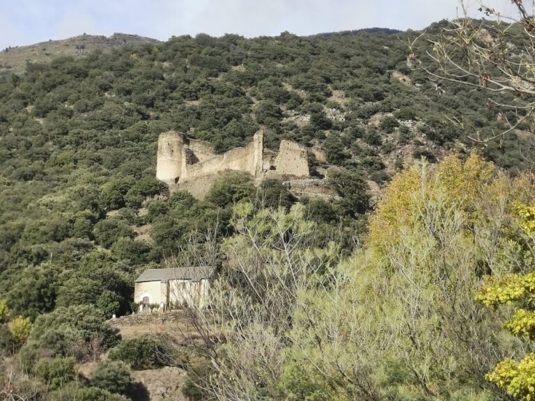
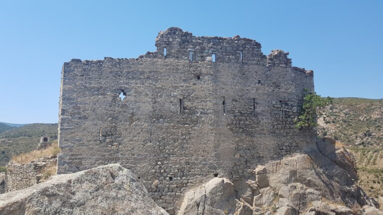
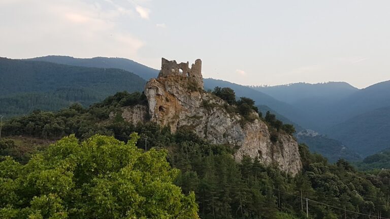
The Castell de Rià occupies a rocky spur overlooking the village, a naturally defensible position enhanced by the terrain. Its layout shows a roughly rectangular main structure, almost square, measuring around 18 by 16 meters. The castle’s walls at the base are notably thick, reaching about 2.1 meters, with upper sections tapering to roughly 1.35 meters. Inside, a partition wall approximately 0.7 meters thick divides the eastern sector, revealing the castle’s internal spatial organization.
Natural rock formations protect the northern, eastern, and southern sides of the castle, while an artificial moat was constructed to secure the western approach, demonstrating strategic adaptation to the landscape. Among the structural features, an oval-shaped opening marks the mouth of a cistern within the castle, indicating arrangements for water storage vital during sieges or times of isolation.
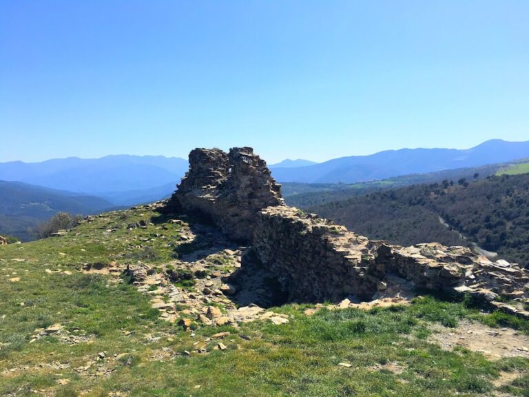
The northern wall remains the most intact part of the fortress, standing up to 3 meters in height. Built from small, roughly shaped pieces of slate or schist bound with mortar, parts of this wall display rows of herringbone masonry—a technique known as opus spicatum—known for its decorative and reinforcing qualities. A separate fragment of wall at the southwest corner rises about 2.5 meters above the cliff edge and is recognized as a distinct tower rather than part of the main building. This tower is constructed from irregularly placed stones, differing in style from the main structure.
Surrounding the principal building, archaeological excavations uncovered additional walls with irregular masonry and thickness between 60 to 70 centimeters. These outer constructions reach preserved heights of up to 1.5 meters and were added after the initial medieval phase, illustrating the castle’s adaptation over time.
Overall, the primary castle structure dates to the late Early Middle Ages, with these later additions reflecting ongoing occupation and modification through subsequent centuries. The visible remains today are mainly foundational and partial walls, offering insight into the fortress’s original layout and defensive features. Preservation of the site is actively managed by a dedicated commission supported by both regional cultural institutions and the local municipality.
Nearby sites