Xemxija Hill Heritage Walk: A Roman Road and Archaeological Route in Malta
Site at a Glance
- Rating
- 4.6
- Popularity
- Low
- Country
- Malta
- Primary era
- Classical
- Eras represented
- Stone Age, Iron Age, Classical, Early Modern, Modern
- Civilizations
- Carthaginian, Maltese Temple Culture, Phoenician, Roman
- Site type
- Infrastructure
- Remains
- Road
On this page19 sections
History
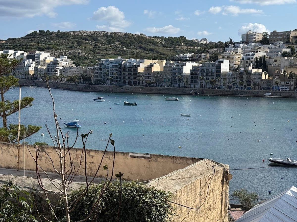
Xemxija Hill Heritage Walk is a historic route in Malta near St Paul’s Bay, built during the period of Roman rule about 2,000 years ago. Also known as the Old Roman Road or the Pilgrims’ Way, it formed part of the island’s wider road network, linking the northern coast with Mdina, Malta’s former capital, and connecting settlements with strategic points. The route later served pilgrims travelling to the Sanctuary of Our Lady of Mellieha, as well as people transporting farm produce and salt.
Earlier settlement and Roman development
Xemxija Hill was occupied before the Roman road was made. Neolithic remains, from the New Stone Age period when farming communities built permanent settlements and monuments, and Punic tombs point to earlier settlement and burial activity. The Punic period was associated with Carthaginian culture in the central and western Mediterranean, and in Malta it is represented especially by rock-cut tombs and other carved-stone features.
One cave connected with the Roman Baths probably began as a Punic burial place around 500 BC. A nearby shaft tomb, also dated to about 500 BC, was probably used by Phoenicians and Carthaginians. The route therefore brought together a Roman transport artery and a landscape that had already been used for burial, settlement, and agriculture.
Pilgrimage and agricultural use
The road became part of the pilgrimage route to the Sanctuary of Our Lady of Mellieha. Travellers etched crosses into the rock, apparently as acts of penance, and some reportedly walked with their feet bound in chains. The route also supported rural work. Its caves were used successively as burial places, dwellings, honey-production areas, fodder stores, and animal shelters. Families and their animals occupied the cave dwellings until the 1930s, while the farmer’s hut and neighbouring caves probably operated together as an agricultural complex.
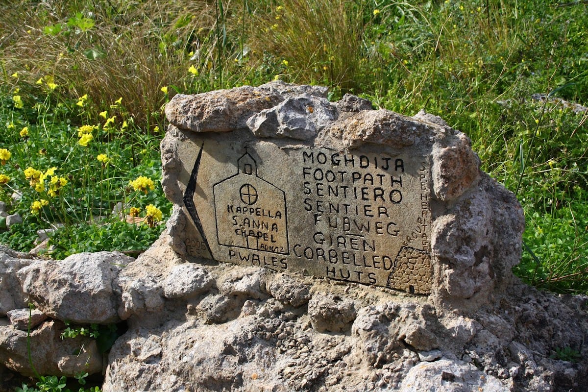
During the seventeenth century, the Roman Baths were probably converted into a farmhouse. Farmers also dismantled part of the Neolithic temple and reused its stones for practical purposes and for other structures, including a nearby corbelled stone hut. Corbelled construction uses successive courses of stone that project inward until they support a roof, generally without mortar or conventional arches.
Later interpretation of the route
The route contains traces from several periods, including prehistoric, Punic, Roman, later agricultural, and World War II activity. A military pillbox added a defensive element during the Second World War. In modern times, the path and its archaeological features were arranged as a heritage walk, with clearance and signs provided by the St Pauls Bay Heritage Group and St Pauls Bay Local Council. Mistra Gate is identified as the final point associated with the route.
Remains
The walk follows a rough, narrow road approximately 3.8 kilometres long. It rises briefly toward the top of Xemxija Hill and then runs mostly level across hills, fields, and areas described as nature-protection zones. Some stretches are formed directly from flattened limestone. More than 20 archaeological and historical points of interest lie along the route, including caves, tombs, apiaries, a Neolithic temple, agricultural structures, Roman installations, cart ruts, and a World War II pillbox.
Caves and agricultural structures
Cave of the Galley
The Cave of the Galley was probably first cut as a tomb and later used as a dwelling. Its doorway carries a carved cross and a galley. These carvings were probably an ex voto, an offering made to fulfil a vow or give thanks for perceived divine help, perhaps connected with a sailor’s or traveller’s rescue.
Apiaries and carob tree
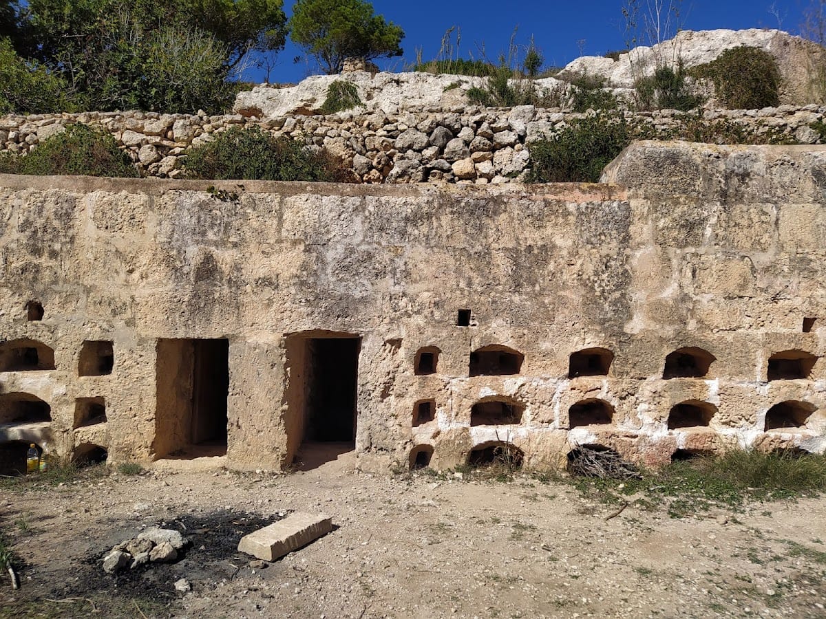
A Punic-Roman apiary has a symmetrical facade and contains terracotta or earthenware pots for collecting honey. It can be viewed from inside by passing behind the facade. Nearby, the Rustic Apiary was built by a local farmer rather than during the Roman period. It retains earthenware honey pots, and flowers from a nearby carob tree supported bees producing dark honey with a carob flavour.
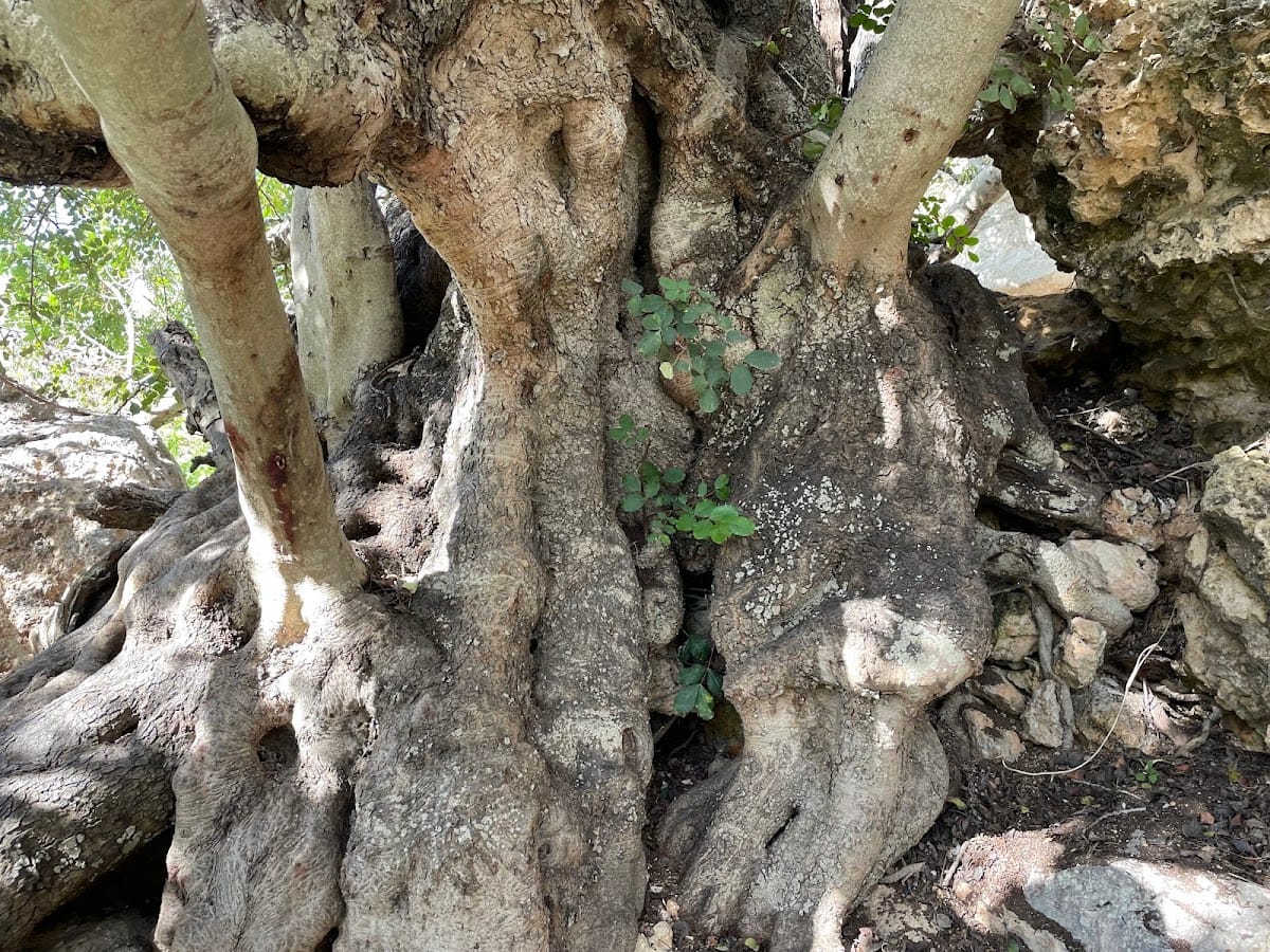
The ancient carob tree beside the burial cave has a trunk circumference of 7.25 metres and is probably about 1,000 years old. A plaque below it carries a poem dedicated by Frans Scerri in March 1989, together with other plaques describing the tree and calling for its protection.
Burial cave and animal pen
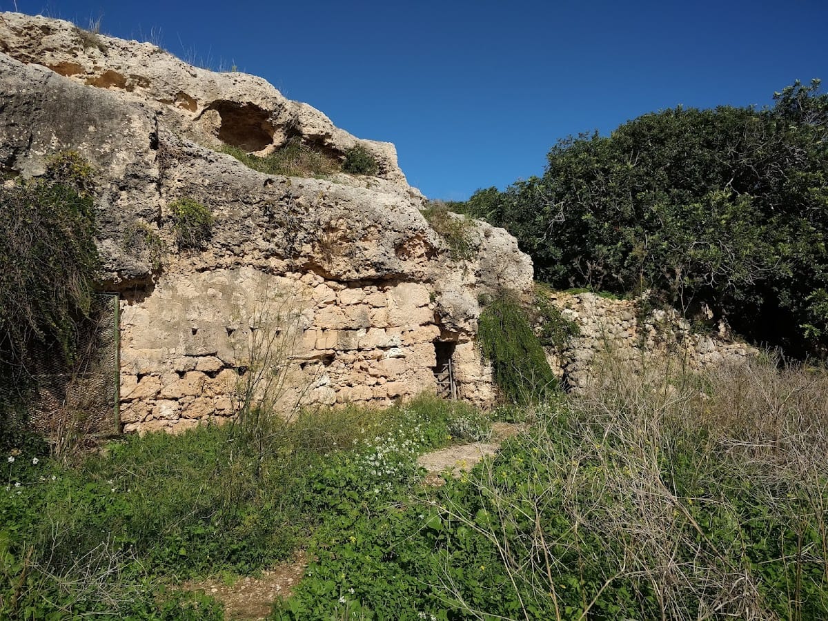
A burial cave lies near the carob tree. Another nearby cave is partly natural and partly cut from the rock. Its large interior was probably used as an animal pen, and its entrance is closed by a rubble wall.
Farmer’s hut and cave dwellings
The roofless farmer’s hut was rebuilt from the original large stones without mortar. It has rubble walls, an external stone bench, a water duct, an alcove, an oil-lamp niche, and an outside staircase. Beside it, the cave dwellings have a corbelled-stone facade and a large interior divided into compartments by additional rubble walls. Channels cut into the rock helped direct rainwater away from the dwellings.
Granary and well
A Roman-period granary silo near the caves was later converted into a well. Additional Neolithic tombs occur in the same area, joining the agricultural remains to earlier prehistoric burial features.
Prehistoric and Punic remains
Neolithic temple
The Neolithic temple survives as a roughly circular arrangement of large stones. It is poorly preserved because many stones were removed by farmers for practical use or for building other structures.
Punic shaft tomb
Several Punic tombs are scattered through the surrounding countryside. The marked Punic shaft tomb is a rock-cut burial chamber reached through a vertical shaft and dates to about 500 BC.
Roman Baths and later farmhouse
The Roman Baths are cut into a cliff face. Their large entrance, window, and broad alcove open into a complex interior divided by rock columns and rubble walls. The rooms include cold, tepid, and hot spaces with pools supplied by springs flowing from the cliffs toward Mistra Valley.
A path beside the baths leads to further rooms cut into the rock whose original purpose is unclear. The cave’s arched doorway was probably added in the seventeenth century, when the complex was converted into a farmhouse. This later alteration remains part of the structure’s present form.
Wartime and transport features
World War II pillbox
A small fortified military pillbox stands near the cart ruts and forms part of the route’s World War II history. The structure remains inaccessible to visitors.
Cart ruts
Near the pillbox, a well-defined pair of parallel grooves is cut into the limestone. The cart ruts may have helped move carts across the Maltese islands, but their abrupt termination, also found at other Maltese cart-rut sites, leaves their construction and purpose unresolved.
Rock-cut channels and pilgrim crosses
At a resting place near the hilltop, pilgrims carved crosses into the rock. Elsewhere along the route, channels cut into the stone were designed to prevent rainwater from entering the cave dwellings, linking the pilgrimage landscape with the practical needs of rural settlement.