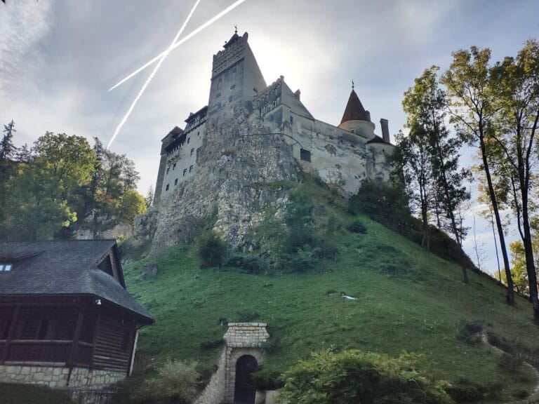
Feldioara Fortress: A Medieval Stronghold in Romania


Visitor Information
Google Rating: 4.7
Popularity: Medium
Google Maps: View on Google Maps
Official Website: primaria-feldioara.ro
Country: Romania
Civilization: Unclassified
Remains: Military
History
Feldioara Fortress is located in the municipality of Feldioara, Romania. It was originally built in the 13th century by the Teutonic Knights, a military order invited to the region by King Andrew II of Hungary.
The fortress’s origins trace back to 1211, when King Andrew II invited the Teutonic Knights to settle in the Burzenland region to protect against incursions by the Cumans, a nomadic people. The knights established their stronghold here, naming it after the Virgin Mary, their patron saint. Initially limited to wooden and earthen defenses, the Teutonic Knights received royal permission in 1222 to construct stone fortifications and towns. Using this authorization, they built Feldioara Fortress as a stone castle, which became the most significant of their five strong castles in the area.
However, expanding their influence beyond Burzenland towards the Land of Brodnici and the Danube raised concerns within the Hungarian crown. In 1225, the Teutonic Knights were expelled from the region. Shortly thereafter, the local Saxon community took over Feldioara, repairing and enlarging the fortress. The construction included rebuilding after the 1241 Mongol invasion, which devastated the original chapel and other structures.
In the following centuries, the fortress endured several destructive events. It was burned by Turkish forces in 1430 and later attacked by Vlad Țepeș in 1457, although the local inhabitants promptly rebuilt it that same year. Additional damage occurred around the time of the Battle of Feldioara, possibly inflicted by the troops of Petru Rareș, a Moldavian ruler. By the era of Sigismund of Luxembourg, the fortress came to serve primarily as a refuge for peasants. The nearby settlement grew around it and was granted city rights, reflecting the fortress’s role in local administration and defense.
Archaeological discoveries have shown that Feldioara’s site was continuously inhabited long before the medieval fortress was built. Finds include Neolithic artifacts, Bronze Age remains, and Roman period objects such as coins and gold ingots dating from the early 5th century AD. These Roman items might have been part of tribute payments linked to migrating groups like the Huns.
Between 2013 and 2017, a comprehensive restoration project led by the Brașov County Council and archaeologist Daniela Marcu-Istrate brought new insights. Excavations during this work uncovered artifacts from different cultural layers, including the Neolithic Cucuteni culture, Geto-Dacian settlements, and medieval periods. After restoration, the fortress opened to the public in 2017 and is now a venue for cultural activities.
Remains
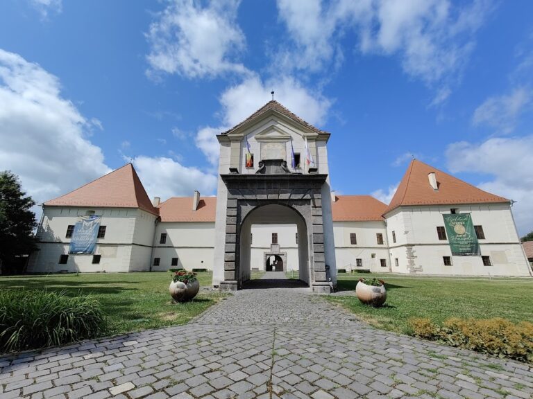
Feldioara Fortress stands on a hill nearly 500 meters above sea level, situated close to the left bank of the Olt River and naturally protected on three sides by the Homorod River. The fortress’s layout consists of two concentric defensive enclosures, built using different construction methods associated with successive phases of building.
The earliest segment, constructed by the Teutonic Knights, features a stone wall at its base formed from large boulders, with smaller stones above held together by fine mortar. This initial fortification contained a Romanesque chapel, a multipurpose “Knight’s House” serving as dining hall, storage, and living quarters, as well as a hospital. These structures were demolished during the Mongol invasion of 1241. The chapel’s remains were later incorporated into the Gothic choir of a Cistercian church built on the same site.
Following the knights’ departure, the local Saxons reshaped the fortress by adapting the enclosure to the oval shape dictated by the hilltop plateau. The fortress’s main entrance faced south. Defensive towers were added along the curtain walls—only the western tower remains largely visible today, with wooden staircases connecting several floors. The eastern tower was notable for its semicylindrical vaulted ceiling, while the southern tower survives only at its base.
The curtain walls reach heights of six to seven meters and display holes designed to hold wooden beams, which once supported the battlement walkways used by defenders. Machicolations, openings in the southern wall for dropping objects or pouring substances on attackers, are also preserved.
A deep well approximately seventy meters deep lies on the western side inside the curtain wall, an essential water source reconstructed during recent restoration efforts. Surrounding the fortress is a Zwinger, a type of outer defensive wall, which has been fully restored along with four principal towers located to the north, south, east, and west.
Restoration work focused on maintaining historical accuracy, employing traditional materials such as hand-made bricks crafted to replicate originals from a local factory, wood, stone, and ceramic roof tiles. A special hydraulic lime mortar was used to repair masonry and plaster, chosen to match the fortress’s historical construction. To differentiate restored sections from original walls, visible wooden elements were integrated into the reconstruction.
Inside the courtyard, the foundations of the chapel and the Cistercian monastery that followed are marked on the ground, allowing visitors to understand the site’s religious significance. The fortress’s current appearance reflects its state in the 17th century, when it displayed a plastered façade.