Ancient Thera: A Dorian and Ptolemaic City in Greece
Site at a Glance
- Rating
- 4.6
- Popularity
- Medium
- Country
- Greece
- Primary era
- Classical
- Eras represented
- Classical, Medieval
- Civilizations
- Ancient Greek, Byzantine, Ptolemaic, Roman
- Site type
- City
On this page23 sections
History
Ancient Thera is an ancient city in Greece, founded by Dorian colonists from Sparta on the steep ridge of Mesa Vouno in Santorini. Archaeological evidence indicates occupation from the ninth century BCE, while tradition associates the settlement’s foundation with the arrival of the colonists in the eighth century BCE. The ridge served as an observation point over the Aegean and a natural fortress. The city and island took the name Thera from the mythical ruler Theras.
Foundation and Archaic Thera
Herodotus and Pausanias connected Theras with Cadmus, the Phoenician ruler, and described him as the son of Autesion of Thebes. According to this tradition, Theras established a settlement on the island, then called Kalliste, after his nephews Eurysthenes and Procles reached adulthood. The island and its city were subsequently known as Thera.
During the Archaic period, Thera was a relatively minor settlement on the southern edge of the Cyclades. Herodotus associated a seven-year drought around 630 BCE with the decision to send colonists to Cyrenaica in present-day Libya under Battus I, the traditional founder and first king of Cyrene. The foundation of Cyrene gave Thera a lasting reputation as its mother city, even though the island settlement itself remained limited in importance.
A group of 760 sixth-century-BCE coins points to commercial connections with Athens and Corinth to the west, and with Ionia and Rhodes to the east. Over time, the city also became an important religious and commercial center within Santorini.
The Ptolemaic transformation
Thera’s role changed in the second half of the third century BCE, when the Ptolemaic fleet assigned to the Aegean was stationed in its harbor. A Ptolemaic garrison was a military community serving the Hellenistic dynasty that ruled Egypt and maintained power across parts of the eastern Mediterranean. The city was rebuilt for the officers, its earlier arrangement replaced by a regular street grid, and large peristyle houses and representative public buildings were added.
The garrison initially comprised three officers and about 300 soldiers. Additional officials and retired officers later settled in the city, altering its social character. Inscriptions show that the soldiers included mainland Greeks and an increasing number of Egyptian mercenaries. Their presence strongly influenced local religious practice, while the wider political status of the population remains uncertain, since it is not clear whether the city came under military administration or retained political independence.
The Ptolemaic fleet was withdrawn around 145 BCE. Historical information about the city then becomes sparse until approximately the beginning of the Common Era.
Roman and Byzantine phases
From the middle of the first century BCE, Thera and the island formed part of the Roman province of Asia. The city remained relatively prosperous and important. Elaborate building projects and the fact that its citizens twice held the office of provincial high priest indicate its continuing standing, although no high Roman officials lived on the island.
During the first third of the third century CE, the broader political crisis of the Roman Empire was reflected in the disappearance of reports about the island. In Byzantine times, Thera was again regularly mentioned as a town serving as a bishop’s seat. It remained the island’s only urban settlement until the fifth century, after which its importance declined.
Refuge, eruption, and abandonment
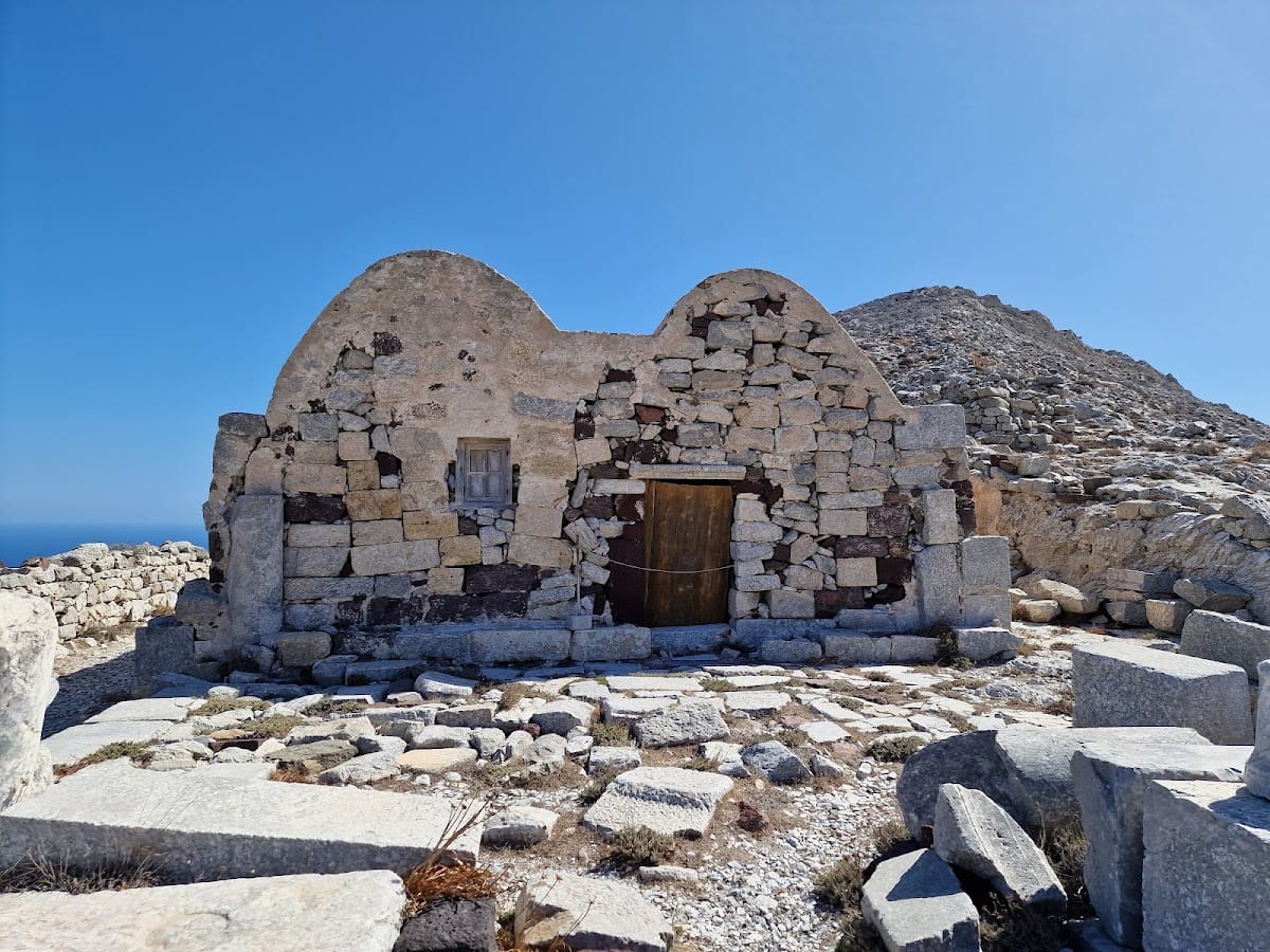
During the eighth century CE, the mountain settlement offered refuge to inhabitants of coastal villages threatened by Arab invasions. A large wall was built along the western edge of the ridge, and makeshift dwellings were constructed among the partly ruined ancient buildings using ancient materials.
In 726 CE, a relatively small eruption of Santorini’s volcano spread a light layer of pumice over the city. The settlement was abandoned soon afterward. Byzantine accounts attributed to Theophanes described the destruction. Because the earliest phases are poorly preserved, the history of Ancient Thera is reconstructed chiefly through evidence from its Hellenistic peak and later development.
Excavation and interpretation
Friedrich Hiller von Gaertringen systematically investigated and excavated Ancient Thera between 1895 and 1904. N. Zapheiropoulos led further excavations from 1961 to 1982 under the auspices of the Archaeological Society of Athens, including work that revealed the necropolis at Sellada. Excavations directed by Wolfram Hoepfner of the Free University of Berlin from 1990 to 1994 further refined understanding of the history of the southern Aegean. Finds from the excavations are exhibited in the Archaeological Museum of Thera in Fira.
Remains
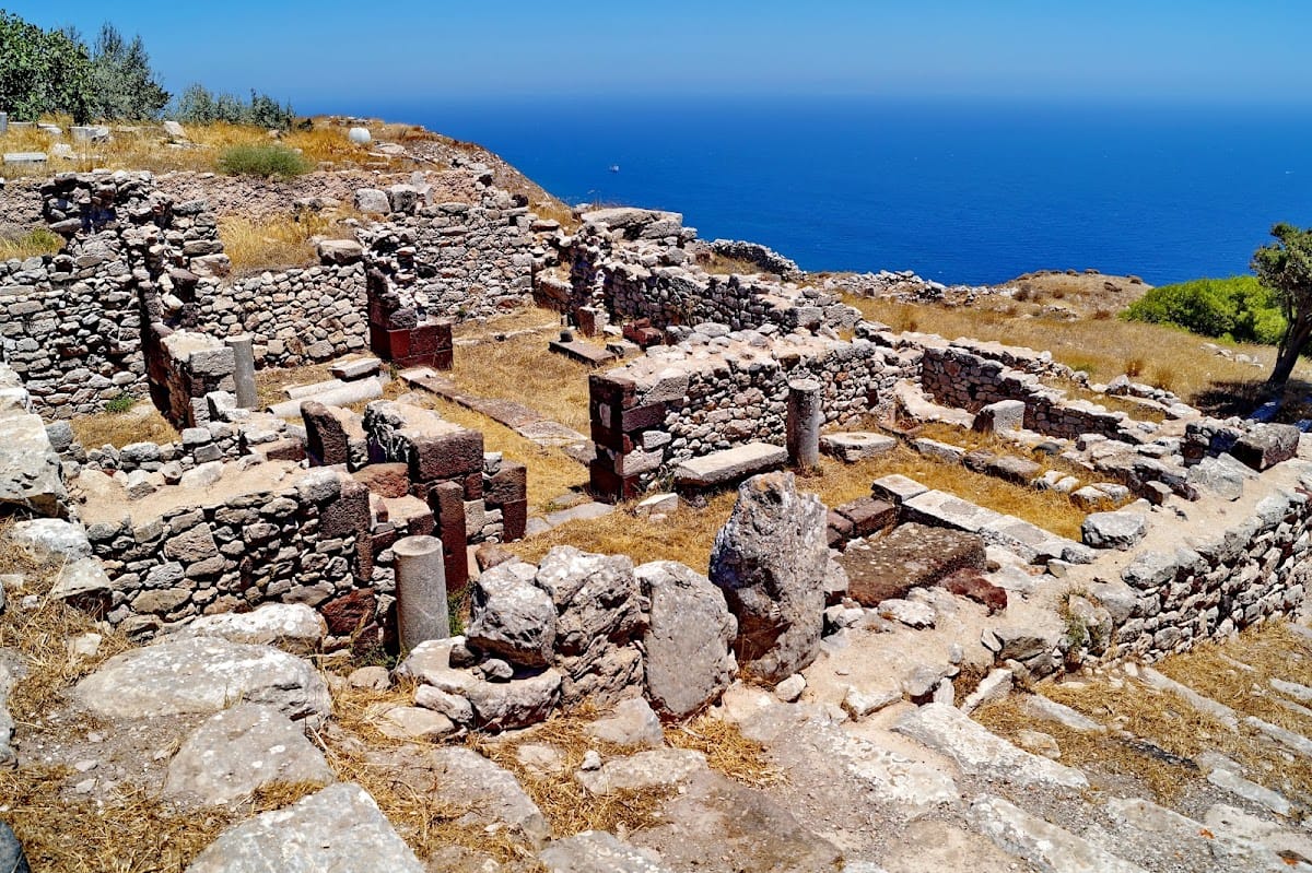
Ancient Thera occupies the ridge and plateau of Mesa Vouno, a steep limestone mountain in southeastern Santorini, approximately 360 to 365 meters above sea level. The position separates the areas of present-day Kamari and Perissa and provides extensive views over the Aegean. Limestone quarried from Mesa Vouno supplied most of the building material. Public structures used limestone masonry, while many private buildings were constructed from smaller, irregular stones.
Streets and civic center
The principal street ran for almost 800 meters in a southeastern direction and measured approximately 2 to 4 meters wide, making it unusually broad for its period. A smaller road branched from it at a right angle and climbed toward the city’s command or garrison headquarters. After about 200 meters, the settlement spread across an exposed plateau measuring roughly 100 by 100 meters above the rocky coast. Residential areas surrounded the agora, a public civic square, while the theater occupied the opposite slope. A separate sacred area at the eastern end of the plateau faced the sea and contained temples and public facilities.
The agora and Basilike Stoa
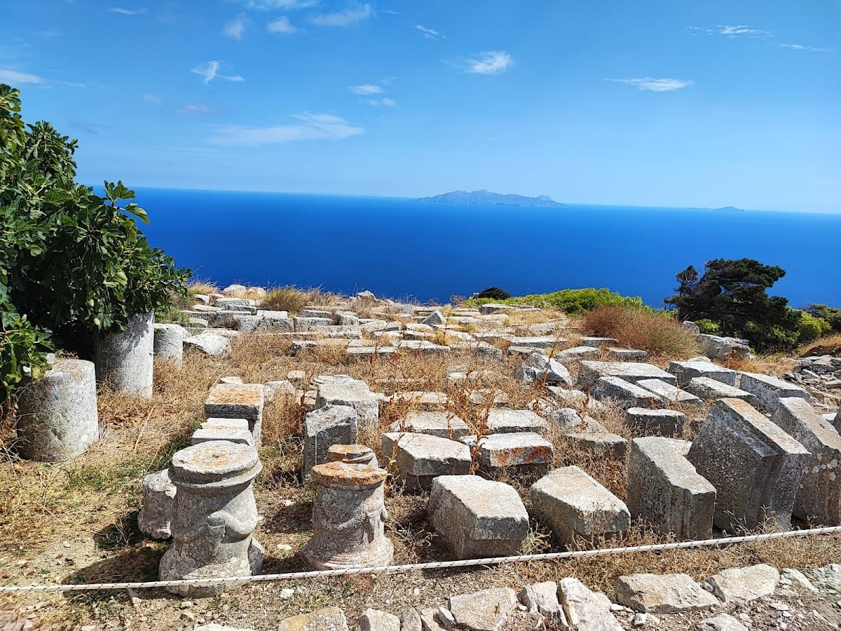
The agora followed the contours of the ridge and measured approximately 110 meters long and 17 to 30 meters wide. Public buildings stood along its western, slope-facing side. Private houses on the eastern side lay below the level of the square, leaving the view toward the sea open.
The Basilike Stoa was a large colonnaded hall measuring approximately 46 by 10 meters. A central row of ten Doric columns supported its roof. The building formed the center of public life and was completely rebuilt in the first century CE. At that time, a separate room at its northern end housed statues of the imperial family.
Theater
The theater was built into the slope below the main street during the second century BCE. Its approximately 1,500 seats exceeded the needs of the city itself, and performances attracted inhabitants from settlements throughout the island, as well as possibly visitors from neighboring islands.
Sacred and military buildings
Sacred precinct
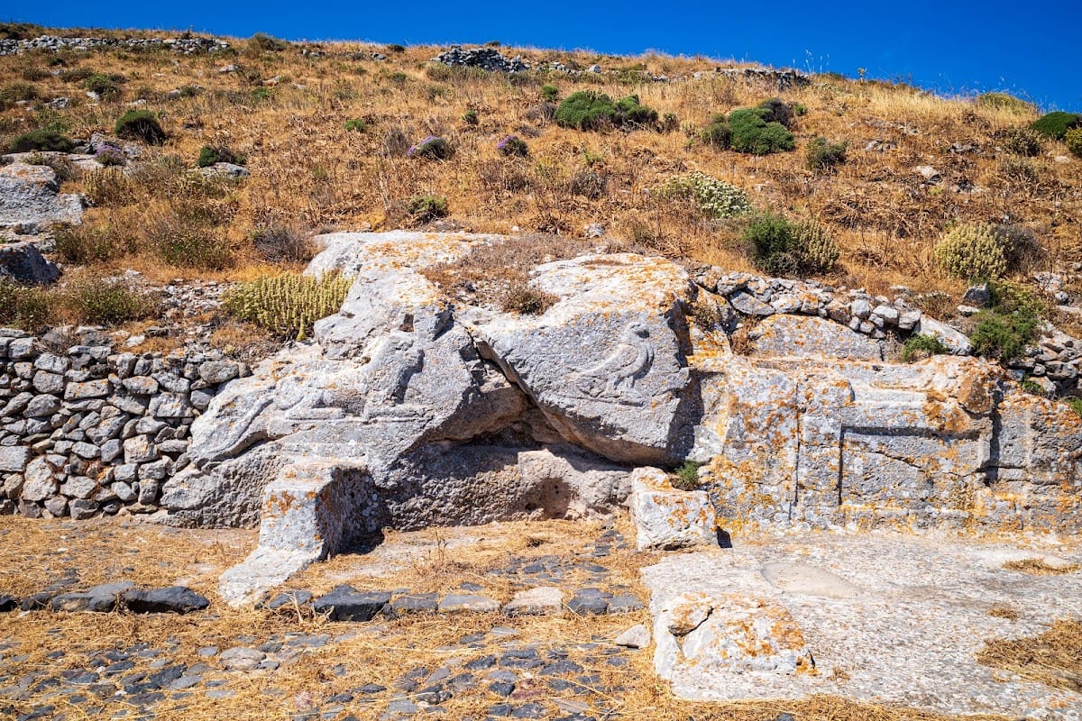
The sacred precinct on the eastern spur of the ridge included a grotto dedicated to Hermes and Heracles and a principal temple of Apollo. A shared rock sanctuary for Egyptian gods was added in the third century BCE, reflecting the religious diversity associated with the Hellenistic Mediterranean. A gymnasium, an institution for athletic training and education, was established for epheboi, adolescent males undergoing civic and physical training, in the second century BCE. Baths were added to it during the first century CE.
Inscriptions and early sanctuaries
Early inscriptions from the sacred precinct date from the transition between the ninth and eighth centuries BCE. They are among the oldest known examples of the Greek alphabet, which developed from the Phoenician script, and some preserve precursor forms of Greek letters. Several are dedications on altar stones to deities including Zeus, Koures, Apollo, Lochaia, Damia, Castor and Pollux, Chiron, Deuteros, Boreas, the Erinyes, Athanaia, Biris, the Charites, Hermes, and Persephone. Their range of divine figures includes lesser deities associated with family, childbirth, children, and child-rearing.
Fleet headquarters and garrison gymnasium
At the highest point of the city, at the end of the side street, stood an imposing building interpreted as the headquarters of the fleet commander. Beside it was a courtyard enclosed by buildings on two sides, interpreted as the garrison gymnasium.
Residential areas and water supply
The private houses belonged principally to two types. Fleet officers lived in spacious peristyle houses, organized around open courtyards surrounded by columns. Most stood on terraces on the eastern slope below the main street and overlooked the sea more than 300 meters below.
Most other inhabitants lived on the plateau in houses arranged around small central courtyards. Cisterns, reservoirs for collecting and storing water, lay beneath these courtyards and supplied essential water. Some houses had two stories, while others included small basements where the terrain allowed.
Burial areas, harbor, and later churches
Necropolis
A necropolis, or large burial area, lay at the foot of the mountain near present-day Kamari. It was used for burials through almost the entire period of the city’s existence. Twentieth-century excavations identified the necropolis at Sellada.
Harbor settlements
Ancient Thera had a harbor whose exact location remains uncertain. Shipyards and lodging for sailors and soldiers are thought to have been associated with it. Two harbor settlements, called Oia and Elefsina, have been associated respectively with the areas of present-day Kamari and Perissa.
Basilica and double church
A sixth-century basilica stood near the city entrance by the mountain saddle. It preceded the later double church of Agios Stefanos.
Objects and rock inscriptions
Gymnasium inscriptions
Rock walls around the forecourt of the gymnasium bear another group of inscriptions. The texts indicate that athletic competitions and consecratory acts took place there before the gymnasium was built. A dark gray-blue crust covered the limestone and could be chipped away to expose the white stone beneath, allowing inscriptions to be made without specialized stonemasons.
One inscription names the contestant who threw a heavy stone the farthest. Others refer to sexual acts that may describe relationships between older men and young athletes or dancers. The very early Greek language makes some of the texts difficult to interpret, and it remains uncertain whether the sexual references were boastful graffiti or had a cultic function.
Ceramics and sculpture
Archaeological finds include eighth-century geometric ceramics and seventh-century orientalizing ceramics influenced by models from Naxos, although this style reached Santorini relatively late. Several mostly damaged seventh-century figures known as Daedalic idols were found as grave goods. Daedalic sculpture is an early Greek style characterized by stylized, strongly frontal figures. The best-preserved example represents a woman with raised arms, interpreted as a gesture of mourning for the dead.
Several larger-than-life marble statues of youths, known as kouroi, were carved during the second half of the seventh century BCE. Kouroi are Archaic Greek statues depicting idealized young men. Both the marble and the artistic style came from Naxos. The finest example, the Apollo of Thera, dates from the beginning of the sixth century BCE. The kouroi were found in burial grounds below the city, and the Apollo of Thera is now in the National Archaeological Museum in Athens.
Caves
Two caves lie near Ancient Thera. One appears to have been an additional ancient sanctuary. The other contains numerous bones and traces of food preparation and has been interpreted either as a cult place or as a refuse pit. Its function may have changed during its history.