Aberystwyth Castle: A Historic Norman and Medieval Fortress in Wales


Visitor Information
Google Rating: 4.6
Popularity: Medium
Official Website: coflein.gov.uk
Country: United Kingdom
Civilization: Medieval European, Modern
Site type: Military
Remains: Castle
History
Aberystwyth Castle is located in the town of Aberystwyth in modern-day Wales, United Kingdom. The site’s origins trace back to the early 12th century when it was first established by the Normans as a strategic frontier fortress.
The initial castle was built around 1110 by Gilbert de Clare, a Norman lord, as a motte-and-bailey structure situated approximately 1.5 kilometers south of today’s ruins, at a site known as Tan-y-Castell or Old Aberystwyth. Throughout the 12th and early 13th centuries, this original castle became a focal point of conflict between Norman forces and Welsh princes, suffering several cycles of destruction and reconstruction as control shifted multiple times.
In 1277, during the first campaign of King Edward I of England against Wales, a new stone fortress was constructed on a rocky promontory north of the earlier location. This younger castle had the purpose of securing English dominance over the region and was completed with the labor of over 1,300 workers in challenging coastal conditions. However, in 1282, during a widespread Welsh uprising, Welsh forces succeeded in capturing and burning both the castle and its adjacent fortified settlement, known as a bastide. Soon after, the castle was retaken and underwent extensive repairs under the direction of the master mason James of St George, reaching completion around 1289 at a considerable cost of several thousand pounds.
The newly fortified castle held out during the 1294–95 Welsh revolt, in part due to its ability to receive supplies from the sea. Yet, by the early 14th century, signs of deterioration appeared, with important structures showing damage and neglect by 1343.
The castle’s role evolved significantly in 1404 when Owain Glyndŵr’s uprising brought Welsh forces back into control. Aberystwyth Castle became one of Glyndŵr’s principal strongholds and served as a center for governance. During this period, a treaty with the King of France was signed at the castle in 1405, marking its importance in Welsh-French alliances. The English reclaimed the fortress in 1408 after two sieges; notably, one siege involved the use of a large bronze cannon, demonstrating early artillery in Welsh military history.
In the 17th century, specifically from 1637, Aberystwyth Castle housed a Royal mint established by King Charles I to produce coins using silver mined nearby. The mint operated until the turmoil of the English Civil War interrupted its function. During the conflict, Royalist forces occupied the castle, which was later captured by Parliamentarian troops in 1646. In 1649, Oliver Cromwell’s forces deliberately damaged the castle in a process called slighting, to prevent its future military use. After the war, the fortress gradually fell into ruin. By the 18th century, much of the remaining stone was quarried for other building projects.
Restoration efforts began in the early 20th century, around 1903, and continued intermittently from the 1970s onward. Today, the ruins are preserved under the care of the town authorities.
Remains
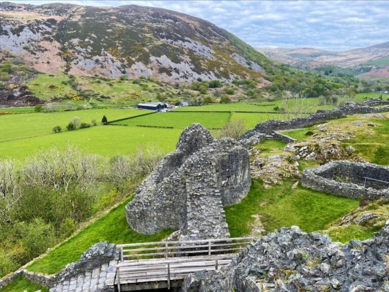
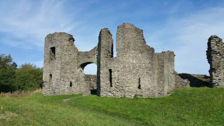
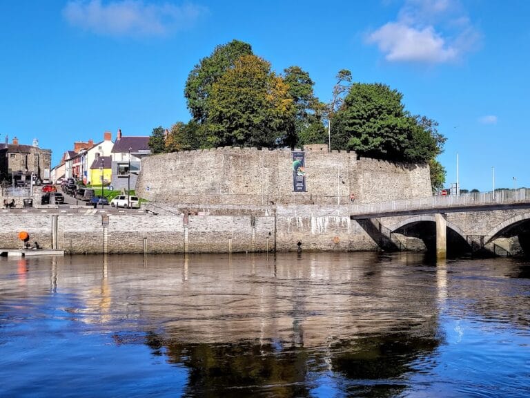
The surviving ruins of Aberystwyth Castle stand on a narrow rocky promontory rising about 20 meters above the waters of Cardigan Bay. This location offered natural defenses, with steep cliffs on three sides, protective marshland to the north, and a river mouth to the south. The castle’s plan reflects an irregular diamond shape, an adaptation to the contours of the cliff. It is one of the earliest examples of concentric castle design in North Wales, featuring two successive rings of defensive walls enclosing the site.
Defensive works included multiple round or semicircular towers at the corners of both the inner and outer walls, with gatehouses also positioned strategically at these points. The castle was protected by a dry moat along the south, east, and north sides, complemented by an outer ward or zwinger on the northwestern end of the promontory, offering an added layer of defense. Access was controlled from the eastern approach through a series of fortified entrances: starting with an outer tower, followed by a double-towered gatehouse, and then a double D-shaped inner gatehouse. An additional gatehouse with twin towers on the northwest side opened toward a harbor landing, which allowed the castle to be resupplied by sea during times of siege.
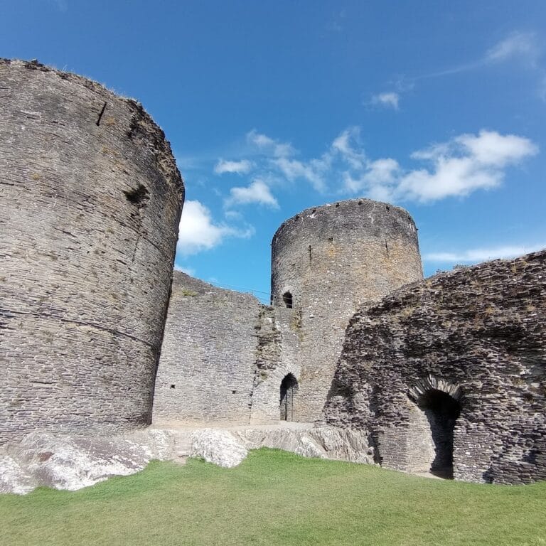
Within the inner walls, the main domestic buildings were arranged along the southeastern side near the main gate. This included the great hall, or palas, which likely contained royal apartments and served as the center of administration and residence. Foundations of this hall and a rectangular structure along the southwestern inner wall can still be seen today.
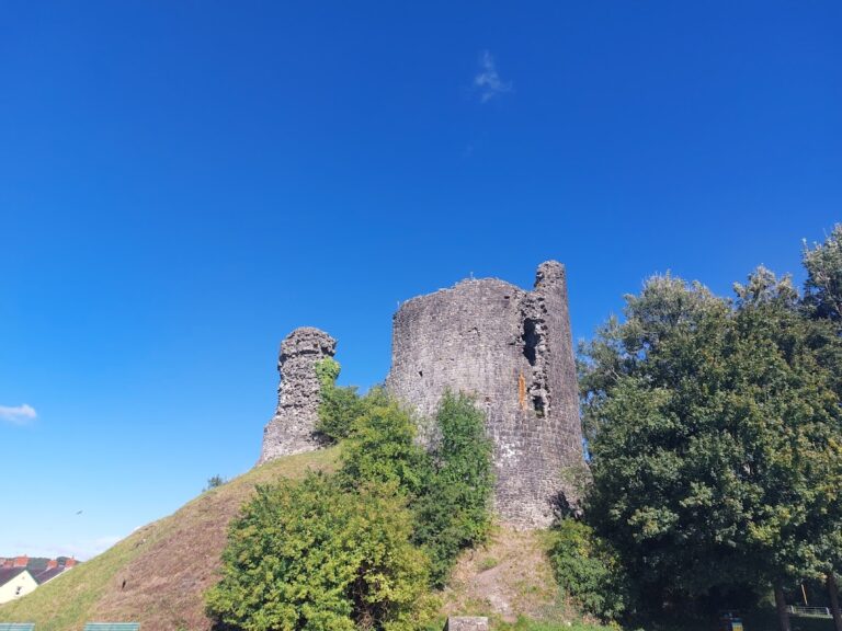
By the 14th century, significant parts of the castle were already in decline, including the long chamber, kitchen range, main gate, drawbridges, and outer bailey. These conditions eventually worsened, with large sections of the walls lost during the 18th century due to stone being quarried for other uses and from coastal erosion. Further damage occurred in the 19th and 20th centuries through the construction of seaside promenades.
Among the ruins, the best-preserved feature is the tall inner gatehouse tower on the northwest side. This tower has endured in part because it served as a navigational landmark for the harbor. The remains scattered across the site include portions of wall fragments and tower bases, offering a glimpse into the scale and complexity of the medieval fortress.
The castle grounds also hold commemorative features from the 20th century. A stone circle erected in 1916 honors the thirteen historic Welsh counties, while a World War I memorial sculpture created by Mario Rutelli in 1923 stands at the promontory’s northwest tip. The surrounding area has since been adapted as a public park with recreational facilities, preserving the site’s historical importance alongside community use.
Nearby sites