Burg Dill: A Medieval Castle in Dill, Germany


Visitor Information
Google Rating: 4.7
Popularity: Low
Country: Germany
Civilization: Medieval European
Site type: Military
Remains: Castle
History
Burg Dill is located on a hill spur above the Dillerbach river in the municipality of Dill, Germany. The castle’s origins trace back to the 11th century when a fortress was established on this site, likely built by the local nobility known as the Counts of Mörsberg from the County of Sponheim. Before the medieval castle, there were earlier fortifications from Roman or Celtic times, suggesting the hill’s strategic importance long before the 11th century.
The probable founder of the castle was Adalbert von Dill, a member of the noble house of Mörsberg. In 1130, a notable treaty involving Meginhard von Sponheim and Mechthild von Mörsberg formalized the control of Burg Dill. This agreement also linked the castle’s ownership to the protective advocacy, known as Schirmvogtei, over the Augustinian religious community at Pfaffen-Schwabenheim, indicating the castle’s role in local religious and political affairs.
Burg Dill stood for several centuries until the late 17th century. During the Palatine Succession War in 1697, the castle was targeted by French forces led by Mestre de camp Melac. While the destruction focused on the castle itself, the nearby village suffered less damage, allowing the settlement to continue afterward. Over time, the castle fell into ruin and remained privately owned for many years. In the 20th century, restoration and conservation efforts took place during the 1960s and early 1970s. Eventually, in 2020, ownership of the site passed to the local municipality, marking a new chapter in its stewardship.
Remains
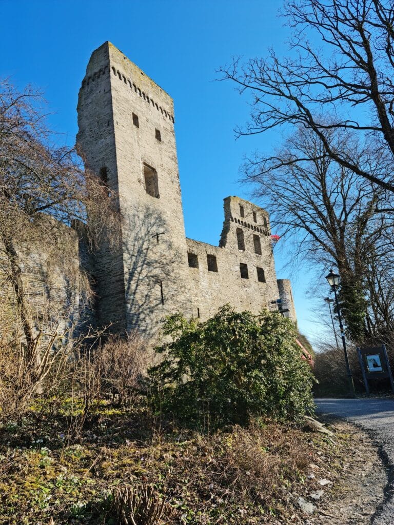
Burg Dill occupies a hilltop site organized around a main fortified area at the northern highest point, with an outer ward—known as the outer bailey—stretching below. The castle’s construction primarily dates from medieval times, constructed atop earlier foundations.
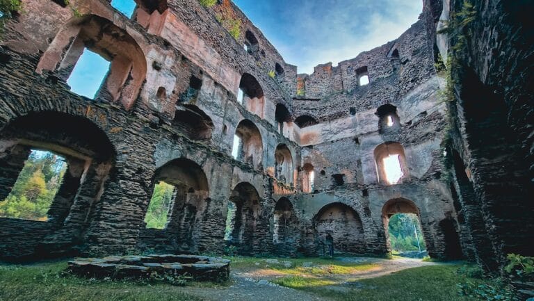
The central structure is a rectangular residential tower standing four stories high, reaching nearly 19 meters tall, with a footprint of about 18 by 12 meters. Three of the tower’s four walls remain intact; the eastern wall has disappeared. Attached to the tower’s north wall is an external latrine, called an Aborterker, which served hygienic functions by projecting outward from the main building.
Beneath the tower, portions of cellar chambers built with barrel vaults—curved stone ceilings that support the floor above—are still accessible. These vaults demonstrate the sturdy medieval method of cellar construction. To the west of the main tower, remnants of the ring wall survive. This defensive wall features masonry laid in a herringbone or fishbone pattern, where stones are placed diagonally to create a distinctive textured appearance.
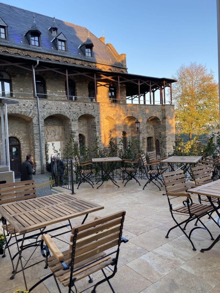
On the eastern lower bailey, the medieval chapel no longer stands. In its place today is an Evangelical church, showing continuity of religious use at the site. Nearby, a well house originally designed to protect the water supply was repurposed as a holiday home, and a modern residence has also been built within the area once occupied by the castle’s lower ward.
The western and southern sections of the outer bailey preserve only foundational remains and fragments of enclosing walls. These parts of the former castle grounds have since been adapted for garden use, blending historic remains with contemporary landscape. Throughout the site, restoration work in the 20th century has stabilized many of the surviving structures, allowing visitors to witness firsthand the castle’s layered history.
Nearby sites