Château de Crussol: A Medieval Fortress above the Rhône Valley
Site at a Glance
- Rating
- 4.7
- Popularity
- Medium
- Country
- France
- Primary era
- Medieval
- External website
- Open
- Eras represented
- Medieval
- Civilizations
- French
- Site type
- Military
- Remains
- Castle
On this page14 sections
History
Château de Crussol is a medieval hilltop fortress in France, built in its visible stone form by the Bastet de Crussol family during the twelfth century. Rising above the Rhône valley, it controlled a major route between the Mediterranean and northern Europe and stood near the frontier formed by the Rhône with the Holy Roman Empire, a political association of territories in central Europe, until the fourteenth century.
Early occupation and the stone castle
The hill had been occupied continuously since the Upper Paleolithic. Archaeological finds include pottery and bones from the Upper Paleolithic, Neolithic, and Bronze Age, as well as pottery and coins from the end of the Roman imperial period and the eighth century.
A fortified site is first mentioned in 963, when Robert donated land south of the “castello Cruseolis” in the cartulary of Saint-Chaffre. The early fort was probably built of wood and probably belonged to the tenth century. Fire destroyed it, after which the castle was rebuilt in limestone during the twelfth century.
Giraud I Bastet, a follower of the Count of Toulouse, acquired the rock through his marriage to Angès de Crussol in 1110 and established the new stone castle. The family later became known as Bastet de Crussol, or Crussol. The castle chapel of Notre Dame de Crussol appears in records from 1185. Odon II, a bishop of Valence from the Crussol family, transferred the chapel to La Chaise-Dieu Abbey after recently receiving it from his nephew Guillaume I. It may have replaced a Roman temple dedicated to Mars.
Expansion and aristocratic power
The Bastet de Crussol family enlarged its possessions through marriage and alliances. Giraud II acquired the castle at Charmes-sur-l’Herbasse in 1220. Giraud III married Marguerite de Pagan, while Jean Bastet married Béatrix de Poitiers in October 1310. As the family’s political influence grew, Château de Crussol was repeatedly enlarged and rebuilt. It probably escaped major effects of the Hundred Years’ War.
At its height, the fortified area accommodated as many as 700 people. During the fifteenth century, the family reached the peak of its power. Gabrielle Bastet de Crussol became abbess of Notre-Dame de Soyons Abbey, and Louis Bastet de Crussol held senior offices at the court of Louis XI, including grand breadmaster of France and governor of the Dauphiné.
From the thirteenth century onward, and increasingly during the fifteenth century, members of the family spent more time at court, in urban palaces, and at more comfortable residences on the plain, particularly at Charmes-sur-l’Herbasse. Château de Crussol was progressively neglected and eventually ceased to serve as a permanent residence.
The Crussol d’Uzès inheritance
In 1486, Jacques I de Crussol married Simone d’Uzès, heiress to the Viscounty of Uzès. He received the estate on the condition that he combine the Uzès name and arms with those of Crussol. In 1565, King Charles IX elevated the viscounty to a duchy for Antoine de Crussol d’Uzès.
Religious wars and destruction
The Crussol family had traditionally been Protestant, but Antoine de Crussol d’Uzès supported the Catholic side during the Huguenot Wars, the French Wars of Religion between Protestant Huguenots and Catholics. After Antoine died at the siege of La Rochelle, Protestant forces captured Château de Crussol in 1573. Catholic troops soon retook it, but Protestant forces damaged the castle. In the spring of 1577 they besieged it again and were defeated on 24 June by troops sent by the bishop of Valence.
Protestant troops captured the castle in 1580, set it on fire, destroyed the keep, and heavily damaged its defenses. Soldiers remained stationed there despite the destruction. When religious conflict revived in 1621, the Catholic side hastily repaired the outer defensive wall. In August 1622, however, the bailiff appointed by the Crussol d’Uzès family fled to Valence and surrendered the castle and Saint-Péray to the Protestants. The fortifications were then definitively demolished by explosions.
When François I de Crussol attempted to stay at the castle in December 1624, it was no longer habitable, and he lodged with his bailiff. The site was abandoned thereafter and gradually deteriorated. An important road from Valence to Le Puy-en-Velay passed below the castle as part of the pilgrimage route to Santiago de Compostela.
Damage, ownership, and conservation
Artillery exercises by the regiment of Valence blew up much of the remaining fabric in 1846. On 3 October 1855, blasting at the Vingard quarry beneath the ruins caused two-thirds of the surviving residential building to collapse. Géraud de Crussol d’Uzès, the eleventh Duke of Uzès, bought the property back in 1864 after it had left family ownership.
Lightning damaged the remains further in 1952 and destroyed the northern tower. The Fondation de Crussol, established in 1964, began stabilizing and restoring the site. Its attempts in the early 1980s to acquire the ruins from the Crussol family failed. Marie-Louise Béziers, widow of the Marquis de Crussol, later sold them to a group formed by Saint-Péray, Guilherand-Granges, and Soyons. The municipalities stabilized and restored the ruins. Guilherand-Granges became the sole owner in 1998, although the site lies within Saint-Péray’s municipal territory.
The ruins have been listed as a historic monument since 31 May 1927. The ruins and Crussol rock are also among Ardèche’s 18 classified natural sites. The wider area is protected as part of Natura 2000, the European Union network for important habitats and species, and as an Espace naturel sensible, a French designation for a protected natural area valued for its ecology or landscape.
Remains
Rock, enclosure, and entrances
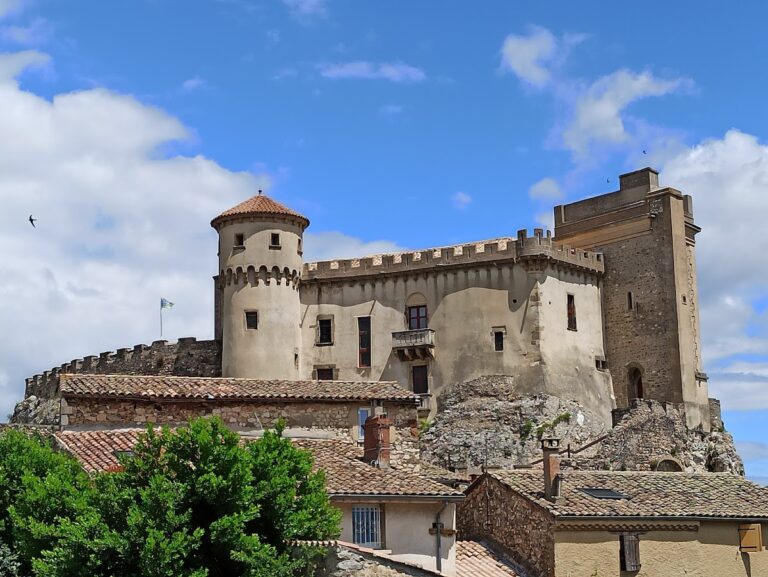
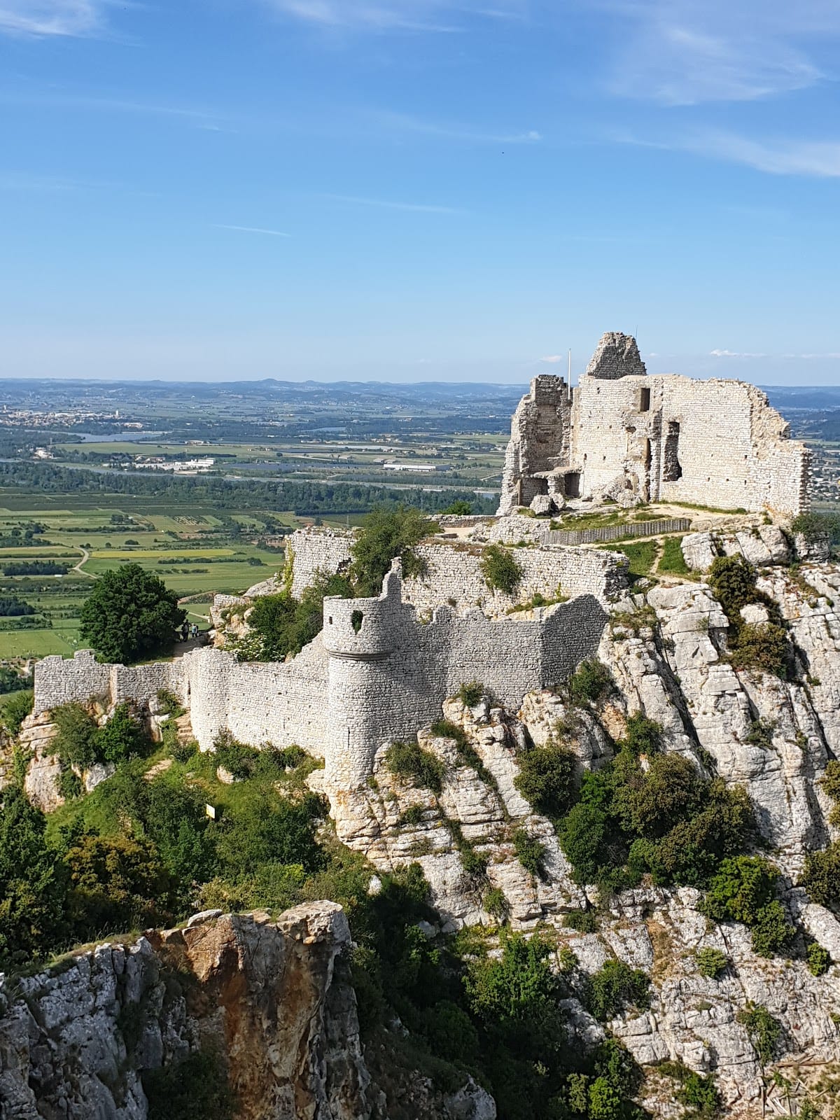
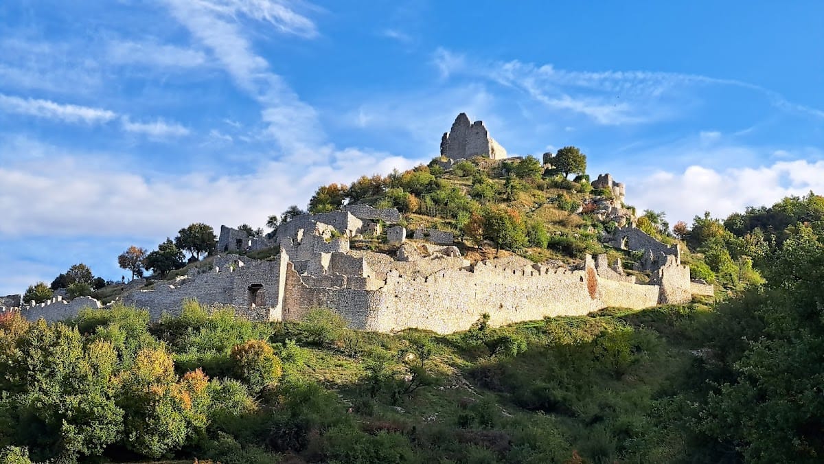
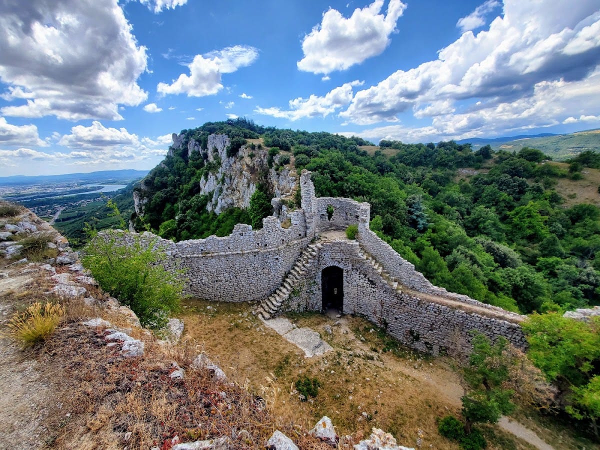
The ruins cover about three hectares on a 337-metre-high limestone rock on Crussol mountain, more than 200 metres above the surrounding plain. The site overlooks Saint-Péray to the west and Guilherand-Granges and Valence to the east, while its eastern side drops steeply toward the Rhône valley.
The shared enclosure
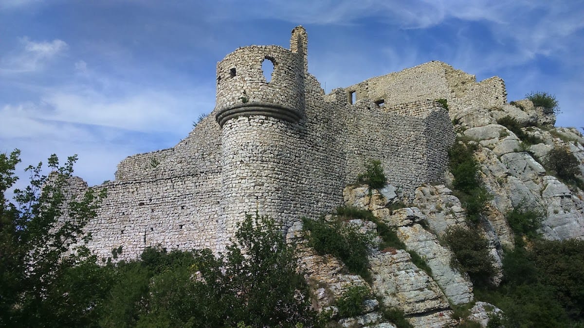
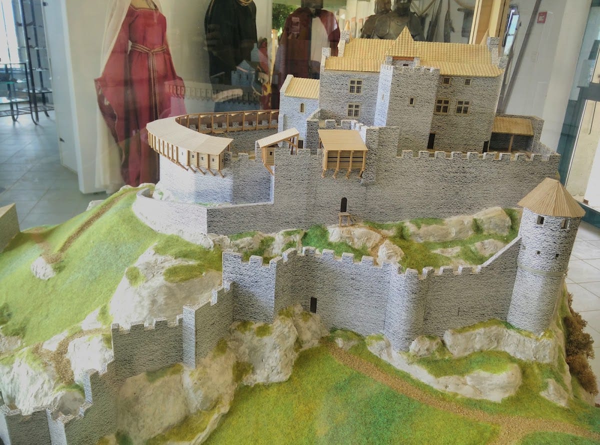
The castle complex consisted of a southern upper castle, a western lower castle, and a fortified village called the Villette to the north. A shared enclosure, about 335 metres long, surrounded the whole area. It was between 0.8 and 1 metre thick and averaged about 8 metres in height. Wooden hoardings strengthened the enclosure. Its almost complete lack of loopholes suggests that at least part of the wall may predate the twelfth century. The section protecting the lower castle was reinforced by a round corner tower and a semicircular wall tower.
The northern gatehouse
At the lowest point of the site, the northern entrance retains a fortified twelfth-century gatehouse with an outer barbican, an additional defensive work protecting the entrance. Beyond the gate lay the Villette. The castle core occupied a small rock plateau whose eastern edge fell sharply into the valley, and its courtyard was reached through a confined defensive passage between fortifications.
The Villette and upper castle
The fortified village
The Villette contained roughly 100 simple houses, intended mainly as temporary refuge for nearby inhabitants during danger rather than as permanent homes. Many were used for storage. The village also had a windmill, two ovens, and a chapel dedicated to the Virgin Mary. Its buildings now survive as ruins or have disappeared.
The upper castle
A large undeveloped area separated the upper castle from the Villette. The upper castle’s principal elements were a quadrangular keep, an adjoining residential building, and a stair tower. Its northwest courtyard contained a rock-cut cistern and the lord’s chapel. The cistern remains recognizable, while the chapel has disappeared.
The date of the residential building is uncertain. Its northern gable wall survives to full height, but its southern exterior wall almost entirely collapsed after the 1855 quarry blast. The stair tower on the northern side contained an internal spiral staircase and now survives only in fragments. Since the seventeenth-century destruction, the keep has remained only at foundation level, and the buildings of the lower castle have disappeared completely.
Landscape and wildlife
The plateau provides views across four departments, from the Alps in the east to the Cévennes in the west and from Mont Pilat in the north to Mont Ventoux in the south. The natural setting includes dry grassland, holm-oak woodland, heath on marl, limestone scree, and limited downy-oak woodland.
Orchid-rich steppe grasslands form an important habitat. Nearly 40 orchid species grow in the area, including the lizard orchid, bee orchids, and the pyramidal orchid, with some varieties endemic. The associated fauna includes eagle owls, short-toed snake eagles, black kites, other daytime raptors, blue rock thrushes, bats, wild boar, jeweled and western emerald lizards, and numerous butterfly and beetle species. Seven bird species and 19 other animal species in the protected territory are identified as protected.