Sagalassos Archaeological Site: A Pisidian City in Türkiye
Site at a Glance
- Rating
- 4.8
- Popularity
- Medium
- Country
- Turkey
- Primary era
- Classical
- External website
- Open
- Eras represented
- Classical, Medieval
- Civilizations
- Ancient Greek, Byzantine, Roman
- Site type
- City
On this page26 sections
History
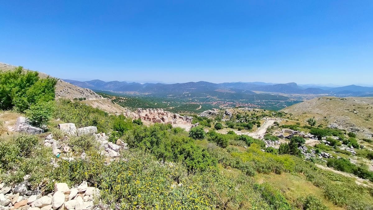
Sagalassos Archaeological Site is an ancient city in Türkiye, near present-day Ağlasun in Burdur Province, where a settlement developed in the mountainous region of Pisidia from the late fifth century BCE. Occupying terraces of the Western Taurus Mountains at roughly 1,400 to 1,600 metres, Sagalassos grew during the Hellenistic period and became one of the most prosperous cities of Pisidia under Roman rule. Its public buildings, pottery industry, religious institutions, and later Christian remains trace the changing fortunes of a highland urban community over more than a millennium.
Before Roman Rule
People lived in the surrounding region by approximately 8000 BCE. Hittite documents from the fourteenth century BCE mention a mountain place called Salawassa, although its connection with Sagalassos remains uncertain. The city itself is generally placed in the late fifth century BCE. It developed through the Phrygian, Lydian, and Hellenistic periods, when political control and cultural influences in southwestern Anatolia changed repeatedly.
From about 546 BCE, Pisidia belonged to the Persian Empire, and men from the region served as mercenaries. Alexander the Great conquered Sagalassos in 333 BCE, by which time it was already one of the wealthiest Pisidian cities. After Alexander’s death, control passed through the territories of Antigonus Monophthalmus, possibly Lysimachus, the Seleucids of Syria, and the Attalids of Pergamon. During this period, the inhabitants rapidly adopted Hellenistic culture, including Greek forms of civic and artistic life.
The late Hellenistic city included political and religious buildings that reflected its status as a civic community. A council chamber dating to approximately 100 BCE provides evidence for Sagalassos as a polis, a self-governing Greek city-state or civic community. The city also expanded onto the eastern slopes, while the Doric Fountain House and a late Hellenistic Doric temple formed part of its developing public and religious landscape.
Integration into the Roman World
When the Attalids transferred their kingdom to Rome, Sagalassos became part of the Roman province of Asia. In 39 BCE, Rome assigned Pisidia to Amyntas, a Galatian client king who ruled parts of central Anatolia. After his death in 25 BCE, Rome incorporated the region into the province of Galatia.
Sagalassos had been an important centre of pottery production from the mid-second century BCE. Under Amyntas, its products captured a regional market. Expansion accelerated under Augustus, the first Roman emperor, as the Pax Romana, a prolonged period of relative political stability under the Roman Empire, supported movement and investment. Roman colonies were established in southern Galatia, and new roads connected inland communities with the coast. The Via Sebaste, a Roman road linking settlements in southern Anatolia with Mediterranean routes, crossed about 63 kilometres of Sagalassos’s territory between Antioch in Pisidia and the ports of Pamphylia.
During the first three centuries of the Roman Empire, the urban area approximately doubled. Public buildings and civic spaces were embellished with monumental architecture, inscriptions, fountains, theatres, baths, and sculpture. A major period of prosperity began under Emperor Hadrian, who favoured Sagalassos, designated it the “first city” of the province, and made it a centre of the imperial cult, the civic and religious veneration of the emperor and imperial family. The city was connected with the Pisidian koinon, a regional political and religious league involved in organising that cult.
Christianisation and Urban Change
By the late fourth or early fifth century CE, Sagalassos had become a bishopric, a Christian district governed by a bishop. The city was represented at the First Council of Constantinople in 381. Around 400, its defensive arrangements were strengthened with new fortifications. Religious tensions during this period were associated with the destruction of the recently restored Neon Library, while the former sanctuary of Apollo Klarios was converted into a Christian church. Apollo was a major Greek and Roman god associated with prophecy, healing, and the arts, and Klarios was an epithet linked to one of his sanctuaries.
An earthquake in the early sixth century, generally dated to around 518, caused extensive damage. The inhabitants responded with substantial repairs and monumental restorations, but the character of the city gradually changed. Public spaces increasingly received private occupation, while altered administrative and economic conditions produced a less formal urban environment.
The plague of approximately 541 to 543 sharply reduced the local population. Declining labour forces, poor harvests, famine, insecurity, unrest, and economic contraction encouraged the abandonment of some urban districts. Large houses were subdivided into smaller dwelling units, reflecting the changing scale of settlement and household life.
Earthquakes, Ruralisation, and Abandonment
Arab raids threatened Sagalassos around 640. A further major earthquake between the late sixth and early seventh centuries, usually placed around the middle of the seventh century, caused the final large-scale destruction of the city. Much of the remaining population moved toward the valley. Surveys and pollen evidence show that the elevated site continued to be used in a more rural and pastoral way rather than becoming immediately deserted, but the urban settlement is generally regarded as abandoned by the middle of the seventh century.
Burials continued for a time in earthquake debris beside the former Apollo Klarios temple, which had become a church. Excavations have also revealed traces of a fortified monastery, possibly associated with a religious community that continued the bishopric. This institution was destroyed in the twelfth century. Another chronology places the final abandonment of the settlement in the early thirteenth century, after a major population decline and migration toward southwestern Anatolia.
Erosion gradually covered the ruins, while the city’s remote and elevated position helped preserve substantial remains. Sagalassos subsequently disappeared from the historical record until the early modern period. Paul Lucas, a French traveller and antiquarian working for the court of Louis XIV of France, became the first recorded Western visitor to see the ruins in 1706. In 1824, Francis Arundell identified the city through its inscriptions and made an early sketch. William Hamilton later described the remains as exceptionally well preserved, and Karol Lanckoroński produced the first map. An Austrian study of Pisidia took place in 1880, followed by Lanckoroński’s more extensive fieldwork in 1884 and 1885. Photographs were taken by Paul Trémaux in 1882 and Gertrude Bell in 1907.
Modern Archaeological Research
Systematic surveys began with a British investigation of Pisidia in 1982. An Anglo-Belgian team led by Stephen Mitchell followed in 1985. A limited rescue excavation in the potters’ quarter preceded large-scale excavations beginning in 1990 under Marc Waelkens of the Catholic University of Leuven. Excavation, restoration, urban survey, geophysical survey, and interdisciplinary regional research have continued since then.
The research programme examines Sagalassos and an approximately 1,800-square-kilometre territory around it, investigating the city’s origins, growth, economy, trade, social history, environment, and decline. Geologists, geomorphologists, seismologists, archaeozoologists, anthropologists, paleobotanists, palynologists, ceramic specialists, residue analysts, architects, and other researchers have contributed to the study.
Research into the wider landscape has identified volcanic activity near Gölcük around 13,000 BCE, earthquakes around 500 CE and in the mid-seventh century, associated seismic faulting, and landslides before, during, and after the city’s occupation. Pollen, animal remains, raw materials, ceramics, and plant remains have provided evidence for vegetation, farming, animal use, imported freshwater and Mediterranean fish, local clay sources, craft production, and changing environmental conditions.
Archaeometric study, which applies scientific analysis to archaeological materials, has confirmed the importance of imperial-period pottery production and identified local glassmaking and metallurgy. Architectural materials and coins reveal regional and international trade, while inscriptions illuminate local history and the role of the elite in urban infrastructure and decoration, particularly during the first two centuries of the Empire.
In 2005, archaeologists identified an older and larger settlement on a plateau several kilometres south of Sagalassos. Named Düzen Tepe, it was partly contemporary with Sagalassos but differed in character. The possibility that its inhabitants moved to Sagalassos because of water shortages remains a hypothesis.
Human remains from the site have contributed to genetic and health studies. A 1999 study found kinship between excavated skeletons and the modern population of Ağlasun, interpreting this as evidence of local intermixture with later Greek, Armenian, and Turkic populations. The skeletons were also assessed as less healthy than the earlier Roman-period population. A mitochondrial-DNA study of 85 skeletons dating from the eleventh to thirteenth centuries found affinities with modern Greek and Balkan, Persian, Italian, and Levantine populations, without confirming a Central Asian contribution. Later research reported maternal genetic continuity over approximately two millennia and a population reduction of about 90 percent in the early thirteenth century, possibly caused by migration.
Sagalassos has been on Türkiye’s Tentative List for UNESCO World Heritage since 2009. Excavation and restoration have exposed the monumental centre and clarified the city’s changing urban, economic, religious, and environmental history. Artefacts recovered at Sagalassos are displayed in the Burdur Museum.
Remains
Sagalassos was laid out across several terraces and sloping areas of the Western Taurus Mountains. The ruins extend approximately 2.5 kilometres from east to west and 1.5 kilometres from north to south, incorporating an urban centre, residential districts, industrial areas, and defensive positions on surrounding slopes. Excavation and non-invasive survey have connected public, domestic, industrial, and monumental areas within a broader map of the ancient settlement.
Agoras and Civic Buildings
Upper and Lower Agoras
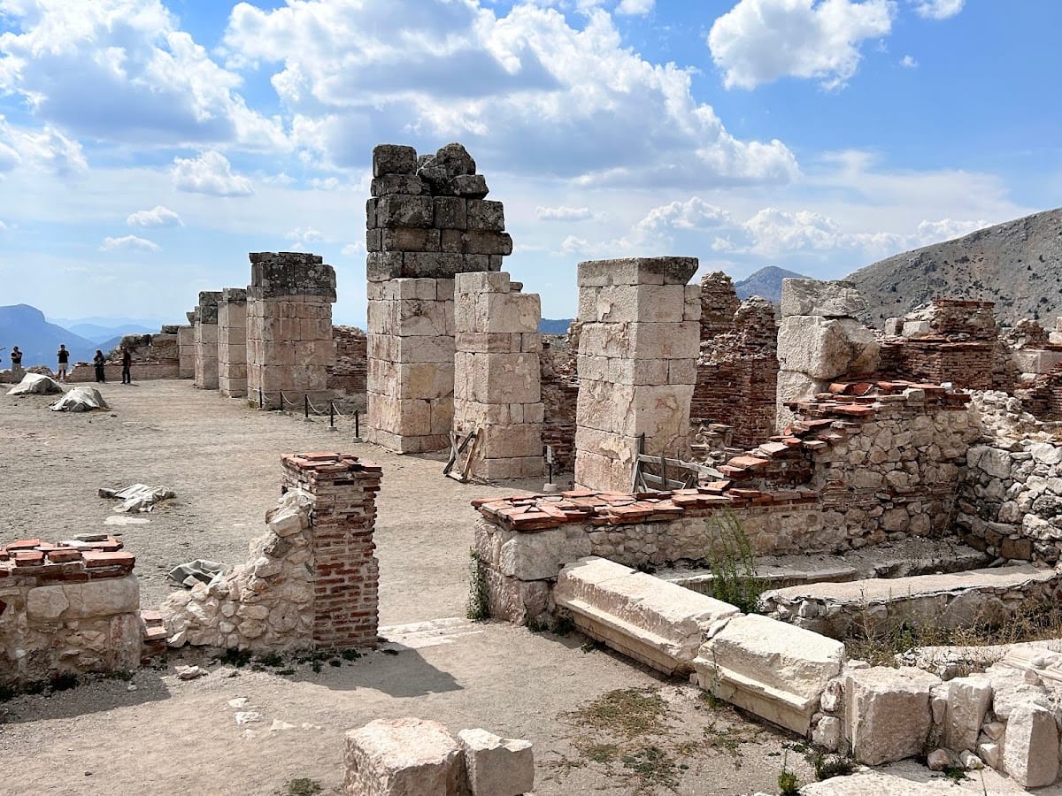
The Upper Agora and Lower Agora formed Sagalassos’s principal public squares. Excavations have exposed both spaces and the monumental buildings that faced them, along with dozens of public inscriptions and architectural decorations. Their terraces and surrounding structures express the city’s development from a Hellenistic civic community into a heavily monumentalised Roman centre.
Council Chamber
A council chamber dating to approximately 100 BCE stood among the buildings associated with the city’s political organisation. Its remains provide physical evidence for the civic institutions of Sagalassos as a polis during the late Hellenistic period.
Nymphaea
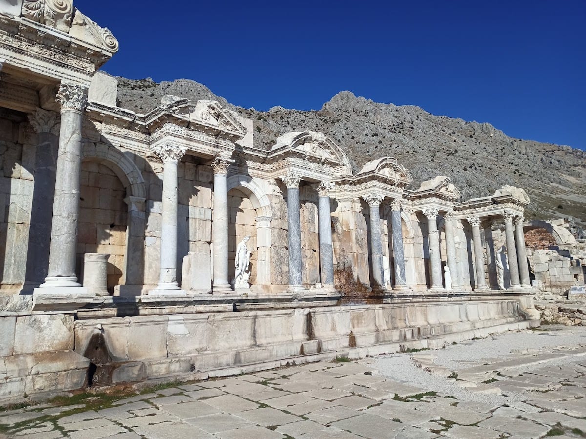
At least four monumental nymphaea, or elaborate public fountains supplied by a local water system, date to the second century CE. They contributed to the appearance of the agoras and incorporated water outlets and basin railings. The arrangement of these elements indicates that water levels and available water declined during the later occupation of the city.
Library and Religious Buildings
Neon Library
The Roman-period Neon Library underwent several alterations. Only the lower part of its rear wall belongs to the initial construction phase. Its stone podium contained niches for small statues and a line of inscriptions honouring Neon and members of his family through the city and people’s councils.
A brick wall built above the rear podium belongs to a second phase dated to approximately 200 CE. Roof problems led to a reduction in the hall, and the surviving side walls belong to this repair. The black-and-white mosaic floor was installed during a later restoration under Emperor Julian, dated to 361 to 363 CE. Its damaged central panel shows Achilles bidding farewell to his mother Thetis before leaving Greece for the Trojan War.
Temple of Apollo Klarios
The former sanctuary of Apollo Klarios was transformed into a Christian church. Burials were later placed in earthquake debris beside the church after the main phase of urban occupation had declined, preserving evidence of the site’s changing religious and funerary use.
Temple of Hadrian and Antoninus Pius
A temple dedicated to Hadrian and Antoninus Pius stood on the promontory of Iskender Tepesi. Its excavation formed part of the investigation into Sagalassos’s Christianisation and the history of later settlement.
Baths, Theatre, and Monumental Sculpture
Roman Bath Complex
Built approximately between 120 and 165 CE, the Roman bath complex was Sagalassos’s largest consumer of water. It contained numerous pools, and two storeys survive. Monumental restorations took place in the late fourth or early fifth century and again after 500 CE. Parts of the complex remained in use until the early seventh century. Later, sections were used to collect human waste mixed with lime, probably to produce manure for nearby fields.
The bath complex also contained colossal imperial statues. Fragments found in 2007 belong to a statue of Emperor Hadrian, probably 4 to 5 metres high, shown in military dress. It was assembled from separately carved sections joined with marble tenons, projecting pieces used to connect stone elements. The vaulted structure of the baths collapsed during a major earthquake, causing the statue to fall and break along its joins.
Marble toes with holes for dowels, pins inserted into drilled holes to secure sculptural elements, suggest the possible presence of a companion statue of Sabina, Hadrian’s wife and empress. That statue has not been confirmed. In 2008, fragments of a colossal statue of Faustina the Elder, wife of Antoninus Pius, and the head and body fragments of a colossal statue of Marcus Aurelius were found in the same complex. Approximately five metres high, the statues stood in niches in a bath hall. Their recovered fragments are displayed in the Burdur Museum.
Theatre
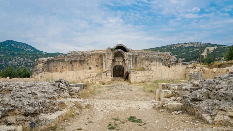
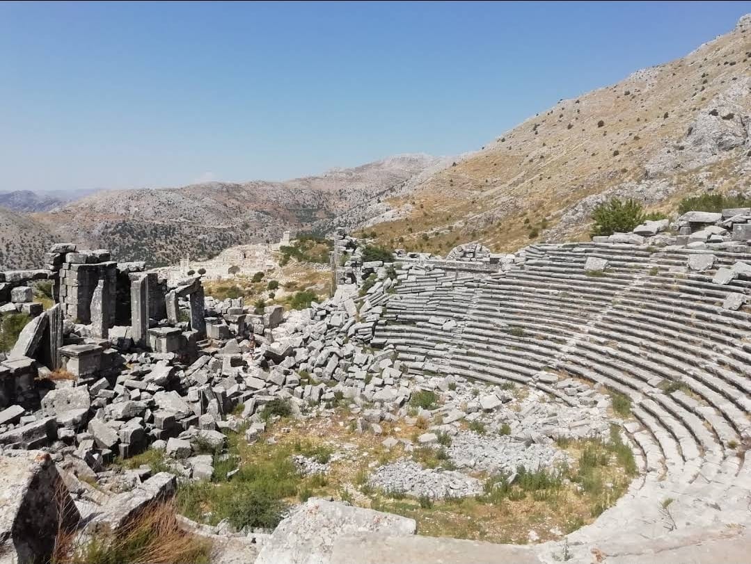
The theatre is among the best-preserved structures at Sagalassos. It was designed for approximately 9,000 people and occupies a place among the world’s highest-altitude theatres. Its survival contributes to the understanding of the city’s monumental public architecture and its use of steep mountain terrain.
Antoninus Pius Nymphaeum
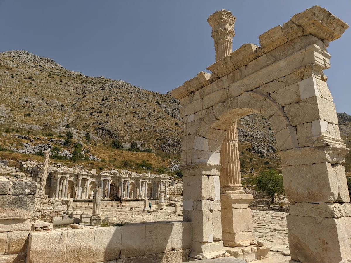
The Antoninus Pius Nymphaeum was excavated and reconstructed in 2009 and 2010. As a monumental fountain associated with the Roman public landscape, it forms part of the city’s extensive system of decorated water structures.
Domestic and Industrial Districts
Eastern Mansion
A large urban mansion stood in the eastern domestic area, southwest of the theatre. It extended across three successive terraces and contained at least fifty rooms. Smaller residential units and shops near the main agoras provide evidence for housing and commercial spaces used by other social groups within the city.
Potters’ Quarter
Excavations in the potters’ quarter identified at least two workshops. One produced fine wares intermittently from the first to the fifth century CE. The other made figurines, lamps, and wine-carrying vessels known as oinophoroi from the fifth century to the middle of the sixth century. Moulds and other production evidence show substantial local specialisation and an industry approaching a primitive industrial scale during the imperial period.
Fortifications and Later Religious Settlement
City Defences
Sagalassos was fortified around 400 CE. Defensive positions occupied surrounding slopes, while the later fortifications formed part of the city’s response to changing conditions in the late Roman period.
Fortified Monastery
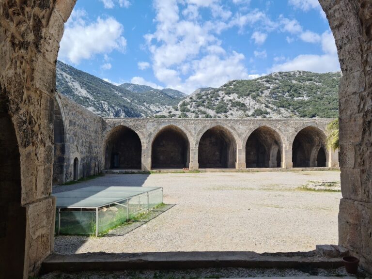
Archaeological remains identify a fortified monastery, possibly connected with a religious community that continued the bishopric after the city’s main urban occupation had declined. The institution was destroyed in the twelfth century.
Artistic and Archaeological Finds
Sagalassos has yielded imperial and divine sculptures, terracotta figurines, lamps, wine flasks, moulds, ceramic vessels, weighing-scale parts, locks, a gladiator helmet, and other objects dating from the Hellenistic through the Byzantine periods. Representations or fragments are associated with Athena, Hygieia, Isis, Cybele, Tyche, Ares, Heracles, Hermes, Zeus, Poseidon, Aphrodite, and other figures.
Architectural remains include cornice blocks, vaulted blocks, a southwest honorary column, a rock-cut sanctuary, and a Claudian-period arch in the southeastern area. Together with the agoras, fountains, theatre, baths, library, council chamber, houses, workshops, temples, and fortifications, these remains preserve the physical development of Sagalassos from the Hellenistic period through the early Byzantine centuries. Erosion deposits and the city’s elevated location helped protect substantial architectural material, while excavation and restoration have brought portions of its public, domestic, industrial, and religious fabric back into view.