Kerak Castle: A Medieval Crusader Fortress in Jordan
Site at a Glance
- Rating
- 4.4
- Popularity
- Medium
- Country
- Jordan
- Primary era
- Medieval
- Eras represented
- Iron Age, Medieval
- Civilizations
- Ayyubid, Crusader, Kingdom of Jerusalem, Mamluk
- Site type
- Military
- Remains
- Castle
On this page16 sections
History
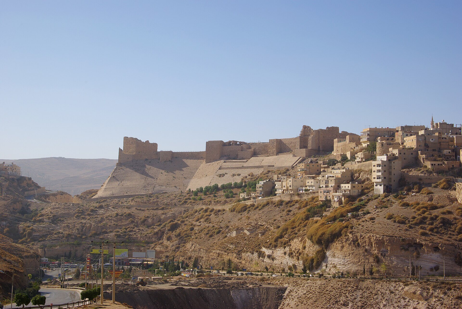
Kerak Castle is a large medieval fortress in al-Karak, Jordan, built and expanded by the Crusaders in the 12th century in an early Frankish architectural style. It became the centre of the barony of Kerak and Shawbak and was one of the largest castles in the Levant. Its location east of the Dead Sea gave it command over routes linking Damascus with Egypt, the Arabian Peninsula, and Mecca.
Ancient and Early Islamic Foundations
The foundations of the site are attributed to the Moabite period, around 860 BC. Nabataeans later used the position, and it continued as a defensive stronghold during the Roman and Byzantine periods. The Madaba mosaic map, a sixth-century map of the Holy Land, includes the fortress among the region’s strongholds.
During the early Islamic conquests, the Muslim army led by Abu Ubayda ibn al-Jarrah reached the fortress, which surrendered. Under Muslim rule, older fortifications were strengthened and enlarged, preserving the site’s defensive function. In 982, the Fatimid commander Bultakin al-Turki held Kerak as a fief. The Fatimids were an Ismaili Shi‘i caliphate that ruled Egypt and parts of the Levant.
The Crusader Barony
Crusader forces occupied southern Jordan in 1115 and 1116 and established the barony of Kerak and Shawbak. In 1142, they seized and expanded the fortress under Pagan the Butler and Fulk, King of Jerusalem. Kerak then became the barony’s administrative centre, replacing the weaker castle of Montreal as the principal centre of power in the region. The Crusader states were Latin Christian territories created in the Levant during the medieval Crusades.
The Crusaders called the fortress Crac des Moabites, meaning “Karak in Moab,” and also referred to it colloquially as Krak of the Desert. Earlier names included Kir Hareseth, Kir Hares, and Kir Moab. The name Kerak developed from the Crusader forms Crac or Krak, meaning fortress.
Pagan the Butler was also Lord of Oultrejordain, the Crusader lordship east of the Jordan River and the Dead Sea. Kerak served as the centre of his authority. His successors, his nephew Maurice and Philip of Milly, added towers and strengthened the northern and southern sides with deep rock-cut ditches.
Raynald of Châtillon and the Sieges of Saladin
In 1176, Raynald of Châtillon gained possession of Kerak through his marriage to Stephanie of Milly, the widow of Humphrey III of Toron. From the castle, he attacked camel caravans and attempted an assault on Mecca. These actions helped provoke Saladin’s campaign against the Crusader territories. Saladin was the Muslim ruler who founded the Ayyubid dynasty and opposed the Crusader states.
Saladin besieged Kerak in 1183 during the marriage of Humphrey IV of Toron and Isabella I of Jerusalem, which was taking place inside the castle. After negotiations, he agreed not to attack the bridal chamber while his siege engines struck other parts of the fortress. Baldwin IV of Jerusalem, the leper king of the Latin Kingdom of Jerusalem, eventually relieved the siege.
Saladin returned in 1184 and tried to fill the ditches so that his siege engines could approach the walls. The siege lasted four weeks, ending when he withdrew before a relieving Crusader army arrived. In 1188, Saladin’s nephew Sa’d al-Din led the final siege of the twelfth century. Muslim forces cut off the castle’s supplies, and Kerak surrendered after several months. The surrender is believed to have followed a shortage of weapons rather than food. Montreal surrendered soon afterward.
Ayyubid and Mamluk Administration
Under the Ayyubid dynasty, the Muslim ruling house founded by Saladin, Kerak became the administrative centre for the regions of Jordan and housed a royal treasury. During Ayyubid internal conflicts in the 1230s and 1240s, it was one of three principalities that remained independent. Sultan al-Salih Ayyub of Egypt retook the castle in 1249.
Kerak’s administrative importance was reflected in the privilege granted to only its governor and the governor of Damascus, allowing them to send official correspondence on red paper. In 1244 and 1245, An-Nasir Dawud expanded and improved much of the castle’s defensive system. Earlier, in 1227, the Damascene Sultan al-Mu‘azzam Isa had commissioned a tunnel connecting the castle with the town.
After the Ayyubid period, Kerak passed to the Mamluk sultans, the Egyptian-based regime that succeeded the Ayyubids across much of the region. Sultan Baibars captured, repaired, and enlarged the castle in 1263. It remained an administrative centre and maintained a substantial military force. Under al-Mughith, its garrison included at least 700 cavalrymen, while an administrative description assigned four ministries to the castle: the army, finance, Kerak, and the chancery.
Ottoman Rule and Modern Interpretation
During the Ottoman period, the castle retained strategic importance because it stood at the crossroads of routes between the Arabian Peninsula, Egypt, and Greater Syria. In 1834, leaders of the Palestinian peasants’ revolt took refuge there. Ibrahim Pasha of Egypt besieged the fortress and destroyed much of its defensive system. In 1844, Egyptian forces inside the castle were themselves besieged, suffered starvation, and lost many men.
In 1893, the Ottoman authorities reasserted control over the area by appointing a resident mutasarrif, an Ottoman provincial governor, and a garrison of 1,400 troops, including 200 cavalrymen. Parts of the castle were reused during this period. Local inhabitants also removed stones containing potassium nitrate, or saltpetre, to manufacture gunpowder, causing further damage.
Ottoman soldiers used the walls and towers to fire on rebels during extensive executions of people resisting Ottoman authority in 1910. During the Arab Revolt, the fortress again played a role in controlling communications between the Hejaz, Syria, and Egypt.
Medieval historian Paul Deschamps studied the Crusader castles during the 1920s. In 1929, Deschamps and architect François Anus produced the first accurate plans of Kerak Castle. The fortress became an archaeological museum in 1980. It reopened in January 2004 with material from the Mamluk and Ottoman periods and sections covering the Neolithic, Bronze Age, Iron Age, Nabataean, Roman, Byzantine, and Crusader periods. In 2019, the museum moved from the castle’s Lower Court to a historic Ottoman building outside the castle, opposite its main wall.
The Jordanian Ministry of Tourism and Antiquities has carried out projects involving the archaeological site and the surrounding urban heritage in cooperation with the World Bank. The Kerak Castle Square project received a Golden Urban Heritage award in an international heritage and environmental-conservation competition. In 1985, the World Heritage Committee decided not to inscribe Kerak as a UNESCO World Heritage site, judging other Crusader castles more representative and noting its relatively poor condition compared with better-preserved Crusader castles in Transjordan.
On 18 December 2016, the castle was the site of a terrorist attack in which fourteen people were killed and thirty-four injured. The victims included Jordanian security personnel, local civilians, and a Canadian tourist. The attackers are said to have withdrawn into the fortress after clashes with police and held civilians hostage.
Remains
Site Layout and Defensive Works
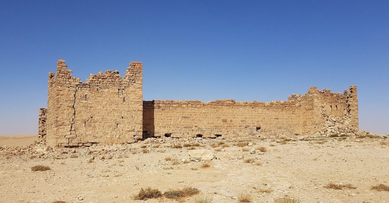
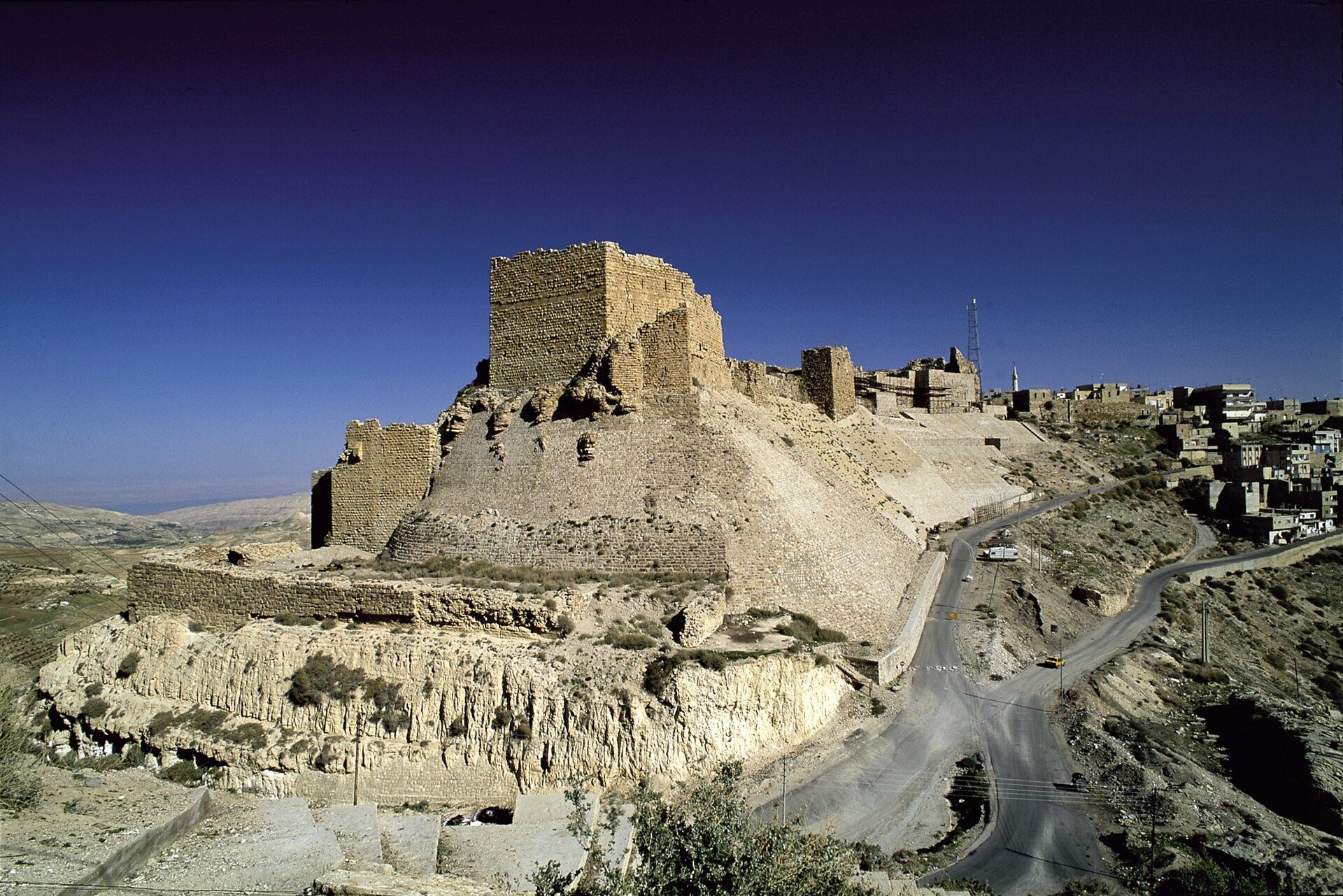
Kerak Castle occupies the southern end of a roughly triangular plateau above al-Karak, surrounded on three sides by steep hills. The site covers approximately 25,300 square metres and stands about 900 metres above sea level. It extends for about 220 metres, with a width of roughly 125 metres on the northern side and about 40 metres on the southern side, where it overlooks a valley containing a water channel. This position concentrated a potential assault on one side of the fortress.
The castle is enclosed by thick stone walls, towers, an artificial slope, and ditches. A glacis, a sloping defensive surface that exposes attackers and hinders their approach, rises at the foot of the walls. A ditch near the castle known as the Byzantine ditch was intended to keep siege engines at a safer distance. Another ditch west of the fortress, near the town, was deeper but narrower and is now almost completely filled in. The southern ditch also served as a cistern.
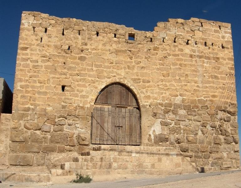
Kerak is an early Frankish castle built around a fortified-tower structure. Its design combines western European, Byzantine, and Arab traditions. Compared with later concentric Crusader castles, its plan is less complex, and its masonry is comparatively rough. The Crusaders built the perimeter walls chiefly from roughly shaped volcanic stone. After the Muslim capture, limestone from nearby quarries was used for repairs and enlargement. Both Christian and Muslim masonry use draft masonry, in which the edges of each block are smoothed while the central surface remains rough and raised.
Walls, Towers, and Internal Passages
Projecting Towers
Rectangular towers project from the walls at regular intervals and are unusually close together, probably to improve visibility between defensive positions. Their square form reflects Byzantine tower construction and belongs to an early Crusader design phase, before round towers became more common in curtain walls. A curtain wall is the main enclosing wall between towers.
Baybars Tower
Baybars Tower forms part of the southern defensive system. Sultan Baybars ordered its construction in 1262, and the tower was completed seventeen years later. The approximately square structure has four storeys, a large interior hall extending through two levels, ventilation and lighting openings in the ceiling, and arrow slits across all four floors. Its walls are about six to seven metres thick.
Northern Halls and Town Tunnel
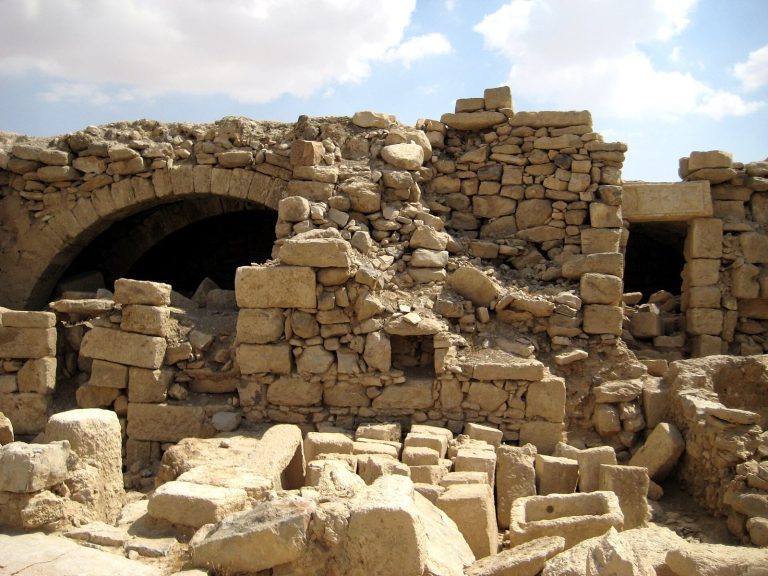
The northern wall contains enormous arched halls on two levels, the most notable surviving Crusader feature. They served as living quarters and stables, as a fighting gallery overlooking the approach to the castle, and as shelter from projectiles fired by siege engines. Passages beneath the fortress lead to fortified rooms. The tunnel commissioned in 1227 connected the castle with the town.
Religious and Archaeological Features
Chapel
A chapel stands on the eastern side of the castle, approximately halfway along the length of the curtain wall. Its position forms part of the fortress’s surviving eastern architectural group.
Archaeological Collections
The museum’s collections include artefacts from the Nabataean, Roman, Byzantine, Crusader, Mamluk, and Ottoman periods, together with material from the Neolithic, Bronze Age, and Iron Age. The objects provide physical evidence for the succession of communities and ruling periods associated with the site.
Tombs South of the Castle
South of the castle are the tombs of several Companions of the Prophet, including Ja‘far ibn Abi Talib, Zayd ibn Harithah, and Abdullah ibn Rawahah, who died at the Battle of Mu’tah.