Fortress of Umm ar-Rasas (Old Roman City): A Roman Frontier Settlement in Jordan


Site at a Glance
- Rating
- 4.3
- Popularity
- Medium
- Country
- Jordan
- Primary era
- Medieval
- External website
- Open
- Eras represented
- Classical, Medieval
- Civilizations
- Abbasid, Byzantine, Roman
- Site type
- Military
- Remains
- Fortified Town
On this page18 sections
History
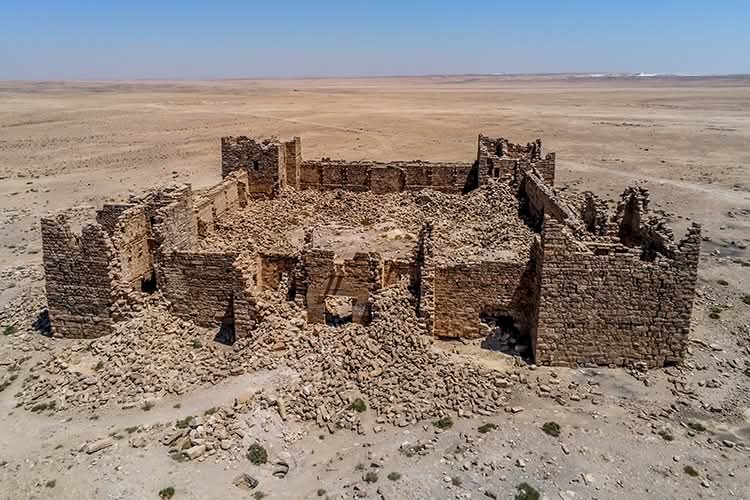
Fortress of Umm ar-Rasas (Old Roman City) is an archaeological site in Jordan built by the Romans as a military station on the desert frontier around AD 300. Anciently known as Kastron Mefa’a, Mefa, or Mefaa, it preserves Roman, Byzantine-Christian, and early Islamic remains dating from the late third century to the ninth century. The site has been associated with the biblical settlement of Mephaat, an interpretation supported by an inscription naming Kastron Mephaa.
Roman frontier station
The Roman garrison occupied a strategic position connected with branches of the King’s Highway, an older long-distance route east of the Jordan and the Dead Sea, and the Limes Arabicus, the Roman defensive frontier across the desert regions of Arabia and the Levant. Its soldiers protected routes between Arabia and the Levant and helped secure the surrounding region.
A late Roman cavalry garrison was established at Umm ar-Rasas around AD 300. Its creation has been linked with the reorganization of the frontier after Emperor Aurelian defeated Zenobia of Palmyra in AD 272 and with the later frontier policies of Emperor Diocletian. The fort initially served a military purpose, but the settlement expanded beyond the garrison during the fifth century.
From garrison to Christian town
During the sixth century, the military abandoned the fort and civilians reshaped the former garrison. Houses, churches, and public areas were inserted within the walls, while another urban quarter developed to the north. This growth did not follow a regular plan. Narrow lanes and irregular passages linked the buildings, reflecting the gradual conversion of a military enclosure into a settled town.
Umm ar-Rasas became an important Christian ecclesiastical and monastic center during the Byzantine period. Pilgrimage and the growth of desert monastic communities brought churches and religious activity together at the site. A tall tower north of the settlement is traditionally connected with stylites, Christian ascetics who practiced religious withdrawal while living on a raised pillar or tower, although its precise function remains uncertain.
Christian life continued after the Muslim conquest of the Levant in AD 636. Churches remained in use during the Umayyad and Abbasid periods, and the Christian community continued to act in social, religious, and administrative affairs at the end of the eighth century. During the Abbasid period, restrictions on Christian images led to the defacement of figures in church mosaics. Human representations were removed, fish heads were erased, and the eyes of some octopuses were destroyed, while one human figure in the Church of St Stephen remained intact.
Decline and archaeological rediscovery
Christian life and the city declined at the beginning of the ninth century. Churches and monasteries were progressively abandoned, although the settlement continued to preserve evidence of the cultural and religious changes that followed Muslim rule.
Excavation began in 1986 and included investigations by the Studium Biblicum Franciscanum at the northern end of the site. Work in the Church of St Sergius complex began in 1987. Much of the settlement remains buried beneath debris. Umm ar-Rasas was inscribed on the UNESCO World Heritage List in 2004 for the artistic and technical achievement of the St Stephen mosaics, its evidence for stylite towers, and its association with monasticism and the spread of monotheism, including Islam.
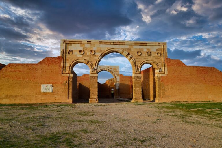
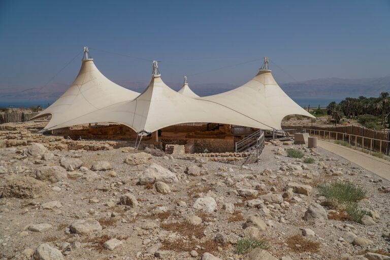
Conservation has improved the condition of the site, but the remains remain vulnerable to earthquakes, sharp temperature changes, winter rain, dust-bearing westerly winds, and erosion of limestone elements. Continuous maintenance protects the St Stephen mosaic, while plans have addressed the stabilization and study of the vertical tower. Protective roofing over the mosaics and the reconstruction of two arches affect the site’s visual integrity, although the roofing also serves a conservation purpose and was regarded as temporary.
Remains
Umm ar-Rasas stands on a high plateau about 760 metres above sea level between Wadi Wala and Wadi Mujib. The ancient city covers roughly 2 square kilometres, while the walled settlement occupies about 3 hectares and measures approximately 158 by 139 metres. Its remains fall into three principal areas: the Roman military camp, the church complex, and religious and monastic installations outside the walls. Fortifications, residential buildings, churches, towers, cisterns, terraces, and buried archaeological areas together reveal the physical growth of the settlement.
The Roman fort and civilian quarters
Fortifications and gates
The Roman fort has a rectangular plan enclosed by high walls strengthened with towers. It housed the garrison responsible for protecting the regional trade route. Gates opened on the northern and southern sides, as well as through a large eastern entrance. The original northern entrance was later blocked and converted into a small heated sweating room, or laconium, associated with a bath complex. Additional northern and southern gates were created as the settlement changed.
Residential and public areas
In the sixth-century civilian redevelopment, houses and churches were placed inside the fortification without a regular spatial plan. Narrow lanes and irregular passages separated the structures. A second urban quarter of approximately similar size grew north of the old garrison walls around a public square. A column bearing a cross stood at the center of this square, as shown in a sixth-century mosaic from the Church of the Lions. A later mosaic in the Church of St Stephen shows the column without its cross, apparently reflecting its removal after the arrival of Islam.
The church complex
Church of St Stephen
The Church of St Stephen is an eighth-century building whose principal mosaic floor dates to AD 785. Covering more than 500 square metres, it is described as the largest preserved mosaic floor in Jordan. A mosaic is a patterned or figurative surface made from small pieces of stone, glass, or ceramic called tesserae.
The floor’s central panel contains hunting and fishing scenes. Other panels represent cities in Jordan, Palestine, and the Nile Delta, including Jerusalem, Kastron Mefa’a, Alexandria, Philadelphia, Madaba, Heshbon, Ma’in, Rabba, Karak, Nablus, Caesarea, Gaza, and Pelusium. The composition includes eight Palestinian cities, nine Jordanian cities, and ten cities in the Nile Delta. Its outer frame is richly decorated, and six mosaicists signed the work: Staurachios of Esbus, Euremios, Elias, Constantinus, Germanus, and Abdela. Greek inscriptions within the floor place it in the period from AD 756 to 785.
The St Stephen floor was laid over an earlier damaged mosaic associated with the Church of Bishop Sergius, dated to AD 587. The church complex also contains other mosaic floors and architectural remains from the late sixth and eighth centuries. Later removal and rearrangement of tesserae changed many human, animal, and architectural images, especially in the Church of St Stephen.
Church of St Sergius
The Church of St Sergius, also called the Twin Church or the Church of the Rivers and the Palm Tree, contains two basilical churches within the fortification. The northern Church of the Rivers predates the southern Church of the Palm Tree. The principal church complex is arranged around four courtyards, the northeastern, western, eastern, and southern. Its enclosing wall sometimes merges with the walls of individual spaces, including the northern wall of the Bishop Sergius church.
Church of St Paul
The Church of St Paul has two entrances in its southern wall. A tiled porch stood before the eastern entrance, and a columned porch extended before the two doorways. Two niches in the eastern wall were associated with the cover of a reliquary, a container made to preserve a religious relic.
The church and its mosaic were built during the second half of the sixth century, in the episcopate of Sergius, and remained in ritual use at least until the middle of the eighth century. A nomadic family later occupied the building and added a room inside and another outside it. This occupation continued until the roof collapsed in the tenth century, after which the later history of the structure is uncertain.
Outlying churches
Additional churches were excavated beyond the northern fortification wall. At least twelve churches or church remains have been excavated at the site, while the wider Umm ar-Rasas area contains fourteen churches. Seven further churches dating from the fifth and sixth centuries were discovered at a village about 3 kilometres west of Umm ar-Rasas.
Towers and monastic installations
Northern tower
North of the fort stands a tower about 15 metres high, with carved crosses on three sides and an upper chamber. Nearby are a small church, a three-storey building, and rock-cut cisterns. The tower is one of the tallest surviving ancient towers in Jordan. Its arrangement with the church and water installations forms part of the outlying religious and service buildings north of the fortified settlement.
Stylite tower
The stylite tower, also called the Hermit’s Tower, stands approximately 1.5 to 1.6 kilometres north or northwest of the walled settlement. Its square base measures about 2.5 by 2.5 metres, and it rises within a walled court containing a church. The upper chamber was formerly covered by a dome.
Carved Christian symbols decorate the sides of the tower. Its traditional interpretation connects it with a stylite, an ascetic monk who lived in isolation on the summit of a pillar or tower. Another interpretation regards it as a lookout and warning post that protected the settlement and nearby stored water. The upper chamber is currently inhabited by flocks of birds, and the tower remains beside a small church ruin and a cistern.
Water management, agriculture, and production
Ancient agricultural terraces survive around the settlement, particularly north, northeast, northwest, south, and southwest of the fort. Low dams built across the wadis retained water for cultivation. The terrace fills consisted mainly of colluvial soils containing gravel and fine sandy silt.
A water-collection system extended across the site, supplying drinking water and irrigation. Cisterns were cut into the bedrock, including installations near the northern tower. A partly excavated large wine cellar contains a pressing area formed by several basins whose floors were covered with white mosaic tesserae.
Earlier evidence and reused inscriptions
Excavations near the churches produced evidence from the Iron Age, including a basalt-column base, a scarab, and pottery belonging to Iron Age IIc, dated to approximately 700 to 586 BC. Thamudic, Nabataean, and Latin inscriptions were reused as building material in the St Stephen complex. These earlier objects and inscriptions add to the evidence for the long occupation and changing use of the plateau before and after the Roman garrison was established.