Volubilis: A Mauretanian and Roman City in Morocco


Site at a Glance
- Rating
- 4.5
- Popularity
- Medium
- Country
- Morocco
- Primary era
- Classical
- Eras represented
- Classical, Medieval
- Civilizations
- Amazigh, Carthaginian, Kingdom of Mauretania, Roman
- Site type
- City
On this page33 sections
History
Volubilis is an ancient city in Morocco, near Meknès, built and developed by Mauretanian and Roman communities from at least the Neolithic period onward. It became an urban settlement during the Mauretanian period, probably in the third century BC, and served as a capital of the Kingdom of Mauretania. Influenced by Berber, Punic, Greek, and Roman cultures, the city later became an important Roman center in the province of Mauretania Tingitana.
Mauretanian beginnings
Volubilis grew from communities that were Berber and Punic or proto-Carthaginian in character. The Mauretanian kingdom became a Roman client state after the fall of Carthage in 146 BC, but Punic political traditions continued. City magistrates retained the title of suffete, a chief office in Punic and Carthaginian political systems. Four fragmentary Punic or Neo-Punic inscriptions and several Libyco-Berber inscriptions provide evidence for the city’s cultural and administrative setting.
The rulers and population remained predominantly indigenous even as Roman influence increased. Political institutions, imported goods, architecture, religious practices, and the adoption of Roman citizenship all contributed to the city’s Romanization. Volubilis was shaped by several traditions rather than by a simple replacement of one culture by another.
Royal city under Juba II
In 25 BC, Augustus placed Juba II of Numidia on the Mauretanian throne. Juba II and his son Ptolemy were Romanized rulers of Berber ancestry. Juba II may have developed Volubilis as a royal residence or second capital, although that interpretation remains uncertain.
During their rule, Volubilis was a prosperous city with important monuments and a broad range of local and imported goods. Its finds include local and imported coinage, Campanian ceramics, Italian amphorae, and other Mediterranean products. Agriculture formed the economic foundation of the city, especially the cultivation of olives and the production and trade of olive oil.
Roman annexation and municipal status
In 40 AD, the emperor Caligula ordered the assassination of Ptolemy. A revolt led by Aedemon, one of Ptolemy’s freedmen, followed and continued from 40 to 44 AD. Volubilis supported Rome by forming an auxiliary militia. In 44 AD, Claudius rewarded the city’s loyalty and military assistance by granting Roman citizenship to its free inhabitants, ten years of tax privileges, and the status of a municipium, a Roman town with recognized civic institutions and a constitution.
After Rome annexed Mauretania in 44 AD, it divided the kingdom into the provinces of Mauretania Tingitana and Mauretania Caesariensis. Mauretania Tingitana covered northern Morocco and adjoining territory. Volubilis became an important Roman outpost on its frontier and was connected by roads with Lixus and Tingis. The Baquates occupied the territory between Volubilis and the eastern province, leaving the city in a strategically isolated position.
Roman prosperity and withdrawal
Volubilis prospered especially during the second and early third centuries AD. Its agricultural hinterland produced grain and olives, while urban wealth supported public monuments, private mansions, mosaics, baths, shops, workshops, and oil presses. The population at its height is estimated at roughly 12,000 to 20,000 inhabitants.
The city’s Roman period ended through a gradual political and administrative withdrawal. After the crisis of the third century, Rome removed its army and administration from Volubilis and the region south of the Loukkos around 285. The decision appears to have reflected the strategic and economic cost of retaining an isolated frontier, rather than only a worsening of local insecurity. Roman rule was not restored in the city.
Occupation continued after the withdrawal. As the aqueduct declined, residents gradually left the higher parts of the city and moved toward the Oued Khoumane. Roman houses were altered with reused materials, municipal institutions fell out of use, and new neighborhoods developed without an abrupt break in settlement. Christian and Jewish communities formed part of the late Roman and post-Roman population, although their precise organization remains uncertain. Christian inscriptions, a bronze seven-branched lamp associated with Jewish presence, and a fourth-century statuette of the Good Shepherd are among the evidence for this period.
Late antique and Islamic Volubilis
By the late sixth century, settlement had shifted westward, and a later enclosure had been built or repaired with material taken from earlier buildings. The area around the triumphal arch became a Christian cemetery during the first half of the seventh century.
Islamic occupation began by the seventh or early eighth century. Local coinage was struck at Volubilis between 722 and 789, while Islamic settlements occupied areas near the river and beyond the earlier urban core. The population gradually converted to Islam, and the site retained regional importance.
In 788 or 789, Idris I established himself at Volubilis among the Awraba Berbers. He used the city as a base for military expansion and for creating the Idrisid state. He was proclaimed imam there and was assassinated at Volubilis in 791, probably on the orders of the Abbasid caliph Harun al-Rashid.
Idris I’s son, Idris II, was also proclaimed imam at Volubilis, but later transferred the seat of power to Fes. The city consequently lost its political importance, although Idrisid coinage continued to be struck there from 789 to 825. A group of Andalusi refugees from Cordoba settled at Volubilis in 818. Occupation continued into the eleventh or twelfth century, with substantial activity possibly lasting until the fourteenth century, though the medieval evidence is uneven.
Decline, rediscovery, and archaeology
By the twelfth century, Volubilis was described as being in ruins. Under the Marinids, it became a pilgrimage site associated with Idris I after an apparition in 1318–19, and the settlement was temporarily reoccupied. Idris I’s body was later transferred to Moulay Idris Zerhoun, where a mausoleum was built.
From the later fourteenth century, the site was known locally as Ksar Faraoun, meaning “Pharaoh’s Castle.” From the late seventeenth to the early eighteenth century, Sultan Moulay Ismail removed usable materials from Volubilis for construction in Meknes and, according to tradition, for the mausoleum at Moulay Idris. A major earthquake in 1755 caused further destruction.
European visitors described and illustrated the ruins from the early eighteenth century. John Windus sketched the arch and other remains in 1722, and James Grey Jackson described the site in 1820. Charles-Joseph Tissot visited in 1871 and identified the ruins with ancient Volubilis. Henri de La Martiniere carried out further surveys and excavations in 1888–89.
Systematic excavation began in the early twentieth century. The French Service des Antiquities was established at Volubilis in 1915, and Louis Chatelain directed the early excavations, later followed by Raymond Thouvenot. Later Islamic and post-Roman layers received less attention during this early work. Excavations continued through Moroccan and foreign collaboration after Moroccan independence. Work in the 1960s and 1970s, stratigraphic investigations in the late 1980s and early 1990s, and Moroccan-British excavations in the 2000s examined later neighborhoods, Islamic baths, and areas south of the enclosure.
Excavations since 2000 revealed a complex outside the Roman walls that may have been the headquarters of Idris I, together with part of the early medieval settlement. About half of the site has been excavated. Public buildings, elite houses, mosaics, industrial installations, and later settlements have been exposed, although the lack of systematic stratigraphy in some early excavations complicates the study of Volubilis’s urban development and its late antique and Islamic phases.
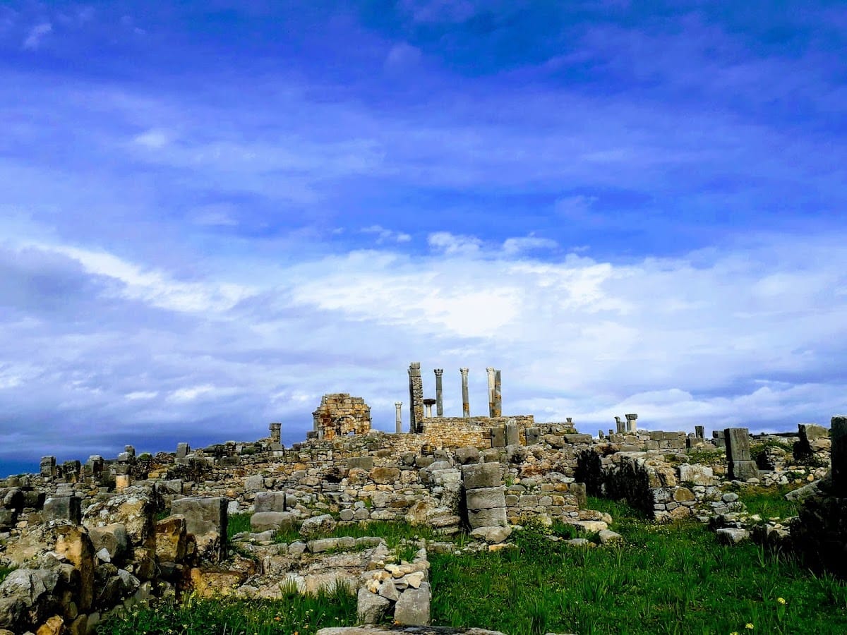
The Arch of Caracalla, the Capitoline Temple, the basilica, several houses, mosaics, and an olive-oil workshop were restored or reconstructed during the twentieth century. Some reconstructions, particularly those of the arch, the Capitoline Temple, and the oil press, have been criticized as radical or insufficiently supported by surviving evidence. Volubilis was protected as a Moroccan historic monument in 1921 and inscribed on the UNESCO World Heritage List in 1997. The protected property covers 42 hectares and has a 4,200-hectare buffer zone, whose boundaries were clarified in 2008.
Remains
Setting, city plan, and defenses
Volubilis occupies a roughly triangular or V-shaped ridge on a plateau below Jebel Zerhoun, between the Oued Fertassa and Oued Khoumane. At approximately 390 metres above sea level, the elevated position and surrounding valleys gave the settlement a naturally defensible setting. The pre-Roman town covered about 12 hectares. Under Roman rule it expanded along a northeast to southwest axis to approximately 40 to 42 hectares, incorporating earlier buildings and adapting to uneven ground.
The Roman city combined an orthogonal plan in the northeastern and monumental sectors with terraced planning in the more irregular southern and western areas. A surviving section of mud-brick wall on a stone foundation lies beneath or near the later monumental zone. The Roman enclosure was built in 168–169 AD. It was about 2.6 kilometres long, 1.5 to 1.6 metres thick, and originally 5 to 7 metres high, with roughly 34 to 40 towers and several principal gates. The Tingis Gate formed the northeastern entrance and has been partly reconstructed.
Streets, water, and civic center
Decumanus Maximus
The Decumanus Maximus, a principal Roman street usually aligned east to west, ran for approximately 400 metres between the Tingis Gate and the Arch of Caracalla. It was about 12 metres wide and bordered by porticoes and shops. A central sewer collector formed part of the street’s infrastructure.
Aqueduct and water system
An aqueduct built near the end of the first century AD, possibly around 60–80 AD, brought water from the Zerhoun hills. It was modified during the second and third centuries and supplied fountains, baths, houses, and distribution chambers. Lead and terracotta pipes, settling basins, wells, and a cistern formed part of the wider water system. Its decline helped shift occupation away from the higher parts of the city after Roman administration withdrew.
Forum and basilica
The forum occupied the center of the Roman city and covered approximately 1,300 square metres. It contained the basilica, curia, porticoed spaces, temples, an altar, a speaking platform, statues, and inscriptions. The space served both political and religious functions.
The basilica was built in the early third century, with construction beginning around 210 AD. It served the administration of justice and the government of the city. Measuring approximately 42.2 by 22.3 metres, it originally had two storeys and upper galleries.
Capitoline Temple
Behind the basilica stands the Capitoline Temple, dedicated to Jupiter, Juno, and Minerva, the three chief deities of the Roman state. The temple had a single cella, the enclosed inner chamber for the cult image, together with Corinthian columns, an altar, porticoes, and thirteen steps. An inscription records its reconstruction in 218 AD. Parts of the cella, steps, and columns were reconstructed during the twentieth century.
Sanctuaries and religious buildings
Temple B
Temple B stood on the eastern side of the city and covered approximately 3,200 square metres. Its buildings included an enclosed sacred area, a three-sided portico, subsidiary rooms, cisterns, and altars. It has traditionally been identified as a temple of Saturn, but that attribution is hypothetical and is not generally accepted.
Anonymous Temple A
Anonymous Temple A was an open-air sanctuary near the Capitoline area. It probably dates to the third or second century BC and contained a small temple, an altar or tufa podium, stelae, and an ossuary deposit. Between approximately 815 and 903 rectangular sandstone or marl stelae were found. Their precise religious meaning remains uncertain.
Temples G13 and H13
Two paired temples known as G13 and H13 stood northwest of the forum beneath the later enclosure. Their construction belongs broadly between the second and later first century BC, although the exact date is uncertain. One podium covered approximately 75 square metres, and the buildings may have remained in use into the second or third century AD.
Baths and domestic architecture
Roman baths
Volubilis had at least four Roman public bath complexes, as well as a later Islamic hammam, or bathhouse arranged around rooms of different temperatures. The North Baths probably date from the late first or early second century AD. They covered about 1,500 square metres, or approximately 2,000 square metres including open areas, and included a 724-square-metre exercise court, a swimming pool, shops, latrines, and heated rooms.
The Baths of Gallienus formed a medium-sized linear or L-shaped complex without an exercise court. Covering approximately 1,200 square metres, they contained three hot rooms and a room used for scraping oil and dirt from the body. The complex was refurbished in the 260s.
Elite houses
Roman houses ranged from simple two-room mud-brick dwellings to large elite residences exceeding 1,500 or 2,000 square metres. Wealthier houses commonly combined a peristyle, reception rooms, gardens, fountains, private baths, shops, workshops, olive presses, bakeries, and storage rooms. Their arrangements show how residential, commercial, and industrial activities could occupy the same urban property.
House of Orpheus
The House of Orpheus occupies an entire city block in the southern part of Volubilis and includes private, public, and industrial areas. Its principal circular mosaic, approximately 3.8 metres in diameter, depicts Orpheus playing a lyre among trees, animals, and birds.
House of the Athlete
The House of the Athlete, also called the House of the Desultor, contains a mosaic of an athlete or acrobat riding backward on a donkey while holding a cup. The figure may represent Silenus. Another mosaic depicts fishing with a rod and net.
House of the Ephebe
The House of the Ephebe has an interior courtyard, reception rooms, mosaics, and a bronze statue of an ephebe. Its mosaic scenes include Bacchus in a chariot drawn by leopards or tigers and a scene of Nereids.
House of the Knight
The House of the Knight, or Cavalier, covers approximately 1,700 square metres. It includes shops, commercial areas, and an olive-pressing installation. A bronze rider discovered there in 1918 gave the house its name. One mosaic shows Bacchus encountering the sleeping Ariadne.
House of the Labours of Hercules
The House of the Labours of Hercules covers approximately 2,000 square metres and contains forty-one rooms. Its principal mosaic represents the Labours of Hercules together with Ganymede, Jupiter, and the Seasons.
Gordian Palace
The Gordian Palace is the largest building at Volubilis and probably served as a governor’s residence rather than as the home of Gordian III. Rebuilt around 238–244 AD, it combined two houses into a complex of approximately 74 rooms. Courtyards, private baths, official rooms, shops, olive presses, and an oil store formed part of the building.
House of Venus
The House of Venus was among the city’s most luxurious residences. It contained private baths and mosaics in seven corridors and eight rooms. A mosaic of Venus was removed to Tangier. Other mosaics associated with the house depict Diana and Actaeon, Hylas and the nymphs, Diana and bathing nymphs, Bacchus and the Seasons, and Cupids feeding birds.
Olive oil, grain, and mosaics
Olive-oil production was carried out across the city. At least 100 presses and about 58 oil-pressing complexes have been identified at Volubilis, with approximately twenty more installations in the surrounding region. A typical installation included a mill, woven baskets, a press operated by a wooden beam and counterweight, and a basin for separating the oil.
Grain production and baking were also important. Sixty-four volcanic-stone querns, mechanical kneading installations, bakeries, and grain silos have been identified. Silos in the Idrisid quarter contained pottery dated to the late eighth or early ninth century.
Mosaics are concentrated especially in elite houses and reception rooms. They use local limestone, marble, schist, ceramic, and glass paste. Most are polychrome opus tessellatum, a technique made from small cubes called tesserae, measuring approximately 0.5 to 1.5 centimetres across.
Sculpture and the Arch of Caracalla
Bronzes and sculpture
Finds from Volubilis include a bronze bust of Cato the Younger, a bronze ephebe, an ephebe crowned with ivy, a rider, a horse, a realistic Old Fisherman, a crouching dog, and statues of Mercury. Fragments of furniture and military equipment were also discovered at the site.
Arch of Caracalla
The Arch of Caracalla stands at the end of the Decumanus Maximus, where the older and newer sectors meet. The procurator Marcus Aurelius Sebastenus dedicated it between December 216 and April 217 on behalf of the people of Volubilis to Caracalla and Julia Domna.
Built from local grey Zerhoun limestone, the arch originally carried a bronze group of Caracalla and Julia Domna in a chariot drawn by six horses. Statues of nymphs poured water into marble basins at its base. The monument was damaged or collapsed in the earthquake of 1755 and was reconstructed by French archaeologists between 1930 and 1934.
Idrisid-period settlement
Outside the Roman walls near the Oued Khoumane, excavated Idrisid-period buildings include interconnected courtyards, reception rooms, grain silos, domestic spaces, and an L-shaped hammam. Coins and pottery date the complex to the reign of Idris I. Its scale and arrangement have led to its probable identification as his headquarters, although that interpretation remains uncertain.