Banasa Archaeological Site: Roman Colony and Agricultural Centre in Morocco
Site at a Glance
- Rating
- 4.2
- Popularity
- Very Low
- Country
- Morocco
- Primary era
- Classical
- Eras represented
- Iron Age, Classical
- Civilizations
- Kingdom of Mauretania, Roman
- Site type
- City
On this page19 sections
History
Banasa Archaeological Site in Morocco preserves the remains of a pre-Roman settlement and the Roman colony of Iulia Valentia Banasa, founded by Octavian, later the emperor Augustus, between 33 and 25 BC. The city belonged to Mauretania Tingitana, the Roman province covering much of northern Morocco, and stood beside the navigable Sebou River on the road between Tingi and Sala. Its colony was created in the Gharb plain for economic development and the settlement of veterans, rather than solely as part of a river defence system.
Pre-Roman settlement
Banasa was occupied before Roman rule. Pottery kilns date to the fifth or fourth century BC, while occupation probably began in the fourth century BC or earlier. By the third and second centuries BC, a substantial Mauretanian village occupied the site. Local potters continued to produce painted vessels until the first century BC, adapting forms and decoration derived from Phoenician, Greek, and Ibero-Punic traditions. Their wares circulated widely through the surrounding region.
Foundation and Roman rule
Octavian established the colony over the earlier Mauretanian settlement while the region remained connected to the kingdom of Juba II and had not yet become a fully incorporated Roman province. Banasa was one of three colonies founded by Augustus in Mauretania Tingitana for veterans of the Battle of Actium, the conflict in 31 BC that established Augustus as Rome’s dominant ruler and preceded the transformation of the Roman state under his authority.
Direct Roman rule reached Banasa in AD 40, after the death of the Mauretanian king Ptolemy. The transition probably brought political and social disturbances. At the beginning of Marcus Aurelius’ reign, the colony took the name Colonia Aurelia Banasa. The reason for this renaming remains uncertain.
Banasa developed an important strategic and defensive role, with auxiliary troops, meaning non-legionary units serving in the Roman army, stationed there. Their presence is recorded by inscriptions until the beginning of the third century AD. The city also became part of the province’s agricultural and administrative economy. Wheat and other cereals produced in its territory entered local and wider systems of distribution. Small boats could reach Banasa on the Sebou, while medium-sized vessels could travel to the port of Thamusida.
Administration and citizenship
An imperial measure dated AD 215–216 records the remission of accumulated arrears in wheat and money. In return for men and other contributions, Banasa’s debt was cancelled, but the community had to resume ordinary taxes and contributions and provide an extraordinary supply of animals. The edict shows that Banasa, like the wider province, supplied goods to the Roman administration. A separate bronze inscription records a remission of tax arrears under Caracalla in AD 216. This was a cancellation of accumulated obligations, not a general exemption of the city’s inhabitants from taxation.
The Tabula Banasitana, a bronze legal document found in 1957 in the East Baths complex, records the grant of Roman citizenship on 6 July AD 177 to Iulianus, a princeps, or leading member, of the Zegrensi tribe, and to his family. The grant recognized exceptional service while preserving their tribal rights. Issued during the reigns of Marcus Aurelius and Commodus, the document illustrates how Roman citizenship could be extended to members of local tribal elites without erasing their existing communal identity.
Contraction and rediscovery
During the third century AD, Banasa was affected by the reorganization and contraction of Roman power in Mauretania Tingitana. When the province was reduced in AD 285 to territories north of the Lixus and Banasa, the city was abandoned. The site has no fourth-century occupation.
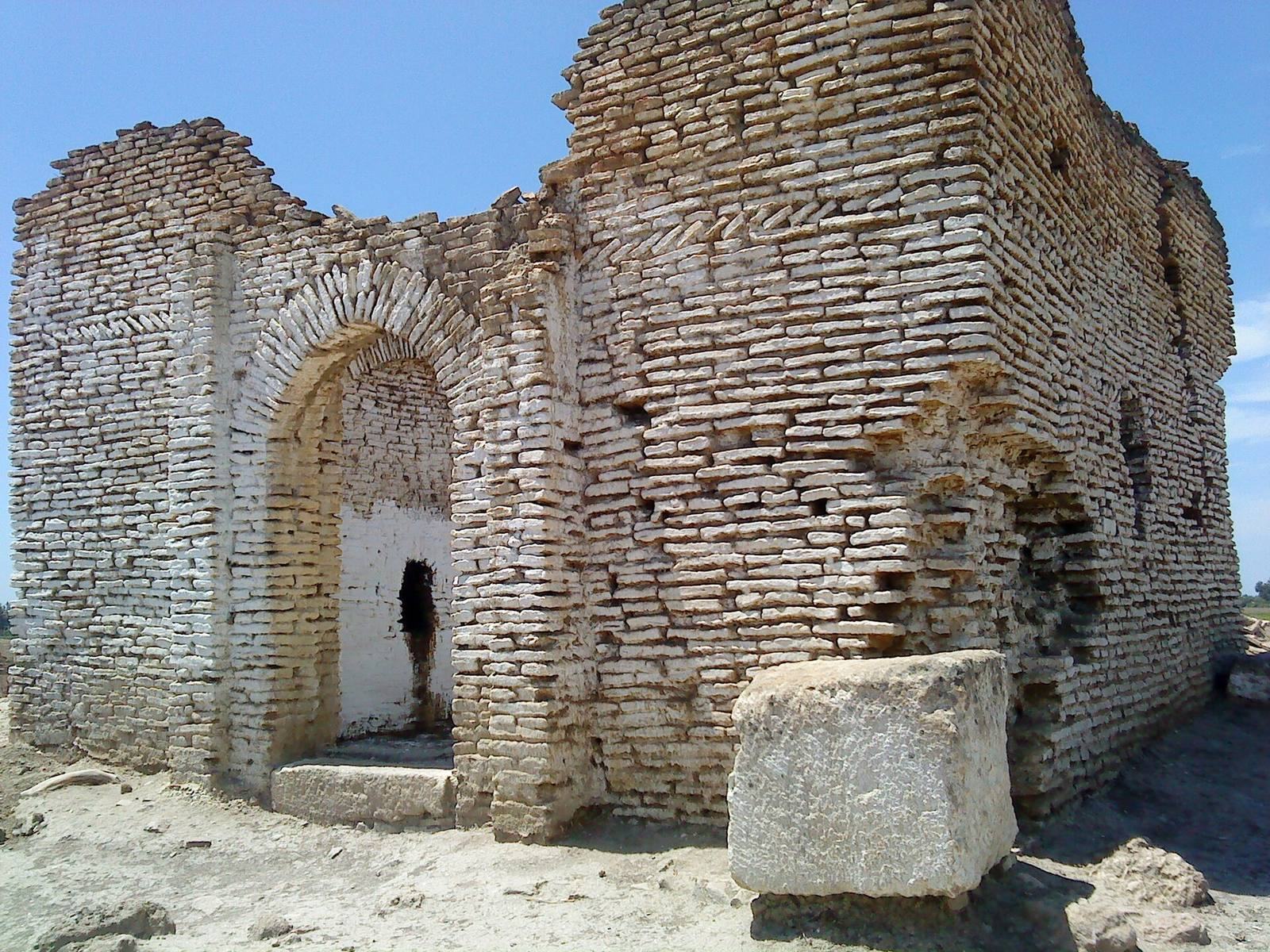
Charles-Joseph Tissot identified the ruins as Banasa in 1871 through an inscription, resolving a location that had previously been known only from literary references. A large group of ancient coins found near the shrine of Sidi Ali Boujenoun in 1904 provided further confirmation. Archaeological research began in 1911, followed by major excavations during the French protectorate from 1933 to 1956 under Raymond Thouvenot, with surveys and fieldwork by André Luquet. Michel Euzennat directed investigations in 1955–1956, including work in the southern district and beside the secondary northern cardo, a principal north-south street, where pre-Roman pottery kilns were found. More recent Franco-Moroccan work has examined the baths and the pre-Roman settlement.
Since 2010, research on Roman warehouses, combined with architectural survey, masonry analysis, and archival study, has reassessed a quadrangular building in the southern part of the city as a food warehouse. Banasa’s ancient remains and associated finds continue to support archaeological investigation and museum preservation, and the site has Moroccan cultural-heritage status.
Territory and economy
Banasa’s river connection supported local development and linked the city with a larger distribution system. From the second half of the second century AD, grain from Banasa and neighbouring communities could enter an extra-territorial distribution network through the great warehouse at Thamusida. Studies have estimated the city’s territory at about 5,000 hectares and, using later survey data, at approximately 477.06 square kilometres.
Archaeological discoveries within about 20 kilometres indicate settlement across the floodplain between the left bank of the Sebou and the northern edge of the marshes. Later alluvial deposits conceal farming settlements and parts of the ancient landscape. The agricultural environment included merjas, marshy or seasonally flooded lowlands, together with fertile black clay Tirs soils, loamy Dhess soils, and sandy fluvial soils. About 257.79 square kilometres of Tirs and Dhess soils were considered suitable for cultivation, with another 102.24 square kilometres subject to cultivation limitations. Estimates of approximately 36,000 hectares of medium- and high-potential farmland produce a calculated cereal yield of about 21.6–28.8 million kilograms at an average yield of 6–8 quintals per hectare. These figures indicate that the city’s warehouse served an urban and local distribution economy rather than holding the entire harvest of its territory.
Remains
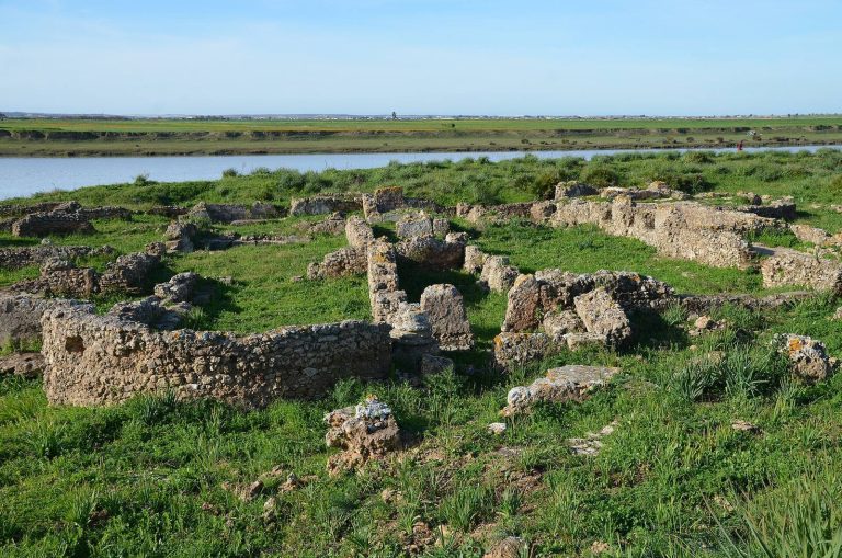
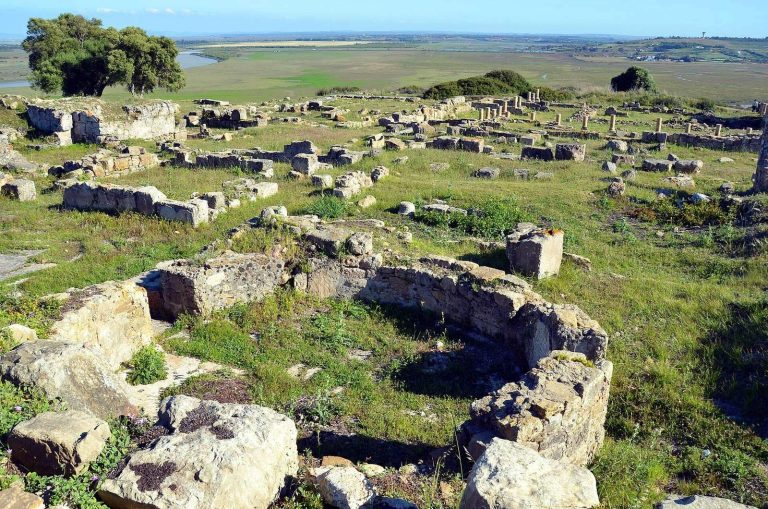
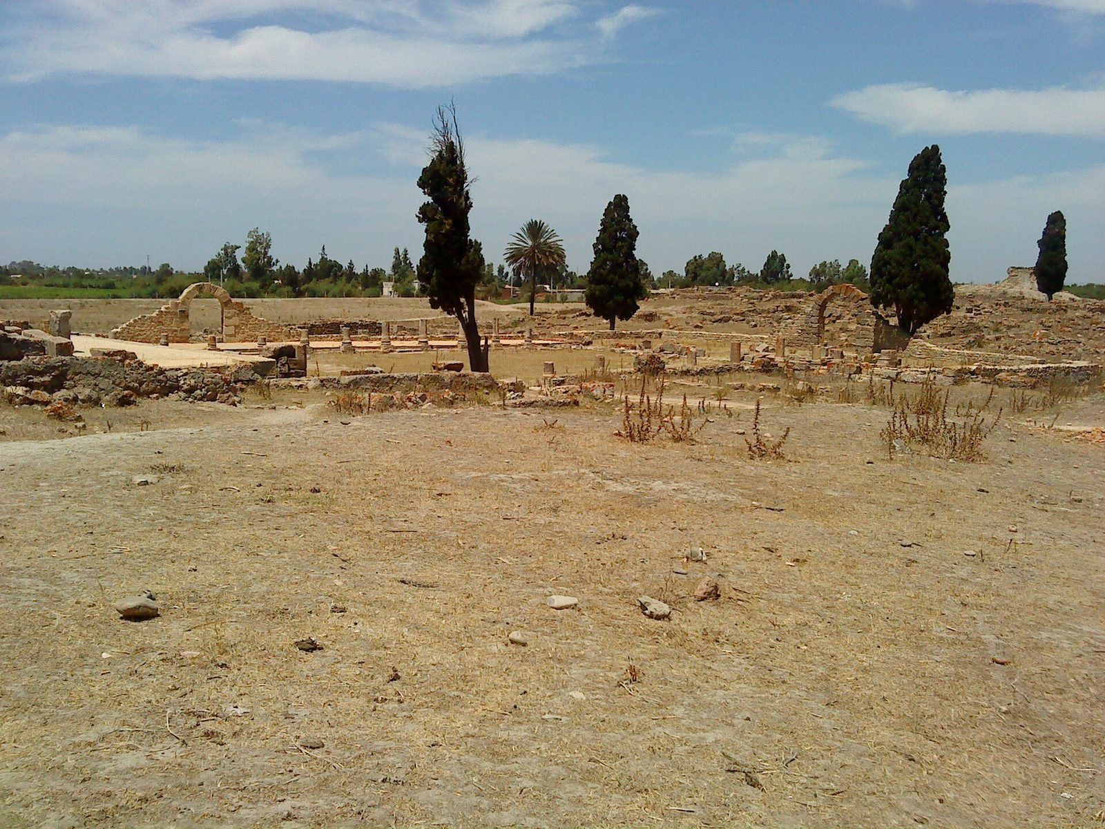
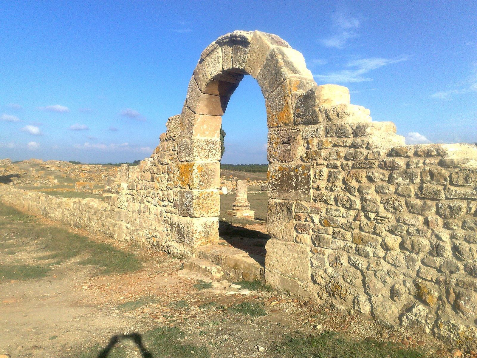
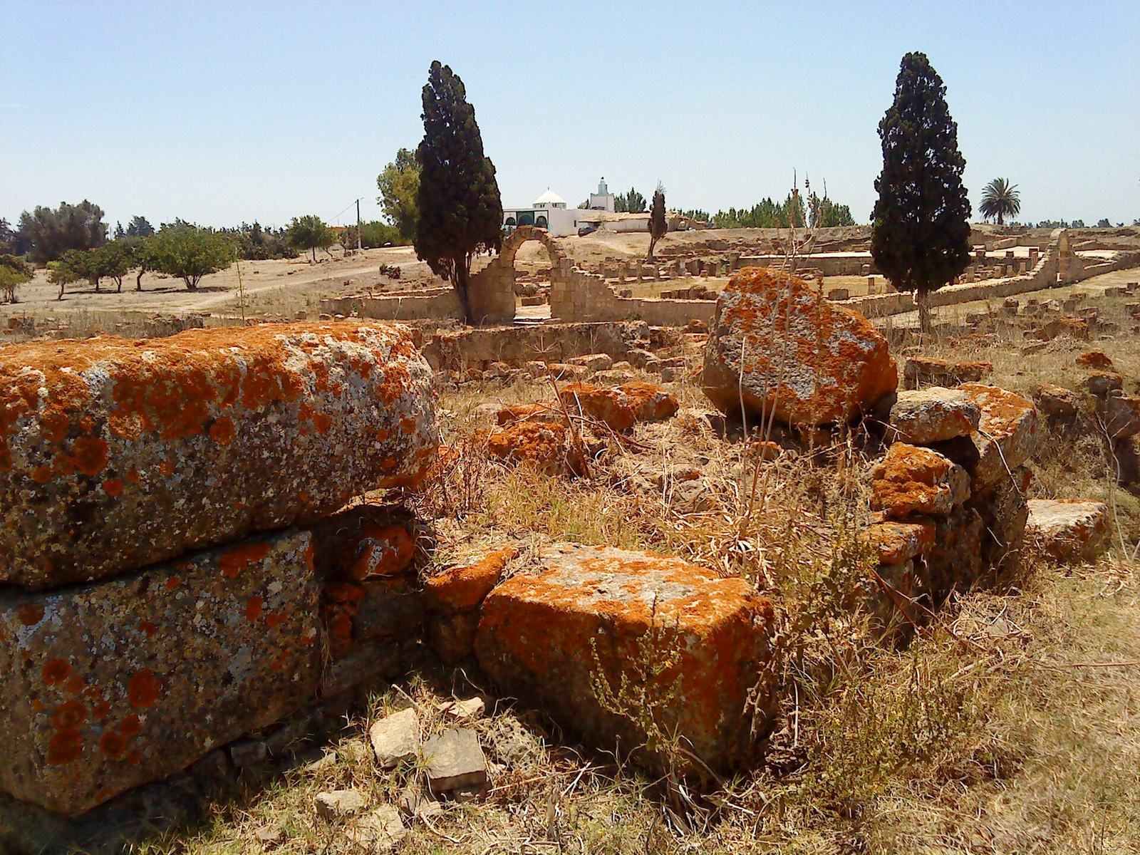
Banasa was built on two artificial hills divided by a central valley containing the forum. The visible archaeological area covers about 4 hectares, while geophysical prospection indicates that the space enclosed by the city wall was slightly more than twice as large. The wall stood at a lower level than the internal buildings. Within it, a loosely orthogonal urban system used irregularly parallel streets, while the principal axes divided the settlement into eight districts. Flooding and alluvial accumulation have buried much of the river frontage and parts of the rural landscape, and pre-Roman occupation layers in some areas lie beneath later Roman deposits.
Civic centre
Forum and public buildings
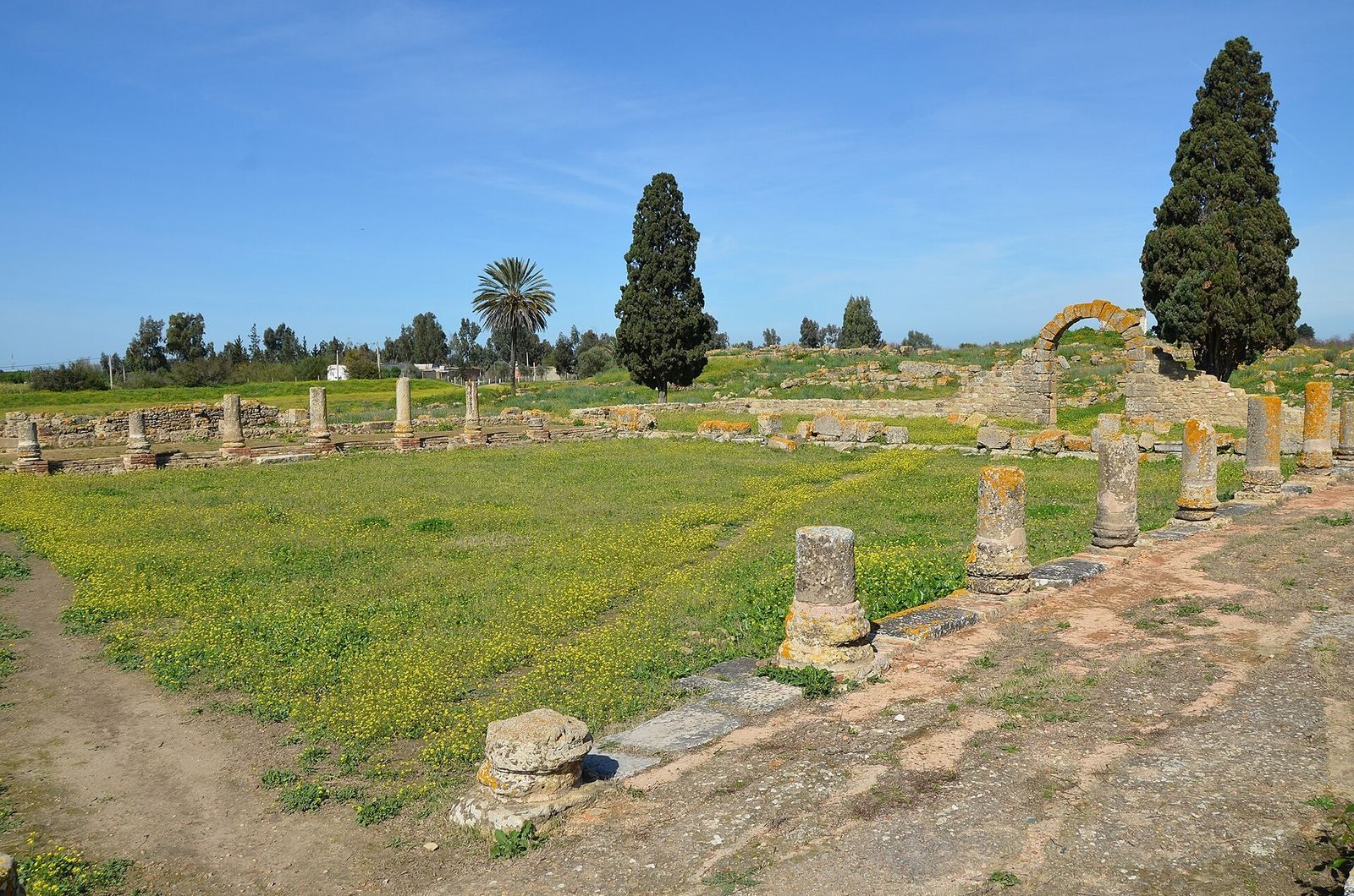
The forum occupied the centre of Banasa at the crossing of the cardo and decumanus, the principal north-south and east-west streets. It formed a trapezoidal paved space measuring approximately 37 by 34 metres, bordered by porticoes, roofed colonnades or walkways. The civic complex included the basilica, a large public building used for judicial, administrative, and commercial purposes, the curia or council house, and the Capitolium, a major temple associated with Rome’s principal state gods.
Basilica and temple complex
A rectangular basilica stood north of the forum. An apsidal hall, meaning a room ending in a curved recess, lay to its east. South of the forum, behind a portico, stood a temple with seven cellae, the enclosed chambers of a temple. The chambers rose on a podium faced with stone plinths and statue bases, probably intended to carry statues.
Baths and mosaics
At least five public baths have been identified in the excavated area, alongside private bathing establishments. Their floors, together with those of some houses, carried mosaics with geometric, figurative, and mythological designs. Motifs include Maltese crosses, swastikas, Gordian knots, braids, and fish. One bath mosaic represents a triton, a mythological marine being with a human upper body and fish-like lower body, surrounded by animals and shells. It is displayed in the Museum of Volubilis. Other Banasa mosaics are preserved in the Rabat Archaeological Museum, while a mosaic showing Eros and Psyche could not be preserved.
Commercial and residential districts
Market and workshops
The macellum, a purpose-built covered market for foodstuffs, occupied about one urban block west of the forum. Excavations also revealed shops, bakeries, oil-making installations, and other commercial buildings. The bakeries correspond to the cereal-producing economy of the surrounding territory. Oil-making installations were present in smaller numbers than at Volubilis.
Urban districts and houses
District 2 extended from the forum towards the decumanus and contained mainly commercial buildings. District 3, south of the obliquely aligned decumanus, combined shops and other commercial structures with houses and baths. District 4 included distinctive two-storey houses. The excavated macellum lay in District 5, while Districts 6 and 8 contained commercial and domestic buildings. District 7 held elite residences and baths, and the southern part of District 8 consisted of long rectangular insulae, urban blocks bounded by streets.
Elite houses included two-storey structures and decorated rooms. Ordinary houses followed less regular arrangements comparable to domestic layouts known from Lixus and Tamuda. The distance from high-quality stone quarries affected building standards. Well-cut rectangular roof tiles were used mainly in public buildings or as decoration. During the second and third centuries AD, imported mosaics and wall paintings made decorative schemes more elaborate.
Food warehouse
Building and construction
A quadrangular warehouse stood at the extreme southern edge of District 2. It was approximately square, with an external area of 307.22 square metres and an internal floor area of 201.19 square metres. Its perimeter walls survive to about 0.80 metres above the foundation pit. The walls were approximately 1.00–1.10 metres thick and were built in distinct layers from stones of different sizes. Stone chips and small stones filled the spaces between the wall faces, while the corners used alternating headers and stretchers, masonry units placed with their short and long faces towards the wall surface.
Raised storage floor
Four limestone or sandstone blocks survived inside the building. Their recorded dimensions include approximately 0.80 by 0.40 by 0.60 metres, 0.90 by 0.40 by 0.60 metres, and 0.75 by 0.47 by 0.68 metres. They are interpreted as supports for joists and a raised wooden floor. The proposed reconstruction places the supports at regular intervals of about 1.78 metres in a grid pattern. They probably carried beams about 1 metre above the ground, creating an aerated floor that protected grain from damp.
The reconstructed floor uses oak beams about 0.20 by 0.20 metres, with an effective span of approximately 5.94 metres, carrying planks about 0.05 by 0.20 by 1.78 metres. Depending on the storage arrangement, the warehouse could have held approximately 49.72–74.60 tonnes in wooden chests, about 85 tonnes as grain piled against usable walls, or approximately 59.28–88.92 tonnes in sacks. A theoretical maximum of roughly 286–290 tonnes applies to loose grain across the full load-bearing floor before the space occupied by roof supports is deducted.
Later alteration
The warehouse’s construction resembled systems used in Roman military granaries, although raised floors were also used outside military settings. Its position near the agricultural plain and its dimensions suit a store for harvesting and distributing food within Banasa’s urban economy. In the third century AD, the area was levelled. The warehouse was flattened, its walls were reused as foundations for two later buildings to the west and south-east, and earth was added to raise the floor level. An entrance to one of these later buildings was placed directly above the former western perimeter wall.
Religious and movable remains
Stone and bronze inscriptions, statue bases, and traces associated with statues of deities and private individuals were found across the site. Inscribed stone stelae preserve the feet of statues of Isis and Minerva. Isis was an Egyptian goddess whose worship spread through the Roman world, while Minerva was a Roman goddess associated with wisdom, crafts, and warfare. Remains associated with Cybele, an Anatolian mother goddess adopted into Roman religious practice, indicate the presence of cults of foreign origin alongside other Roman religious practices.
Recovered objects include a bronze snake’s head, bronze figurines, furniture fittings, bone toilet and cosmetic implements, coins in bronze, silver, and gold, gold earrings, pendants, necklace medallions, rings, bronze necklaces, glass beads, semi-precious stones, and other jewellery. Some of these objects and mosaics are preserved or displayed in museums in Rabat.