The Bridestones: A Neolithic Chambered Cairn in Cheshire
Site at a Glance
- Popularity
- Medium
- Country
- United Kingdom
- Primary era
- Stone Age
- Eras represented
- Stone Age
- Civilizations
- Unclassified
- Site type
- Burial
- Remains
- Burial Mound
On this page15 sections
History
Neolithic monument
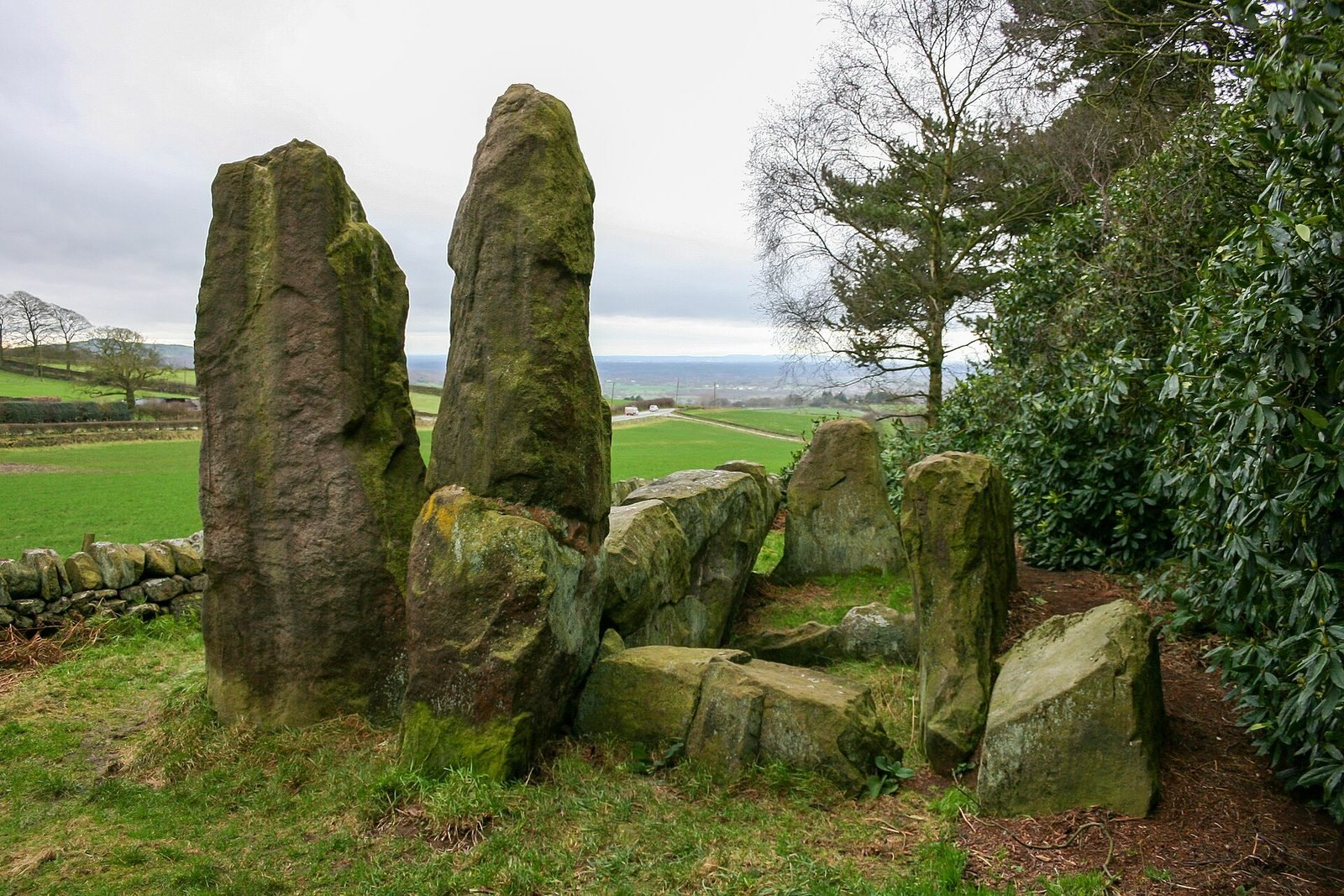
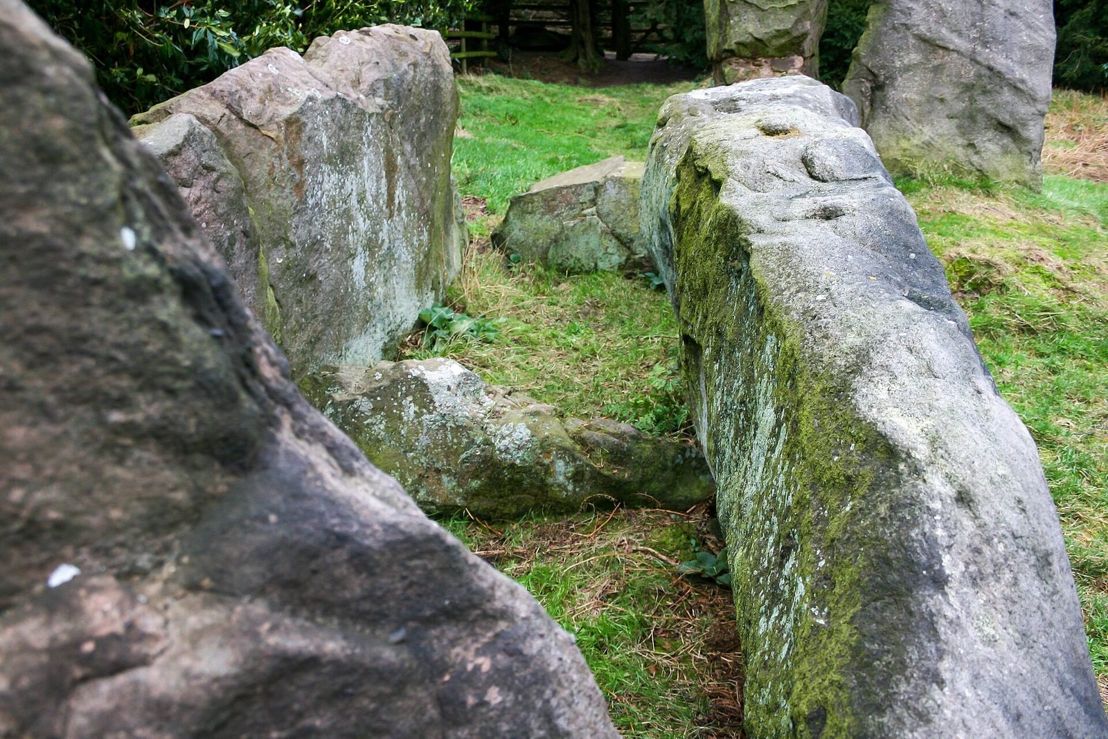
The Bridestones is a Neolithic chambered cairn, a burial monument enclosed by a mound of stones, near Congleton in Cheshire, England. It dates to about 3500 to 2400 BC, during the later Stone Age, when farming and settled communities spread in Britain. Its architectural form is unusual in England and difficult to classify. Apart from a few long dolmens, or elongated stone tombs, and destroyed enclosures, it is Cheshire’s only authentic Neolithic monument. The reason for building such a structure in Cheshire remains unclear.
The origin of the name is uncertain. One legend tells of a newly married couple murdered at the site and buried beneath stones. Other suggestions connect the name with Brigantia, a Celtic goddess associated with the ancient Brigantes, or with the Old English word briddes, meaning birds. The latter proposal relates to the possibility that the stones’ original arrangement resembled birds.
Eighteenth-century disturbance
In 1764, stones were removed to build the Ashbourne–Leek–Congleton Turnpike, a toll-maintained road about 60 yards from the monument. The road is now Dial Lane, just south of the cairn. Several hundred loads of stone were taken, exposing the structure for examination. Stone was also used for a nearby house and farm, and for an ornamental garden in Tunstall Park.
A detailed description of the monument’s condition in 1764 drew on an account by Thomas Malbon, rector of Congleton. It appeared in the second edition of Henry Rowlands’s Mona Antiqua Restaurata, published in 1766 and edited by Henry Owen. The account apparently was not included in the work’s original 1723 edition.
Excavation and protection
Professor W. H. Fleure of Manchester University excavated the site in 1936 and 1937, aiming to restore it as far as possible to its earlier condition. The Bridestones is protected as a scheduled monument, a designation in England that provides legal protection against unauthorized works.
Remains
Setting and overall layout
The monument lies east of Timbersbrook, near Congleton, between the sandstone hills of Bosley Cloud and Wolfe Lowe and close to the Staffordshire boundary. The cairn was described as about 120 yards long and 12 yards wide. Its stone covering has been greatly reduced by removal. Of three reported compartments, the surviving fabric includes part of the main chamber. Descriptions also record a crescent-shaped paved forecourt and a stone circle around the cairn.
The arrangement has been compared with chambered tombs in Scotland’s Clyde region and with Irish court tombs, a regional form of Neolithic chambered tomb. Cashtal yn Ard on the Isle of Man has been identified as the closest example. The partition opening has also been compared with those in Cotswold-Severn tombs, another regional form of Neolithic chambered tomb. A stone of roughly similar proportions occurs at Devil’s Ring and Finger in Staffordshire.
Main chamber
Structure and roof
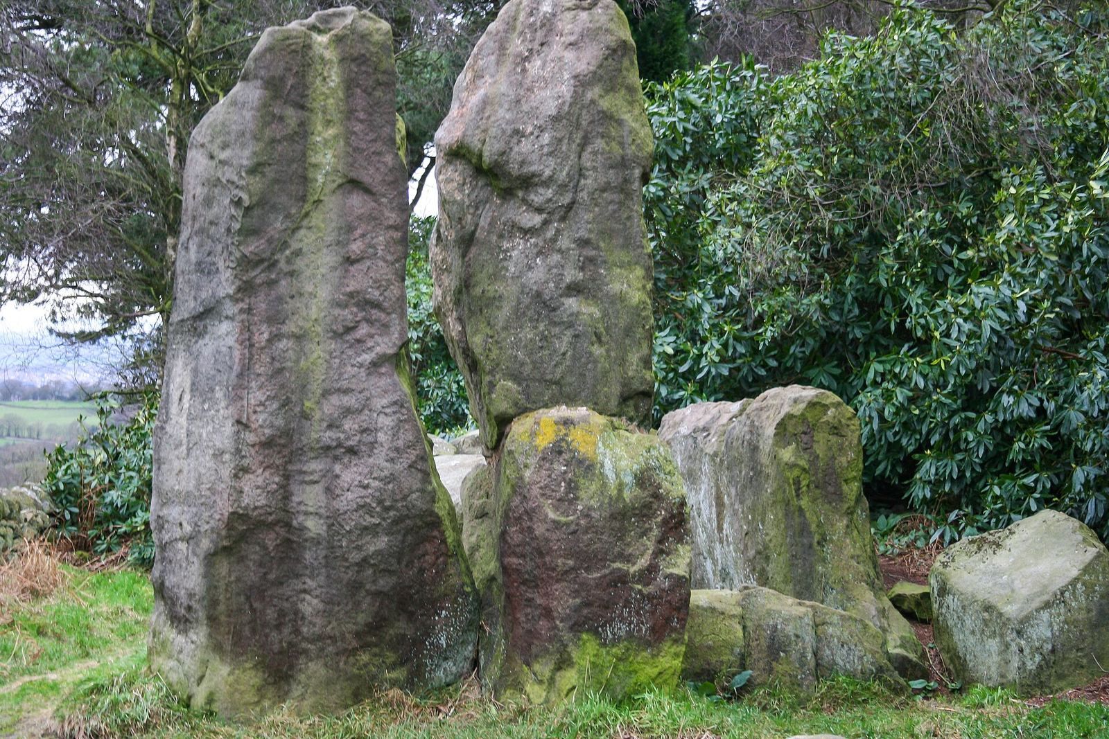
The surviving part of the main chamber measures about 6 metres by 2.7 metres and is formed from upright stone slabs. Its long sides were each made from a single unworked stone, about 18 feet long, 6 feet high, and 14 inches thick. Both sides were later broken in two. The southern side split in 1843 after a picnic bonfire was lit against it.
Long, large, flat, unworked stones once covered the chamber as a roof, and the recorded height from floor to roof was 5 feet 10 inches. The roof stones have since been removed. In the 1764 description, unworked stones and earth blocked the entrance.
Partition and floor
A stone partition crossed the chamber. It was about 5½ feet high and 6 inches thick, with a circular opening roughly 19½ inches across, large enough for a person to crawl through. The partition broke sometime before 1854, and its upper section was replaced in 1877.
The floor consisted of broken stone pieces about 2½ inches thick, laid over roughly 6 inches of pounded white stone. The upper 2 inches of this layer were blackened, possibly by ash passing through the paving. Above it lay about 2 inches of ash and oak charcoal. Small bone fragments were found, but their human or animal origin could not be determined.
Forecourt and standing stones
Forecourt and portal stones
A paved, crescent-shaped forecourt was described in front of the chamber. Portal stones, large stones marking an entrance, were reported as part of a group of four around the cairn; two survive. One of the surviving stones was broken and joined with concrete. The damage was reputedly caused by an engineer from the Manchester Ship Canal who used the stone to demonstrate a detonator.
Semicircular stone setting
A description from 1764 records six upright, freestanding stones, each 3 to 6 feet broad, set about 6 feet apart in a semicircle, with two more stones inside the arrangement. The earth there was very dark and mixed with ash and oak charcoal. Apparent stone-holes led to the suggestion that the setting might have formed a complete circle about 27 feet across. Two other stones were noted to the east, each about 5 to 6 yards from the preceding stone.
Tapering stones
The same description noted rough, square, tapering stones about 4 feet 3 inches broad and 2 feet thick. The stone on the north side was broken off, as was part of the other stone.
Other reported chambers
Smaller chambers
An eighteenth-century description records a smaller chamber of similar construction about 55 yards from the main chamber. It measured 2½ yards long, 2½ feet wide, and 3 feet 2 inches high, with no internal partition. The description also mentions part of another chamber.