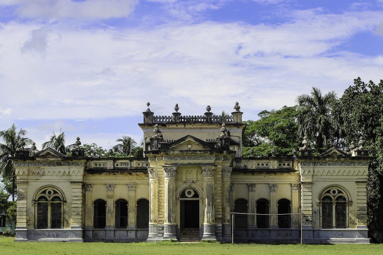
Mahasthangarh: An Ancient Fortified City in Bangladesh
Site at a Glance
- Rating
- 4.3
- Popularity
- Medium
- Country
- Bangladesh
- Primary era
- Medieval
- Eras represented
- Iron Age, Classical, Medieval, Early Modern
- Civilizations
- Bengal Sultanate, Kushan, Mughal, Pala Empire
- Site type
- City
On this page22 sections
History
Mahasthangarh is the fortified remains of an ancient city in Bangladesh, identified with Pundranagara or Paundravardhanapura, in the historic territory of Pundravardhana. Settlement began by the late fourth century BC or at least the third century BC, and the city became an important centre under the Mauryan Empire, an early South Asian imperial state that ruled much of the subcontinent from approximately the fourth to the second century BC. Its elevated position on the Barind Tract, beside the Karatoya River, helped reduce the risk of flooding.
Origins and the Mauryan period
A six-line inscription in Prakrit, a group of Middle Indo-Aryan languages, was found on a limestone slab at Mahasthangarh in 1931. Written in Brahmi, an ancient South Asian writing system, the inscription dates to the third century BC and records a land grant or administrative order. It is understood as an instruction to distribute grain and money from the royal treasury to people affected by famine. The text provides direct evidence for the city’s existence during the Mauryan period and indicates its administrative importance.
Mahasthangarh continued to serve as a provincial or regional capital under the Mauryas, Guptas, Gauda rulers, Palas, Senas, and later Hindu feudatories. The Pala dynasty ruled much of Bengal and Bihar from approximately the eighth to the twelfth century and was a major patron of Buddhism. The Sena dynasty followed as an important Hindu ruling house in Bengal. Archaeological layers and structures at the site preserve successive phases from before the Mauryan period through the Mauryan, Shunga-Kushan, Kushan-Gupta, Gupta, post-Gupta, Pala, and Islamic or Sultanate periods.
A Buddhist and regional centre
Mahasthangarh was also a centre of Buddhist learning. Monks from China and Tibet came to study there before carrying Buddhist teaching to other parts of South and Southeast Asia. The Chinese Buddhist monk and traveller Xuanzang visited Pundranagara between 639 and 645. His account describes religious centres in South Asia, and Alexander Cunningham later identified one of Mahasthangarh’s stupas with the Ashoka Stupa mentioned in that account. This identification remains an archaeological interpretation rather than a certainty.
The city and its name became associated with several religious and legendary traditions. The Skanda Purana, a major Sanskrit Hindu religious text, attributes the name Mahasthan to Parasurama, who is said to have practised asceticism beside the Karatoya River. The name is commonly explained through the words Mahasthan, meaning a place of great sanctity, and garh, meaning fort. Later traditions describe Pundranagara as the capital of the Pundra kingdom and connect the site with King Parasuram, Shah Sultan Balkhi Mahisawar, and a conflict between them. The supposed arrival of Shah Sultan is assigned variously to the fifth, eleventh, or seventeenth century, so these traditions do not provide a fixed chronology.
Later occupation and changing names
The fortified area remained in use through the eighth century, while activity continued across the wider settlement during the medieval Islamic period. Shah Sultan Balkhi Mahisawar is traditionally regarded as a Muslim preacher associated with the spread of Islam in the region and with a shrine at Mahasthangarh. The shrine is linked by tradition to a fourteenth-century preacher, although the surrounding legends vary. In 1680, the Mughal emperor Aurangzeb assigned three brothers, Syed Reza, Syed Tahir, and Syed Abdur Rahman, responsibility for supervising the shrine.
The present name developed after the city’s ancient period. Mahasthan first appears in a thirteenth-century Sanskrit text, while an administrative decree of 1685 records the form Mastangarh. These later names reflect the continuing religious and fortified character attached to the site.
Archaeological investigation and preservation
Francis Buchanan Hamilton first located and visited the ruins in 1808. Alexander Cunningham visited in 1879 and identified Mahasthangarh as the capital of Pundravardhana. C. J. O’Donnell, E. V. Westmacott, and Beveridge also recorded observations of the remains.
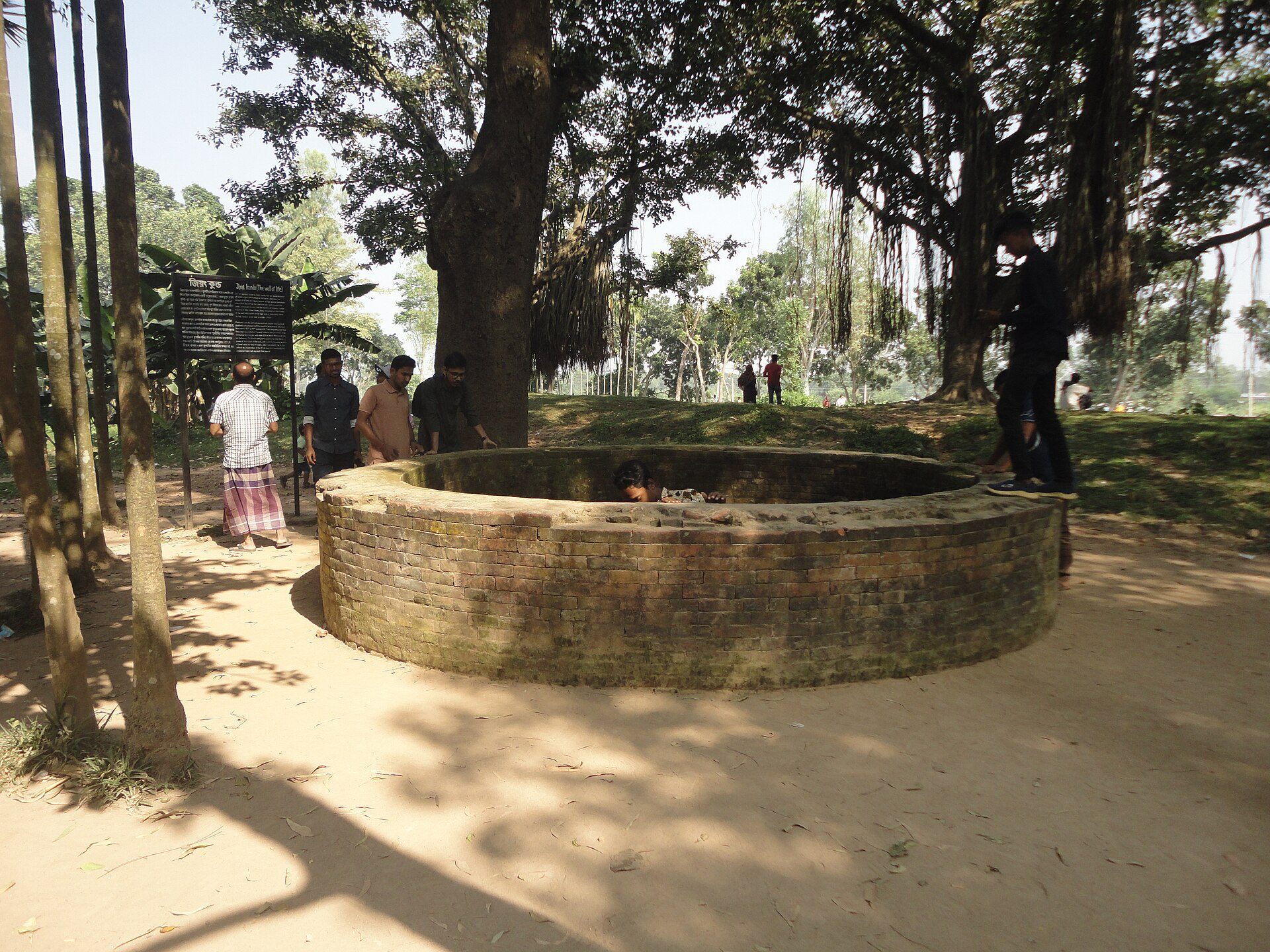
Systematic excavation began in 1928 and 1929 under K. N. Dikshit of the Archaeological Survey of India, the government body responsible for archaeological research and heritage conservation in India. The initial work concentrated on Jahajghata, Munir Ghon, and Bairagir Bhita. Excavations resumed at Bairagir Bhita and Govinda Bhita in 1934 to 1936, followed by work around the mazhar, Parasuramer Prasad, Mankalir Dhap, Jiat Kunda, and the northern rampart during the 1960s. Preliminary excavation reports appeared in 1975.
Excavations resumed in 1988 and continued almost annually until 1991, especially near the mazhar and the northern and eastern ramparts. A Bangladesh-France archaeological project, established under a 1992 agreement, continued work near the middle of the eastern defensive rampart and in other parts of the site. Excavations outside the citadel also examined Vasu Vihara, Bihar Dhap, Mangalkot, and Godaibari. The project exposed eighteen archaeological layers extending from the fifth century BC to the twelfth century AD and reaching virgin soil at approximately 17 metres. The complete history, cultural sequence, and urban organization of Mahasthangarh remain only partly reconstructed.
Mahasthangarh was placed on Bangladesh’s tentative list for UNESCO World Heritage status and was declared a SAARC Cultural Capital in 2016, when cultural events were held there. Heritage assessments have identified inadequate management, especially poor drainage, as well as looting, brick removal, and unauthorized house construction as threats to the remains.
Remains
Mahasthangarh consists of a large rectangular citadel surrounded by extensive ancient suburbs and associated religious and settlement mounds. The citadel measures approximately 1.523 kilometres from north to south and 1.371 kilometres from east to west, covering about 185 hectares. The Karatoya runs along its eastern side. The surrounding archaeological area extends for at least 9 kilometres, with ancient suburbs reaching toward Baghopara, Gokul, Vamanpara, and Sekendrabad. The elevated red soil of the Barind Tract places the citadel about 36 metres above sea level and roughly 15 to 25 metres above the surrounding land.
Citadel walls and entrances
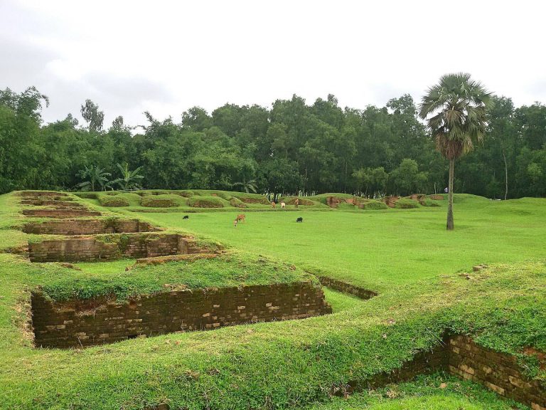
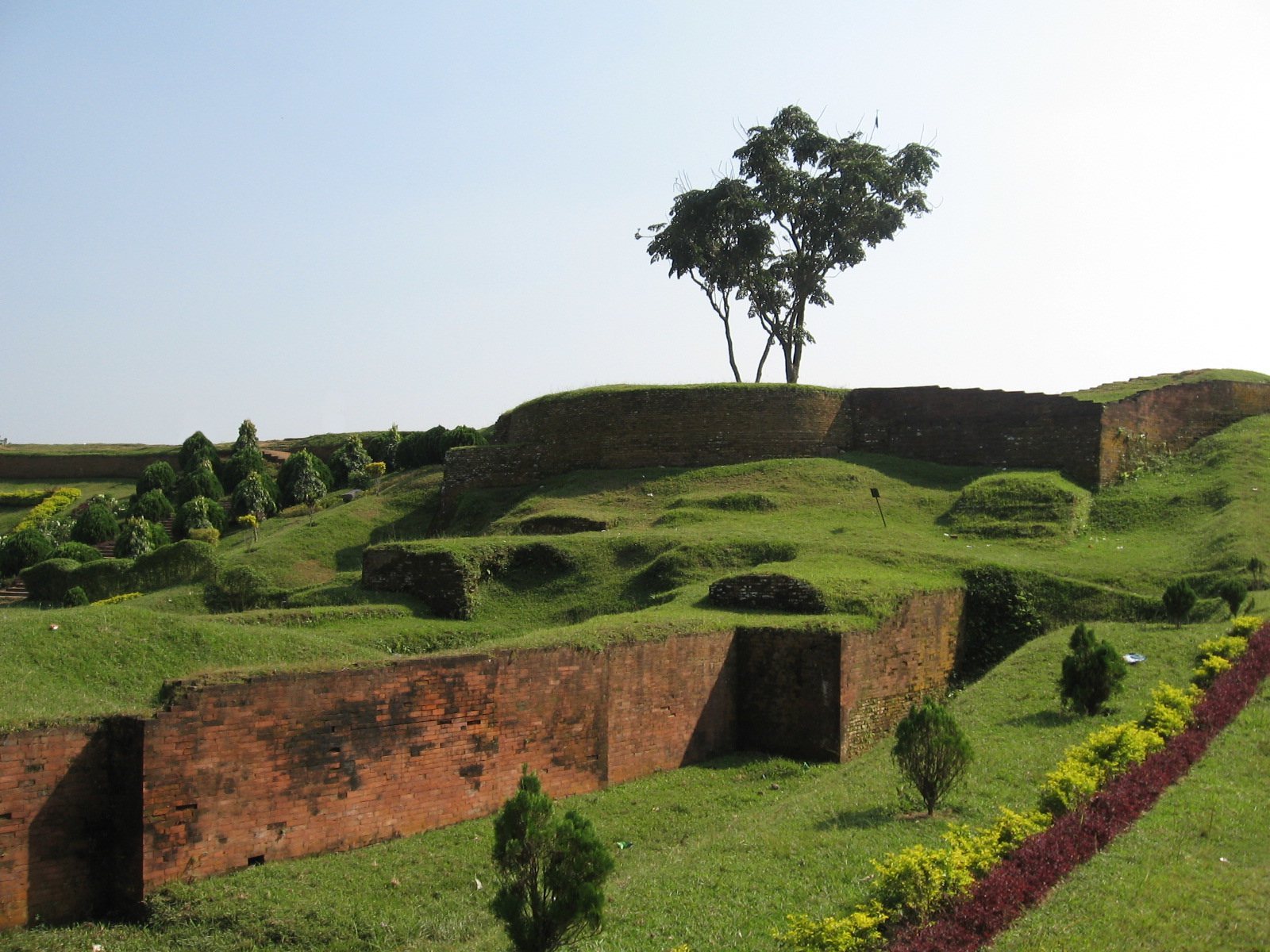
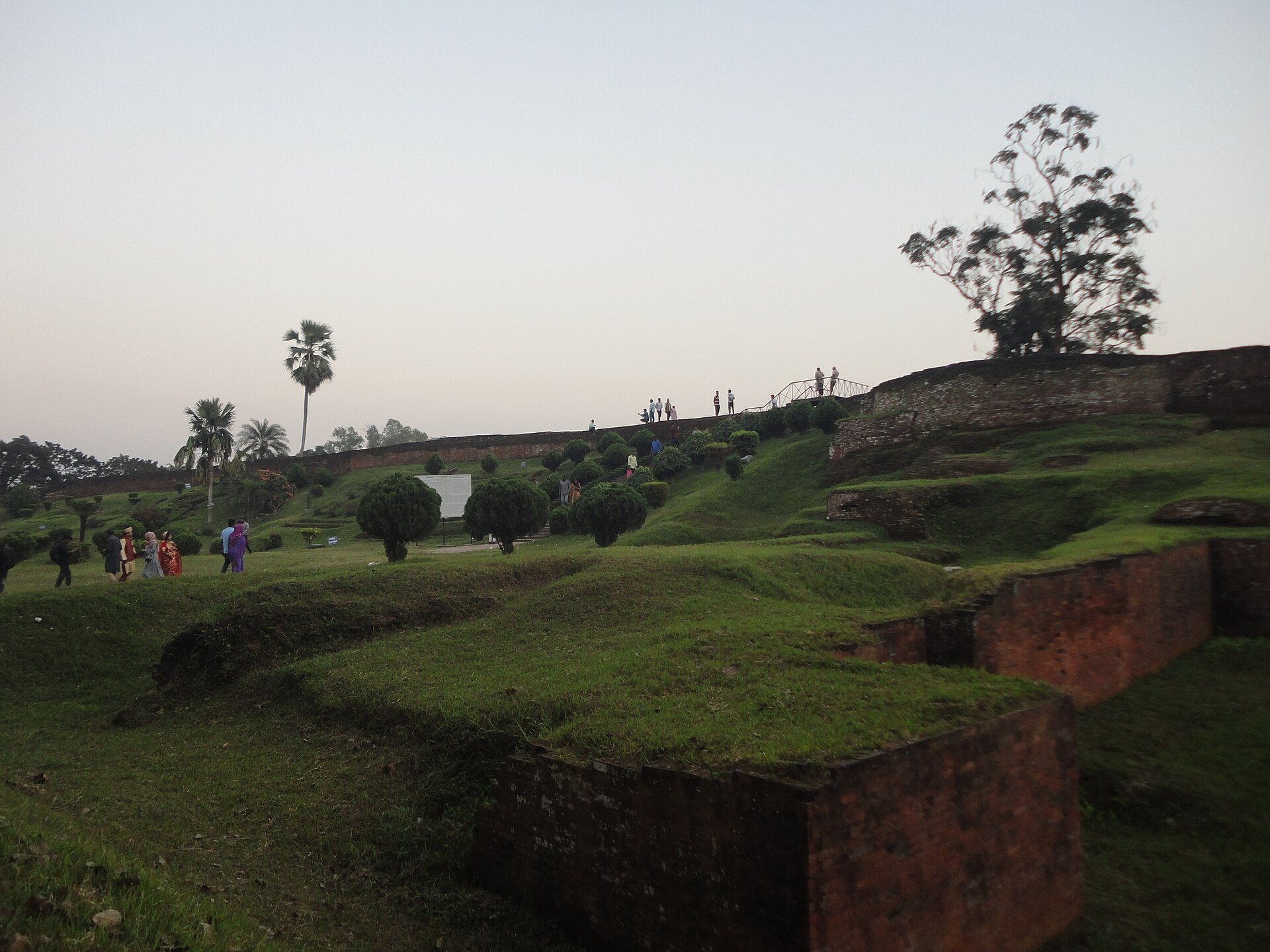
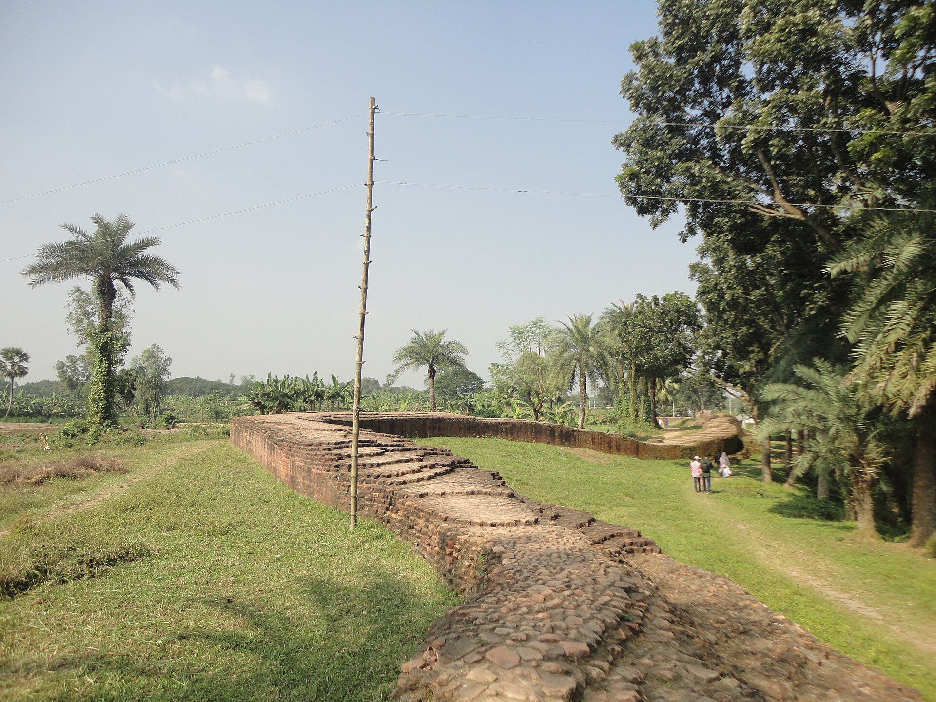
The central citadel is enclosed by high, broad earthen ramparts, or defensive banks made largely from packed earth. Before excavation, the interior stood more than 4 metres above the surrounding ground and contained several elevated mounds. The ramparts rose approximately 11 to 13 metres above the surrounding area and show evidence of forced breaches or openings. Six successive construction phases have been identified. The earliest is probably Mauryan, while later phases belong to the Shunga-Kushan, Gupta, early Pala, late Pala, and Sultanate periods. Later walls were built over earlier ones, although the relationship between the earliest wall and the first settlement remains uncertain.
Northern gateways
Two excavated gateways pierce the northern rampart. One lies 442 metres east of the north-west corner and measures about 5 metres wide and 5.8 metres long. The other is approximately 1.6 metres wide. Both were used during early and later Pala phases. Their guard rooms stood on the inner sides, while projecting bastions strengthened the outer faces.
Eastern gateway and named entrances
The eastern gateway lies near the middle of the eastern rampart, about 100 metres east of Parasuramer Prasad. It is approximately 5 metres wide and was probably constructed over an earlier entrance. Excavation has not exposed it completely. Other traditionally named entrances are Kata Duar to the north, Dorab Shah Toran to the east, Burir Fatak to the south, and Tamra Dawaza to the west.
Citadel mounds and religious buildings
Jahajghata and Govinda Bhita
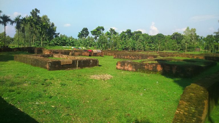
Jahajghata is a flight of steps at the north-eastern corner of the citadel and belongs to a later phase of the site. Govinda Bhita lies beyond it on the bank of the Karatoya, about 185 metres north-east of Jahajghata and opposite the site museum. Excavated remains there range from the third century BC to the fifteenth century AD and include the foundations of two temples. The name means the dwelling of Govinda, a Hindu form of Vishnu, but the excavated remains do not identify a specifically Vaishnava complex.
The mazhar and mosque
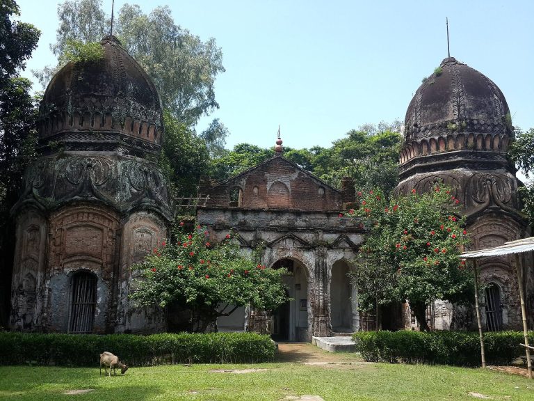
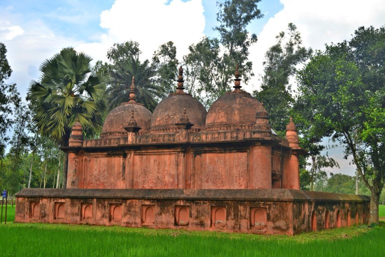
A mazhar, or holy tomb, stood at the south-eastern corner of the citadel. A later mosque built in 1718 and 1719 also occupied this area. A Persian inscription records its construction during the reign of the Mughal emperor Farrukhsiyar, who ruled from 1713 to 1719. An Arabic inscription dated 1300 to 1301 records the construction of a tomb for Numar Khan, described as a Meer-e-Bahar, or lieutenant of the naval fleet.
Khodar Pathar Bhita
Khodar Pathar Bhita is an east-facing rectangular Buddhist temple site associated with the early Pala period, probably the eighth century. Excavation in 1970 exposed a temple and small finds including a large polished granite threshold or stone slab. Carved stone fragments yielded three Buddhist images seated in a row, while other fragments show a transcendent Buddha with devotees kneeling with folded hands. The images are preserved at the Varendra Research Museum in Rajshahi, and much of the temple structure remains buried.
Bairagir Bhita
Excavation at Bairagir Bhita revealed foundation remains resembling temples and two sculptured sandstone pillars. The complex was constructed or reconstructed in four periods: the fourth to fifth, sixth to seventh, ninth to tenth, and eleventh centuries. A separate description identifies two temple ruins at the mound.
Mankalir Dhap
Mankalir Dhap lies east of the former pond known as Maja Pukur. Excavation revealed a temple beneath the foundations of a fifteen-domed mosque, probably built in the fifteenth or sixteenth century. The mosque measures approximately 26.21 by 14.54 metres and has no surviving inscription. Its form has led archaeologists to suggest a date before the Mughal period. Finds from the mound include terracotta plaques, a bronze Ganesha, a bronze Garuda, and a terracotta image of Surya.
Parasuramer Prasad and the temple near the mazhar
Parasuramer Prasad contains remains from three occupation periods. Finds include an eighth-century Pala-period stone Vishnupatta, fifteenth- or sixteenth-century glazed pottery of Muslim origin, and two British East India Company coins issued in 1835 and 1853. The temple near the mazhar was constructed and rebuilt in five Pala-period phases. Its surviving plan is fragmentary, while associated finds include large terracotta plaques, toys, pellets, decorated bricks, and pottery.
Surrounding archaeological settlement
About one hundred additional mounds lie within approximately 9 kilometres of the citadel. Together they indicate a settlement extending well beyond the fortified centre. Their remains include temples, monasteries, a terraced structure, and other religious buildings.
Totaram Panditer Dhap and Narapatir Dhap
Totaram Panditer Dhap lies in the village of Vihara about 6 kilometres north-west of the citadel. It contains the structural remains of a damaged monastery. Narapatir Dhap, also called Vasu Vihara, lies in Basu Vihara about 1.5 kilometres farther north-west. It contains the foundations of two monasteries and a temple. Cunningham identified the site with the place visited by Xuanzang in the seventh century, although that identification remains interpretive. A fifth-century stone Buddha was recovered from Vasu Vihara.
Gokul Medh
Gokul Medh, also known as Behular Basar Ghar or Lakshindarer Medh, lies about 3 kilometres south of the citadel. Excavations in 1934 to 1936 exposed a terraced podium containing 172 rectangular blind cells, recessed compartments that do not open into an interior space. The structure dates to the sixth or seventh century. Local mythology associates it with Lakshmindara and Behula, figures from Bengali literary and folk traditions.
Skandher Dhap and Khulnar Dhap
Skandher Dhap is a damaged temple site near Baghopara, about 3 to 3.5 kilometres south of the citadel. A sandstone image of Kartikeya, also called Kartik or Skanda, and structural remains were found there. The site is traditionally identified with Skandha Mandira, a temple mentioned in the Karatoya Mahatmya and in Kalhana’s Rajatarangini, written in 1149 and 1150, but the identification remains uncertain.
Khulnar Dhap lies about 700 metres west of the north-west corner of the citadel and contains the remains of a temple. Its traditional name refers to Khullana, the wife of Chand Sadagar in Bengali literary tradition. Other associated sites include Mangalkot, Godaibari Dhap, Bihar Dhap, and Lakhindarer Medh. Major unexcavated mounds include Rastala Dhap, Shoshitola Dhap, Chader Dhap, Shindinath Dhap, Dhanbhandar mound, Kacher Angina, Mongolnather Dhap, Sannyasir Dhap, and Doshahatina Dhap.
Material remains and archaeological layers
The eighteen excavated layers provide a sequence from the fifth century BC to the twelfth century AD. Early levels contain Northern Black Polished Ware, rouletted and black-and-red wares, grey pottery, mud-built houses and floors, hearths, post-holes, stone querns, and a limited area of brick paving. Mauryan-period levels contain early roof tiles, terracotta wells, brick fragments used for wall bonding, ring stones, bronze mirrors and lamps, cast coins, terracotta plaques and animals, semi-precious stone beads, and stone querns. Radiocarbon dates for associated phases include approximately 366 to 162 BC and 371 to 173 BC.
Shunga-Kushan layers contain substantial brick architecture, brick floors, post-holes, terracotta wells, Shunga-style plaques, agate, carnelian, and quartz beads, cosmetic rods, punch-marked silver coins, silver bangles, cast copper coins, terracotta architectural finials, and red, yellow, and grey pottery. Associated radiocarbon ranges include approximately 197 to 47 BC, 60 BC to AD 172, and 40 BC to AD 122. Kushan-Gupta levels contain distinctive pottery such as handled cooking vessels, dishes, bowls, sprinklers, and decorated lids, along with terracotta plaques, glass and terracotta beads, glass bangles, stone objects, and terracotta seals.
Gupta and post-Gupta levels include large brick remains at Govinda Bhita, brick houses, floors, roads, terracotta plaques, seals, glass and semi-precious-stone beads, terracotta balls and discs, copper and iron objects, and stamped pottery. One phase has a radiocarbon range of AD 361 to 594. Pala-period remains include structures at Khodar Pathar Bhita, Mankalir Kunda Dhap, Parasuramer Prasad, and Bairagir Bhita, while numerous Buddhist buildings were constructed outside the citadel. Islamic-period finds include glazed pottery, Chinese celadon, Sultanate coins, the fifteen-domed mosque at Mankalir Kunda, and the one-domed mosque associated with Farrukhsiyar’s reign.
The Mahasthan Brahmi Inscription is a limestone slab measuring approximately 4.4 by 5.7 centimetres. Other finds include silver punch-marked coins dating from the fourth century BC to the first or second century AD, uninscribed cast copper coins, and coins of fourteenth- and fifteenth-century sultans. Additional material comprises terracotta plaques and animal figures, moulded and decorated bricks, beads and pellets, bronze mirrors and lamps, bronze bangles, iron and copper objects, seals, ring stones, stone querns, and glazed pottery. Sculptural finds include bronze Buddhas dated to the tenth or eleventh centuries, a stone Lokeshvara combining Vishnu and Avalokiteshvara, sandstone door frames, pillars and lintels from the fifth to the twelfth centuries, and Buddhist and Hindu images from several associated mounds.
Landscape features and collections
Mahasthangarh is associated with Kalidaha Sagar, a historic water body west of the citadel, and the earthen fort of Garh Jaripa beside it. Shiladebir Ghat lies on the Karatoya east of the citadel. Bhimer Jangal is a long red-earth embankment or raised causeway extending northward from Bogra. Its surviving sections stand approximately 20 feet above the surrounding ground and appear to have served a military or defensive purpose, although its exact relationship to Mahasthangarh remains interpretive.
The local museum opposite Govinda Bhita preserves excavated objects from Mahasthangarh, including gold, silver, iron, bronze, stone, and terracotta artefacts, inscriptions, weapons, domestic vessels, ornaments, and sculpted or carved architectural fragments. Together, the citadel, surrounding mounds, religious buildings, inscriptions, coins, and stratified deposits preserve evidence for a long sequence of settlement, religious construction, defensive rebuilding, and changing material culture rather than a single-period urban plan.