Archaeological Site of Jerash: The Ancient City of Gerasa in Jordan
Site at a Glance
- Rating
- 4.6
- Popularity
- Very High
- Country
- Jordan
- Primary era
- Classical
- External website
- Open
- Eras represented
- Classical, Medieval
- Civilizations
- Byzantine, Kingdom of Macedon, Mamluk, Ptolemaic, Roman, Seleucid, Umayyad
- Site type
- City
On this page28 sections
History
The Archaeological Site of Jerash in Jordan preserves the ancient city of Gerasa, near the modern city of Jerash. Its history extends from a Neolithic settlement through Hellenistic, Roman, Byzantine, Islamic, and Ottoman periods. The site is regarded as one of the largest and best-preserved concentrations of Greek and Roman architecture outside Italy, giving rise to the descriptive names “Pompeii of the East” and “City of a Thousand Columns.”
Early settlement and the Hellenistic city
The earliest known occupation is represented by the Neolithic settlement of Tal Abu Sowan, where human remains dating to approximately 7500 BC were found. Bronze Age settlement is also present, broadly dated to 3200–1200 BC, while excavated material spans approximately 2500–700 BC.
In the Hellenistic period, the city was known as Gerasa. Its foundation remains uncertain. Inscriptions connect it with Alexander the Great, the Macedonian king whose conquests extended across much of the eastern Mediterranean and Near East, and with his general Perdiccas. They may refer to the settlement of Macedonian veterans at Gerasa in 331 BC. Other traditions attribute the city’s foundation or development to Seleucid King Antioch IV or to Ptolemy II of Egypt. The name “Antioch on the Golden River” is associated with the Seleucid period.
In the early 80s BC, or approximately 84 BC, Hasmonean King Alexander Jannaeus besieged and conquered Gerasa, incorporating it into the Kingdom of Judea. Archaeological evidence suggests that some public buildings may have been destroyed during this phase.
Roman expansion and civic prosperity
Roman forces conquered the region in 63 BC. The general Pompey ended the short-lived Jewish rule, attached Gerasa to the Decapolis, and allowed it considerable autonomy under Roman protection. The Decapolis was a league of Hellenistic cities in the southern Levant. Gerasa became an important commercial and cultural center on caravan routes, and its prosperity supported extensive civic construction, apparently financed largely through trade with Syrian and Nabataean cities.
During the Roman period, Gerasa was principally inhabited by Syrians and also contained a Jewish community. During the First Jewish–Roman War, it was one of the few non-Jewish cities in the region not to kill or imprison its Jewish residents. Instead, inhabitants escorted Jews who wished to leave to the frontier.
In AD 106, Gerasa became part of the Roman province of Arabia. The security established by Roman rule encouraged economic development and civic building. Emperor Trajan constructed roads through the province, increasing trade, and Emperor Hadrian visited Gerasa in AD 129–130. The city reached its greatest prosperity under Roman rule, especially by the early third century AD. Its population may have approached 20,000, and in AD 217 Emperor Caracalla raised Gerasa, together with Palmyra, to colonia status.
Gerasa was also associated with intellectual and political figures. The mathematician Nicomachus of Gerasa, who lived approximately from AD 60 to 120, was born there. Gerasa has also been proposed as the birthplace of the Jewish Zealot leader Simon bar Giora, although that identification remains uncertain.
Christianity and late antique change
Christianity was established in Gerasa by the fourth century. The city became an important Christian center, and at least 14 churches were built between the fourth and seventh centuries. Many replaced or reused earlier temples and Roman buildings. Bishops from Gerasa attended church councils in AD 359 and 451.
The city declined after the third century as trade routes shifted, Palmyra weakened, regional security deteriorated, and Persian expansion disrupted the area. Political, economic, and religious crises accelerated the decline during the fourth century. The Sassanids, the Persian ruling dynasty that competed with the Byzantine Empire for control of the Near East, invaded in AD 614. After Byzantine forces were defeated at the Battle of Yarmouk in AD 636, Gerasa became part of the Rashidun Caliphate.
Islamic, medieval, and Ottoman settlement
Gerasa flourished again under the Umayyad Caliphate, the hereditary caliphal dynasty that ruled from Damascus during the seventh and eighth centuries. Shops, a mint producing coins marked with the Arabic name of Jerash, and a ceramic industry operated in the city. The pottery identified both the maker and the place of manufacture. A large mosque was built while churches continued to function as places of worship, indicating the coexistence of Muslim and Christian communities.
A devastating earthquake in AD 749 destroyed much of Jerash and its surroundings. Later earthquakes, including a major earthquake dated to 847, caused further destruction and contributed to the city’s abandonment. Small settlements nevertheless existed during the Mamluk and Ottoman periods. Excavations in the Northwest Quarter have revealed Middle Islamic and Mamluk domestic structures and pottery, showing that settlement resumed before the Ottoman period.
An Ottoman census of 1596 recorded Jerash, then called Jaras, as having 12 Muslim households. Residents paid taxes on agricultural products, livestock, beehives, and olive-oil or grape-syrup production. Two people served the mosque and a religious school or lodge.
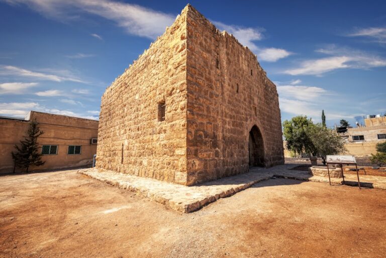
In 1120, Zahir ad-Din Toghtekin, the atabeg, or military governor and regent, of Damascus stationed a garrison of 40 men at Jerash and ordered a fortress to be built. The fort was probably placed at the highest point of the northeastern city walls. Its identification with the Temple of Artemis has often been proposed, but there is no evidence that a twelfth-century fortification was constructed inside the temple itself. Baldwin II, king of Jerusalem during the Crusader period, captured and destroyed the fortress in 1121 or 1121–1122. The Crusaders then abandoned Jerash and withdrew toward Sakib, near their eastern frontier.
Rediscovery and archaeological investigation
The German traveler Ulrich Jasper Seetzen visited the ruins in 1806 and recorded what he observed, helping to draw wider attention to the site. Jerash was described as a ruin in 1838. Circassian immigrants settled there during the late Ottoman period, with settlement reported in 1885 or 1886. They worked mainly in agriculture and animal husbandry, while others became merchants, blacksmiths, and goldsmiths.
In 1923 the ruins were declared state property. This helped protect the western half of the ancient city, while the eastern half was subsequently almost completely destroyed by modern construction. The modern city expanded mainly east of the river that divided ancient Jerash. Systematic excavation began in 1925 through cooperation among British, American, French, and Italian institutions and has continued into the present. Work since 2011 has substantially clarified the Middle Islamic and Mamluk occupation.
Archaeological research in 2025 identified a mass grave containing approximately 230 people who died during the Plague of Justinian, a sixth-century pandemic that spread through the Byzantine Empire and neighboring regions during Emperor Justinian’s reign. Archaeological and genetic evidence from the grave documents the pandemic’s presence in the region and has been described as the first confirmed mass grave associated with it in the eastern Mediterranean.
Since 1981, the ancient city has also hosted the Jerash Festival of Culture and Arts. Dance, music, theater, poetry, opera, and traditional performances have made the continuing festival part of the site’s modern cultural identity.
Remains
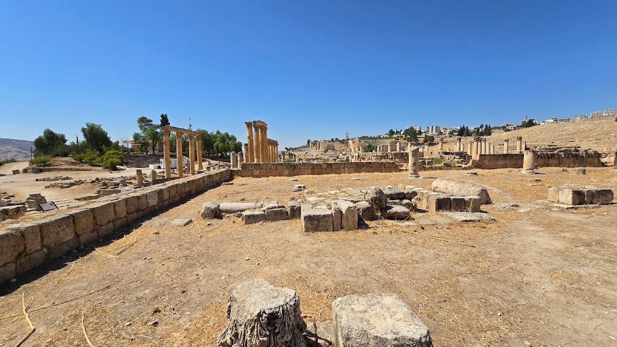
Ancient Gerasa was divided into eastern and western sections by a river crossed by Roman bridges. The western section contained the principal colonnaded streets and public buildings and remains the better-preserved part of the site. The walled city covered approximately 80 hectares, while the broader urban area extended across about 210 hectares. The walls were approximately 3.5 kilometers long, 2–3 meters wide, and 4–5 meters high, with as many as 120 watchtowers. Much of the wall has disappeared, especially on the eastern side.
Urban plan and principal streets
Cardo maximus and tetrapyla
The Cardo maximus, the principal north–south street of a Roman city, linked Gerasa’s northern and southern gates. Built in the second half of the first century AD, it was paved with large limestone slabs and measured about 12.3 meters wide in the north and 12.6 meters in the south. The avenue extended for approximately 800 meters.
Columns of varying sizes lined the street, mostly with Corinthian capitals. Ionic capitals survived in parts of the northern avenue and around the Oval Forum. Public buildings faced the road, while shops occupied spaces beneath the arcades. Approximately 500 columns still stand along the avenue. An underground drainage system carried away rainwater, and wheel ruts remain visible in the paving, particularly near the southern tetrapylon.
The northern and southern tetrapyla, four-sided monuments formed from gateways or groups of columns, stood where the Cardo crossed two principal east–west streets. The southern tetrapylon had four broad, niche-decorated bases, while shops around it were converted into dwellings during the Islamic period. The northern tetrapylon, built in the second century AD, originally had four arches supporting a dome, with bases decorated by fountains.
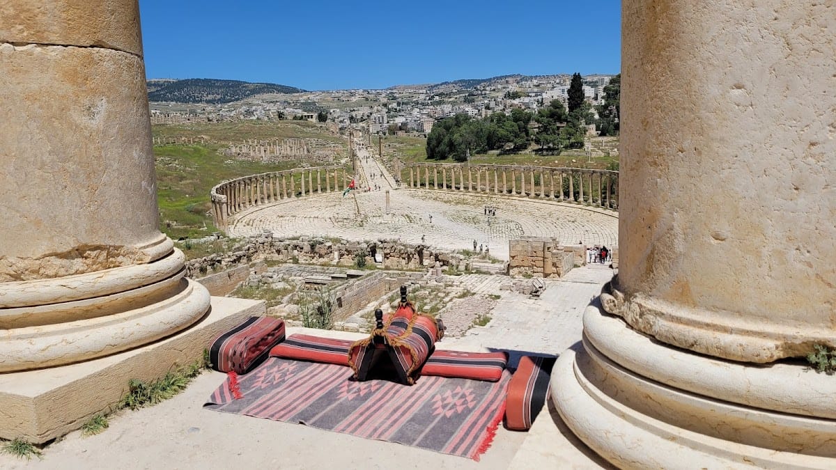
Oval Forum
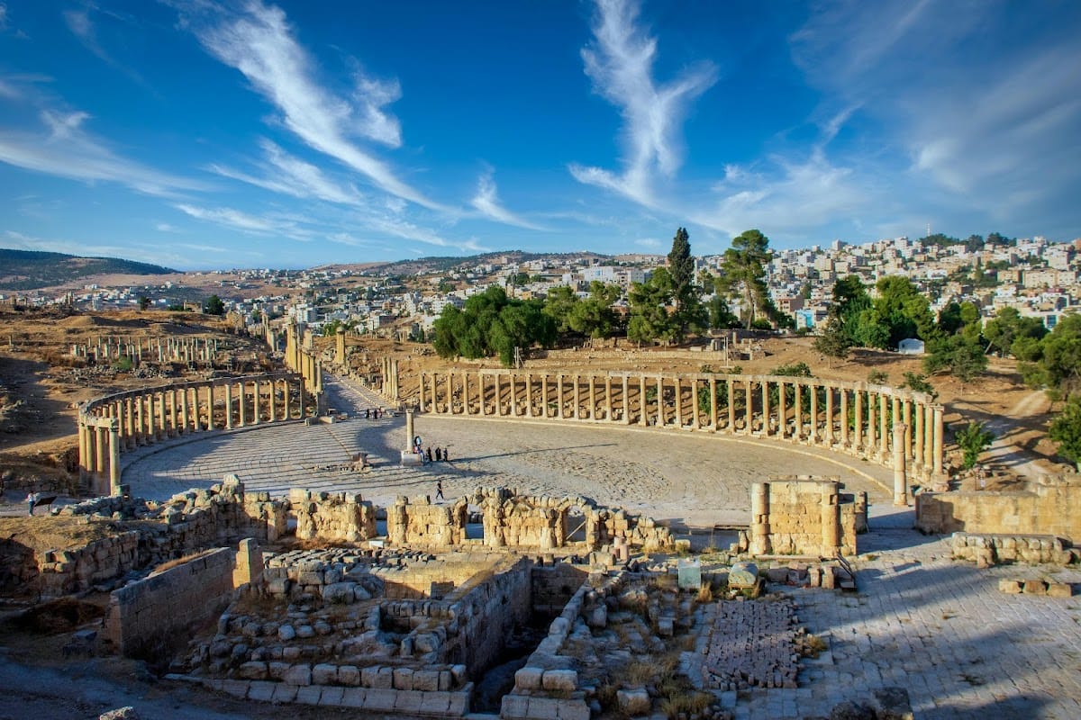
The Oval Forum occupies a natural depression in the southern part of the city. It measures approximately 90 by 80 meters and is bordered by broad paved walkways with 56 Ionic columns on each side. The colonnade was built in the first century AD, and shops stood between the columns. Different sizes and types of stone were used in the paving to emphasize the elliptical form.
The forum may occupy the location of some of Gerasa’s earliest buildings. Part of the uneven ground was filled with sand before construction. A monument may originally have stood at the center before being converted into a fountain in the seventh century. The fountain was supplied from a cistern in the northern part of the city. Inscriptions on the eastern colonnade record residents who contributed financially to the forum’s construction.
Temples and sacred buildings
Temple of Zeus
The Temple of Zeus occupies a high point that had already served a cultic purpose during the Iron Age. An earlier temple was built between AD 22 and 69 over a Hellenistic structure, and the visible temple was added in AD 162. Its terrace measures approximately 41 by 28 meters and was approached by a broad staircase. An arched arcade originally surrounded it.
The temple had a cella, or enclosed inner chamber, surrounded by eight columns on its short sides and twelve on its long sides. Each column was approximately 15 meters high. Marble faced the interior, where a statue of Zeus stood at the rear. The arcade survives mainly as foundations, while most columns have fallen and only small wall sections remain.
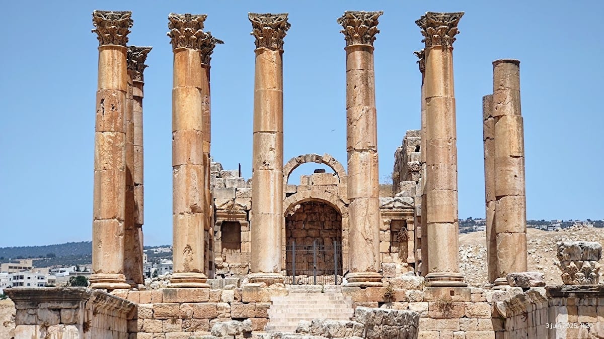
Temple of Artemis and its Propylon
The Propylon was the monumental gateway to the sanctuary of Artemis. A staircase connected it with the temple. Seven ramps, each consisting of seven steps, were designed to appear as one staircase when viewed from below and as a level surface when viewed from above. Four columns beside the entrance were approximately 16 meters high and 1.5 meters in diameter.
The Temple of Artemis, dedicated to the city’s protecting goddess, was built around AD 150 within a sacred enclosure measuring approximately 161 by 121 meters. Its terrace was about 42 by 41 meters and 4.5 meters high. The cella was surrounded by six 13-meter-high columns on each short side and eleven on each long side. The Corinthian columns were approximately 1.75 meters in diameter.
The enclosure was entered through five gates from an outer arcade. An altar and basins stood before the temple. The sanctuary had marble-faced walls and a wooden roof, now lost, while the cella remains comparatively well preserved. Evidence suggests that construction may have remained unfinished. During the Byzantine and Umayyad periods, part of the temple was reused as a pottery workshop. A later section was converted into a fortress and was subsequently destroyed by Baldwin II.
Theaters, arena, and water architecture
South Theatre
The South Theatre, beside the Temple of Zeus, was built around AD 90. Its 32 seating rows were divided into two sectors, and it could accommodate approximately 3,000–5,000 people. Its north–south orientation reduced the disruptive effect of sunlight, while its design produced excellent acoustics.
Numbered stone seats filled the auditorium. The lowest rows were reserved for civic dignitaries and guests, and eight upper sections were reached from the hillside behind the theater. Niches cut into the stage foundation contributed to the acoustics. Water-resistant partitions could be installed to flood the stage for staged naval spectacles. The theater was restored in 1953 and continues to accommodate cultural performances. A stone in the center of the orchestra marks a location from which normal speech can be heard throughout the auditorium.
North Theatre
The North Theatre was inaugurated in AD 164, expanded around AD 222, and remained in use until the sixth century. It could hold approximately 1,600 people and was originally roofed. Its first use centered especially on council meetings and gatherings before it was adapted for theatrical performances.
The building had 14 lower seating rows and eight additional rows added during the third-century expansion. Seats were associated with deities, tribes, and citizens entitled to vote in the city council. Five covered passageways served the upper seating. A sixth-century earthquake badly damaged the theater, and many columns and architectural elements were reused in Christian churches. The building was later used as a pottery workshop.
Hippodrome
The Hippodrome, a chariot-racing arena, was probably built in the second or third century AD. It measures approximately 241 meters long and 51 meters wide and could accommodate about 15,000 spectators. Fifteen rows of seats stood on vaulted supports around the U-shaped arena. Six entrances led to the seating and three opened directly onto the arena.
Shops and storerooms occupied spaces beneath the vaults, and excavations revealed remains of several stables in the southern section. The structure is now ruined. It hosted chariot races, athletic contests, and other spectacles. Caravan resting use is possible but remains uncertain. Rock-cut tombs were made around its walls during the Roman and Byzantine periods.
Nymphaeum
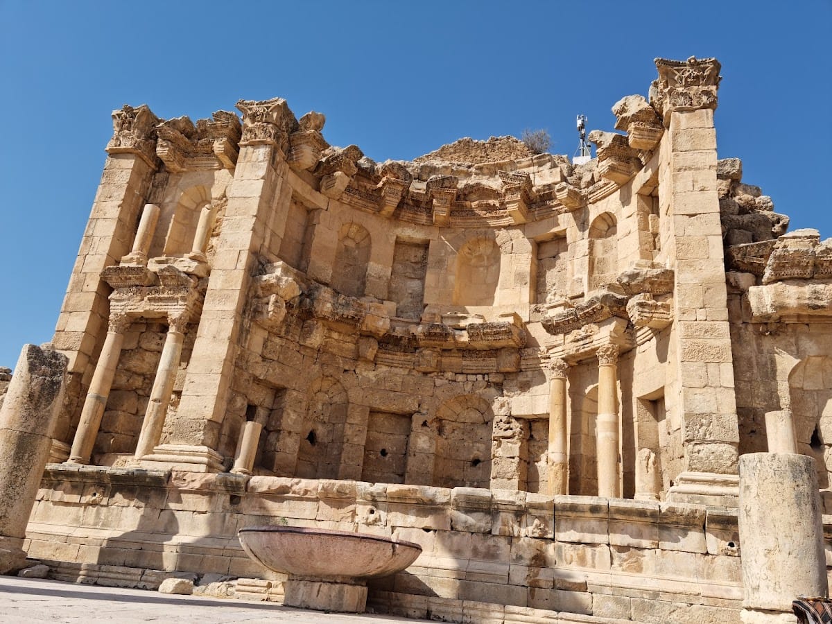
The Nymphaeum, a monumental fountain associated with water nymphs, was probably completed around AD 190. Approximately 20 meters wide, it has a concave two-level facade with Corinthian columns, niches for statues of deities and nymphs, and probable shell-shaped half-domes decorated with mosaics.
The lower facade was faced with green marble and the upper section with stucco. Water flowed through statues on the lower level into a large basin, then through seven lion-head outlets into six smaller basins before reaching channels beneath the Cardo. A large granite basin in front of the fountain dates to the Byzantine period.
Gates, baths, and infrastructure
Arch of Hadrian and city gates
The Arch of Hadrian, also called the southern gate or triumphal arch, was built in honor of the emperor’s visit in the winter of AD 129–130. It stands approximately 400 meters beyond the existing city walls, past the Hippodrome. It was intended to become the city’s main entrance, although the connecting walls were never completed.
The arch has three openings. Its central arch is approximately 13 meters high, 7 meters wide, and 6.5 meters deep, while its surviving height is about 11 meters. Four half-columns have bases decorated with carved acanthus leaves, and niches once held divine statues. An inscription honoring Hadrian survives on the north, city-facing side. The south side has been restored, while the north side remains damaged by earthquakes.
The South Gate was a monumental three-arched entrance built in the first century AD. Its half-columns have acanthus-decorated bases, and the adjoining road retains grooves cut by wheeled vehicles. Travelers arriving from Philadelphia, modern Amman, entered through this gate toward the city’s cultic and representative buildings. Its original flanking watchtowers have disappeared.
The North Gate was built around AD 115 under Trajan over the remains of an earlier gate. The construction and the road linking Pella to Gerasa were directed by Claudius Severus. Its single arch is approximately 9 meters high and 5.4 meters wide, with two statue niches on each side. Its asymmetrical design reflects the connection between the Cardo and the road from Pella.
Western Baths and water systems
The Western Baths were built in the second century AD, and only a small portion of the complex has been excavated. The domed baths contained hot-water, warm-water, and cold-water areas, changing rooms, and large pavilions. Gerasa also had an aqueduct, cisterns, drains, roads, side streets, markets, two large bridges across the nearby river, and an extramural sanctuary with large pools and a small theater.
Christian and Islamic buildings
Cathedral and Byzantine churches
Built in AD 365 beside the Cardo on the site of a former temple of Dionysus, the Cathedral was Gerasa’s earliest Christian building. It was a three-aisled basilica with a semicircular apse, 12 Corinthian columns separating the nave from the aisles, and a monumental entrance decorated with reliefs and Corinthian columns.
The Cathedral is poorly preserved, but its ornate stone doorway and ground plan survive. A chapel dedicated to the Virgin Mary was attached to its eastern wall in the fifth century. The courtyard behind the building may have been the entrance court. It was paved with rectangular pink sandstone and contained a stone episcopal throne and a basin.
At least 14 Byzantine churches and one chapel have been excavated. Two churches followed the Cathedral in the fifth century, 11 were built in the sixth century, and a final church was added in the seventh century. Most were basilical, while some had simple domes. Their exteriors were relatively plain, but their interiors were richly decorated with colored mosaics. Many were built during the reign of Justinian with substantial financial support from wealthy local elites.
Churches of Saint John, Saint George, and Saints Cosmas and Damian
The churches of Saint John and Saint George were built between 529 and 533 and formed a complex with the neighboring Church of Saints Cosmas and Damian, built in 533 over abandoned Roman structures. The circular Church of Saint John was decorated with four columns and consecrated around 531 during the episcopate of Bishop Paul. Its ruined mosaic floor depicts animals, plants, crosses, human figures, allegorical seasons, and Egyptian cities including Alexandria and Memphis.
The basilical Church of Saint George was consecrated in AD 530 and remained in use until the eighth century. Of the three churches in the complex, it suffered the least damage from the earthquakes of the seventh and eighth centuries. The single-aisled Church of Saints Cosmas and Damian retains a comparatively well-preserved mosaic floor showing geometric designs, animals, plants, and human figures. Near the choir, portraits and inscriptions commemorate two local benefactors, Theodor and Georgias.
The Church of Bishop Genesius, built in AD 611, was the last Christian building erected at Gerasa. Other named Christian buildings include the churches of Isaiah, Saint Theodore, Saint John the Baptist, Saint George, Bishop Genesius, and Saints Peter and Paul, together with the tomb of Germanus.
Umayyad Mosque and later occupation
The Umayyad Mosque was built in the second quarter of the eighth century, probably during the reign of Caliph Hisham ibn Abd al-Malik. It stands at the intersection of the Cardo and a principal east–west street and was built into the forecourt of a Roman house. Its mihrab, the prayer niche indicating the direction of Mecca, was adapted from an earlier decorative niche.
The ancient city also contained a large mosque and a supposed water-powered sawmill. The sawmill’s identification remains interpretive. Its proposed technology used a crankshaft to convert rotary motion into the linear movement required to saw wood or stone. A trapezoidal plaza bordered by two open exedrae, or recessed meeting spaces, formed part of the city’s other public features.
Archaeological finds and collections
Sculptures and sarcophagus
The 2018 excavation of the Eastern Baths produced at least 14 marble sculptures, including representations of Aphrodite and Zeus. Excavations in 2016 recovered fragmentary Roman marble statues identified as the Muses of the Olympic pantheon, which were partially restored. Other sculptures found at Jerash in the same year include restored statues of Zeus and Aphrodite and a marble head thought to represent Roman Empress Julia Domna.
A lead sarcophagus dated to the late fourth or fifth century is preserved in the Jerash Archaeological Museum. It bears both Christian and pagan symbolism. The museum also displays sculptures, altars, and mosaics associated with excavated material from Jerash.
Museum and archaeological presentation
The Jerash Archaeological Museum stands on Camp Hill east of the Cardo and overlooks the Oval Forum. Its chronological displays include material from the prehistoric through Islamic periods. The Jerash Visitor Center presents the city’s development, economy, technology, religion, and daily life through a thematic archaeological display.