Caesarea National Park: The Ancient Port City of Caesarea Maritima


Site at a Glance
- Rating
- 4.6
- Popularity
- Very High
- Country
- Israel
- Primary era
- Classical
- External website
- Open
- Eras represented
- Classical, Medieval, Modern
- Civilizations
- Byzantine, Crusader, Kingdom of Jerusalem, Ottoman, Phoenician, Roman
- Site type
- City
On this page25 sections
History
Caesarea National Park in Israel preserves the remains of Caesarea Maritima, a major port city whose planned Roman transformation began under Herod the Great between approximately 22 and 10/9 BCE. Built on the eastern Mediterranean coast at the western edge of the Sharon plain, it became the administrative, economic, and cultural capital of Judea, with an artificial harbor dedicated to Caesar Augustus in 10/9 BCE.
Phoenician and Hasmonean Settlement
The earliest settlement was a Phoenician trading village founded in the fourth century BCE by Abdashtart I, also known as Straton I, king of Sidon. Called Straton’s Tower, it stood beside a small Sidonian naval station on a coast without a natural harbor. A curving defensive wall may have enclosed about 270 dunams, while excavations north of the settlement’s mound have exposed part of a Hellenistic wall with two round towers.
In 90 BCE, Alexander Jannaeus, the Jewish ruler of the Hasmonean kingdom, captured Straton’s Tower and incorporated it into his realm, partly in connection with shipbuilding. The settlement remained Jewish for about two generations. Rome annexed the region in 63 BCE, after which Straton’s Tower became an autonomous city.
Herodian Foundation and Roman Capital
Rome assigned the coastal territory to Herod the Great in 30 BCE. Herod rebuilt and greatly enlarged the settlement, creating a city oriented toward the wider Roman world and naming it Caesarea in honor of Caesar Augustus, the first Roman emperor. Construction is broadly dated to 25–13 BCE, while the enlargement of the settlement is placed approximately between 22 and 10/9 BCE. The city and harbor were dedicated to Augustus in 10/9 BCE.
Herod’s city was laid out on a largely level site over the earlier settlement, allowing a planned, grid-like design. Its extensive use of local kurkar sandstone, a widely available coastal stone, gave the buildings the pale appearance described by Josephus after their surfaces were covered with plaster. Underground drainage channels served the streets. Herod also built storerooms, markets, baths, public buildings, an arena, a theatre, and a temple dedicated to Roma and Augustus.
The harbor of Sebastos, the Greek equivalent of Augustus, was an artificial deep-water port built to compensate for the exposed coast. It was intended especially to receive Roman grain ships sailing from Alexandria to Rome. The harbor made Caesarea a center of maritime commerce, while the city itself became Judea’s administrative and cultural capital.
After Judea became a Roman province in 6 CE, Caesarea replaced Jerusalem as its civil and military capital. Roman governors, including the procurator Antonius Felix and the prefect Pontius Pilate, lived there. A procurator or prefect was a senior Roman provincial official. Caesarea had a mixed population with a strongly Hellenistic character, and recurring tensions between Jewish and non-Jewish residents produced conflict.
Josephus connected Caesarea with a major act of civil disobedience in 26 CE, when inhabitants protested Pilate’s order to place eagle standards on the Temple Mount in Jerusalem. In 66 CE, violence near the city’s synagogue formed part of the chain of events that began the Jewish revolt against Rome. After the revolt was suppressed, games celebrating Titus’s victory were held at Caesarea, and Jewish captives were brought to the city. Kasher stated that 2,500 captives were killed in gladiatorial spectacles.
Roman Colonial and Christian Caesarea
Vespasian granted Caesarea colonial status under the name Colonia Prima Flavia Augusta Caesarea. A Roman colony was a settlement with special legal status, often associated with Roman citizens or military veterans. After the Bar Kokhba revolt in 135 CE, Caesarea became part of the province of Syria Palaestina and was one of four Roman colonies in the region associated with veterans. Alexander Severus later granted it the title of metropolis.
Caesarea was also an important early Christian center. According to the Acts of the Apostles, Philip the Deacon introduced Christianity there, and Peter baptized Cornelius the Centurion and his household, the first recorded Christian baptism of Gentiles. Paul stayed in Caesarea as a prisoner for two years before being sent to Rome, and Christians from the city accompanied him when he left Jerusalem after threats against him.
During the third century, Origen lived and wrote in Caesarea, producing the Hexapla and other theological works. The city’s theological school became associated, particularly through the presbyter Pamphilus, with an ecclesiastical library said to have held more than 30,000 manuscripts. Persecutions under Diocletian damaged the collections, which were later repaired by Caesarean bishops. The library may not have survived the Muslim conquest.
Caesarea was a metropolitan Christian see, meaning a major bishopric with authority over subordinate dioceses. In 390, it became the capital of the Byzantine province of Palaestina Prima and retained that position through the fifth and sixth centuries. After the Council of Chalcedon established Jerusalem as a patriarchate in 451, Caesarea became the first of Jerusalem’s three subordinate metropolitan sees.
Conquest and Early Muslim Rule
The Sasanian Persians captured Caesarea in 614 during the Byzantine–Sasanian War, a conflict between the Byzantine and Sasanian empires. Byzantium reconquered the city in 625, but Caesarea was permanently lost to Byzantine rule during the Muslim conquest in 640. A destruction layer is associated with the conquest, although another interpretation proposes a gradual economic contraction accompanied by the departure of the Christian aristocracy.
Under early Muslim rule, the city, then called Qisarya, probably remained inhabited for some time with a greatly reduced population. The surrounding land continued to be cultivated from the Rashidun period through the First Crusade. Al-Baladhuri gave figures for substantial Jewish and Samaritan communities in the seventh century, although those figures remain debated.
By the eleventh century, Qisarya had again become a fortified town with running water, gardens, fountains, strong walls, and an iron gate. A Friday mosque described in that period was later converted into the Crusader church of Saint Peter.
Crusader Caesarea
Baldwin I captured Caesarea in 1101 after a fifteen-day siege. The Crusaders breached the defenses, killed part of the male population, enslaved women and children, and looted the city. Baldwin spared the emir and qadi after receiving a substantial ransom and appointed a Latin archbishop. Caesarea became a lordship within the Kingdom of Jerusalem, and a Latin ecclesiastical see was established there.
The city remained under Crusader control from 1101 to 1187 and again from 1191 to 1265. Saladin captured it in 1187, but Crusaders retook it during the Third Crusade in 1191. In 1251, Louis IX of France strengthened the settlement with high walls and a deep moat.
In 1265, Mamluk forces under Sultan Baibars captured Caesarea by scaling the walls at several points simultaneously. Baibars ordered the fortified city completely destroyed so that it could not again serve as a Crusader stronghold. The ancient and Crusader ruins then remained uninhabited during the Mamluk period.
Ottoman Village and Modern Archaeology
Caesarea became part of the Ottoman Empire in 1516. It declined during the eighteenth century and was described in 1806 as a ruin inhabited by poor fishermen. Between 1880 and 1882, approximately fifty Bosnian Muslim refugee families, mainly from Mostar, established a settlement among the ruins. Called Qisarya, the village developed a market, two mosques, a caravanserai, a governor’s residence, a harbor, warehouses, and customs offices.
The village economy declined in the mid-1940s after the British railway was extended beyond the shallow-draft harbor. Kibbutz Sdot Yam was established about one kilometer south of the village in 1940, and its agricultural settlement later reused the Greek Orthodox Patriarchate’s Bayyarat al-Khuri estate.
During the 1947–1948 war, most Qisarya residents left after a 31 January 1948 Lehi attack on a bus leaving the village killed two people and injured six. Haganah forces occupied the village, and the remaining inhabitants were expelled. On 19–20 February, Palmach forces demolished most of the houses. Thirty houses were destroyed and six remained when explosives ran out, after which the last twenty residents were expelled.
A Jewish town of Caesarea was established about one to two kilometers north of the ancient ruins in 1952. Large-scale archaeological excavation began in the 1950s and 1960s and has continued under archaeological supervision, revealing remains from the Phoenician, Hasmonean, Roman, Byzantine, Islamic, Crusader, Mamluk, Ottoman, and modern periods. Excavations by L. I. Levine and Ehud Netzer took place in 1975, 1976, and 1979. Further work by teams from the Israel Antiquities Authority and the University of Haifa continued through 2013, and a new research phase began in 2018 under Joseph L. Rife, Phillip Lieberman, and Peter Gendelman, working with Vanderbilt University and the Israel Antiquities Authority.
The ancient city became part of Caesarea National Park in 2011. The park is administered by the Israel Nature and Parks Authority, and Caesarea has been included on UNESCO’s Tentative List of World Heritage Sites since 2000. A 2015 underwater discovery recovered about 2,000 gold coins more than 1,000 years old from the ancient harbor. Re-examination in 2021 recovered hundreds more. The Arabic-inscribed coins are 24-carat gold with approximately 95 percent purity and may have belonged to a merchant ship trading among Mediterranean ports or been intended to pay a Fatimid military garrison.
Remains
Caesarea’s remains extend across a coastal urban site shaped by successive ports, public buildings, administrative quarters, religious complexes, water systems, fortifications, and settlements. Local kurkar sandstone forms much of the ancient construction, while the harbor preserves evidence of large-scale underwater engineering. The surviving archaeological landscape also includes Byzantine, Crusader, Ottoman, and early twentieth-century features built over or beside earlier remains.
The Harbor and Water Supply
Sebastos Harbor
Sebastos was divided into inner, central, and outer areas. Small boats used the inner sections, while larger ships anchored in the outer harbor. At its greatest extent, the basin covered approximately 100,000 square meters. Herod’s two principal breakwaters were built between 22 and 15 BCE. The southern breakwater was about 500 meters long and the northern one about 275 meters long.
The construction used underwater concrete made from lime and volcanic pozzolana, an ash that reacts with lime and hardens beneath water. More than 24,000 cubic meters of pozzolana was imported from Puteoli in Italy, together with about 12,000 cubic meters each of local kurkar rubble and slaked lime. The northern breakwater used large double-planked wooden caissons, with about 23 centimeters between their inner and outer walls. These floating containers were positioned at sea, filled with pozzolana, lime mortar, and kurkar rubble, and allowed to settle onto the seabed.
The more exposed southern breakwater was built with barges joined by mortise-and-tenon joints. The barges received a ballast layer of approximately half a meter of pozzolana concrete and were then filled with alternating layers of pozzolana-based concrete and lime-sand mortar. The harbor concrete was weaker than comparable hydraulic concrete in ancient Italian ports. Poor adhesion between the mortar and kurkar rubble, voids caused by low-quality lime, and large lumps of unmixed lime affected the structure. The harbor also crossed a geological fault, and seismic movement gradually tilted the breakwaters and pushed them into the seabed. Sedimentary evidence indicates that a tsunami struck in the first or second century CE. The harbor was unusable by the sixth century, and surviving jetties now lie more than five meters underwater.
The Aqueducts
Caesarea’s water system consisted of the High Aqueduct, Low Aqueduct, and Southern Pipe. Together, these works brought water from springs and reservoirs outside the city as the population, bathhouses, and standard of living expanded beyond the capacity of local groundwater wells. During the Crusader period, the reduced city relied on an open canal.
The High Aqueduct served Caesarea for about six centuries, until the Muslim conquest in 640/641. Its three principal channels were built and modified at different times. Channel A carried water from the En Shuni springs, about 12 kilometers northeast of Caesarea, across arches and through a tunnel with maintenance shafts near Jisr al-Zarqa. Parts near the sea were roofed, probably to prevent sand from entering. Channel B, built under Hadrian by the Tenth Legion, brought water from the Tzabrein springs through a six-kilometer underground tunnel between En Tzabrein and En Aviel and an approximately five-kilometer open channel across the Nadiv Valley. It bears ten known inscriptions, including inscriptions associated with the Second, Sixth, and Tenth Legions.
Channel B also collected water through underground works near Elyakim, Amikam, and Aviel. Where soft ground caused subsidence, ceramic pipes formed an inverted siphon. Channel C replaced an earlier pipeline and functioned as a later gravity channel, while Channel D predates the artificial reservoir formed by the Nahal Tanninim Dam. The Low Aqueduct probably dates to the late fifth or early sixth century, although another proposal places it in the late fourth or early fifth century. It brought water from the Nahal Tanninim reservoir and was in use by the sixth century. The Southern Pipe, probably built in the fourth century, carried water from the En el-Assal spring about four kilometers south-southeast of Caesarea through ceramic pipes coated externally in concrete.
Herodian Public and Residential Complexes
Herod’s Palace
Herod’s palace stood on a promontory projecting into the sea. The two-level complex included a decorative pool, surrounding colonnaded walkways, a large northern hall with corridors on both sides, and western rooms with a geometric mosaic floor. Some researchers attribute the mosaic to the Herodian period, while another proposed date is later. During the Roman period, the palace became the residence of the governors and received additional offices and a bathhouse. Bricks stamped by the Tenth Legion Fretensis were found in the bathhouse floor.
Wealthy villas were built south of the palace. Warehouse districts lay to their north, and underground grain-storage facilities were located nearby. The palace district therefore combined official, residential, storage, and administrative functions within the expanding Roman city.
Temple of Roma and Augustus
The Temple of Roma and Augustus occupied a walled sacred precinct. It had a front porch, a deep main chamber, and a staircase rising from west to east. From the surviving remains, Ehud Netzer proposed that it was a peripteral temple, meaning one surrounded by a single row of columns. The building was constructed from local kurkar coated with thick fine stucco, while marble elements were added during the later Roman period.
A Byzantine octagonal church was later built directly over the temple podium, and a subsequent Muslim structure occupied the same general area. At the temple precinct’s northwest corner stood a nymphaeum, a monumental fountain or water shrine. It was first excavated by Avraham Negev in 1961, investigated again by Yosef Porath in the 1990s, and reopened after a period of covering in 2014.
Palace and Administrative Quarter
The Roman and Byzantine administrative quarter included a large complex in archaeological Area CC, in the first urban block south of the Crusader wall, near the sea and beside the east–west street known as the decumanus. It first served as the praetorium of the equestrian fiscal procurator and later as the seat of the Byzantine governor.
Its basilica contained an apse where magistrates sat. Fragments of inscriptions list fees that court clerks could claim, indicating that the building functioned as a hall of justice. A rectangular Byzantine administrative building east of the hippodrome formed part of the same wider administrative center. Rooms surrounded its central space, which contained a cut-stone mosaic floor, known as opus sectile, and stone benches that probably served as waiting places. An inscription reads, “If you obey the tax authorities, you have nothing to fear.” The building stood on a raised floor, probably to reduce humidity around documents vulnerable to damp.
Entertainment Buildings
Roman Theatre
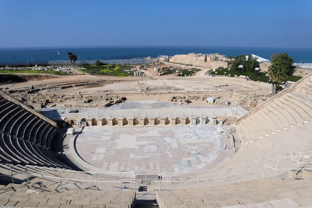
Herod’s theatre was built from kurkar stone and plaster and held approximately 4,000 seats. It continued to function for centuries, into the Byzantine period. Under Septimius Severus, marble and porphyry columns were added. The theatre was excavated by an Italian expedition in the late 1950s and later underwent extensive conservation, restoration, and development.
A reused limestone block found in the theatre ruins in 1961 bears a dedication to Pontius Pilate as prefect. The inscription refers to a structure called a Tiberieum, although the nature of that building remains uncertain; it may have honored Emperor Tiberius. The block is preserved in the Israel Museum in Jerusalem. The conserved theatre was later adapted for large cultural performances, beginning in September 1961 with an inaugural performance by the Catalan cellist Pablo Casals.
Coastal Arena and Eastern Circus
A coastal arena or hippodrome was built under Herod. Stone benches originally surrounded its performance area, and paintings of animals hunting were found along the enclosing walls. Starting gates at the northern end indicate that the building also functioned as a hippodrome or circus, combining several types of public entertainment. Athletic contests, gladiatorial games, theatrical performances, mime, pantomime, athletic displays, and executions formed part of the city’s public spectacles.
A larger eastern circus was constructed during Hadrian’s reign and remained in use until the sixth century. It occupied an open eastern part of the city and measured about 450 by 70 meters. Its stone seating was supported by vaulted structures, much of which was later robbed. Water basins were arranged along the central barrier, or spina, around which chariots raced. The spina carried a granite obelisk imported from the Aswan region of southern Egypt, while conical stone markers at its ends identified the turning points.
Religious Buildings and Archaeological Finds
Churches and Synagogue
The principal Byzantine church was an octagonal martyrion, a church or shrine associated with a martyr or sacred relic, built in the sixth century on the podium of Herod’s temple. It had richly paved floors, small radiating enclosures, and leafy capitals decorated with crosses. A mosque later occupied the site.
A large Roman synagogue complex is represented by a mosaic and associated remains. Josephus mentioned the synagogue as containing a Torah scroll, and later tradition connected it with the outbreak of the Jewish revolt. Caesarea’s later Roman Jewish population included merchants and farmers. Three small fragments of a Hebrew stone inscription found in sand in 1962 date to the third or fourth century. They preserve parts of place names associated with priestly courses and refer to Galilean places apparently occupied by Jewish priestly groups after the First Jewish–Roman War under Hadrian.
Mosaics and Sarcophagus
A sixth-century panel found in 2005 was covered with an elaborate mosaic made from gold glass and colored opaque glass tesserae. It functioned as a table and carried designs of crosses and rosettes. A separate mosaic found near a Crusader bridge in 2018 dates to the second or third century CE. Measuring approximately 3.5 by 8 meters, it depicts three male figures in togas, geometric designs, and a largely damaged Greek inscription. It is an unusually high-quality surviving example.
A broken Roman-period marble sarcophagus discovered in 2025 dates to approximately 1,700 years ago. Its relief shows a drinking contest between Dionysus, the Greek god associated with wine and ecstatic worship, and Hercules, the hero celebrated for extraordinary strength and his traditional labors. Hercules reclines in an intoxicated state while Dionysus appears triumphant. Maenads, female followers of Dionysus, satyrs, Hermes, Pan, panthers, and lions complete the scene. Conservation specialists reassembled the sarcophagus.
An assemblage of 24 gold coins and a gold earring discovered in 2018 was tentatively dated to 1101, the year of the Crusader conquest. The underwater harbor discoveries provide a separate group of early Islamic-period evidence, including gold coins with Arabic inscriptions recovered from the seabed.
Medieval, Ottoman, and Modern Remains
Crusader Fortifications
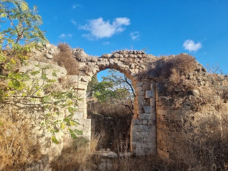
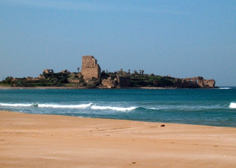
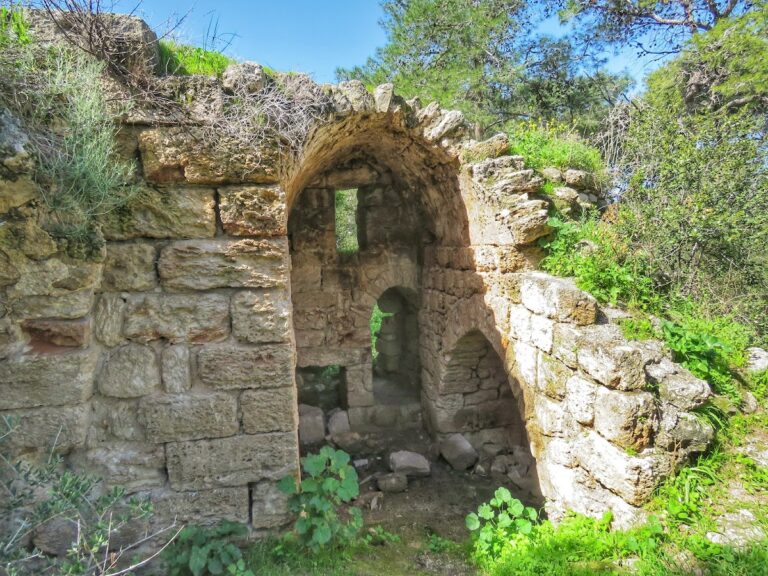
The medieval city preserves portions of the Crusader walls, a citadel surrounded by the sea, the remains of a cathedral and a second church, and sections of the fortifications strengthened under Louis IX. The Crusader settlement was smaller than the earlier Roman and Byzantine city. Its defenses reflect the later history of Caesarea as a fortified lordship and its destruction by Baibars in 1265.
Bosnian Village
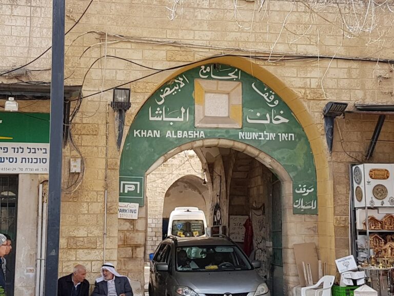
The nineteenth-century Bosnian village was built partly with ancient masonry. Its houses were generally arranged in blocks and were usually one story high, apart from the governor’s house. Broad intersecting streets served a settlement that included two mosques, a caravanserai, a market, a governor’s residence, a harbor, warehouses, and customs offices.
The Bosnian Mosque at the southern end of the former village, beside the harbor, is a simple stone building with a red-tiled roof and cylindrical minaret. Several mosques existed in the nineteenth century, while this was the one that survived. Some village houses near the sea were later reused as restaurants, and the mosque was converted into a bar.
Bayyarat al-Khuri
In the early twentieth century, the Greek Orthodox Patriarchate of Jerusalem established Bayyarat al-Khuri, or the Priest’s Orchard, within the Roman hippodrome and southeast of the Ottoman village. The agricultural estate included a monumental limestone gateway carrying a monogram of the Brotherhood of the Holy Sepulchre, a manually filled drinking fountain, a well house powered by a locally made diesel engine, and a large plastered stepped reservoir.
The reservoir supplied open irrigation channels for citrus, date, and olive cultivation. Properties of the patriarchate in the former village included a supposed prison cellar associated with Saint Paul and remains of the Crusader cathedral. The ecclesiastical properties also served occasionally as retreats for church elders.
Investigations outside the old city walls in 2025 suggested that the Roman-period settlement may have extended farther and been wealthier than previously thought. These findings add to a continuously expanding archaeological picture of Caesarea’s urban development.