Castell de Xivert: An Islamic and Templar Fortress in Spain


Site at a Glance
- Rating
- 4.4
- Popularity
- Medium
- Country
- Spain
- Primary era
- Medieval
- External website
- Open
- Eras represented
- Bronze Age, Medieval
- Civilizations
- Almohad, Crusader, Knights Templar
- Site type
- Military
- Remains
- Fortified Town
On this page14 sections
History
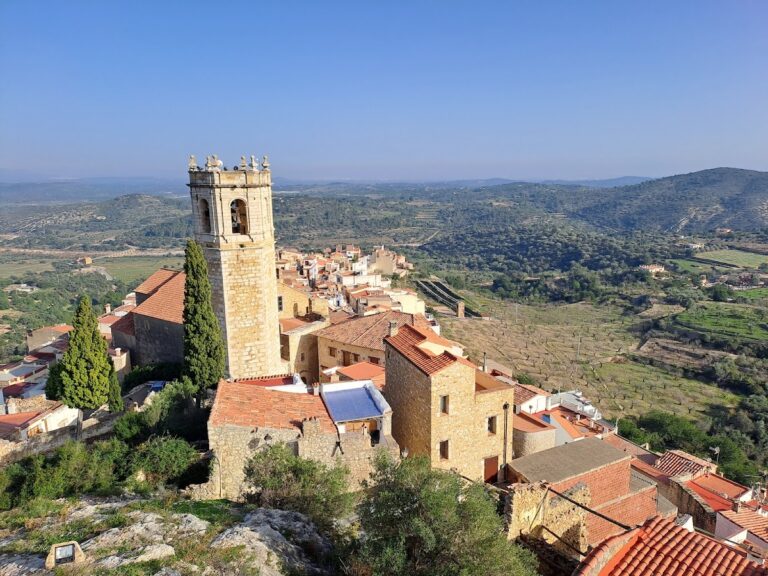
Castell de Xivert is a fortified mountain complex in Spain, above Alcalà de Xivert, whose Islamic fortress was established during the tenth or eleventh century. The site occupies a defensible position on Xivert Mountain and remained occupied from at least the Middle Bronze Age, around the fourteenth or thirteenth century BC, until the early seventeenth century. Its history includes Bronze Age and Iberian settlement, Muslim rule, Templar administration, and later control by the Order of Montesa.
Early settlement and the Islamic fortress
Archaeological evidence places an early settlement on the plateau now occupied by the medieval citadel, although its full extent is unknown. The site later supported an Iberian occupation and an urn-field burial area. The Islamic occupation altered the earlier landscape, destroying or removing much of the previous built fabric when the citadel was constructed.
The Islamic stronghold was a hisn, a fortified settlement that defended and administered surrounding rural communities. It comprised a citadel and a fortified settlement, later modified under the Almohads. The fortress formed part of a wider network of eastern Iberian defenses and controlled the agricultural plain below, together with routes toward Santa Magdalena de Pulpis and Peniscola.
Templar rule and the Muslim quarter
As the Crown of Aragon advanced into the Kingdom of Valencia, Xivert changed from an administrative center into a frontier stronghold. In 1169 Alfonso II of Aragon granted the fortress, together with Oropesa Castle, to the Knights Templar, a medieval military-religious order whose members combined religious vows with military service. Xivert was still under Muslim control at the time. In 1225 James of Aragon granted it to Rodrigo Ximen de Llusia, but the earlier Templar grant was confirmed on 22 July 1233.
The Templars took possession on 28 April 1234 after a peaceful surrender and issued a settlement charter. Muslim inhabitants were permitted to retain their customs and religion, while the military order occupied the citadel and the albacar, an enclosed area beside a fortress used for shelter or military purposes. The population moved from the summit to the western slope, where it formed a fortified aljama, or Muslim quarter under Christian rule.
The castle became the seat of a Templar commandery, an administrative and economic center of the order. After the Templars were dissolved, Castell de Xivert and its aljama passed to the Order of Montesa in 1319. This later Iberian military-religious order inherited many former Templar possessions. The transfer of the commandery to Peniscola reduced Xivert’s importance and affected the quality of subsequent construction.
Decline, destruction, and abandonment
The aljama contained about 300 inhabitants in 1320 and about 140 in 1421. By the latter date the castle was no longer occupied. During the fourteenth and fifteenth centuries the settlement declined in importance, partly because of the growth of the Christian town of Alcalà de Xivert.
During the War of the Germanies, a major revolt in the Crown of Aragon during the early sixteenth century, troops commanded by General Miguel de Estelles sacked and burned the castle, mosque, and aljama on 29 June 1521. The population later rose to more than 200 during the 1570s, largely because Moriscos arrived from nearby settlements. Moriscos were Muslims converted to Christianity who retained a distinct cultural and historical identity.
In 1580 Pedro Luis Garceran de Borja, the last master of the Order of Montesa, granted Xivert town status. Claims made in 1596 stated that the population had adopted Christian customs and religion and abandoned its language, but all the inhabitants were expelled to North Africa after the expulsion order of 22 September 1609.
In 1632 the fortress was attached to Alcalà de Xivert. Christians temporarily resettled the aljama, but the new families abandoned it within a few decades. By 1648 the castle and town were described as ruined, and by 1677 the entire site appeared in ruins.
Archaeology and protection
Archaeological recovery, excavation, cleaning, consolidation, and restoration began in 1996 and continued during the twenty-first century. This work exposed parts of the settlement, restored two houses, traced sections of streets, consolidated the walls, and restored or consolidated the Poniente Tower, South Tower, and Alafia Wall. Castell de Xivert has been legally protected as a cultural-interest monument since 7 December 2001.
Remains
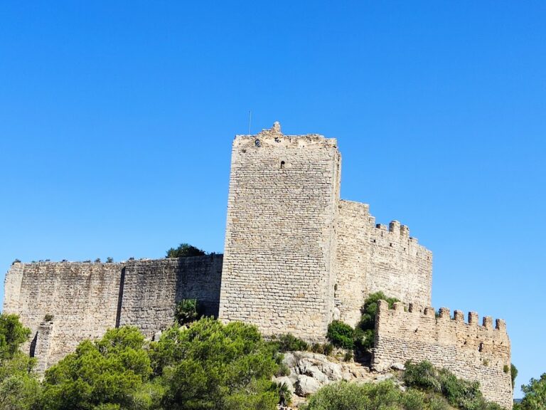
The fortified complex occupies the summit and slope of Xivert Mountain in the foothills of the Irta range. Its remains cover about 8,000 square metres, within an ensemble described as approximately 50 metres wide and 70 metres long. The rocky hill rises to roughly 370 metres above sea level above the agricultural plain of Alcalà de Xivert. The complex consists of an upper citadel, the lower enclosed albacar, the saloquia, or main fortified enclosure, and the raval, an outer settlement. The Islamic outer enclosure surrounded the settlement and castle, with the terrain largely determining their separation and giving the upper enclosure a refuge function.
Islamic fortifications
Poniente and South Towers
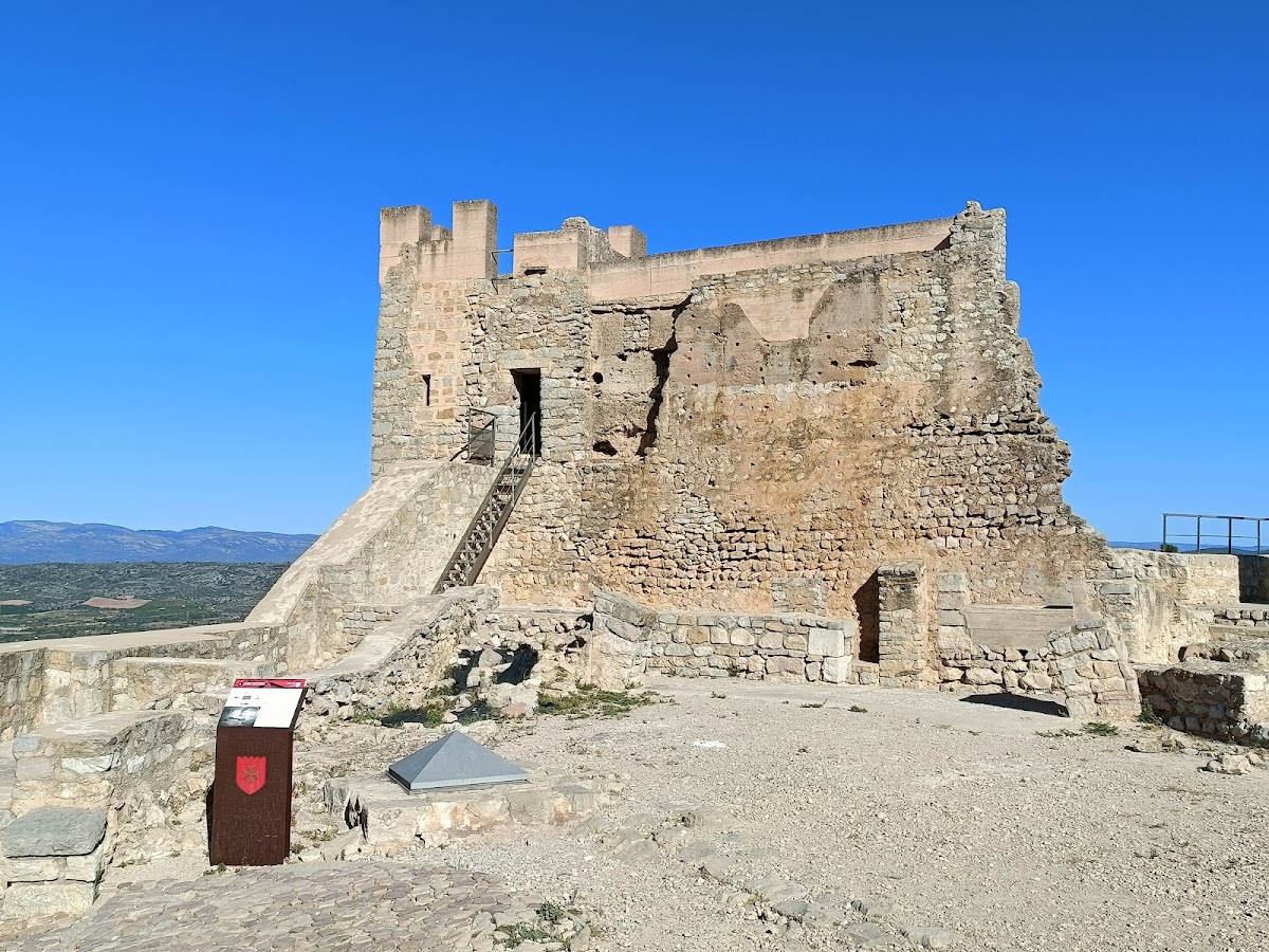
The Poniente Tower is built of rammed earth, a technique in which compacted earth is raised within formwork. Before restoration it survived to a height of 10 metres and contained two interior rooms. The lower room may have served as a silo, while the upper room was used by guards.
The South Tower is the largest tower in the fortification. Built during the Andalusi period, the era of Muslim rule in the Iberian Peninsula, and later remodeled, it controlled entry to the citadel. Its trapezoidal plan contains two ground-floor rooms divided by a large pointed arch. Restoration added a roof terrace to consolidate the walls and prevent water infiltration, bringing the tower to slightly more than 8.5 metres in height.
Albacar wall and Islamic towers
The southern wall of the albacar contains the Levante Tower, the Alafia Wall, and two semicircular towers. The Alafia Wall measures 12.45 metres in length and reaches 9.8 metres in height. Its lower section consists of irregular, low rubble masonry laid directly on the rock. A second masonry phase is set back 15 centimetres from the lower section and rises 2.9 metres. Above it is decorated, lime-coated rammed earth designed to imitate ashlar masonry, which uses regularly cut stone blocks.
An Arabic inscription, probably from the twelfth century, is set into the decorated upper surface of the Alafia Wall. Its words, al-fatih Allah, mean that God grants victory. The albacar itself has a polygonal plan and walls pierced by loopholes. Its southern side contains three towers, including a badly damaged square tower, as well as an originally Islamic cistern.
Templar citadel
Circular towers and connecting wall
The Templar rebuilding of the thirteenth century retained the general Islamic arrangement while adapting the castle for military and administrative use. Two large circular towers and their connecting wall were added on the northeastern side of the citadel. The first building phase used high-quality, well-cut ashlar bearing visible masons’ marks. The towers reached up to 10 metres and the wall stood slightly more than 5 metres high.
A second phase used poorer-quality masonry after the commandery was transferred to Peniscola. The towers were raised to slightly more than 12 metres and the connecting wall to just under 10 metres. Dormitories, a kitchen, and a stable were attached to the inner side of the wall. Little survives of these buildings, although excavations exposed foundations identified with the chapel, stables, and kitchen.
Entrance, church, and cistern
The western entrance is an angled passage, probably built in the thirteenth century, that cuts through earlier Andalusi access structures and joins the cistern. Two paved ramps turn through the entrance, with a guardroom between them. The guardroom appears to have been a four-metre-square tower from the earlier Muslim fortification, reused for a new purpose. Its total height remains unknown, as do the heights of the other western structures.
A church stood beside the South Tower, and its ground plan survives. The lower room of the tower served as a sacristy, while archaeological work also exposed foundations associated with the chapel. The Templar cistern lies inside the citadel beside the entrance, between the Poniente and South Towers. It measures approximately 11 by 5 metres and is oriented from north to south.
Muslim and Morisco settlement
The Muslim and Morisco settlement lay below the castle on the western slope, adapted to the terrain and facing south. Its substantially preserved plan includes a main street, secondary streets, alleys, houses, and public spaces. The settlement wall survives particularly on the eastern side, while natural rock protected the other sides. The wall enclosed houses, a cistern, and a mosque beside the cistern. Excavation revealed much of the urban layout, restored two houses, traced sections of streets, and consolidated the settlement wall.
Bronze Age and Iberian evidence
Excavations beneath the present albacar, in an area that also formed part of the Islamic settlement, uncovered an urn-field burial ground directly above Bronze Age levels. The vessels held cremated remains and belong to two chronological groups. One group consists of wide-mouthed bowls with short cylindrical necks and fluted decoration, probably dating from the tenth century BC. The other contains shallow truncated-conical vessels dated to the eighth and seventh centuries BC.
Several superimposed hearths from different occupation phases were found in the Bronze Age settlement. Abundant pottery extended into the Iberian period, the later pre-Roman culture of the Iberian peoples, providing material evidence for the site’s long occupation before the medieval fortress was built.