Burgruine Saxenegg: The Ruins of a Thirteenth-Century Hilltop Castle in Austria


Site at a Glance
- Rating
- 4.1
- Popularity
- Very Low
- Country
- Austria
- Primary era
- Medieval
- Eras represented
- Medieval
- Civilizations
- Duchy of Austria, Habsburg, Holy Roman Empire
- Site type
- Military
- Remains
- Castle
On this page12 sections
History
Burgruine Saxenegg is the heavily deteriorated remains of a former hilltop castle in Austria, located in the municipality of St. Thomas am Blasenstein in the Perg district of Upper Austria. Its construction date is uncertain, but the castle is generally assigned to the thirteenth century. The name Saxenegg comes from Sachsen, an older name for the present Käfermühlbach, which becomes the Klambach farther downstream.
Lordship and feudal ownership
Saxenegg first appears in the written record on 12 March 1297, when Ulrich and Wernhart den Sechseneker were identified as its owners. In 1342, Duke Albrecht II granted the castle to Burghart dem Kneusser as a fief, meaning property held from a superior lord in return for service and loyalty. Hans der Kneusser sold Saxenegg to Duke Albrecht III in 1382. At that time, the lordship included 14 farms, 22.5 fiefs, and 23 farmsteads in the surrounding parishes.
The lordship then passed through several feudal holders. Wolf dem Schenk von Dobra held it before Hans dem Ruckendorfer took possession in 1403. Albrecht dem Schweinwarter followed in 1405, and the brothers Erhard and Wilhelm von Zelking acquired Saxenegg in 1410. The Zelking family subsequently retained the property. The lordship included rights over local resources, including fishing, timber, and hunting.
Damage and abandonment
Hussite armies may have damaged Saxenegg between 1424 and 1432. The Hussites, followers of the Bohemian religious reformer Jan Hus, carried out military campaigns across parts of Central Europe during the fifteenth century. A local tradition says that cannon fire was directed at the castle from the southeast, across the Käfermühlbach valley.
On 26 May 1438, King Albrecht II authorized the Zelking family to demolish and destroy the “somewhat dilapidated” fortress. This Albrecht II was a different ruler from Duke Albrecht II, who granted the castle as a fief in 1342. Saxenegg was largely abandoned after the authorization. In 1473, Christoph von Zelking gave the inventory of the castle chapel to the parish church of Kefermarkt.
Later administration
The brothers Prüschenk of Greinburg acquired the lordship in 1493. In 1525, ownership passed to Anna Prager, the widow of Ladislaus Prager, and her sons. Saxenegg was later administered from the lordship of Windhaag until manorial authority was abolished in 1848. In that year, local citizens and farmers reportedly held a freedom festival at the Tanzanger below the ruin.
Remains
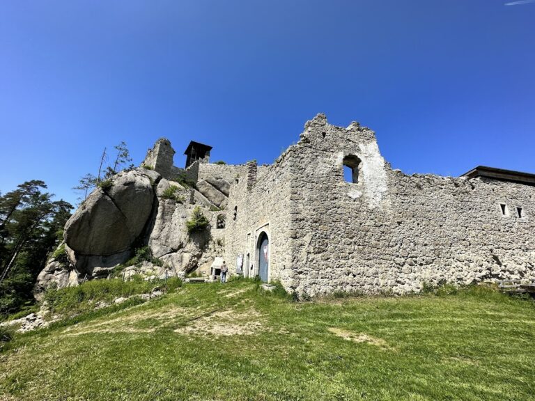
The castle occupied a south-projecting rocky spur in wooded terrain between the Käfermühlbach and the Hinterbergerbach, formerly known as the Saxeneggerbach. Its enclosed area covered 1,707 square metres. The ground falls steeply to the south, east, and west. The site is described at about 530 metres above sea level, while a recorded elevation gives 488 metres.
Approach and outer bailey
Neck ditch and entrance
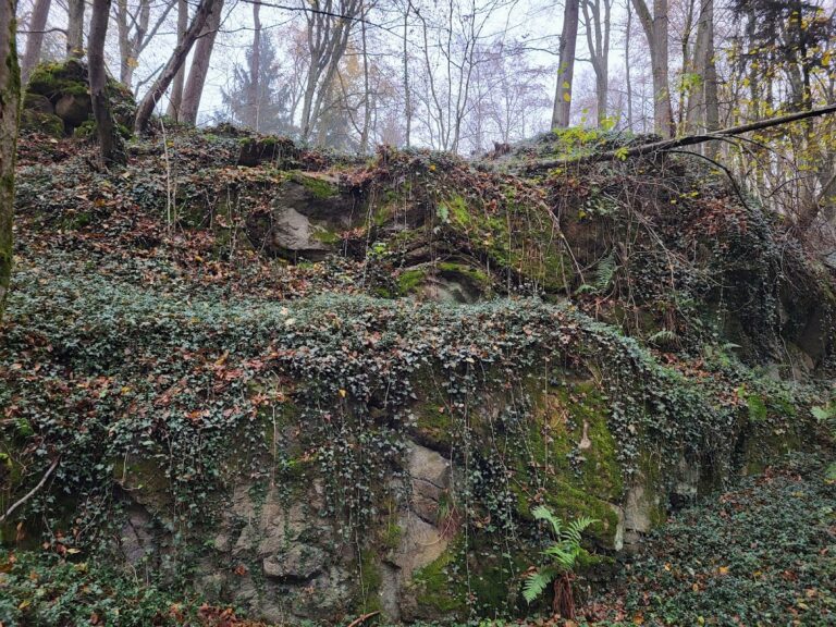
Access to the castle was from the northwest, across a substantial neck ditch. This defensive ditch, cut across the narrow connection to the projecting spur, remains about 10 metres deep and 20 metres wide. The former gate structure has not survived. Beyond the ditch to the southeast is the outer-bailey rock, where bastion-like structures once stood. Only sparse masonry at foundation level remains there.
Outer-bailey plateau
Farther southeast, at a slightly lower level, lies a roughly 40-metre-long trapezoidal plateau belonging to the outer bailey. Its perimeter walls survive as an edge along the steep slope, while raised areas in the ground indicate the positions of angular buildings. A circular cistern survives beneath the main castle rock and formed an important part of the outer-bailey remains.
Main castle rock
Keep and shield wall
The uneven castle rock shows woolsack weathering, a rounded, block-like form produced when rock weathers along intersecting fractures. A square keep, the castle’s principal fortified tower, formerly rose about 17 metres above the rock. Alfred Höllhuber’s analysis proposes that the keep’s three walls on the exposed attack side slid away or were dismantled at an early stage. The old southeast wall apparently remained, and a new protective wall 2.55 metres thick was built against it.
The surviving old and new walls together formed a double wall 3.9 metres thick, functioning as a shield wall designed to protect the castle’s most exposed side. A high, round-arched entrance to the keep remained in the older southeast wall. It was later reused, apparently as a seating niche or for a similar purpose. After 1980, the old southeast wall and its niche collapsed inward, leaving low remains and a rubble cone. The 2.55-metre-thick protective wall still survives, and traces of the former keep entrance can be recognized in its masonry.
Residential and retaining structures
The main castle extended about 30 metres southeast of the double wall and included the palas, the principal residential and representative building of a medieval castle. Its surviving form is represented by terrain terraces and several massive retaining walls. These remains stand amid steep ground descending toward the Käfermühlbach and Hinterbergerbach.
Depicted and associated features
A 1656 engraving by Clemens Beuttler shows the castle from the west. Its representations of the round arch and cistern are specifically identified as inaccurate. Outside the castle, Beuttler’s map labels a house garden and a building. A flattened rectangular mound about 75 metres northwest of the neck ditch may be connected with those features. The principal manor farm stood across the Hinterbergerbach on less steep ground at Hofberg, at the present Hofberger holding in the municipality of Münzbach.
Nearby sites