Château de Merpins: A Historic Fortress in France
Visitor Information
Google Rating: 3.7
Popularity: Very Low
Country: France
Civilization: Medieval European
Site type: Military
Remains: Castle
History
The Château de Merpins stands near the town of Merpins in modern-day France, positioned on a rocky hill overlooking the meeting point of the Né, Charente, and Antenne rivers. Its origins trace back to prehistoric times, as evidence shows people settled here during the Neolithic era, highlighting the site’s longstanding strategic significance.
Local tradition suggests that the fortress was originally established around 810 under the reign of Charlemagne, who is said to have ordered the counts of Angoulême to build a stronghold to defend against Norman raids. Although no written records confirm this foundation story, it is known that the castle was captured by the Normans in 850. By the 10th century, ownership of the lordship of Merpins had passed to the Taillefer family, who were the counts of Angoulême.
In the late 12th century, the castle entered English hands following military actions in the region. In 1176, the English forces seized the fortress, and in 1180, Richard the Lionheart granted it to his illegitimate son, Philippe de Falcombridge, who married Amélie de Cognac. Philippe later sold Merpins to King John of England in 1204, who undertook repairs to strengthen the fortress. Subsequently, John’s son Henry III rewarded Hugues X de Lusignan, count of La Marche and husband to Isabelle d’Angoulême, with the castle.
The castle’s control alternated over the following centuries. After the Battle of Taillebourg in 1242, Merpins was briefly reclaimed by the French crown but reverted to English control under the Treaty of Brétigny in 1360, which ceded large parts of southwestern France to England. In 1387, after enduring a prolonged siege led by Marshal de Sancerre lasting six years, the castle was seized by French forces. King Charles VI then ordered its partial destruction to prevent further military use by the English.
During the French Wars of Religion in the late 16th century, the fortress remained a contested site. It was occupied at different times by Catholic and Protestant forces until the Duke of Mayenne expelled the Protestant occupants in 1577. Despite these conflicts, the site saw no further major military action in the centuries that followed.
Remains
The Château de Merpins occupies a naturally fortified rocky hill shaped roughly as an elongated mound, extending about 40 meters wide from west to east and roughly 60 meters long from north to south. This elevated position overlooks a strategic junction of three rivers, providing natural defenses complemented by man-made fortifications. Surrounding the motte are broad, deep ditches cut directly into the rock on the northern and eastern sides. These ditches form part of a defensive enclosure resembling an oppidum, an ancient fortified settlement.
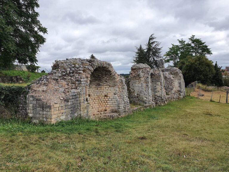
Encircling the motte is a curtain wall, or defensive stone barrier, which was reinforced over time. This wall features four towers, including a central main tower known as a donjon, although the precise location of this donjon has not been identified through archaeological work. Additional elements include a postern gate, which served as a secondary or secret entrance, and a subterranean corridor linking parts of the castle.
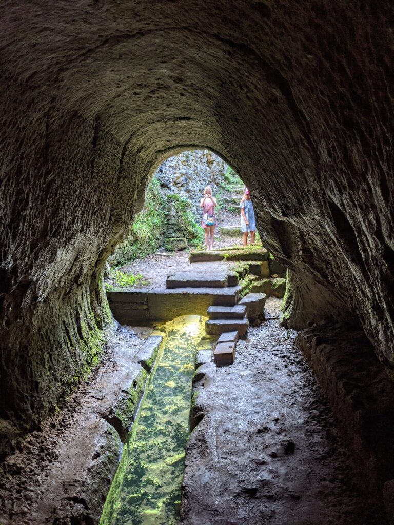
Excavations uncovered a remarkable underground passage approximately 30 meters in length. The corridor slopes downward and is carved partly directly from the bedrock at the lower end, while the upper portion was constructed from masonry—carefully shaped stone blocks fitted together. Measuring about 3.5 meters wide and 3 meters high, this passage included a staircase and connected the castle’s inner areas to the external ditch. A door opening from this corridor into the ditch was found roughly five meters below the current surface level; a window also provided light and visibility.
Another notable find came from beneath what was once a walled opening in the barbican—the fortified entrance structure of the castle—where archaeologists discovered a pointed-arch door dating from the 12th century. This door allowed access into a rock-hewn corridor leading to a staircase, indicating complex underground movement within the castle’s defenses.
The castle’s defensive works evolved through several construction phases. Initial structures possibly date from the 9th century, with stone reinforcements added from the 10th century. Between 1140 and 1150, the main castle buildings and the donjon were built. After 1179, under English control, further fortifications were erected, including three additional towers, strengthened walls, and the excavation of a dry moat encircling the fortress. Continued enhancements were made during the 13th century, further developing the site’s military architecture.
Together, these features illustrate the castle’s role in regional defense from the medieval period and its adaptation to changing military technologies and political circumstances. The remains visible today attest to centuries of occupation, siege, and rebuilding on this strategically placed historic site.
Nearby sites