Citadel of Salah Ed-Din: A Medieval Fortress in Syria


Site at a Glance
- Rating
- 4.7
- Popularity
- Low
- Country
- Syria
- Primary era
- Medieval
- Eras represented
- Medieval
- Civilizations
- Ayyubid, Byzantine, Crusader, Mamluk, Principality of Antioch
- Site type
- Military
- Remains
- Castle
On this page17 sections
History
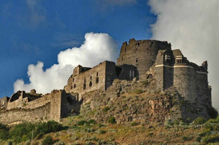
The Citadel of Salah Ed-Din is a medieval fortress in Syria, built and expanded under Byzantine, Crusader, Mamluk, and Arab rule on the coastal mountain route near Latakia. Historically known as Sahyun, it occupies a strategic position between Latakia and Antioch and preserves fortifications shaped by successive political powers from the tenth century onward. Its modern name commemorates Saladin, the Muslim ruler who captured the fortress in 1188.
Early fortifications and Byzantine rule
The site’s earlier name was associated with the Greek form Sigon and with the Arabic rendering of “Zion.” Byzantine and Frankish usage included the forms Sigon and Saône. During the Greek period, the location was under the authority of Arwad. In the fourth century BC, the son of the king of Arwad reportedly surrendered a city called Siphon to the victorious Macedonians. Siphon has been proposed as an origin for the medieval name Sahyun, although this interpretation remains uncertain.
The ridge was fortified by at least the mid-tenth century. Sayf al-Dawla, the Hamdanid emir of Aleppo, seized the fortress and used it as one of his strongholds. In 975, it passed to the Byzantine emperor Ioannes I Tzimiskes and remained under Byzantine control until about 1108.
Crusader expansion
After the Franks, the medieval term commonly used in the Islamic world for western European Crusaders, captured Latakia in 1108, they probably took Sahyun as well. The fortress became part of the Principality of Antioch, one of the Latin Christian Crusader states founded in the eastern Mediterranean after the First Crusade. Robert the Leper probably became its first lord and controlled it by at least 1119. His descendants retained the fortress until 1188.
A major Crusader building program enlarged the earlier Byzantine defenses and produced much of the fabric visible today. The work was probably carried out by Robert the Leper or by his son William of Zardana. Unlike many Crusader fortresses, Sahyun was not entrusted to a major military order such as the Knights Hospitaller or the Knights Templar.
Saladin’s conquest
Saladin, founder of the Ayyubid dynasty, and his son Az-Zahir Ghazi besieged Sahyun in July 1188 during Saladin’s campaign against the Crusader territories. The Muslim army reached the fortress after difficult movement through valleys and mountain passes. Saladin placed siege engines on the eastern plateau while Az-Zahir attacked from the north.
The siege lasted three days, approximately from 27 to 29 July 1188. Mangonels, medieval engines that hurled stones against fortifications, caused substantial damage with projectiles weighing about 50 to 300 kilograms. Az-Zahir’s forces then exploited the incomplete northern ditch and breached the walls. The garrison withdrew into the inner fortress and surrendered on Saladin’s terms.
Saladin granted Sahyun and Bourzey to his emir Mankawar, also known as Mankurus ibn Khumartigin. Mankawar strengthened Sahyun and made it one of the region’s strongest fortresses. His heirs held it until its transfer to the Mamluk sultan Baybars in 1272.
Mamluk administration and abandonment
In the 1280s, the Mamluk emir Sunqur al-Ashqar used Sahyun as a refuge during his conflict with Sultan Al-Mansur Qalawun. The Mamluks were a military elite who ruled Egypt and Syria from the thirteenth to the early sixteenth century. Sahyun became the administrative center of Sunqur’s small, semi-independent emirate. Qalawun sent the emir Turuntay to besiege it in late 1286 or early 1287. Sunqur refused an offer of pardon in exchange for surrender, but capitulated in April 1287.
Sahyun later became part of the administrative province of Tripoli. It remained strategically important and prosperous under Mamluk rule until at least the end of the fourteenth century, while a town grew beside the fortress. The site was gradually abandoned in the following decades. Sibay was its last Mamluk deputy in 1500, and the Ottoman conquest of Syria in 1516 contributed to the abandonment of Sahyun and other fortresses.
Investigation, conservation, and heritage status
By the modern period, shrubs and trees had overgrown the ruins. A French engineer recorded the fortress’s condition in 1929. In 1937, the western Arab bath gate was restored, other buildings were repaired, and several buried structures were uncovered. Since 1966, Syria’s Directorate-General of Antiquities and Museums has carried out restoration and maintenance.
In 2006, the Citadel of Salah Ed-Din was inscribed with Crac des Chevaliers as part of the UNESCO World Heritage property “Crac des Chevaliers and Qal’at Salah El-Din.” The citadel component covers 6.49 hectares within a site area of 8.87 hectares and a 129.52-hectare buffer zone. The Syrian government administers the fortress. During the Syrian civil war, which began in 2011, UNESCO expressed concern about possible damage, but the fortress had survived without significant damage by 2016.
Remains
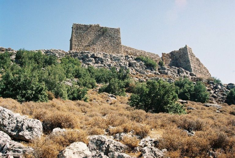
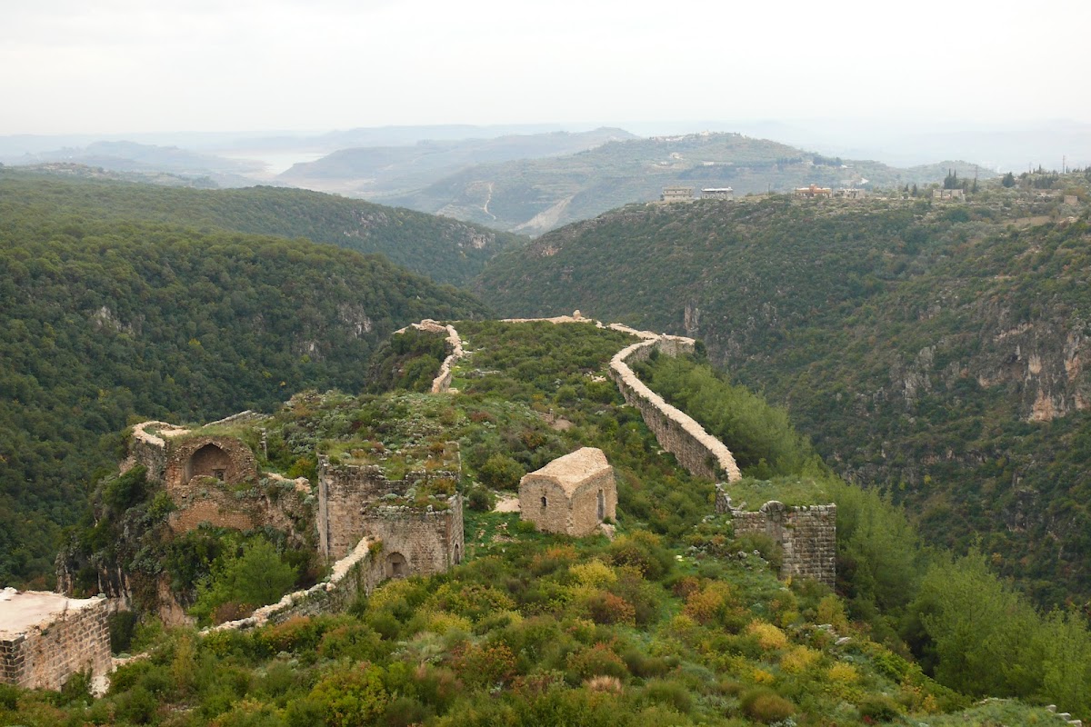
The citadel occupies a long, rocky ridge about 410 metres above sea level between two deeply cut valleys. The ridge extends approximately 700 to 740 metres, with its eastern end connected to a plateau and the valleys converging below the western side. Forests surround the site, which overlooks the historical route between Latakia and Antioch. Its elongated, roughly triangular plan has a broader eastern base, a higher eastern section containing most of the major defenses, and a visibly lower western section.
Ridge defenses and entrances
Eastern fortifications and ditch
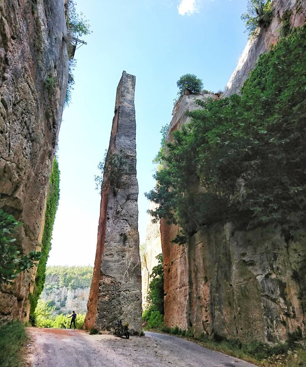
The eastern approach from the plateau was blocked by irregular Byzantine walls with flanking towers. A small settlement stood outside the defenses near the eastern end of the ridge. The plateau was later separated from the rocky ridge by a ditch cut into bedrock. This principal ditch is about 28 metres deep, 156 metres long, and 14 to 20 metres wide. At the bridge crossing, a solitary rock tower rises about 28 metres to support the drawbridge, a movable bridge that could be raised to obstruct access. The ditch may have begun in the Byzantine period and been completed during the Crusader period.
Southern entrance and watchtower
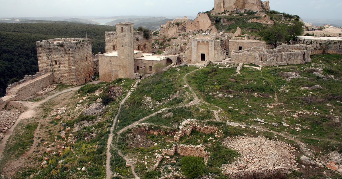
The southern side contains an entrance passage beside a Crusader bastion, a projecting defensive tower. Another defensive tower stands several metres farther along the approach. A large watchtower overlooks the ditch, with a stable and a cistern beside it. The cistern, a constructed reservoir for storing water, formed part of the fortress’s support system. The watchtower has walls about 5 metres thick and covers approximately 24 square metres.
Northern gate
The northern gate formerly had a drawbridge. Much of the northern wall was less massive and lacked defensive towers, while the northern part of the ditch remained incomplete during the 1188 siege. This weakness allowed Az-Zahir’s forces to breach the defenses during the assault.
Central citadel and religious buildings
Byzantine citadel
The Byzantine citadel stands near the center of the fortress. Its surviving remains include a large cistern and two Byzantine chapels. A Crusader church was built beside one of the chapels, adding a later religious structure to the central complex.
Crusader and later buildings
Crusader structures
Beyond the principal defenses, Crusader additions include a second large vaulted structure and a tea house or open pavilion. These buildings form part of the architectural remains produced during the Crusader expansion of the earlier fortress.
Mamluk and Arab-period structures
Arab-period additions include a mosque dating from the reign of Qalawun and a palace containing baths, a courtyard, and iwans. An iwan is a vaulted hall or recess opening onto a courtyard. These later structures have undergone limited repair.
Construction and surviving fabric
Limestone is the principal building material. The surviving fabric combines Byzantine, Crusader, Mamluk, and Arab-period construction, and the fortress is partly ruined. Medieval descriptions present its defenses in different ways, either as three defensive walls, including two outer walls and the main enclosure, or as five successive fortified levels or walls. These accounts reflect different descriptions of the fortress’s layered defenses rather than a single securely established count.