Nimrod Fortress: An Ayyubid and Mamluk Stronghold in Syria

Site at a Glance
- Rating
- 4.8
- Popularity
- Medium
- Country
- Syria
- Primary era
- Medieval
- External website
- Open
- Eras represented
- Classical, Medieval, Modern
- Civilizations
- Ayyubid, Mamluk
- Site type
- Military
- Remains
- Castle
On this page14 sections
History
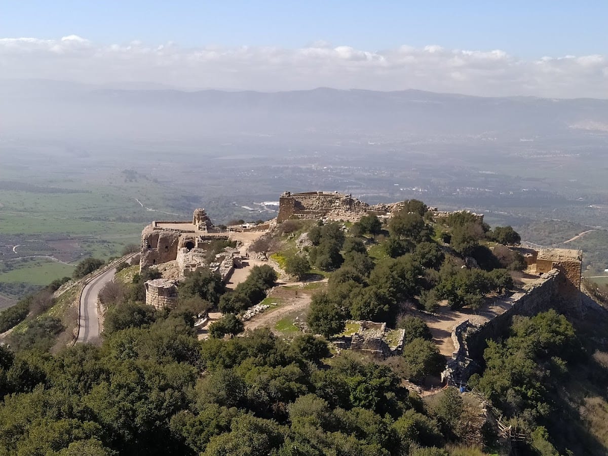
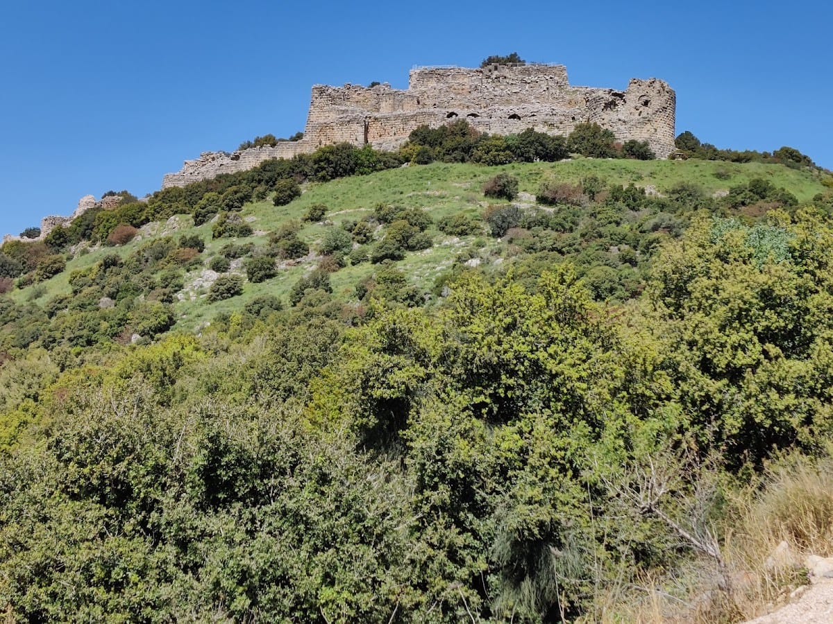
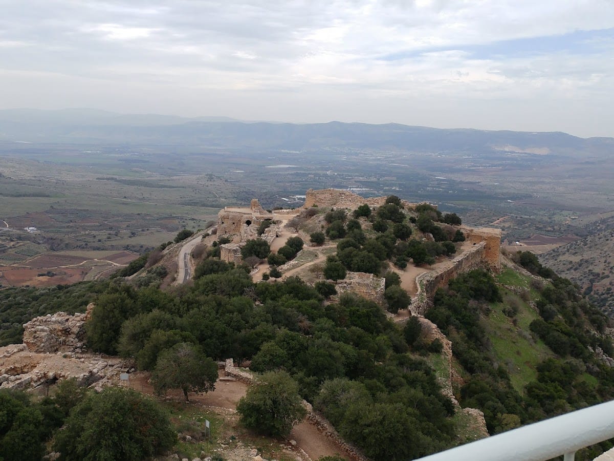
Nimrod Fortress is a medieval fortress in Syria, built chiefly by the Ayyubids on a narrow ridge on the southern slopes of Mount Hermon. The major surviving stronghold was established around 1227–1228 and expanded until about 1230 to help protect Damascus from the armies of the Sixth Crusade, the thirteenth-century campaign associated with Emperor Frederick II. Its elevated position, about 800 metres above sea level, overlooks Banias, the Hula Valley, and a route linking Galilee with Damascus, giving the site lasting strategic importance.
Early fortifications and the Ayyubid foundation
The fortress has evidence of several earlier phases, although the origins of the first structure remain uncertain. One archaeological interpretation places an earliest fortress in the Hellenistic period, after 332 BCE and possibly as late as 30 CE. Another places it in the Byzantine period, between the fourth and seventh centuries. Masonry and cross-shaped rib vaults, which are ceilings supported by intersecting structural ribs, have also been used to propose a Crusader building phase.
The principal fortress was created under Al-Aziz Uthman, governor of Banias and son of Al-Adil, an Ayyubid sultan and brother of Saladin. Construction probably received financial support from Al-Mu’azzam Isa, ruler of Damascus. Work continued until approximately 1230 and extended the defenses across the ridge, producing the long fortified complex that survives in substantial ruins.
Mongol capture and Mamluk expansion
In 1260, the Mongols captured Banias and Nimrod Fortress. Part of the defenses was dismantled, and authority over the site remained with a son of Al-Aziz Uthman. After the Mamluks, a military ruling class that governed Egypt and Syria, defeated the Mongols at the Battle of Ain Jalut, Sultan Baibars recovered the fortress and ordered its strengthening.
Baibars granted the fortress as a palace to his second-in-command, Bilik. Extensive construction under Bilik was commemorated by an inscription dated 18 July 1275. Baibars also made the fortress and Banias an administrative district subordinate to Damascus, whose governor was appointed directly by the sultan in Cairo. The site therefore served not only as a defensive position but also as an administrative and residential center.
Palace, prison, and Ottoman decline
After the Crusaders were expelled from the region at the end of the thirteenth century, the fortress lost much of its strategic importance and fell into disrepair. From the fifteenth century, it was used by the Mamluks as a palace-prison for nobles who had rebelled against the central government. The northern tower is traditionally or archaeologically associated with this prison function.
The Ottomans conquered the region in 1517 and used the fortress as a luxury prison for Ottoman nobles. It was later abandoned, probably during the sixteenth century, after which shepherds and travelers used the ruins for shelter. An Ottoman demolition order concerning the fortress is recorded for 1616. Local rulers repaired parts of it in the eighteenth century, but Ottoman authorities later besieged the fortress and ordered the newly repaired sections demolished. These episodes are dated to either 1760 or 1764. A regional earthquake in 1759 had already caused substantial damage.
Modern military use and conservation
During the Syrian Revolt of 1925–1927, an uprising against French rule, the French established a garrison at the fortress to monitor rebel movements and control the roads. After the revolt, the site was again left empty.
Following Israel’s control of the Golan Heights and Mount Hermon after 1967, plans were developed for trails and conservation. Earth was cleared and visitor facilities were prepared in 1973, followed by further site-preparation work in 1983. The fortress was later declared a national park, and conservation work included a western entrance and improved access to excavated and restored areas. The Israel Nature and Parks Authority manages the site. Israel administers the Golan Heights, while the international community regards the territory as Syrian.
Remains
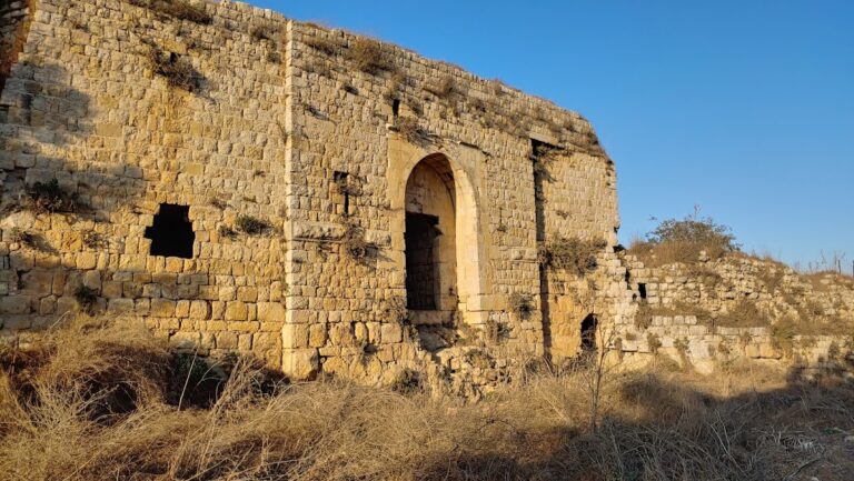
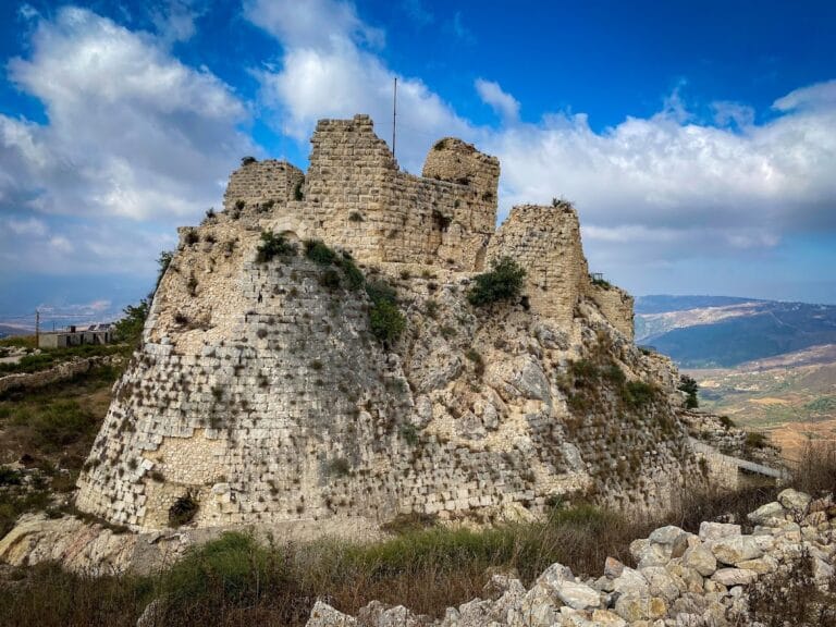
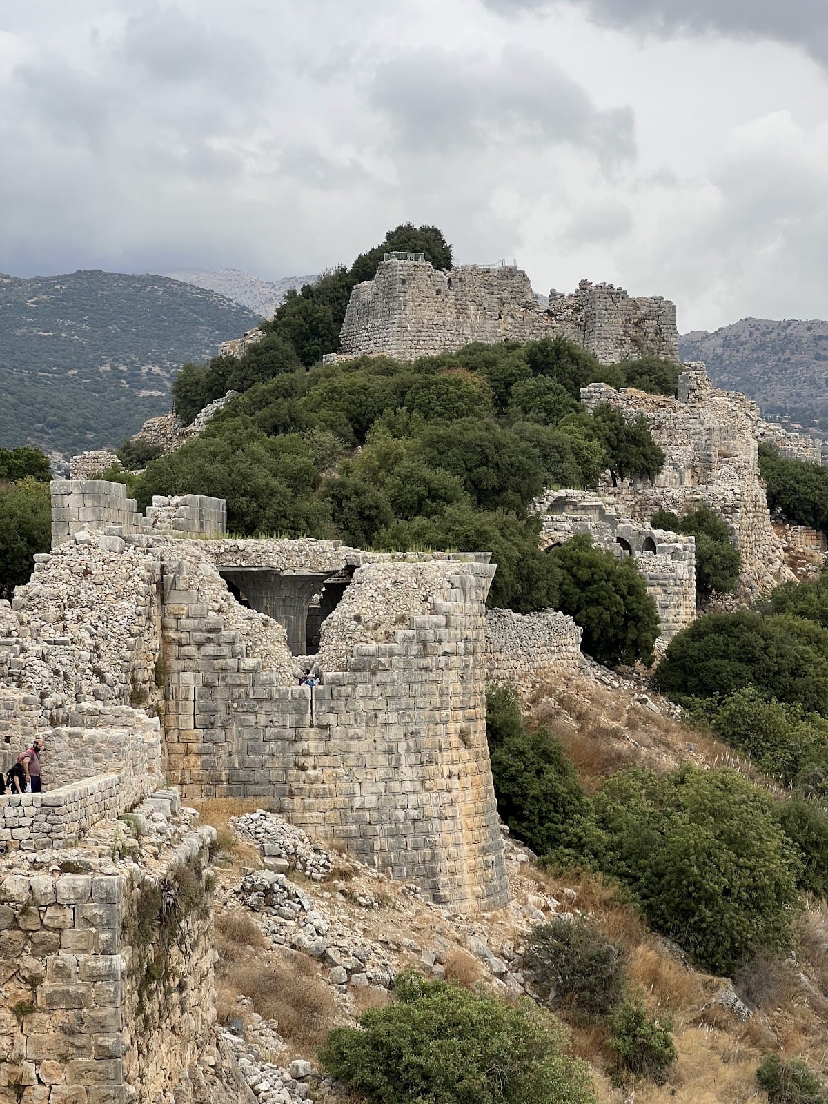
Nimrod Fortress follows the elongated, narrow shape of the ridge. It extends approximately 420 metres from end to end, varies from about 60 to 150 metres in width, and covers roughly 33 dunams, a traditional unit of land area. Large, carefully squared stones form the principal masonry. Stone walls enclose the complex and incorporate rectangular and semicircular towers, many covered by pointed or cross-shaped arches. The fortress is divided into an upper section, centered on the keep, and a lower western section containing administrative and service buildings, water-storage facilities, and stables.
Outer walls and entrances
The defensive arrangement responds closely to the ridge. The northern wall has a single tower above a very steep cliff, while the more accessible southern wall originally carried ten projecting towers. Four large towers protected the western side near a natural area where an attacking force could assemble. Entrances to the lower section opened through the southern and western walls. The upper section was reached through a small fortified tower in the southern wall, which now survives only in ruins.
Southern entrance tower
The large southern entrance tower was restored during Baibars’s reign around 1275 and was badly damaged by the earthquake of 1759. Much of one wall, a staircase, and three defensive levels remain. The upper level contains a low vaulted hall with projecting angular ribs and openings into two rooms bearing Arabic inscriptions associated with Baibars’s palace.
Southeastern wall and towers
Six rectangular and rounded towers form part of the southeastern curtain wall. The octagonal Beautiful Tower projects from the eastern wall, has a domed roof, and contains six loopholes, narrow openings through which defenders could fire weapons. Another rounded tower retains a vaulted defensive level and two loopholes, while a further tower survives only in its foundations.
Cistern and fountain
A deep cistern beside the southern tower measures approximately 9 by 25 metres and contains a staircase descending into it. On its eastern side, a drinking fountain was built in 1240 by Al-Said Hasan, son of Al-Aziz Uthman. The feature reflects the infrastructure required to sustain the fortress during occupation and defense.
The eastern keep
The eastern keep, or inner fortress, formed a stronghold within the larger complex and offered a final refuge if the outer defenses were breached. It stood above the rest of the site, commanding its walls and gates, and measured approximately 65 by 45 metres. Four internal towers, one at each corner, protected it. The approach formerly crossed a wooden bridge dating to the period of Al-Aziz Uthman, but the bridge is now ruined and its stones are scattered.
Three massive gates at the keep’s northwestern corner provided entry. Inside are luxurious halls, numerous rooms, water pools, and vaulted underground passages. These remains suggest that the keep may have served as the governor’s permanent residence. Its southern side was protected by a moat and two large towers, while a separate rectangular structure at the center created a final fortified enclosure. The strongest tower contained a defensive level within an octagonal hall, and several underground passages extended beneath the inner fortress, with some leading toward the final tower.
Water installations and western section
East of the inner fortress is a rectangular water pool measuring approximately 54 by 26 metres. Local inhabitants used it to water livestock and support irrigation. The western entrance leads into the first section of the fortress, where winding enclosed corridors, staircases, and underground cisterns survive. Some of the cistern plaster remains visible, and a path within the fortress connects the lower section with the keep.
Northwestern rooms and prison tower
At the far northwestern end, a long room is completely ruined. Its remains include a hall, a concealed exit, and an underground passage leading toward the valley. Cut into the ground, the passage descends by steps, runs north at first, then turns sharply east. It is built of finely dressed and polished stone blocks. Its possible use as an escape route remains an interpretation.
The northern tower contains arrow-slits, a staircase leading to the roof, and a large interior hall. Its association with a fifteenth-century prison connects the surviving structure with the fortress’s later Mamluk use as a palace-prison.
Inscriptions and stone emblems
A 1275 inscription found among the ruins of the gate tower records the restoration of the tower under Sultan Baibars. It names Bilik and other officials and builders involved in the work, and remains at the fortress. In 1998, a large stone bearing Baibars’s emblem was found at the site. It shows a young lion playing with a mouse beneath its paw. A second lion relief discovered about fifteen years later is approximately 25 percent larger but lacks the lion’s head. The first was located inside an inner tower, while the second was set high on the eastern outer wall, where it could be seen from farther away. Their alignment has led to the possibility that additional matching relief stones remain concealed within the site.