Caesarea Philippi: A Hellenistic and Roman Sacred City in Israel

Site at a Glance
- Rating
- 4.6
- Popularity
- Very Low
- Country
- Israel
- Primary era
- Classical
- Eras represented
- Classical, Medieval, Early Modern
- Civilizations
- Ayyubid, Byzantine, Crusader, Kingdom of Jerusalem, Mamluk, Ottoman, Ptolemaic, Roman, Seleucid
- Site type
- City
On this page18 sections
History
Caesarea Philippi is an ancient city in Israel that developed around a major spring at the foot of Mount Hermon. The site became a Hellenistic and Roman religious center, an administrative capital under the Herodian dynasty, and later a contested frontier settlement. Its perennial water, fertile surroundings, and position between the Hula Valley, the Golan, Mount Hermon, the Mediterranean coast, and Damascus gave it both sacred and strategic importance.
Hellenistic foundations and the cult of Pan
Before the Hellenistic period, the spring was associated with the Semitic deities Baal-Gad or Baal-Hermon. The site entered written history around 200 to 198 BCE in connection with the Battle of Panium, when Antiochus III defeated a Ptolemaic army. The victory consolidated Seleucid control over the region, which became known as the Panion.
The Ptolemaic kings, who ruled Egypt after the conquests of Alexander the Great, established a cult center at the spring in the third century BCE. After the Seleucid victory, the new rulers established a temple dedicated to Pan. Pan was a Greek god associated with wild landscapes, shepherding, music, hunting, and sudden fear, a connection reflected in the modern word “panic.” The names Paneas and, later, Banias developed from this religious association.
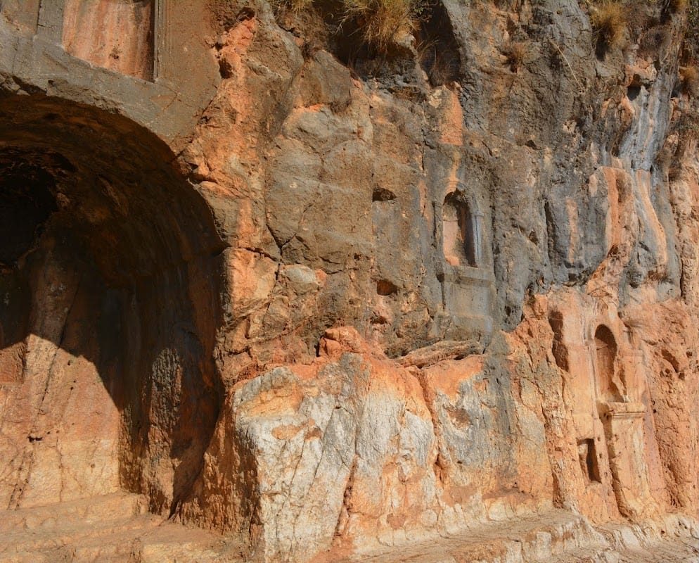
The earliest sanctuary was an open-air sacred precinct beside the spring. During the second and third centuries CE, additional temples and open areas for worship were built east of the cave on the terrace above the city. The water-filled cave formed part of the ritual complex, while statue niches and inscriptions helped define the sanctuary’s religious character.
Herodian and Roman development
Around 19 to 20 BCE, Augustus assigned the territory around Paneas to Herod the Great, the Roman client king of Judaea from 37 to 4 BCE. Herod built a monumental white-marble temple dedicated to Augustus at nearby Omrit. In 3 BCE, Herod’s son Philip the Tetrarch made Paneas his administrative capital and developed it as a city. It became known as Caesarea, or Caesarea Philippi, to distinguish it from Caesarea Maritima and other cities named Caesarea.
After Philip died in 34 CE, his territory was briefly incorporated into the Roman province of Syria. The city retained autonomy over its revenues before passing first to Herod Agrippa I and then to Herod Agrippa II. Agrippa II expanded Caesarea Philippi, erected monumental buildings and a large palace, and in 61 CE attempted to rename it Neronias Irenopolis in honor of Emperor Nero. That name was abandoned in 68 CE.
The city also acquired an important place in Christian tradition. The Gospels of Matthew and Mark identify Caesarea Philippi as the place where Peter confessed Jesus as the Messiah. The site consequently became a Christian pilgrimage destination. Eusebius later preserved a tradition connecting Paneas with the woman healed after touching Jesus’ garment. According to that tradition, she erected a bronze statue at her house, although identifying a later basilica with the church that preserved fragments of the statue remains interpretive.
In 67 CE, during the First Jewish-Roman War, Vespasian briefly visited Caesarea Philippi before advancing toward Tiberias. After the destruction of the Second Temple, Titus stayed at Paneas and staged spectacles in which Jewish captives were forced to fight one another or wild animals. After Agrippa II’s death around 92 CE, the city returned to the province of Syria and later became part of Phoenicia.
Late Roman and Byzantine change
From the second through the fifth centuries CE, Caesarea Philippi covered approximately 730 dunams and included a civic center, a sacred precinct, residential quarters, and extensive burial areas. In the fourth century, as Christianity spread through the region, Paneas became the seat of a bishop in Phoenicia.
In 361, Emperor Julian temporarily restored pagan symbols and Hellenistic religious practices in the city, replacing Christian symbols. This restoration did not last. A large Byzantine basilica later stood in the civic center over the remains of a Roman columned building, while another assembly building with a small church or chapel was constructed over the Roman complex at the cave entrance.
The city declined from the middle of the fifth century. Parts of its residential quarters were abandoned, and the eastern aqueduct fell out of use. The precise causes remain uncertain, although excessive taxation and the fiscal reforms of Diocletian have been proposed as important factors.
Islamic rule and the Crusader frontier
Arab forces conquered the region in the seventh century. In 635, Paneas obtained favorable surrender terms from the army of Khalid ibn al-Walid. A Byzantine army used the city as a staging post in 636 before the Battle of Yarmouk. After the conquest, the disappearance of traditional markets caused rapid depopulation, although Paneas remained the principal city of the al-Jawlan district in the military province of Damascus because of its frontier position.
During the early Islamic period, settlement contracted toward the spring and the northwestern part of the city. In the tenth century, Paneas was described as an important agricultural supplier for Damascus. Jewish, Christian, and Muslim communities continued there at least into the late Umayyad period. A Jewish community included two groups, each with its own court. One excavated building has been identified as an eleventh-century synagogue that was later converted into a mosque.
In the late ninth and tenth centuries, the city was known by Arabic names including Madinat al-Askat and remained associated with the al-Jawlan district. Byzantine advances brought an influx of Muslim refugees. The Qarmatians took the city in 968, the Fatimids briefly recovered it in 970, and the Qarmatians then regained control. Fatimid rule was restored in 975, while a Sunni Sufi community and a school of hadith continued in Banias.
Banias became contested because it controlled the road toward Damascus. The Assassins held it from 1126 to 1129. After their expulsion from Damascus, the town was transferred to the Franks and was held by Crusader forces from approximately 1129 to 1132 and again from 1140 to 1164. The Crusaders called it Belinas or Caesarea Philippi.
Shams al-Mulk Isma’il recaptured Banias in 1132. In 1137 it came under Imad al-Din Zengi, and in 1140 Mu’in ad-Din Unur transferred it to the Crusaders during the reign of King Fulk in return for their assistance against Zengi. Banias became the principal center of Humphrey II of Toron’s fief, although the Knights Hospitaller later relinquished the holding after an ambush.
Nur al-Din began a siege on 18 May 1157 using siege engines. Baldwin III of Jerusalem temporarily relieved the siege but was later ambushed at Jacob’s Ford. Nur al-Din finally captured Banias in 1164, after which the Crusaders never ruled it again. The loss removed a major frontier position and exposed the approaches to the Crusader kingdom.
After Nur al-Din’s death in 1174, Amalric I and, in 1177, Baldwin IV unsuccessfully besieged Banias. In 1179 Saladin placed its forces under his personal control. In 1187, Saladin’s son al-Afdal sent 7,000 horsemen from Banias to participate in the battles of Cresson and Hattin. Banias remained a frontier center between Muslim and Crusader territories.
Ayyubid, Mamluk, and Ottoman periods
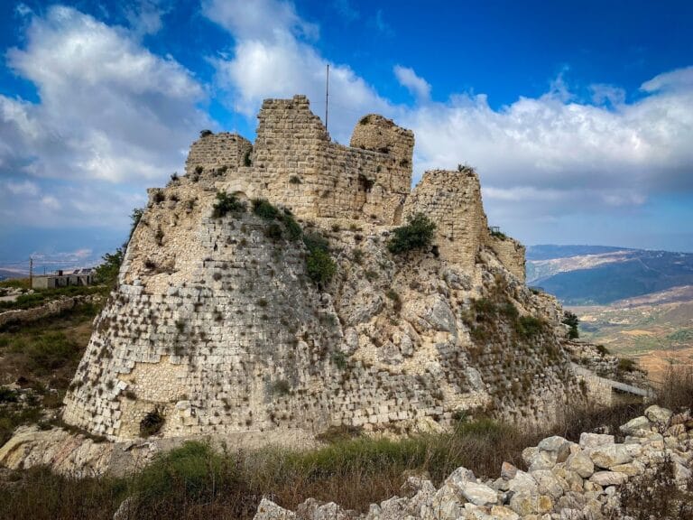
In 1200, Sultan al-Adil I assigned Fakhr al-Din Jaharkas to seize Qal’at al-Subeibeh, the hilltop fortress above Banias. Jaharkas received the associated land-revenue assignment in 1202. A major earthquake that year partially destroyed the city, and Jaharkas rebuilt a fortress tower. In March 1219, as part of a policy of dismantling fortifications to prevent a Crusader recovery, Banias was surrendered and its fortress was destroyed.
Banias later became a hereditary possession of members of the ruling dynasty. Al-Sa’id Hasan transferred it to al-Salih Ayyub in 1247. Crusader forces briefly captured the town in 1252 but were expelled by the garrison of Subeiba. Mongol forces took Banias in 1260, but the Mamluks soon returned.
Under the Mamluks, Banias became the administrative center of a subdistrict subordinate to Damascus and controlled the northern Golan and parts of Mount Hermon. Sultan Baybars repaired the town in 1265 and stationed a military unit there. The settlement expanded beyond the fortress during the thirteenth and fourteenth centuries.
Under Ottoman rule, Banias became a small village and a customs point on the road to Damascus. J. S. Buckingham described about 500 inhabitants in 1825, while descriptions from the 1870s record a stone village of approximately 350 Muslims surrounded by fruit gardens.
Modern boundary, conflict, and preservation
The 1923 Anglo-French boundary placed the village and spring in the French Mandate for Syria, while the Banias stream remained under the British Mandate for Palestine. The boundary ran about 750 metres south of the spring. After the 1948 war, the spring remained in Syrian territory and the river flowed through the demilitarized zone into Israel.
Syria and Israel disputed the status and use of the Banias waters during the 1950s. In 1964, Syria began a project to divert the river eastward toward the Yarmouk. Israel opposed the plan, and military exchanges followed, including Israeli tank and artillery action in 1965 and later airstrikes. The proposed diversion would have carried the Banias flow and water from the Hasbani through a 73-kilometre canal at approximately 350 metres above sea level.
Syrian forces used the village as an observation post before the Six-Day War. The Golani Brigade captured Banias on 10 June 1967. After the local population fled to Majdal Shams, Israeli bulldozers destroyed the village, leaving the mosque, church, and various shrines.
In 1977, the Israel Nature and Parks Authority declared the area the Hermon Stream, or Banias, Nature Reserve. The reserve incorporates the springs, waterfall, and archaeological site, protecting both the natural water system and the ancient remains. Excavations have taken place in several areas, including work by Zvi Maoz, Vassilios Tzaferis, and Ehud Netzer. In 2020, an altar bearing a Greek inscription was found reused in the walls of a seventh-century church. In 2022, excavations recovered a hoard of 44 pure-gold coins from the early seventh century, including coins of the Byzantine emperors Phocas and Heraclius and examples dating to the Arab conquest of the Levant.
Remains
Spring, waterfall, and sacred terrace
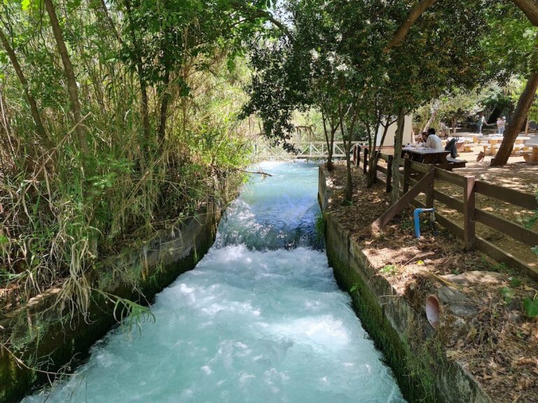
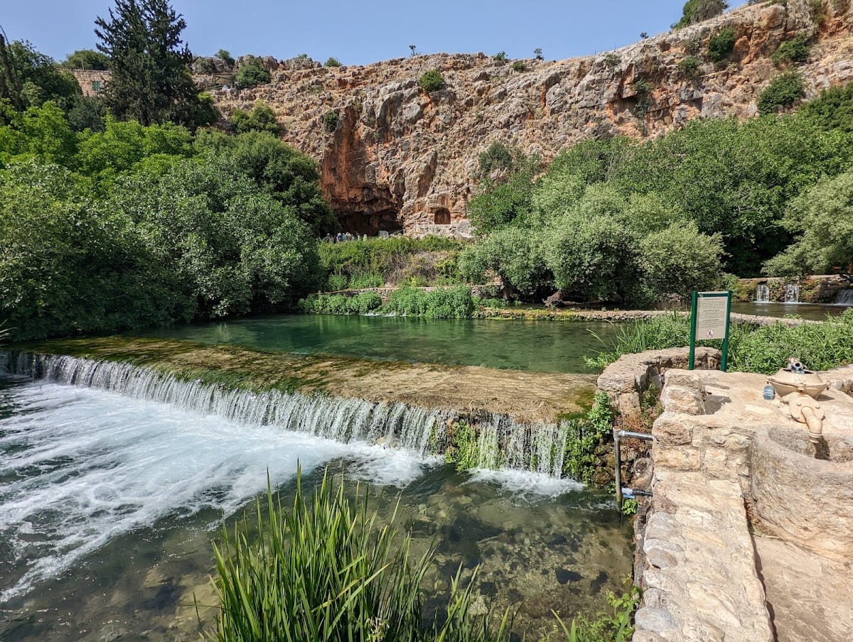
The natural setting centers on a spring that originally emerged from a large limestone cave cut into a sheer cliff. An earthquake shifted the spring to the foot of the natural terrace. Water now emerges quietly from the bedrock with a greatly reduced flow and forms Nahal Hermon, one of the principal tributaries of the Jordan River. The Banias waterfall is less than 10 metres high and divides into two streams around a tree growing at its summit.
The sanctuary of Pan
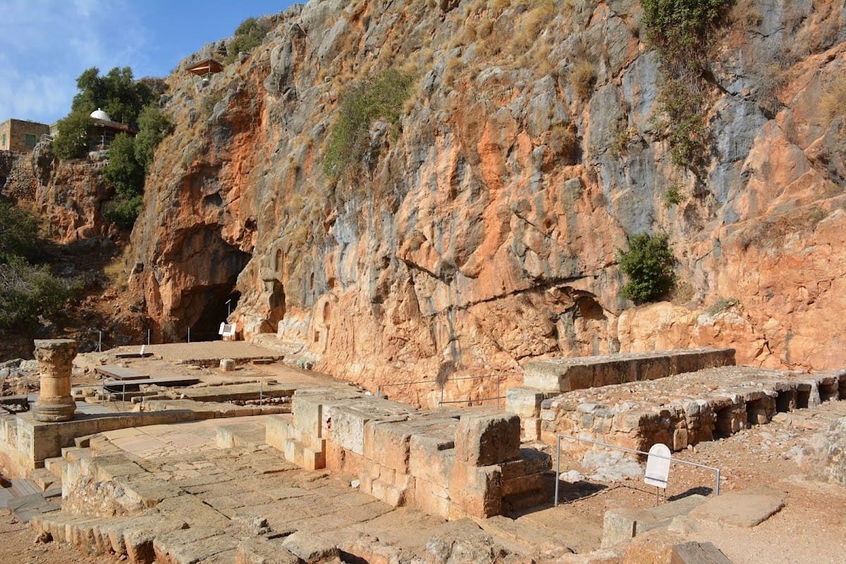
The sacred precinct, or temenos, was a religious area set apart from ordinary use. It occupied an elevated natural terrace about 80 metres long along the cliff above the northern part of the city. Its final arrangement included a temple at the cave entrance, open courts for rituals, and niches for statues. The cave and its water formed part of the ritual complex.
Inscriptions and cult installations
A four-line inscription at the base of one statue niche refers to Pan and Echo and dates to 87 BCE. Other inscriptions in the niches record substantial donations, while coins depict statues of Pan, Echo, and Hermes that once stood there. During the Roman period, the cave entrance contained an open reception and dining structure, probably a dining hall combined with a water shrine, attributed to the period of Agrippa II. A temple and further cult installations were later built along the terrace.
Roman city and Herodian architecture
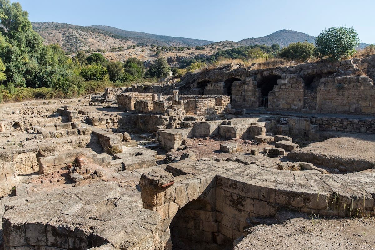
The ancient urban area included a north-south colonnaded main street, known as a cardo, a large and richly built columned structure near the spring, and a large palace. The palace may have belonged to Agrippa II and was later converted into a bathhouse after his death. South of the spring and sacred precinct lay the civic center, while residential quarters extended east, south, and west of it. Numerous built or rock-cut tombs occupied areas west and south of the city. An aqueduct brought water from springs east of Banias to the higher neighborhoods.
The palace platform
A building proposed as Herod the Great’s palace stands on a rectangular platform approximately 100 yards west of the sacred cave. Its southern retaining walls were constructed in Roman concrete using opus reticulatum, a technique in which small masonry units form a net-like surface. Excavations in the palace area recovered about 170 geometrically cut tiles and fragments from an opus sectile floor, made from triangular, square, and octagonal pieces arranged in patterns.
The reconstructed decorative floors have parallels in Herodian palace architecture at Jericho. Arched stairways cut into the mountain and the building’s ground plan also resemble projects attributed to Herod the Great. These similarities support, but do not conclusively prove, the identification of the building as Herod’s palace.
Roman and Byzantine civic buildings
A large Byzantine basilica was built in the civic center over the Roman columned building. A second assembly building, with a small church or chapel attached, was constructed over the Roman complex at the cave entrance. The site also preserves churches, shrines, and other structures from the Roman, Byzantine, early Islamic, and Crusader periods.
Objects and later settlement
Inscribed altar and gold hoard
A Greek-inscribed altar reused in the walls of a seventh-century church records its dedication by Atheneon, son of Sosipatros of Antioch, to Pan Heliopolitanos. A separate hoard found in 2022 contained 44 gold coins approximately 1,400 years old. Some were minted under Phocas, most under Heraclius, and the latest belong to the period of the Arab conquest.
Islamic and medieval buildings
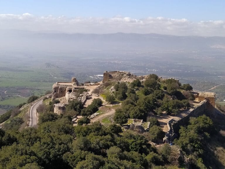
A building identified as an eleventh-century synagogue was later converted into a mosque. Medieval Banias included a fortress within or above the settlement and was overlooked by Qal’at al-Subeibeh, later known as Nimrod Fortress, on a high hill above the town. The fortress controlled approaches between the Golan, Mount Hermon, and Damascus.
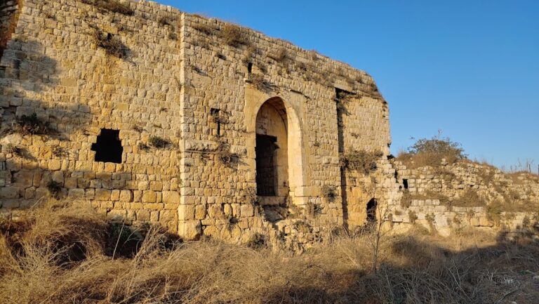
A rebuilt Banias fortress and a stone inscription dated to 1226 are associated with construction activity under al-‘Aziz Uthman. The most substantial visible fortress remains date from the thirteenth century. The medieval settlement lay chiefly north of the Sa’ar stream and west of the Hermon stream, using the two watercourses as natural defensive boundaries. During the Crusader period, archaeological evidence indicates a small fortified settlement concentrated in the former Roman civic area.
Ottoman waterworks
During the Ottoman period, water ran through small aqueducts into and beneath the village. The present reserve includes the spring area, archaeological remains, the waterfall, and a hanging trail, bringing together the surviving natural features and the long sequence of settlement around them.
Nearby sites