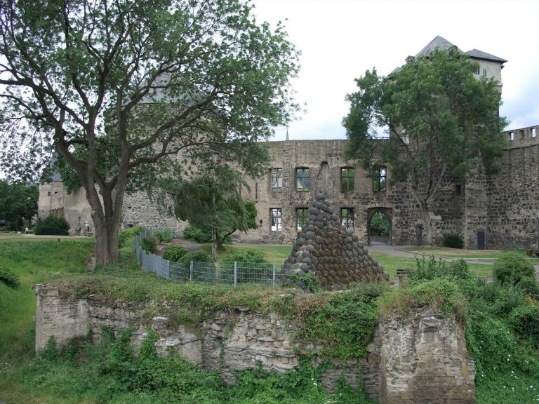
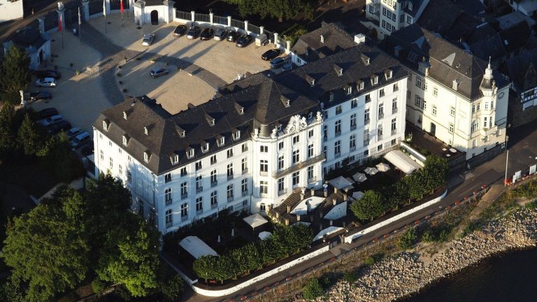
Castra of Niederbieber: A Roman Frontier Fort in Germany
Site at a Glance
- Popularity
- Medium
- Country
- Germany
- Primary era
- Classical
- Eras represented
- Classical
- Civilizations
- Roman
- Site type
- Military
- Remains
- Fort
On this page18 sections
History
The Castra of Niederbieber was a Roman frontier fort in Niederbieber, a district of Neuwied, Germany. Built in the late second century on the Upper Germanic Limes, part of Rome’s frontier system in Upper Germany and Raetia, it replaced the fort at Heddesdorf and became the largest and most strongly fortified auxiliary fort in the Limes’ northern sector.
Foundation and frontier service
The fort was established to strengthen the frontier amid pressure from Germanic groups. Its foundation is dated either to about 185 or to 193/194. An inscription honoring Septimius Severus, found in 1958 and published in 1997, supports the later date. The garrison remained at Niederbieber from about 185 or 190 until possibly 260.
The fort was designed for two unusually large numeri, Roman auxiliary units serving outside the legions, with an estimated combined strength of about 1,000 men. One was the Numerus Exploratorum Germanicianorum Divitiensium, a partly mounted scouting force associated with Divitia, at present-day Deutz. The other, the Numerus Brittonum, recruited its soldiers in Britain. Inscriptions name both units. They probably remained separate forces but may have shared a commander, likely the scouts’ prefect.
The garrison probably watched roads leading into the Neuwied Basin from the north and northwest, as well as routes through the Wied valley. Its duties may also have included supplying personnel to watchtowers and small forts along the northern frontier as far as Rheinbrohl, and sending scouts beyond the Roman line.
The fort’s end
Earlier explanations attributed the fort’s violent destruction to a Frankish or Alamannic attack. More recent interpretations connect its fall with the political and military upheaval around 260, when Postumus established the Gallic Empire, a rival Roman regime that lasted until 274. These interpretations place Niederbieber’s end at the collapse of the Upper Germanic-Raetian Limes around 259 or 260, or shortly before.
Three coin hoards found at the fort in 1900 and 1906 contained no coins later than the joint reign of Valerian and Gallienus, from 253 to 260. Their latest coins are consistent with a third-century end to occupation. Historian Lawrence Okamura proposed that the garrison had supported Saloninus, the son of Gallienus, who was based in Cologne, and that forces loyal to Postumus besieged the fort. The proposed siege and its outcome remain interpretations of the evidence.
Excavation and archaeological importance
Reports of ruins and inscribed stones around Niederbieber date to the seventeenth century. In 1759, Count Johann Friedrich Alexander began assembling antiquities at Neuwied Castle, while Pastor Breusing started excavating at the fort. A weighing scale and a copper bust of a deity were among the finds he reported, although some objects were lost before they reached the collection.
Princess Luise Wilhelmine zu Wied sponsored excavations from 1791 and took part in the work. Engineer-captain Christian Friedrich Hoffmann led the digging intermittently; after his death in 1820, archivist Hugo von Knopäus continued it until 1829. Antiquarian Wilhelm Dorow published further results and material from Hoffmann’s papers in 1826. By the mid-nineteenth century, stone-robbing had removed much of what remained visible above ground. The defensive wall, still visible in 1861, was later broken up for road construction.
Investigations resumed in 1894 under Constantin Koenen and, from 1897, Emil Ritterling. The Reich Limes Commission carried out further work in 1898, 1900, and from 1905 to 1912. In 1914, Franz Oelmann published the fort’s pottery, including a group associated with the third century and the Limes’ collapse. Several pottery forms take their name from Niederbieber; the term “Niederbieber horizon” refers to finds associated with the period of the fort’s occupation. A third-century helmet type also bears the site’s name.
Postwar housing and extensive pumice extraction in the civilian settlement prompted emergency excavations in 1963–1968 and 1973–1974, led locally by Hans Eiden. The work took place as development and the loss of archaeological deposits threatened the remains. In 1986, the bath and north gate were rescued. The Upper Germanic-Raetian Limes received UNESCO World Heritage status in 2005, which helped protect part of the south gate from development. The remaining archaeological areas, fort, and associated earthworks also have legal protection in Rhineland-Palatinate.
Remains
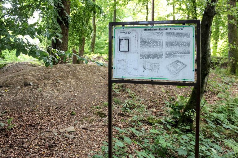
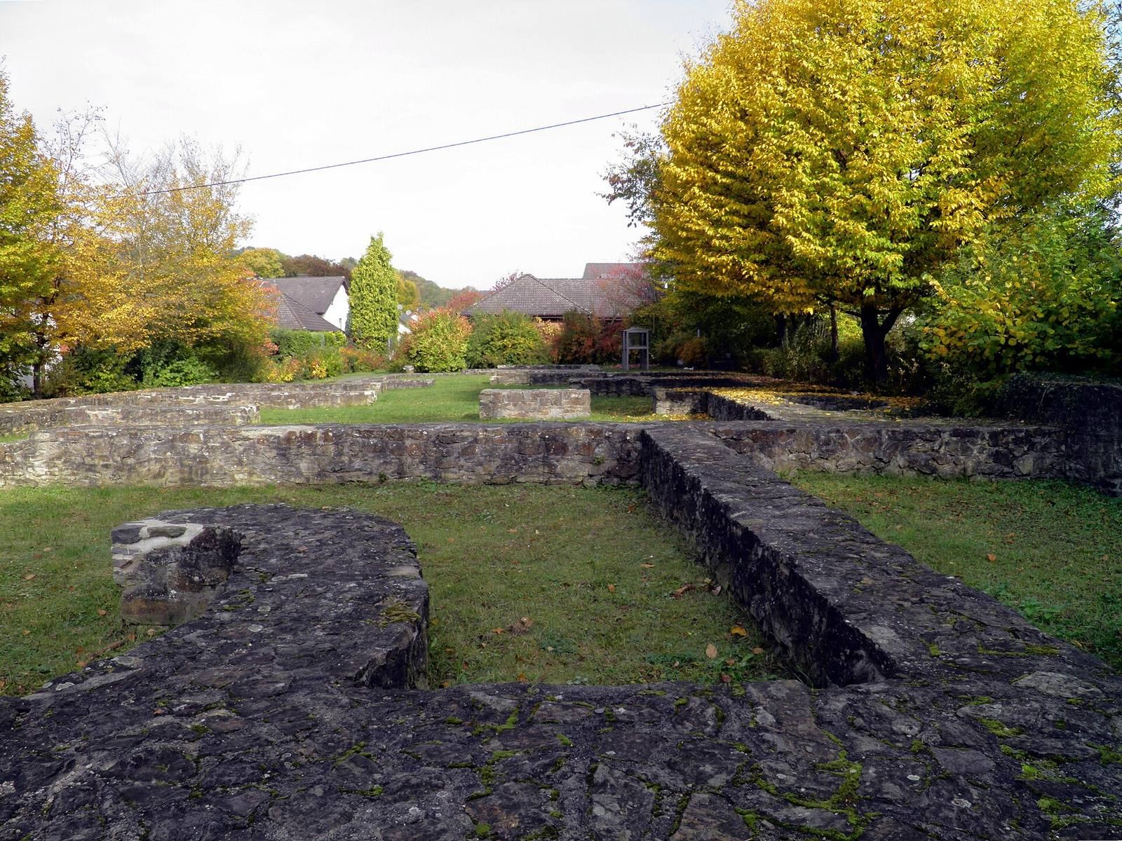
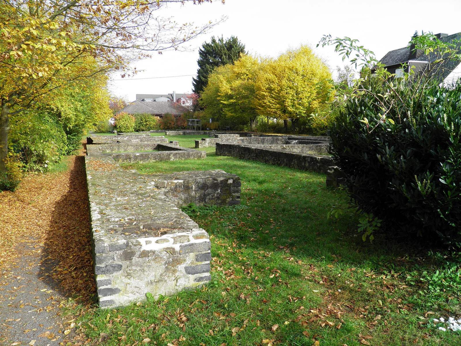
The fort occupied a low rise east of a bend in the Wied, where the river leaves the Westerwald and enters the Neuwied Basin. The Aubach borders the rise to the east and south, and the Limes passed about 150 metres northeast of the fort. Built of stone, the fort had a rectangular plan with rounded corners, measuring about 265.2 by 198.5 metres and covering 5.25 hectares. Its main front faced south, away from the nearby frontier. The site now lies largely beneath a post-1945 housing estate in Niederbieber; the foundations of the north gate and bath have been conserved and partly reconstructed within the modern neighborhood.
Defensive works
Walls and outer defenses
The curtain wall, the defensive wall linking the towers, measured about 1.50 to 1.60 metres thick above ground, with foundations up to 2.40 metres thick. Its plastered exterior was painted white with red lines to imitate dressed stone blocks. A rampart about three metres high stood behind the wall, strengthened at its base with palisades and dry-stone walls. A walkway ran behind the notched wall. Outside it lay a level strip between the fortification and ditch, about 5.50 to 6.50 metres wide, followed by a V-shaped ditch about 1.50 metres deep and six to 6.50 metres wide. Small ditches for pointed stakes and traces of felled branches formed further obstacles beyond the main ditch. These defenses occupied an open strip about 100 to 150 metres wide between the fort and the civilian settlement.
Towers and gates
Large towers projected from the corners, and at least ten substantial intermediate towers, each about 3.25 metres wide, stood along the walls. Their placement allowed defenders to cover the ground outside the fort and fire along its perimeter. Their size may also have allowed light arrow-launching weapons to be used from the platforms.
Four gates pierced the defenses, each flanked by projecting towers. The south-facing main gate was 20.70 metres wide. The east and west gates had similar designs, and all three were double gates with two passages, each three metres wide. The rear gate on the north side measured 14.80 metres across and had one three-metre passage. When excavated in 1801, the north gate still stood about 0.60 metres high. A worked tuff block at its base carried the incised number XXV on its reverse, possibly a record of a stonemason’s daily output. Early investigators mistakenly identified this rear gate as the main gate.
Interior and military buildings
Roads and central forehall
Excluding the gates and defensive structures, the usable interior covered about 40,000 square metres. A road ran around the inside of the wall. Two main roads crossed at the center, dividing the fort into four parts, and a large forehall stood at their crossing in front of the headquarters. The north-south road to the main gate was the Via Praetoria; the road to the rear gate was the Via Decumana. Roads running east and west led to the side gates.
Headquarters and standards shrine
The headquarters building (principia), shared by the two units, measured about 53.30 by 52 metres and covered nearly 2,800 square metres, not counting its large rectangular forehall. Its rooms and service areas surrounded an open courtyard with columns. Numerous box fittings, locks, and weapons came from a room on the courtyard’s right. At the rear, nine rooms arranged in an east-west row included a central standards shrine with a semicircular recess and eight offices. Small traces of underfloor heating were found in some rooms.
The easternmost office served the Numerus Brittonum as a records room. Fittings and locks from document cupboards were recovered there, along with a stone fragment representing the room’s protective spirit, or Genius. Its inscription names Vibius Mercurialis, a records clerk in the Numerus Brittonum Antoninianorum, as the donor. The unit’s honorific title is associated with the reign of Caracalla.
A room immediately east of the standards shrine belonged to the association of standard-bearers and imperial-image bearers. A stone Genius statue found there in October 1815 stood on a base with a dedication dated to AD 239. The inscription names standard-bearer Attianus Coresi and image-bearer Fortionius Constitutus, who dedicated the statue, a shrine, and a marble tablet in honor of the imperial household and their group’s protective spirit.
Other objects from the rear rooms included a sandstone statuette and two offerings shaped as feet, one of iron and one of silver. A bronze Genius statuette found in 1791 had lost the cornucopia it once held. Its original location is uncertain: it was associated either with a nearby drain or with the bath’s main sewer, though an original position in the headquarters has also been considered likely. Its inscription records a dedication on September 23, AD 246, and a later repair, paid for by fourteen people after the object was damaged. The dedication refers to the imperial household and an association of standard-bearers, as well as a group whose function is uncertain. The association’s name remains disputed, including the suggestion that it was the ancient name of Niederbieber.
Fragments of painted plaster from the headquarters preserve colored lines and leaf forms against a white lime background. The building also contained evidence associated with the fort’s violent end. A combat casualty lay near the room linked to the standard-bearers. Pieces of a silver military standard identify the Cohors VII Raetorum equitata; a crushed gilded relief disc and an iron helmet edged with bronze were also found with the remains. The dead man may have been a standard-bearer who arrived with reinforcements from nearby Niederberg. The disc has been interpreted as a portrait of Saloninus, but that identification is uncertain.
Large quantities of animal bones around the headquarters may indicate that animals were brought inside before a siege. Okamura interpreted damage thought to represent an attempt to tunnel beneath a southern tower of the west gate as evidence of a Roman siege rather than a Germanic attack. In this reconstruction, Postumus’s forces entered the fort and killed its defenders. These readings of the remains are interpretive.
Granary and workshop
A granary (horreum) stood west of the headquarters, while a workshop (fabrica) lay to the east. Each had an interior floor area of just over 650 square metres. The granary’s raised wooden floor rested on posts, and openings in its outer walls allowed air to circulate around stored grain and pulses while making it harder for small rodents to reach the supplies. The workshop had a ground-level floor, and excavations found large quantities of charcoal and iron slag there. It may first have served as a granary before its conversion to workshop use.
Commander’s residence
The commander’s residence (praetorium) stood west of the granary. Its plastered walls included painted rooms, and its floors were finished with screed. Several rooms had heating beneath the floor and within the walls, including a spacious bath made up of several rooms. Nearby rubbish pits contained fine drinking vessels and large quantities of oyster shells.
Barracks and stables
Troops and the horses of partly mounted units occupied the front and rear portions of the fort. Eight soldiers shared a two-room living unit called a contubernium; eight to ten such units formed a long barrack built with simple timber framing. Centurions and decurions had larger quarters at the end of a barrack.
Two buildings were identified as horse stables. One may have accommodated about 80 horses and the other about 30 to 40. The proposed arrangement placed the horses in two facing rows along each building, perhaps secured to a simple beam.
Bath complex
The large bath stood in the rear part of the fort, immediately east of the road to the rear gate and north of the headquarters. It was a symmetrical double complex, divided along an east-west axis and also into an unheated southern part and heated bathing rooms to the north. From the southern entrance, bathers first reached an unheated exercise space. The bathing rooms were duplicated on either side of the central axis and comprised an undressing room, a cold room, a warm room, and a hot room. A semicircular bathing pool in part of the cold room and an apse, a rounded recess, are among its recorded features.
Seven furnaces on three sides heated the complex through systems beneath the floors. Its bricks bear stamps of Legio VIII Augusta, a Roman legion based at Argentoratum, the Roman name for Strasbourg. The bricks may have been supplied by the legion, or construction may have been carried out by one of its detachments. The bath was built with the fort under Commodus. Its water probably came from springs about 1.7 kilometres northeast, near a Limes watchtower and about 50 metres above the fort. Water entered through a small opening in the north wall, and traces of conduits were recorded in 1897. Three drains fed a main sewer that carried wastewater out through the rear gate.
Civilian settlement
Settlement layout and houses
The civilian settlement associated with the fort, called a vicus, began beyond the open defensive strip, extended north to the Limes, and reached as far as about 500 metres in other directions. A boundary ditch marked its northeastern and southeastern edges. Buildings stood in loose groups rather than along a regular street plan, an arrangement that may indicate an important role for gardening. Long, narrow houses predominated. They were probably built with timber frames and clay infill; some had cellars, and only a few had heating.
Pumice extraction, particularly from the 1950s to the 1970s, damaged many settlement remains. Excavations often encountered cellars, some lined with stone, while evidence of timber buildings is limited. The settlement’s surviving physical record therefore includes structures of different materials and degrees of preservation.
Finds from the settlement
A bronze portrait head of Gordian III came from the southeastern settlement. Koenen found it in 1894 within a small metal or mixed hoard in the heating channels of a grain-drying installation. Other large bronze fragments from Niederbieber belong to an armored statue, although their exact findspots are unknown; they date broadly between 185 and 260. A dragon-head finial from a cavalry standard was also found in the settlement. The fort and vicus additionally yielded pottery associated with the Niederbieber group, as well as objects such as roof tiles, charcoal, and ash.