Nuraghe Oes: A Nuragic Residential Complex in Sardinia
Site at a Glance
- Popularity
- Low
- Country
- Italy
- Primary era
- Iron Age
- Eras represented
- Iron Age
- Civilizations
- Unclassified
- Site type
- Military
- Remains
- Fort
On this page20 sections
History
Nuraghe Oes is a Nuragic residential complex in Giave, Sardinia, Italy. Nuraghi are prehistoric and early historic stone towers associated with Sardinia’s Nuragic civilization, generally dated to about 1600 to 400 BC. The central tower at Oes dates to the early centuries of the first millennium BC, while an addition attached to it was built before the sixth century BC.
Construction and development
Giovanni Lilliu distinguished the central tower from the later attached structure and also proposed that the tower itself may have been altered. The surviving complex includes the principal tower, an attached bastion, and additional structures, reflecting more than one phase of building.
Study and conservation
The site drew the attention of Petit-Radel in 1826. Alberto La Marmora made a drawing of it in 1840, and archaeologists Antonio Taramelli and Giovanni Lilliu studied the monument during the twentieth century. In the 1980s, a consolidation campaign helped secure the upper masonry of the main tower. A rough repair from that decade also reused two or three stones from the lower sides of a former window in the tower’s southern wall.
Remains
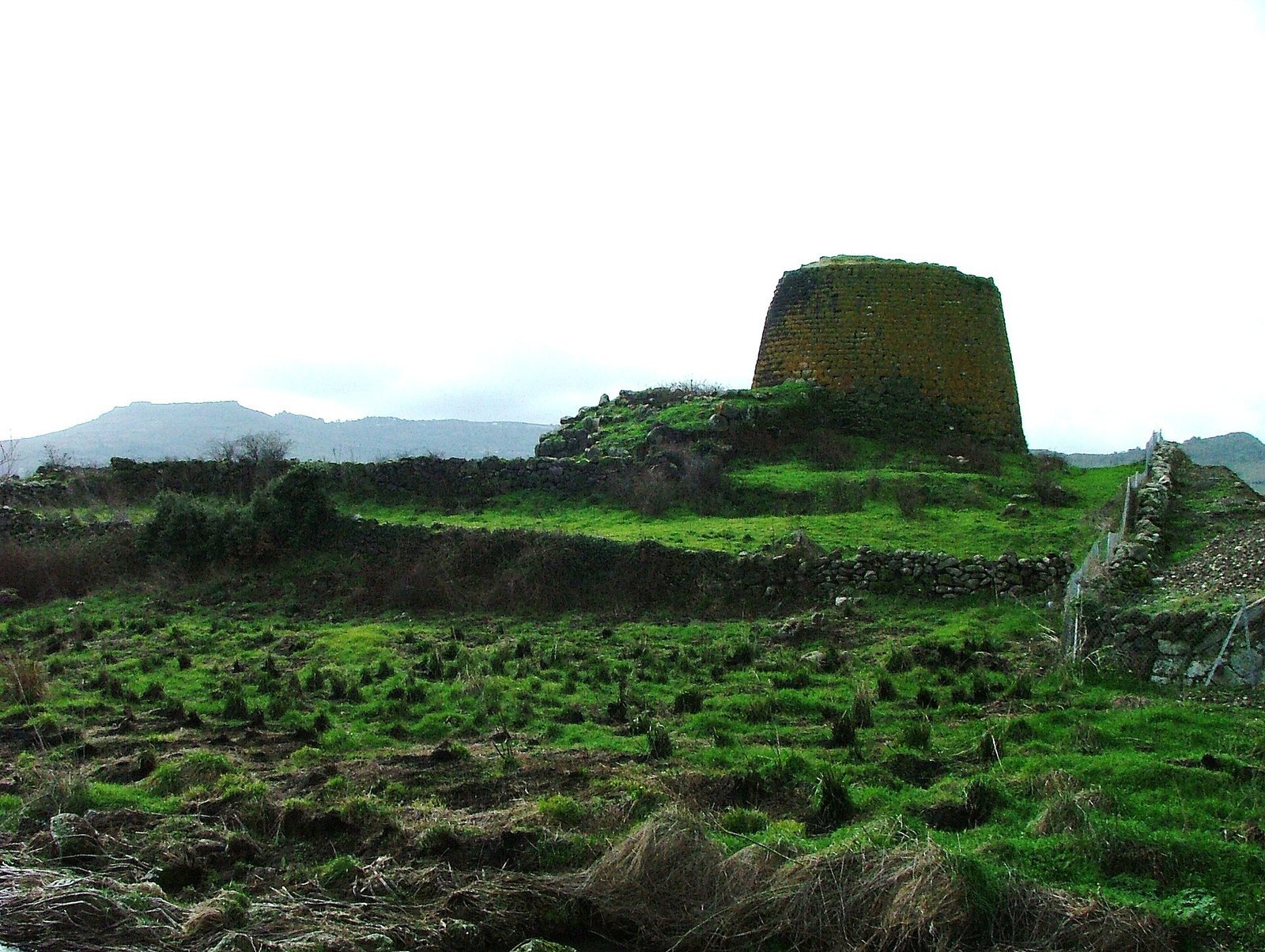
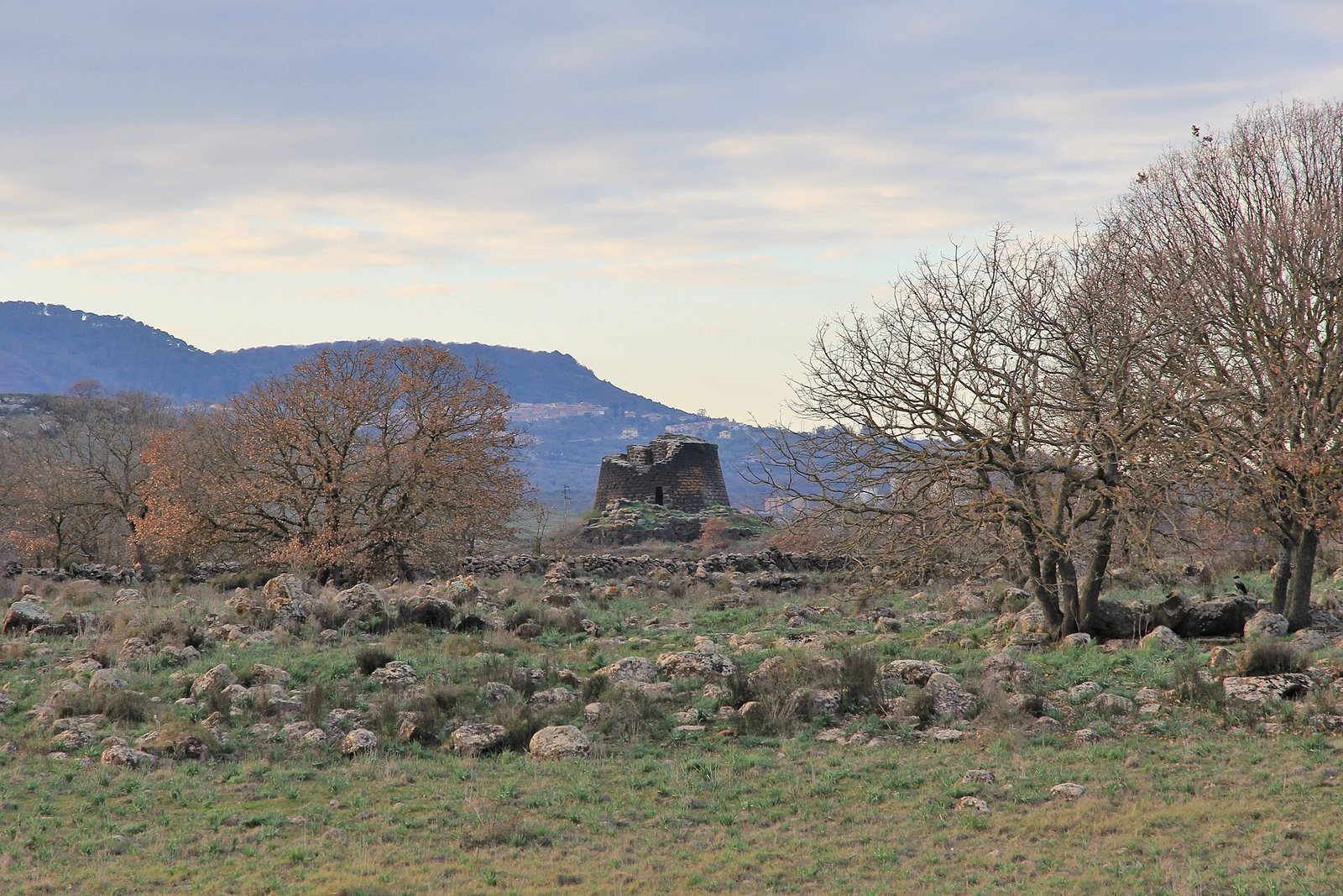
The complex stands on the Cabu Abbas plain, also called the Valley of the Nuraghi, about 800 metres from Nuraghe Santu Antine. Its central tower and attached bastion form the principal group, measuring about 25 by 27.5 metres overall and covering approximately 425 square metres. Other remains extend around the complex, including defensive walls, towers, huts, and a sacred precinct to the east.
Main tower and attached bastion
Central tower
The central tower has a base perimeter of 34.6 metres and a diameter of 16.15 metres along its southwest-to-northeast axis. Its diameter near the top is about 13 metres, and its walls taper at an approximately uniform angle of nine degrees. The base diameter is the largest recorded among Sardinian nuraghi. Surviving exterior masonry reaches 11.4 metres on the northeast side; the maximum height measured from ground level is about 13 metres on the southeast.
The tower’s lower courses consist of large, roughly shaped blocks of porous basalt laid in a near-polygonal pattern. Seven or eight courses of smaller stones above them become progressively more regular, with smaller packing stones between blocks. Higher up, the masonry is more carefully finished and laid in almost level courses, an arrangement known as isodomic masonry.
The interior is divided into several levels. The partly buried first-floor chamber is elliptical, measuring 4.30 by 3.75 metres, and survives to a height of up to 2.65 metres. The second-floor room is also elliptical, measuring 5 by 4.5 metres at the base of its ledge. Its surviving walls range from 2.72 metres high in the southwest to 4 metres in the southeast. A shallow recess in the masonry may have supported an additional floor. Perimeter ledges and holes for beams suggest that timber floors may have separated the levels. The uppermost room was probably covered by a tholos, a beehive-shaped roof made of stones layered inward. Lilliu considered whether later alterations replaced rooms with such roofs with spaces beneath horizontal timber ceilings. Rubble fills the ground-floor room, while the upper two chambers are open to the sky following the collapse of their floors and roof.
A spiral staircase runs within the tower walls and survives in three turns. One section is about 23 metres long, rises 3.8 metres, and has a 16.52 per cent gradient. A further section, about 21 metres long and rising 2.8 metres, continues toward the top. This upper stretch is open to the sky and ends at a passage below. The original stairway may have reached a terrace about 18 to 20 metres above ground. Regular openings admitted light, and a small recessed space with a stone lintel is set into one wall.
The ground-level entrance faces southeast and is blocked by collapse. Access is now through a trapezoidal opening on the first floor, 0.65 to 0.83 metres wide and 2.02 metres high, topped by a large lintel, the horizontal stone spanning an opening. A passage behind it extends about 5 metres and connects with the staircase and upper chamber. The chamber entrance is another trapezoidal opening, about 1.3 metres high, with a small lintel and a gap above it intended to reduce pressure on the lintel. A larger opening once lit the second-floor landing; its position can still be discerned.
The upper walls show structural distress. The northern face leans unusually at a height of about 6 to 7 metres. This may be related to pressure from an estimated 150 to 180 cubic metres of rubble inside the tower.
Attached bastion and courtyard
The bastion joins the main tower along its northeast-to-southwest axis and has a continuous concave-convex outline. It surrounds a courtyard and several secondary towers. The structure measures about 52 metres around its base, 25 metres across, and up to 12.7 metres deep. Its surviving height varies from about 1.2 metres on the east to 6.07 metres at the top of the southwest tower. The basalt blocks are generally less finely finished than those of the central tower, although the courses around the northern entrance are more regular.
The main entrance through the bastion’s southeast face is trapezoidal, about 1.15 to 0.90 metres wide and 1.55 metres high above the present fill. A large stone spans the opening. Its passage is 3.6 metres long, 1.15 to 1.90 metres wide, and about 1.5 metres high above the fill, with a roof formed by three large slabs. A doorway in the passage’s left wall leads to a niche about 3.6 metres long, aligned northeast to southwest. At its far end, a narrow raised tunnel leads to a small crosswise space. Rubble blocks the northwest end, which may once have connected with a passage serving the lower chamber of the southwest tower.
Debris now fills the courtyard, which is thought to have been roughly trapezoidal and about 24 square metres in area. It provided access to the central tower and the ground-floor rooms of the secondary towers. A masonry stairway in the north wall may have led to the bastion terrace, where doorways opened into raised chambers. A separate north-facing entrance now opens into the courtyard. It is about 0.9 to 0.84 metres wide and 0.95 metres high above the fill, with a 2.2-metre lintel. Its passage extends 6.5 metres, is about 1.5 metres wide, and stands 0.8 metres above the fill; a recessed guard space in its right wall is almost entirely buried.
The bastion and its entrances are unstable. The right side of the main passage has subsided and damaged its roof slabs. Cracks affect the northern entrance lintel and passage roofs, as well as the covering slabs of a niche in the southern tower.
Eastern tower
A passage from the courtyard leads to the lower chamber of the eastern tower. It is about 3.3 metres long and 0.8 metres high above the fill. The circular room, nearly filled with rubble, has a diameter of 4.7 metres and surviving walls 1 to 2 metres high. It contains at least two recessed spaces, one to the northwest and one to the southwest, both largely filled with stone and soil.
The upper room survives as a curved stretch of inner wall about 4.4 metres long and 1.5 metres high above a ledge. It was reached from the bastion terrace through a north-facing doorway, of which part of the left side remains. La Marmora described the tower as about 8 metres high in 1840 and gave its internal diameter as approximately 4.5 metres.
Southeastern tower
A small tower on the bastion’s southeast side was visible to La Marmora. Its circular chamber measured about 3 metres across. The remains include part of a curved wall, four stones along the southwest side, and blocks that partly outline the entrance and north wall.
Outer defenses and nearby structures
Outer wall and terraces
Sections of an outer defensive wall run from north-northeast to south-southwest, forming a raised embankment inside the enclosure. The northern stretch was badly damaged during construction of the railway. Along the slope parallel to the Riu Mannu, a northeastern section extends about 60 metres and stands 1.5 to 3.5 metres high. A southwestern section is about 35 metres long, 0.5 to 2.2 metres high, and roughly 2 metres wide; it may have contained an entrance. The southeastern stretch is about 45 metres long and up to 1.5 metres high, partly obscured by later dry-stone walls.
A second wall, probably built later with reused stones, runs about 18 metres north to south and reaches outer structures around the southwest hut. Farther southeast, walls of large blocks bound two artificial terraces. The arrangement may indicate that the complex once had more than one defensive circuit.
Outlying eastern defensive tower
About 50 metres east of the main monument, a defensive tower stands at the edge of a rocky slope cut by the Riu Mannu. It rests on a natural basalt platform and has a slightly elliptical plan, measuring 7.4 metres east to west and 7.7 metres north to south. Its base circumference is about 24 metres. The surviving height ranges from 0.9 metres on the south to 2.6 metres on the northeast, where a supporting wall braces the masonry. A southern entrance and short passage lead into an overgrown, rubble-filled chamber measuring about 4.2 by 4.7 metres, with a maximum surviving height of 1 metre.
Western tower and nearby hut
About 12 metres west of the main complex lies a much more deeply buried tower, represented at the surface by a few blocks from its inner and outer walls. Nearby, a circular hut survives as part of its western arc, spanning a chord of 5.74 metres. Its walls are about 1.3 metres thick and stand up to 0.45 metres high.
Huts near the central complex
A polygonal hut is partly incorporated between the central tower and bastion. Its double-faced walls, built of medium and small stones, are about 1.3 metres wide and survive to heights of 0.3 to 0.9 metres. The southern entrance measures about 0.9 metres in both width and height.
Southern and eastern traces
Further remains extend southward and onto the hills to the east. They include the outline of a possible cistern cut into bedrock, two circular huts about 6 and 4 metres in diameter, and straight and curved wall traces. The huts survive to heights of about 1.2 metres and 1 to 1.3 metres. Numerous quern fragments are scattered across the wider area; querns are hand-operated stones used to grind grain.
Sacred and funerary remains
Sacred precinct and temple
East of the nuraghe, a roughly hexagonal enclosure measures 47 by 36 metres. Inside it stands the foundation plan of a rectangular megaron, a temple with an elongated rectangular form, measuring 12.3 by 6.5 metres. The surviving foundation courses consist of large, unworked basalt blocks set upright, generally forming walls with two faces.
Standing stones
About twenty upright stones between the sacred precinct and the nuraghe form a roughly elliptical arrangement measuring about 15.5 by 12 metres. A large, leaning, irregularly pentagonal slab at the west may be a standing monument; it has a circular recess near its top. To the east, a pointed stone about 1.1 metres high resembles a small betyl, a standing stone associated with religious veneration. Its eastern face is carefully worked, while the rougher western face has a circular recess near the base.
Funerary blocks and reused slab
About 60 metres east of the main monument, among hut remains, lie blocks from a Giants’ tomb, a Sardinian funerary monument, built with regularly coursed masonry. The stones include a single arch-shaped block measuring 0.9 by 0.6 by 0.6 metres, a rectangular upright monument now lying on the ground, about 0.9 by 1 metre and 0.2 metres thick, and carefully shaped blocks with truncated-pyramid forms. The rectangular stone has a carved, crescent-shaped border. About 15 metres north, a slab reused to support a low bank bears a broken ring motif cut into its surface. The motif is about 15 centimetres wide and has an inner diameter of 0.65 metres; the slab may have belonged to an ancient milling press.
Building southeast of the precinct
About 75 metres from the southeast boundary of the enclosure, a badly damaged building has a roughly rectangular plan measuring 12 by 6 metres, aligned southeast to northwest. Its double-faced basalt walls are about 1.3 metres thick and survive to a maximum height of 1.3 metres. A worked block on the south side has a bowl-shaped circular hollow. The southeast-facing entrance is about 0.8 metres wide and 1.25 metres deep. An angular approach wall, about 7 metres long, consists of a single course of five large stones. The building’s function is uncertain, though it may have served as another temple.