Castra of Traismauer: A Roman Auxiliary Cavalry Fort
Site at a Glance
- Popularity
- Medium
- Country
- Austria
- Primary era
- Classical
- Eras represented
- Classical, Medieval, Early Modern
- Civilizations
- Duchy of Austria, Habsburg, Holy Roman Empire, Roman
- Site type
- Military
- Remains
- Fort
On this page22 sections
History
The Castra of Traismauer was a Roman auxiliary cavalry fort beneath the medieval and later center of the Austrian town. It formed part of the Danube frontier defenses of Noricum, a Roman province in central Europe, and was probably occupied by Roman troops from the first through the fifth century. Its position at a junction of river and valley routes connected it with neighboring forts and routes carrying iron and salt toward the Danube.
Foundation and frontier role
The fort’s foundation date is uncertain. It may have been established under Emperor Claudius, who ruled from AD 41 to 54, or during the Flavian dynasty of AD 69 to 96. An interpretation of coins raises the possibility that the fort was already in existence during the Year of the Four Emperors, the succession crisis of AD 69. The earliest garrison is also uncertain. The legion Legio XIIII Gemina may have built the first fort for a partly mounted cohort, a Roman military unit combining infantry and cavalry.
The site’s ancient name was probably Augustianis, likely taken from the Ala I Augusta Thracum, an auxiliary cavalry unit associated with the fort by inscriptions and stamped bricks. The name Trigisamum, once applied to the fort, probably referred instead to a crossing of the Traisen River. Among possible garrison units in different periods were Legio XIIII Gemina, the cavalry units Ala I Hispanorum Auriana and Ala I Augusta Thracum, and the Equites Dalmatae. These identifications do not establish that every unit served there. After Diocletian’s administrative division of Noricum, Augustianis belonged to Noricum ripense, the Danube-side part of the province. The late Roman register known as the Notitia Dignitatum is the fort’s only other mention in ancient written records.
Stone rebuilding and late Roman defenses
The first timber-and-earth fort was destroyed by fire toward the end of the first century. Stone rebuilding was complete by about AD 140–144, probably through the efforts of the Ala I Augusta Thracum. An altar dedicated by the unit to Emperor Antoninus Pius dates to around this time. Later, a layer of burning between the archaeological levels of the first and second stone forts may relate to destruction during the Marcomannic Wars, conflicts between Rome and Germanic peoples in the second century, but this connection is uncertain.
During late antiquity the fort expanded westward and its defenses were repeatedly altered to meet changing military needs. By the fourth century, these changes had reshaped the site’s defensive arrangements. A smaller fortified position, or surviving part of the fort, may have housed a reduced garrison in its final phase. The fort burned almost completely in the late fourth or early fifth century, but occupation in the area continued. Evidence associated with the headquarters building and southern cemetery indicates activity into the late fifth century. A modest settlement may have occupied the ruins, perhaps including Germanic groups serving under treaty arrangements with Rome. One hypothesis places Augustianis among Romanized settlements tributary to the Rugians, a Germanic people active in late antiquity.
Settlement and medieval reuse
The area was resettled in the eighth century, and a settlement called Treisma is known by about AD 799. Around 1247, an archiepiscopal castle was built at the Roman enclosure’s northwest corner, where river erosion had affected the ground. A late Roman defensive building there may first have been incorporated into an early medieval fortification, perhaps from the Carolingian period, before being largely dismantled for the castle. Roman remains were reused in later town defenses, and much of the surviving town wall dates to the seventeenth century, during the Ottoman wars. The medieval town eventually spread beyond the Roman fort’s boundary.
Rediscovery and protection
The fort was identified as Trigisamum until 1949, although Augustianis had been proposed earlier. The altar inscription of the Ala I Augusta Thracum was known to the humanist Johannes Aventinus in the sixteenth century. A veteran’s gravestone was found in 1828, and old masonry was reported on Venusberg by 1830. Railway construction in 1884–1885 uncovered foundations, graves, and grave goods. Excavations and chance discoveries during the twentieth century greatly expanded knowledge of the fort, its civilian settlement, and its cemeteries. Since 2021, the surviving Roman ground remains have formed part of the UNESCO World Heritage property of the Danube Limes. Austrian law also protects the archaeological remains.
Remains
The Roman fort lies beneath Traismauer’s medieval and later town center. Its irregular rectangular plan had clipped corners and followed the ancient Danube bank to the north and the former course of the Traisen to the west. The early stone fort covered about 3.75 hectares; its late Roman expansion reached about 4.1 hectares, while an earlier estimate put the area at approximately 4.7 hectares. The fort stood on slightly raised ground on the Danube and Traisen terrace, but flooding repeatedly deposited silt in its V-shaped ditches, and rising groundwater affected construction from the second century onward. A change in the Traisen’s course probably destroyed the northwest corner.
Early fortifications and Roman walls
The medieval street pattern preserves parts of the Roman layout. Today’s Wiener Straße follows much of the via principalis, the fort’s main cross-street, while a footbridge in Kirchengasse lies over the line of the via decumana, the road leading toward the rear gate. The main road continued west across the Traisen floodplain. A stone pillar, probably a Roman milestone, was mentioned in a ninth-century document and removed during gravel extraction in the 1940s.
Timber-and-earth fort
Remains of an early fort, probably built in two phases, have been found at several locations, although its full extent is uncertain. Excavations revealed barracks blocks, wooden buildings, and a timber-framed building with several rooms that may have served as the headquarters. In Florianigasse, a V-shaped ditch lay about 35 metres from the north wall. Its base was about 0.8 metres below the groundwater level and 1.7 metres below the base of the outer ditch of the first stone fort.
An excavation in 1991 exposed part of the eastern rampart: a clay bank about four metres wide, braced against slipping by a horizontal timber frame. An eight-metre-wide gravel road ran behind it, although its relationship to the northern ditch, about 180 metres away, is unclear. A barracks building with a portico had been destroyed by fire.
Stone Fort I
The first stone fort stood within the line of the medieval town walls. Its north wall may have reached west as far as the front of the castle, while the exact course of its western boundary and northwest corner is uncertain. The southern wall did not follow the surviving southern town wall: excavations found a mortar-built foundation more than a metre wide, with a square-plan tower attached inside. Here the Roman wall turned at a clipped corner and lay about five metres inside the medieval wall.
A section of the eastern stone wall cut into the earlier rampart. Stone slabs level with the wall’s foundation step suggest that the ground between the wall and ditch was paved. A rectangular intermediate tower was attached inside the southern wall.
Eastern gate
Excavated in 1978, the early stone fort’s eastern gate had rectangular towers on either side. They were set unevenly: the right tower was about 5.4 metres long, while the left stood about 5.5 metres farther north and had walls about 1.4 metres thick. A brick stamped by Legio XIIII Gemina had been built into a foundation. The gate was later dismantled down to its lowest stone courses. V-shaped ditches from earlier defenses were also found beneath the late Roman corner towers.
Gates and defensive towers
Wiener Tor
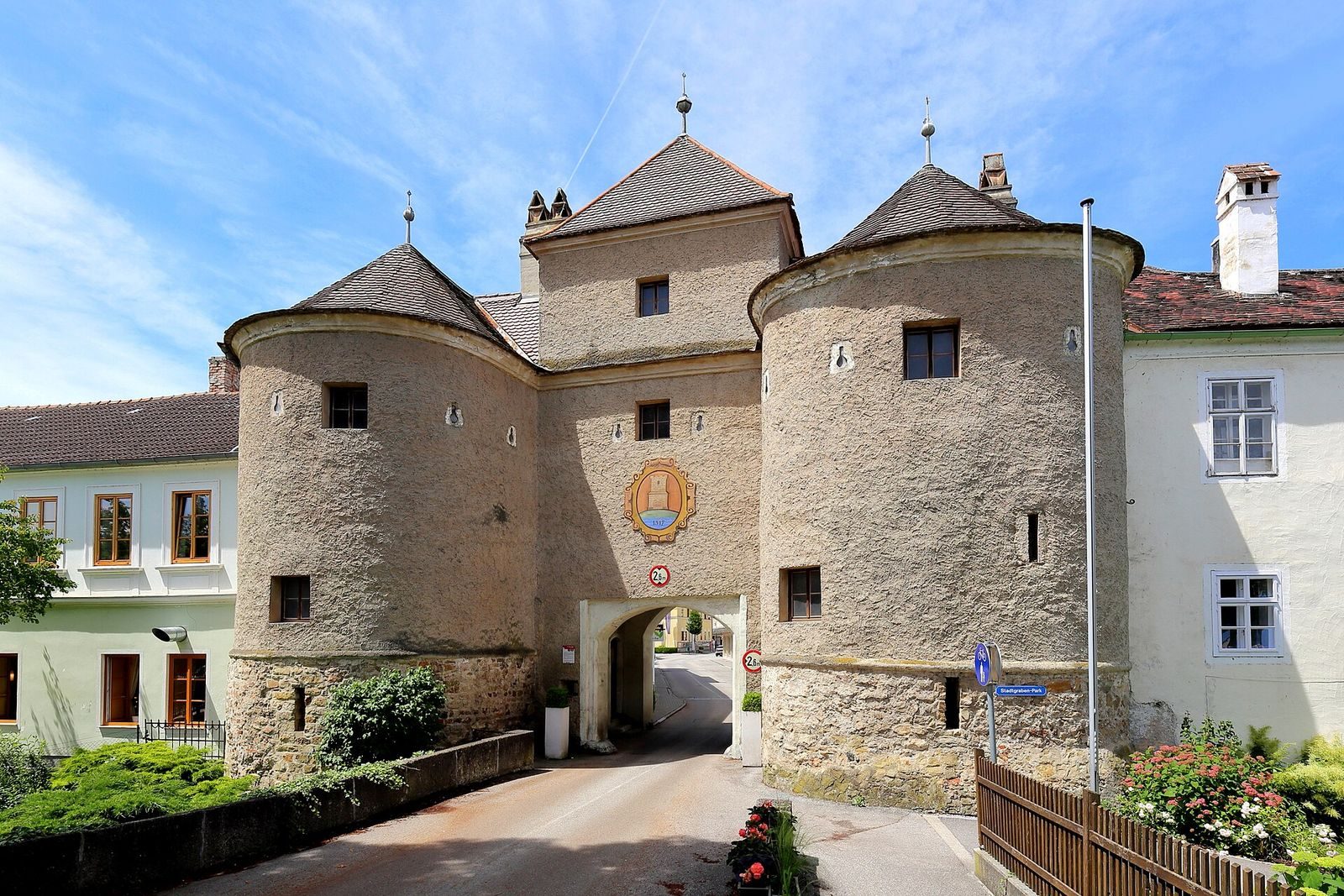
The present Wiener Tor, also called the Roman Gate, has a form dating to the sixteenth or seventeenth century. Its masonry incorporates the late Roman eastern gate, whose joint markings and scaffold holes survive as high as the second storey. Two horseshoe-shaped towers flank the gateway and stand slightly back from the fort wall. The ground floor has a rounded molding, and the central rectangular gate tower is medieval. The late Roman entrance stood somewhat farther east than its earlier predecessor. The gate underwent extensive renovation in 1976; work beside its northern tower in 1998–1999 examined the ground after a timber structure was removed, and the tower’s plaster was conserved in 2013.
Southern intermediate tower
A tower uncovered inside the southern fort wall at Kirchengasse 2 measured 2.3 by 3 metres. Its rubble-stone walls were 0.6 metres thick and stood on a rounded-stone foundation set 0.5 metres into the ground. Two layers of interior plaster and two floor surfaces lay over 0.4 metres of rubble. A clay layer about 0.2 metres thick above the floor may have been a late Roman leveling deposit. The tower may have belonged to the southern gate.
Late Roman fan towers
Fan-shaped towers, projecting defenses with a broad curved outer face, were added during the late Roman period. The fourth-century tower at the southwest corner survives in foundations at Venusbergstraße. Its masonry was traced to a depth of four metres. The north side measured 1.5 metres across, while another section was 1.8 metres wide. Scaffold holes occurred at irregular intervals about 1.9 metres above ground. The tower’s neck was 2.2 metres wide, and its interior measured about nine metres. It had a central hearth and a terrazzo floor, a composite flooring material. Carefully mortared rubble-stone foundations reached the bottom of the structure; the two earlier V-shaped ditches beneath it had filled with flood deposits. The southern corner could not be excavated.
The southwest tower may later have been used by civilians, as two loom weights were found there. A rubble layer points to rapid decay after the Roman garrison left, and flooding eventually brought down the southwest corner. Its remains were incorporated into St. Pölten Gate, also known as Wall Gate or New Gate, in the fourteenth or fifteenth century. At the southeast corner, part of another tower’s front survives beneath a later brick wall built hastily as protection against Ottoman incursions. A nineteenth-century painting shows a projecting semicircular structure there, while a 1668 votive image depicts an inward-opening Roman-style fan tower. A similar tower is suspected at the northeast corner.
Reck or Hunger Tower
The medieval tower known as the Reck or Hunger Tower incorporates a late Roman horseshoe tower built over a square intermediate tower belonging to the first stone fort. The horseshoe tower may date to the reign of Emperor Valentinian I, AD 364–375. Parallel timbers found about 2.3 metres below ground to its east have been interpreted as the base of an earlier earth rampart. Inscribed stones are set into the tower’s exterior wall.
Castle, headquarters, and forum
Castle and late Roman building
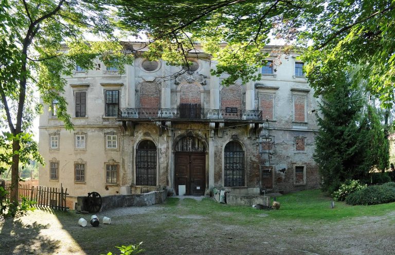
Roman masonry survives within the medieval castle, including part of an exterior wall reaching as high as the second storey. It may belong to a late Roman small fortification or remnant fort, probably dismantled for the castle’s construction. Some foundations reused gravestones from the middle-imperial period, including stones associated with the Ala I Augusta Thracum. The castle’s inner court contains a light-well roof supported on twelve pillars and a well shaft.
Headquarters and forum
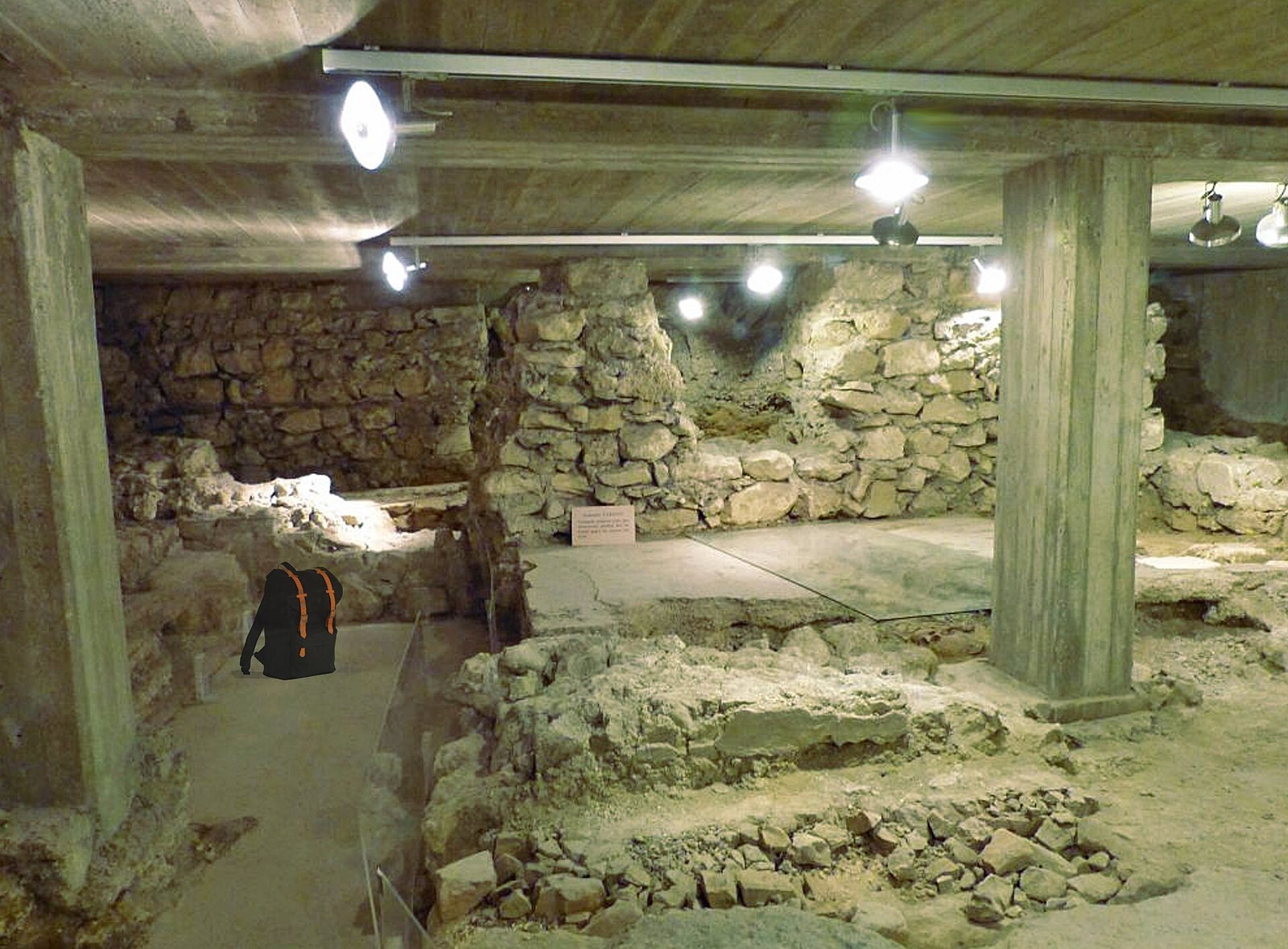
Excavations at the parish church of St. Rupert uncovered the fort’s principia, or headquarters building, and the adjoining forum. The headquarters contained a shrine for the unit’s military standards and administrative rooms. A pillared portico surrounded the forum on three sides. A fragment of a bronze statue wearing armor came from a burnt layer in this area, and remains of an equestrian statue from the forum were destroyed in the late Roman fire.
A cellar belonging to the Roman military treasury was converted into a burial chamber in the early Middle Ages. Roman and early medieval standing masonry survives in places to a height of three metres, and some rooms in the headquarters and burial structure have been conserved. The altar inscription associated with the Ala I Augusta Thracum is represented by a copy above the castle entrance; the original has been in the municipal archaeological collection since 2022. A veteran’s gravestone, found at Gemeinlebarn in 1828, is displayed in the castle lapidarium.
Civilian settlement and cemeteries
The civilian settlement, or vicus, began just east of the fort’s ditches and extended eastward and southward for nearly a kilometre. It developed alongside the military installation and included substantial stone buildings and a bathhouse.
Eastern settlement
The eastern part of the settlement extended about 500 metres along the road leading from the fort’s eastern gate, with buildings facing the road. Its earliest structures included compacted-clay floors and side walls made of woven branches covered with clay, sometimes built over gravel leveling. Later phases included stone buildings, late Roman alterations, and pottery kilns; some buildings passed through as many as four construction phases. Excavations near the Roman Gate also uncovered walls, terrazzo floors, and rubbish pits.
Southern settlement
The southern settlement lay mainly beside the road from the eastern gate and in fields south of the fort. The alignment of its buildings indicates planned development. A pottery kiln found in 1950 beneath a school’s south wing had a firing chamber that still contained pottery of the third century; the kiln’s dome was probably destroyed when the school was built in 1897. An approximately eight-metre-wide gravel road excavated in 1972 had settlement remains on both sides, including compacted-clay floors and wall fragments.
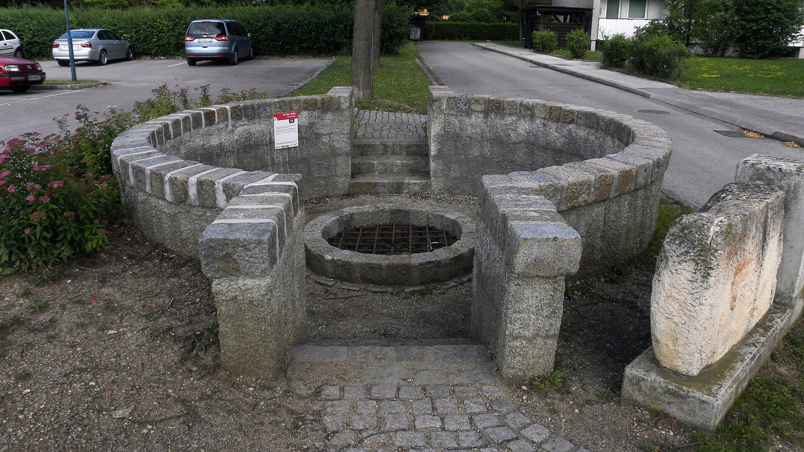
An excavation covering 890 square metres in 2002 identified several phases. The earliest postholes, foundation trenches, and cellar pits date to the second half of the first century. Middle-imperial stone buildings were aligned north to south, with smooth floor surfaces laid over loose gravel. Two wells were examined, one lined with wood and the other with stone; one was conserved in a park. Near the southeast corner tower, 678 kilograms of animal bones probably came largely from a slaughterhouse and offer evidence of the garrison’s diet.
Cemeteries and burial finds
Burial grounds of different periods lay south and east of the civilian settlement, especially southeast of the fort and on Venusberg. By 1995, excavations at Stollhofen, northeast of the town, had examined 382 late Roman burials. On Venusberg, excavations in 1964 uncovered 39 inhumations and one cremation burial; the cemetery extended southeast and northwest. Investigations around the lower Venus and Schuller hills also found graves.
Stone burial chambers had been found in a field known locally as the community field by 1925. Excavations in 1976 and 1980 uncovered foundations of grave buildings, pits, inhumations, some in stone chambers, and cremation burials. The 1980 work found 19 inhumations and three cremations. In 1959, construction work between the Werksbach and Werkstraße uncovered a gravestone and a block of conglomerate measuring 160 by 70 by 50 centimetres. A central recess, 40 by 22 by 20 centimetres, was closed by another stone; the block may have formed part of a tomb.