Habsburg Castle: Ancestral Seat of the Habsburg Dynasty in Switzerland



Site at a Glance
- Rating
- 4.5
- Popularity
- Medium
- Country
- Switzerland
- Primary era
- Medieval
- External website
- Open
- Eras represented
- Medieval, Early Modern, Modern
- Civilizations
- Habsburg, Holy Roman Empire
- Site type
- Military
- Remains
- Castle
On this page21 sections
History
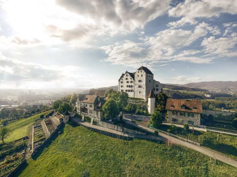
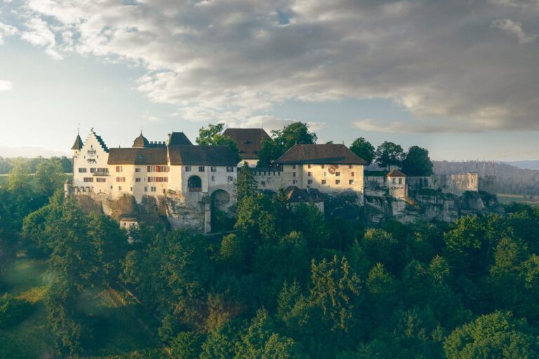
Habsburg Castle is a medieval hilltop fortress in Switzerland, built by the Habsburg family around 1020–1030 on the Wülpelsberg in the municipality of Habsburg. Known as the ancestral castle of the Habsburg dynasty, it marks the family’s early rise from regional aristocratic power in Aargau to a European ruling house later centered in Austria and Vienna.
Early occupation and the foundation of the castle
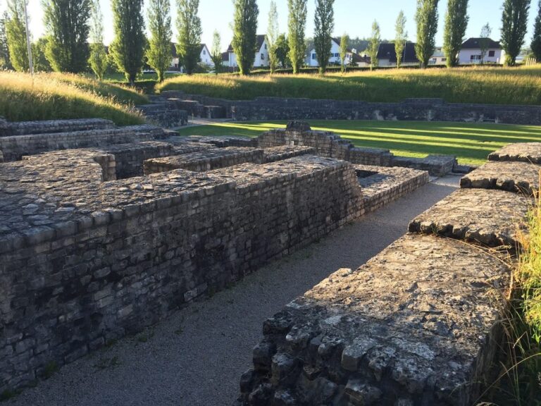
The summit had earlier uses. A small settlement occupied the site during the Hallstatt period, the Early Iron Age culture of central Europe. From the second half of the first century AD, Roman legionaries from Vindonissa, a military camp at present-day Windisch, maintained a signal station on the Wülpelsberg. The station connected the camp, about four kilometres to the northeast, with the Bözberg Pass and probably continued operating after Vindonissa was closed in AD 101. In the late third century, the hill was used as a refuge by civilians during intermittent Alamannic raids.
The castle’s foundation is linked to Radbot, the younger brother of Werner, Bishop of Strasbourg. A legend first recorded in the mid-nineteenth century tells that Radbot found a lost hawk on the wooded summit while hunting. Recognizing the hill’s strategic advantages, he supposedly chose it for a castle. A related story says that Werner criticized Radbot’s first, simple tower, prompting Radbot to assemble knights and retainers to demonstrate that the site could be defended. These stories explain the castle’s traditional association with the hawk, but they are not secure accounts of its construction.
The early history of the Habsburg dynasty itself remains uncertain. The Acta Murensia, compiled around 1160, names Guntram the Rich as the family’s ancestor. Guntram probably descended from a branch of the Alsatian Etichonid family and held scattered possessions in Aargau, Breisgau, Frickgau, Upper Alsace, and Zürichgau during the second half of the tenth century. His son Lanzelin, also called Kanzelin, established the small castle of Altenburg on the Aare, using existing Roman fortifications to administer the family’s possessions.
A testament that named Bishop Werner as the founder of Habsburg Castle was produced as a forgery around 1085. Radbot is now regarded as the person who commissioned the castle, approximately two kilometres south of Altenburg. The project may have followed a feud with his younger brother Rudolf over property at Muri and the destruction of a local manor. In 1027, Radbot and his wife Ita of Lorraine, the daughter of Duke Friedrich of Upper Lorraine, founded Muri Abbey, a Benedictine monastery in Aargau, probably as an act of penance.
The castle served territorial expansion and the assertion of lordship. An older interpretation that it was built as a military base during conflict with the Kingdom of Burgundy, to secure a frontier and transport routes, has been rejected. The modern derivation of the name connects it with the Old High German word habuh, meaning “hawk.” The historian Aegidius Tschudi instead associated it with Habesburg, a name linked to possessing, preserving, or securing property. The name appears in forms including Havichsberch in 1108, Havekhesperch in 1150, Habisburch in 1213, and Habsburc in 1238–1239. Otto II was the first family member documented as Count of Habsburg, in 1108.
Expansion of Habsburg power
By the late eleventh century, the Habsburgs had become landgraves in Upper Alsace and advocates of the Strasbourg bishopric. Their position grew after the Lenzburg family died out in 1173, allowing them to acquire county rights in western Zürichgau and Frickgau, followed around 1200 by rights in southern Aargau. Further territories came after the extinction of the Zähringer family in 1218. Political alliances, including one with the Staufers, a German ruling dynasty, supported this expansion.
The Habsburgs occupied the castle as their principal residence for roughly two centuries. Between 1220 and 1230, however, the increasingly powerful family left for Brugg because the castle had become too small and insufficiently representative. A residence later known as the Effingerhof became one of their important buildings there, although it was demolished in 1864 during the construction of a printing works.
Habsburg power shifted decisively eastward under Rudolf I. His election as German king in 1273 was followed by his acquisition of the Kyburg inheritance. In 1278, at the Battle of Marchfeld, he defeated the Bohemian king Ottokar II and conquered the duchies of Austria and Styria. Vienna then became the center of Habsburg power, while the family’s scattered possessions in Switzerland, Alsace, and southern Germany became known as the Habsburg Forelands, or Vorlande.
Fiefs, Bernese rule, and later administration
After the Habsburgs departed, the castle was granted as fiefs to ministerial families. A ministerial was a member of the medieval administrative and military service nobility who often held land or offices from a more powerful lord. The unoccupied Front Castle passed to the Lords of Wülpelsberg. The Rear Castle was held by the Schenken of Habsburg and the Truchsesses of Habsburg-Wildegg, families whose court offices included responsibilities at the castle and nearby fortresses. They had once formed a single lineage but had divided into two branches by the second quarter of the thirteenth century.
The Lords of Wülpelsberg died out around 1300, and their section passed to the knight Werner II of Wohlen. His son Cunrat III acquired part of the Rear Castle fief from the Truchsesses in 1364. In 1371, Cunrat’s son Henmann von Wohlen bought the remaining shares and united the entire fief.
During the conflict associated with the Council of Constance, King Sigismund called on the Swiss Confederates to conquer Habsburg territories. Bern rapidly occupied western Aargau, and Henmann von Wohlen surrendered Habsburg Castle without a fight in late April 1415. He recognized Bernese rule in return for a guarantee of his property. The Habsburgs thereby lost their ancestral castle permanently.
Henmann transferred his property to his nephew Petermann von Greifensee in 1420. Petermann sold the castle to the city of Bern in 1457. It then passed to Hans Arnold Segesser in 1462 and to Königsfelden Abbey in Windisch in 1469. When the abbey was dissolved during the Reformation in 1528, the castle returned to Bern. Bernese officials installed a high watchman and appointed an estate manager to oversee the surrounding fields, forests, and vineyards.
Forest south and east of the castle was cleared in the early fifteenth century, creating the hamlet of Habsburg. It initially contained only a few houses and did not develop into a village until the eighteenth century. Since 1804, the castle has belonged to the canton of Aargau, which continued to use it as an agricultural estate. It has been under cantonal monument protection since 1948 and is listed in the Swiss Inventory of Cultural Property as an item of national importance.
Archaeology and present interpretation
Archaeological investigations took place in four stages between 1978 and 1983, followed by further excavations in 1994–1995. The earlier work exposed and conserved concealed remains of the Front Castle. The later excavations accompanied plans for underground extensions connected with the restaurant. A comprehensive building survey in 1983 substantially revised the dating of the Rear Castle, especially the Small Tower, Great Tower, and Palas, the principal residential and representational building of a medieval castle.
Finds from the excavations include Roman building ceramics, roof-tile fragments stamped by Legio XXI Rapax, a Roman legion stationed at Vindonissa from AD 44 to 69, and a coin of Emperor Probus. Reused Roman stonework from Vindonissa was incorporated into the East Tower. Medieval material includes animal bones, bone- and antler-working waste, pottery, imported Pingsdorf ware, an aquamanile shaped as a bull, dress fittings, glass rings, a blue-glass board-game piece, iron tools, and coins, including a minting from the Fraumünster in Zurich.
Other excavated material includes Hallstatt-period pottery and animal bones, a possible Neolithic stone-axe blade, medieval pottery, a horseshoe, late fourteenth-century stove-tile fragments, part of an iron helmet, and a Salzburg silver coin. Material from the filled defensive ditch includes sixteenth- and seventeenth-century glazed pottery, grease lamps, stove tiles, glass vessels, agricultural tools, horseshoes, door fittings, and dress accessories. These objects were probably associated with prosperous farmers or small townspeople managing the estate.
About 120 kilograms of animal bone came from the excavations of 1978–1983 and 1994–1995, although only part of it underwent archaeozoological analysis, the study of animal remains to reconstruct past diet and economy. Domestic animals greatly outnumbered wild species, indicating that hunting had little economic importance. Pig bones dominated medieval layers, while cattle became more important in the early modern period. Chickens accounted for no more than one percent of the bone weight in any examined layer.
Since 1979, the Palas has housed a restaurant, with dining areas in the Knights’ Hall, Schlossstube, Gothic Hall, Tavern, Jägerstube, and courtyard. Exhibitions about the Habsburg dynasty, the castle’s building and settlement history, and medieval daily life are displayed in the Small and Great Towers. Since 2009, Habsburg Castle has belonged to the Museum Aargau network.
Remains
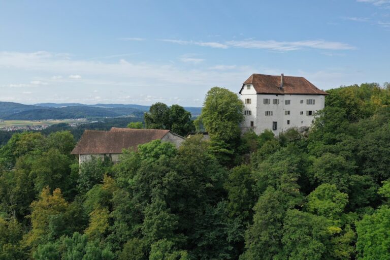
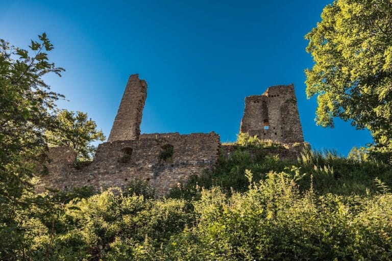
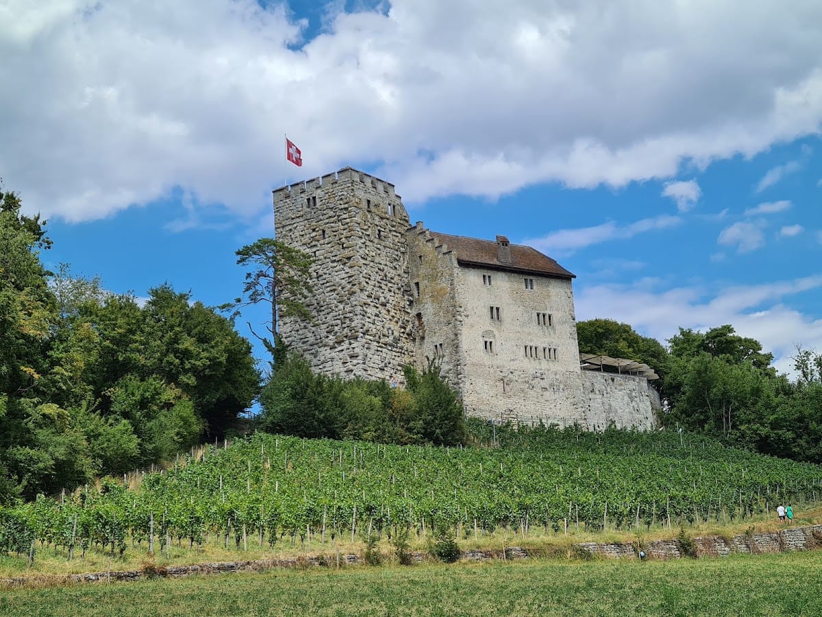
Habsburg Castle occupies the rocky summit ridge of the Wülpelsberg at 505 metres above sea level. The limestone ridge is covered by mixed woodland, falling steeply toward the Aare valley to the west and north, while the east and south lead onto a gently sloping plateau toward the Birrfeld. The complex extends for slightly more than 100 metres and is arranged from east to west as a Front Castle, a central courtyard, and a Rear Castle. Construction developed in several phases from about 1020–1030 to approximately 1300, producing a double castle whose eastern section later became ruinous while the western section largely survived.
Front Castle
Stone House
The earliest Front Castle was probably built mainly of timber. Its surviving Stone House dates from the second quarter to the middle of the eleventh century. Originally freestanding, it measured about 18.5 by 13.2 metres and had walls 1.9 metres thick. Its several stories served representational and defensive purposes. The surviving masonry reaches slightly less than two metres in height and consists of small dressed stones interrupted by breaches. A dry-stone wall or wooden palisade enclosed the house on three sides, while timber service and economic buildings probably occupied the courtyard.
An eastern doorway opened into a basement-like ground floor, and a northern entrance was inserted later. A transverse wall was added during the last third of the eleventh century and faced on both sides in the twelfth century, probably when the building was raised. Two wall stubs on the northern side have an uncertain function. A water reservoir built in 1908 now occupies the area west of the transverse wall.
East Tower and enclosing wall
An artificial motte, an earthen mound supporting a fortified building, descended eastward from the Stone House toward the neck ditch. The rectangular East Tower was built during the last third of the eleventh century. It measured approximately 9.5 by 9.2 metres and was set about 45 degrees askew from the Stone House, touching it at only one corner. A small walled enclosure on its northern side served as a latrine shaft.
The East Bering, or enclosing wall, was constructed at the same time as the tower. It began at the latrine shaft, followed the edge of the neck ditch, and ended on the south side at the gate enclosure. The artificially cut neck ditch remains visible as a pronounced cut through the ridge.
North Tower and northern defenses
The North Tower was attached to the northwest corner of the Stone House. Its ground plan measured about 8.5 by 8.2 metres, with walls 1.3 metres thick. Its position above the steep northern slope contributed to poor preservation and landslides in the rubble used to level the ground. A compacted-clay hearth at ground level indicates that the tower served as a kitchen. A small cellar, measuring 2.2 by 1.8 metres, occupied its northeast corner and could be entered only through an opening in the ceiling.
The North Bering was added in the twelfth century to close the gap between the North Tower and the East Bering. Its winding course probably resulted from the collapse and slightly displaced rebuilding of a weakly constructed section.
South Bering and gate enclosure
The South Bering stood about five metres in front of the southern sides of the Stone House and East Tower. It formed a gate enclosure 22.5 metres long, with outer walls 1.3 metres thick. The outer gate stood at the eastern end where the wall met the East Bering and East Tower. Beyond the enclosure, a second gate led into the courtyard. This began as a simple passage and was enlarged into a gatehouse around 1200, of which only the foundations survive.
Central courtyard
Courtyard layout and service buildings
The central courtyard formed a mostly level space between the Front and Rear Castles, averaging about 32 metres in length and 30 metres in width. Its perimeter included the defensive ditch, chapel, service house, well, and cistern. The service house probably measured approximately 10 by 7.5 metres and had a small latrine-shaft annex on its western wall.
The castle chapel was probably a two-story building east of the service house. It was demolished in 1680, and its form is partly reconstructed from older images, including a 1634 watercolor by Hans Ulrich Fisch. During the seventeenth and eighteenth centuries, a lime kiln and two pits for slaked lime occupied part of the courtyard. The lime-burning area used demolition material from the Front Castle.
Well and cistern
The well had an oval opening about 2.9 metres wide and 2.4 metres long. When it was rediscovered, it was completely filled with limestone and gypsum fragments, probably from a nineteenth-century gypsum pit at Habsburg or Windisch. Conservation drilling in 1995 established a depth of 68.5 metres.
The cistern was built at the beginning of the thirteenth century near the gatehouse, slightly outside the enclosing wall. Its draw shaft probably rose to the level of the wall walk.
Later courtyard ditch
After the Front Castle had fallen into disrepair, the Truchsesses of Habsburg-Wildegg excavated a section ditch through the courtyard during the fourteenth century to protect the eastern side of the Rear Castle. The ditch averaged 7.4 metres in width and 2.5–3.7 metres in depth. A causeway-like castle path crossed it from 1562, and the ditch was filled around 1650–1670. The remaining Front Castle ruins were demolished around 1680, and the area was leveled in 1815.
Rear Castle
Small Tower
The Small Tower formed part of the Rear Castle’s expansion during the last third of the eleventh century. It measures approximately 7.6 by 7 metres and belonged to an earlier rear complex that was replaced by the Great Tower and Palas in the early thirteenth century. The Small Tower was retained during that rebuilding.
At the end of the sixteenth century, the tower was reduced in height when the courtyard was converted into residential accommodation. Work in 1937–1938 and 1947–1949 added modern interior fittings, new intermediate floors, and new windows, removing further historic fabric. Two blocked window slits with inward- and outward-sloping reveals belong securely to the original building. A sandstone frame around the blocked high entrance probably dates from a thirteenth-century alteration, while the north facade retains the beginnings of a projecting latrine. Other narrow slits belong to a later medieval phase; the remaining openings date from the sixteenth to twentieth centuries.
Great Tower
The Great Tower was built at the beginning of the thirteenth century. It rises about 20.15 metres and has a diamond-shaped plan measuring approximately 10.2 by 10 metres. Its walls are 2.1 metres thick at the base and narrow to 1.8 metres at a height of 10.5 metres through an internal setback. The tower is built of roughly dressed stones laid in horizontal courses, a masonry method characteristic of local castles.
The original entrance stands 7.4 metres above the courtyard floor. A ground-level entrance was cut in 1898. All four present intermediate floors were installed after 1866 and no longer occupy their medieval levels. The lowest was inserted in 1995 below the old entrance and is accessible only from above; it protects the castle museum from weather and has no medieval predecessor.
The present second floor was originally the first floor and contained the tower entrance. It retains a chimney remnant in the northwest corner, probably little used because the 1995–1996 investigation found no soot traces. The present third floor was originally the second and has an eastern exit toward the courtyard gallery. Blocked beam sockets indicate that a two-story gallery probably surrounded the tower at this level before the Palas was built. The upper story was probably reached from the former third floor.
In the medieval period, the Great Tower was probably covered by a square pointed roof. Contemporary images provide the evidence for its medieval and early modern roofing because a new upper termination with a crenellated crown, a battlemented tower top, was built in 1866 and destroyed the surviving traces of the earlier roof supports.
Palas
The rectangular Palas projects southward and adjoins the Great Tower on its eastern side. Its walls date from the middle of the thirteenth century, making it younger than the tower. The building has three stories and a basement, and its west wall retains the remains of a projecting latrine.
Extensive remodeling in 1559 gave the Palas its basic present appearance. The eastern and southern elevations received two- and three-part Gothic window groups, while the building acquired a gabled roof with an eastern half-hipped end. The stair and gallery system was renewed in 1948. Two late Gothic decorated oak pillars with saddle timbers support the basement ceiling. The flat barrel ceiling over the ground-floor dining room, installed in 1948, copies the 1559 original.
The Schlossstube on the first floor largely preserves its 1559 form. Its flat barrel ceiling has beams decorated with star, spiral, and spiral-wheel motifs ending in heart-leaf shapes. Ribbed oak pillars support the corners, and the entrance portal has matching molded details. An eighteenth-century tiled stove from the Würenlos parish house stands in one corner. Its white tiles depict idyllic castle landscapes and floral decoration and are thought to have been made at Muri. An adjoining room contains a plain box stove installed in 1948. Its tiles show ruin landscapes in Rocaille frames, decorative eighteenth-century shell and scroll patterns. The stove is signed by Johann Jakob Fischer of Aarau and dated 1744.
Rear Castle courtyard and lost flank tower
The Rear Castle courtyard forms an irregular U-shaped space linking the Small Tower, Great Tower, and Palas. It was roofed over and converted into a residential wing in 1594. Storm damage led to the replacement of its shallow lean-to roof with a steeper roof in 1634. The residential structure was removed at the beginning of the nineteenth century after becoming unsafe, leaving the courtyard open again. Its eastern side is bounded by the courtyard wall, formerly supplemented by the section ditch.
A Flanking Tower once connected with the courtyard wall and protected the complex’s northwest side. It belonged to the early thirteenth-century building phase but has not survived. A branch of wall extending from it probably blocked the ridge toward the west.
Knights’ Hall
The Knights’ Hall occupies the second floor of the Palas. It was originally divided into several chambers and took its present form in 1913–1914. The room contains a prism-shaped stove with green-glazed relief tiles from the seventeenth century. The tiles are attributed to workshops at Steckborn, formerly in Ermatingen, although the attribution is not confirmed by signatures or written evidence. Their decoration includes female allegories of virtues beneath arches and between pilasters, with putti among lions’ heads and scrollwork in the base frieze.
The surviving and reconstructed fabric reflects repairs and renovations carried out in 1866–1867, 1897–1898, 1947–1949, 1979, and 1994–1996. Archaeological conservation exposed selected remains of the Front Castle, while the Rear Castle retains much of its historic exterior despite later alterations.