Strata Florida Abbey: A Cistercian Monastery in Wales
Site at a Glance
- Rating
- 4.4
- Popularity
- Low
- Country
- United Kingdom
- Primary era
- Medieval
- External website
- Open
- Eras represented
- Medieval
- Civilizations
- Unclassified
- Site type
- Religious
- Remains
- Monastery
On this page17 sections
History
Strata Florida Abbey is a Cistercian monastery founded in 1164 in the United Kingdom, near Ystrad Meurig in Wales. Established in the valley of the Afon Fflur by monks from Whitland Abbey, it became a major religious and cultural centre of the medieval principality of Deheubarth. Its first settlement stood at Hen Fynachlog, meaning “Old Monastery”, a short distance from the present site.
Foundation and Cistercian development
The foundation is associated with Robert FitzStephen, a Cambro-Norman military lord, while Rhys ap Gruffydd, Lord of Deheubarth, provided its principal patronage. In 1184, Rhys reaffirmed the monastery’s position under the patronage of the principality. The abbey belonged to the Cistercian line of Clairvaux, one of the order’s principal medieval houses, and Whitland remained its mother house. The Cistercians were a Western Christian monastic order that stressed communal discipline, agricultural work, and relatively austere buildings.
Strata Florida established daughter communities at Llantarnam in 1179 and at Rhedynog Felen in 1186. The latter community was later transferred to Aberconwy. Construction of the abbey church began in 1184, and the completed church was consecrated in 1201. Its position in the upper course of the river system, at about 200 metres above sea level, placed the monastery within a valley landscape that also gave it its name, referring to the Afon Fflur and the “valley of flowers.”
Dynastic and cultural centre
The abbey became closely connected with the Dinefwr princely dynasty of Deheubarth, a medieval principality in south-west Wales ruled by that family. Members of the dynasty used Strata Florida as a burial place. About eleven princes and other members of the family are associated with burials there, including Cadell ap Gruffudd, Gruffudd ap Rhys II, and several later descendants. Tradition also identifies the monastery as the burial place of Dafydd ap Gwilym, a leading Welsh-language poet of the fourteenth century.
The monastery controlled agricultural lands and granges, or monastic farms established to provide food and income, across an area extending roughly 25 miles around the abbey. Its community therefore depended on a substantial rural estate as well as on the religious functions of the monastery.
In about 1238, Llywelyn ap Iorwerth, known as Llywelyn the Great, held a council at Strata Florida. Welsh leaders there acknowledged his son Dafydd ap Llywelyn as his successor. The abbey is also traditionally regarded as the place where the Brut y Tywysogion, a medieval Welsh chronicle of the Welsh princes, was compiled by one or more members of the community. Its writing room, or scriptorium, may also have maintained royal annals.
War, occupation, and rebuilding
In 1212, King John ordered the abbey’s destruction because he suspected its monks of supporting the Welsh. The attack was averted by a large fine, which was still being paid in 1253. The monastery nevertheless suffered damage during the wars of 1282–1283, from lightning during the 1280s, and from fires set by English soldiers in 1294–1295. The church underwent extensive repairs after these events.
During the opening years of the rebellion led by Owain Glyndŵr, the Welsh prince who challenged English rule in the early fifteenth century, Henry IV and his son seized the abbey in 1401. The monks were regarded as sympathetic to Glyndŵr, so they were expelled and the monastery was plundered. The buildings were converted into a military base. By 1402, the Earl of Worcester held the site for the English Crown with a garrison of several hundred soldiers, and the abbey continued to support campaigns against Welsh rebels in 1407 and 1415.
After the rebellion, the monastery was returned to the Cistercians. The community later experienced a revival, and the cloister was rebuilt during the fifteenth century. By 1535, however, only seven monks remained, while much of the complex, including the refectory and infirmary, was already in ruins.
Dissolution and later investigation
Strata Florida was dissolved in 1539 during the suppression of England’s and Wales’s monasteries under Henry VIII. The monastic buildings and their contents were valued and sold, and the site later passed through the hands of noble families including the Stedman and Powell families. Much of the church and its associated buildings was dismantled for reusable stone, roof lead, tiles, and window glass.
The refectory and dormitory were rebuilt as a gentry house known as Tŷ Abaty, meaning “the Abbey”. Some former monastic lands passed to Thomas Cromwell, Henry VIII’s chief minister during much of the Reformation and dissolution, who sold them to Sir John Vaughan of Trawsgoed. The ruins continued to deteriorate after the dissolution.
Interest in the site revived during the nineteenth century, particularly after the railway arrived in the region. The railway engineer Stephen William Williams visited Strata Florida in 1848 and encouraged archaeological interest through the Cambrian Archaeological Association. He later directed excavations that removed large quantities of soil and exposed many of the remains visible today. Further investigations took place between 1887 and 1890.
The ruins became a Scheduled Ancient Monument in 1919. Administration passed to the government through the Church in Wales in 1931, and Cadw, the Welsh government service responsible for historic monuments, now cares for the site. Geophysical surveys and continuing excavations by the University of Wales, Lampeter, and the University of Wales Trinity Saint David have identified further structures, field boundaries, water channels, and industrial evidence around the former monastic precinct.
Remains
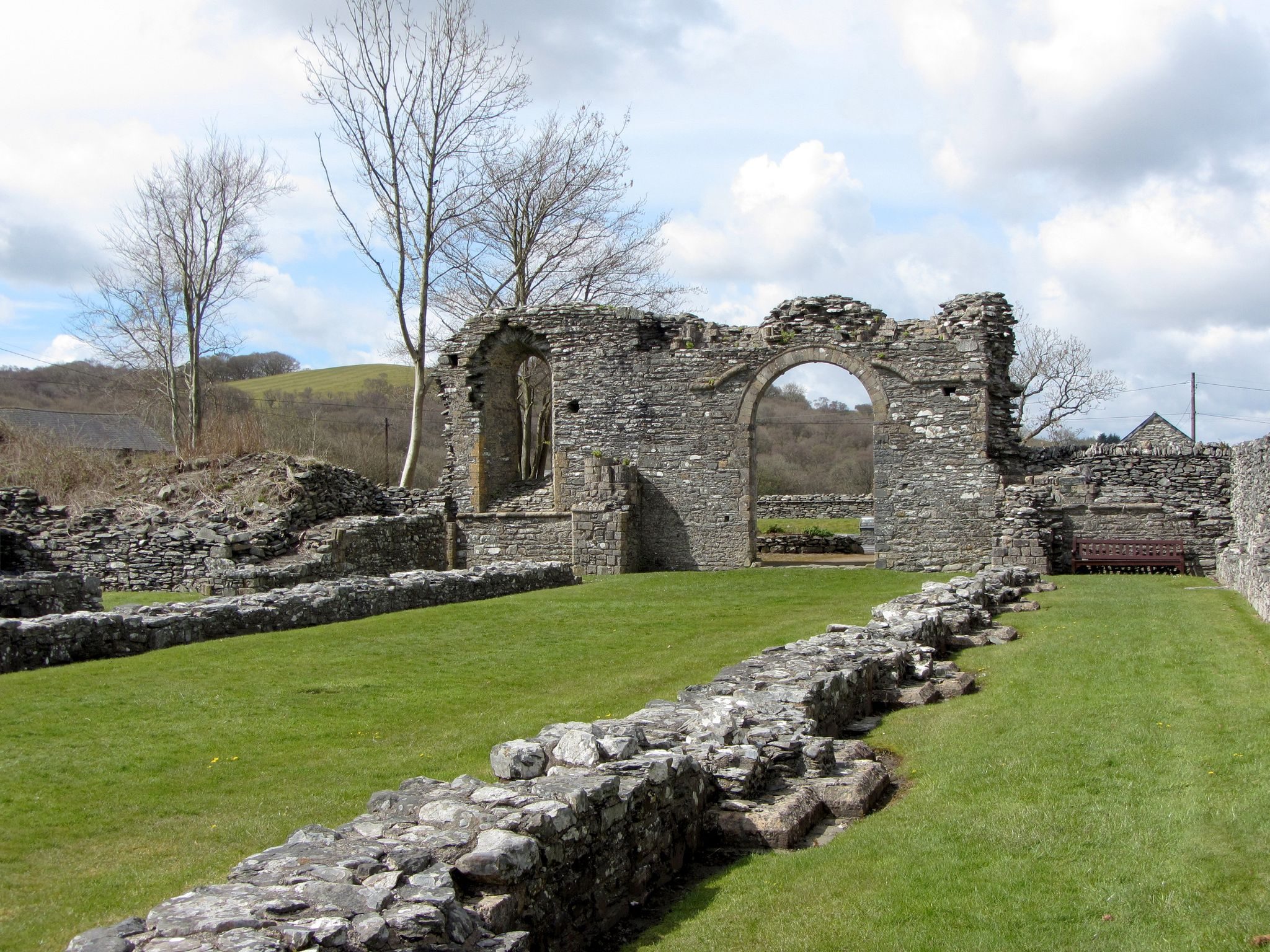
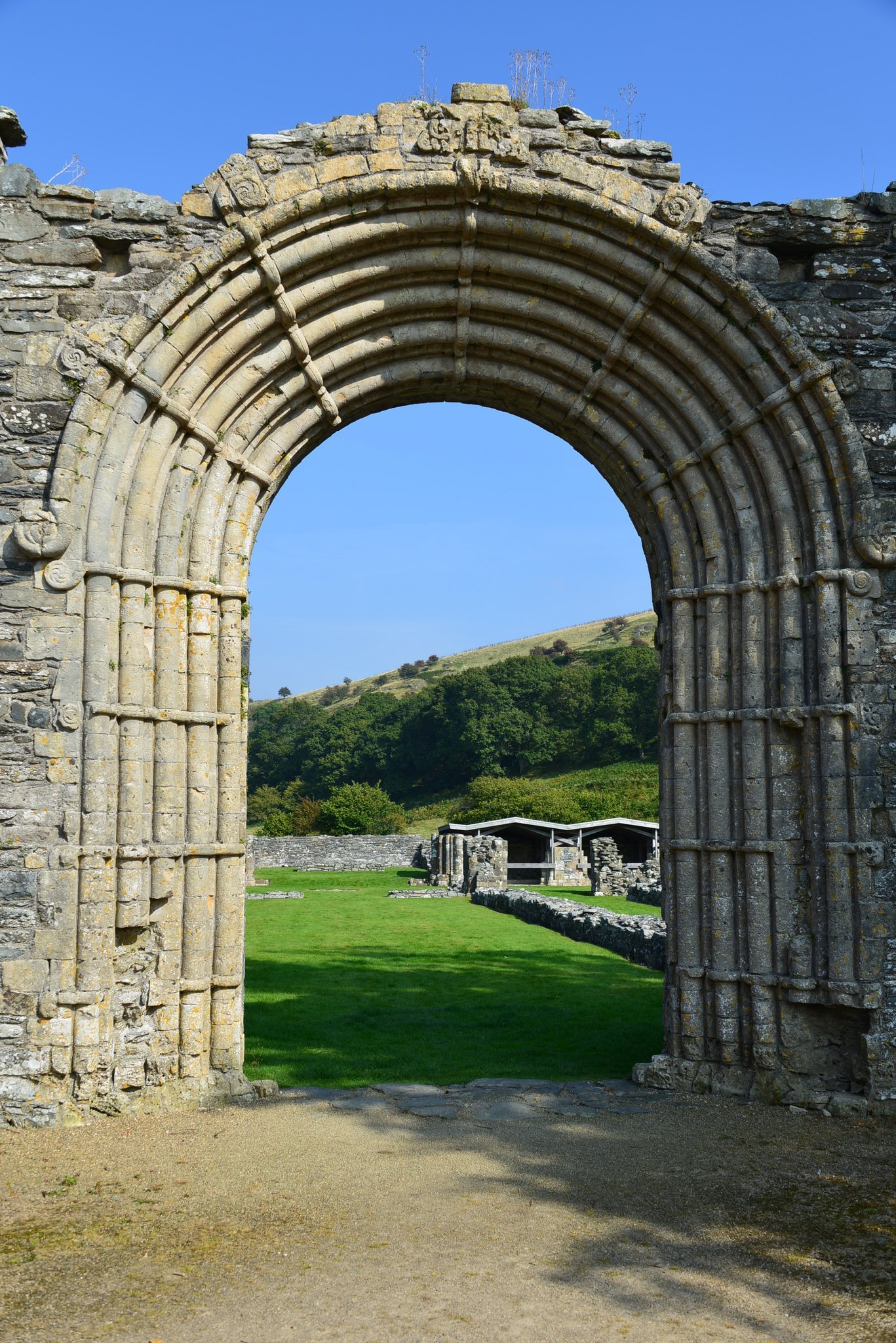
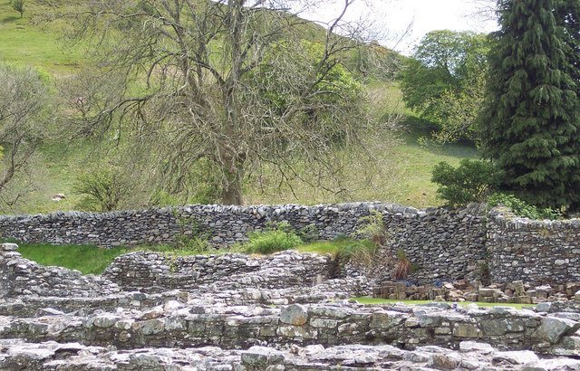
Strata Florida stands on the southern bank of the Afon Teifi, in the upper part of the river’s course. The church occupied the northern side of a courtyard, while the other monastic buildings were arranged around it. The principal surviving structure is the western entrance archway, and low walls mark the extent of the church and its six subsidiary chapels.
The abbey church
Plan and entrance
The church followed a substantial Cistercian plan, measuring approximately 65 metres long and 35.7 metres wide. It was aligned from west to east, with a nave, two aisles, two transepts, a flat-ended eastern termination, and three chapels on each side of the choir. Limestone formed its principal building material.
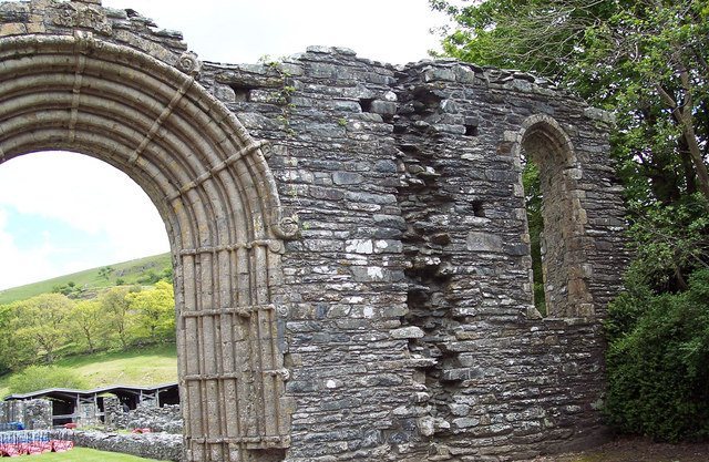
The western entrance preserves the most substantial surviving part of the church. Its large, decorated archway dates from the late twelfth century and leads into the nave. The combination of decorative elements is described as unique in Britain, although individual features, including spiral forms, have parallels elsewhere. A pointed-arch window survives south of the gateway.
Nave and choir
Low partition walls, about 1.5 metres high, divided the nave’s side passages from its central area. Pillars and arches rose above these partitions. Comparable arrangements are known in Ireland, but the arrangement is not otherwise found in England or Wales.
A wooden pulpitum, or screen separating the nave from the choir, stood across the church. Its stone supports remain visible, as do the bases of two altars beside the nave. Nineteenth-century excavations found burials in front of these altars.
The choir extended eastward to the presbytery and its altar. At its centre stood an unusual stone basin with steps on both sides. It may have been used for the mandatum, the Holy Week ceremony in which an abbot washed the feet of twelve members of the community. It may instead have formed part of the drainage system, and evidence indicates that it could be covered by a hatch or stone.
Transepts and floor tiles
The north transept contained three chapels along its eastern side. A doorway in its northern wall led towards the monks’ burial ground. The south transept also contained three small chapels. A modern wooden roof protects their surviving fourteenth-century floor tiles and traces of medieval painted plaster.
The tiles are decorated mainly with geometric patterns, alongside images that include a medieval man in period clothing looking at himself in a mirror, a dragon, and a griffin. Some of the tiles are displayed in the site museum.
Tower and associated rooms
A bell tower stood above the choir. A large bell was consecrated by the bishop of Bangor in 1255, possibly when the central tower was completed. Two rooms stood beside the south transept. One probably served as a sacristy and the other as a book room.
Chapter house and cloister
Chapter house
The chapter house stood south of the rooms beside the south transept. In the early thirteenth century it measured approximately 16.5 by 8 metres, but its size was reduced by half during the fourteenth century. It also served as a burial place for members of the Deheubarth princely family.
The princes were placed in a mass grave covered by a large stone. That stone is now in the site museum, while a replica occupies the chapter house. A stone memorial there commemorates the princes associated with burial at Strata Florida.
Cloister
The cloister lay south of the nave and west of the chapter house. Its conventional arrangement placed the monks’ building to the east, the lay brothers’ building to the west, and communal buildings to the south. A northern alcove held a lectern for Compline, the final office of the monastic daily cycle. The cloister was rebuilt in the fifteenth century, but nothing survives above foundation level.
Outer precinct and later buildings
Farm and parish church
The Great Abbey Farm stood south of the nave and west of the chapter house, probably on the site of the former refectory. It has occupied that position since at least the late seventeenth century. The graveyard beside the ruins remains in use. A memorial to Dafydd ap Gwilym stands beside an ancient yew tree, and the present parish church of St Mary, within the graveyard boundaries, may have been built with stone taken from the monastery.
Gatehouse and water management
Geophysical surveys have identified several large structures around the monastic precinct, including a possible gatehouse to the inner enclosure. Excavation revealed fragments of medieval pottery tiles, suggesting that a chapel may have stood above the entrance. The structure was later reused as a residence and possibly as agricultural buildings. A substantial frontage was subsequently built over the original gateway road before the building fell into disrepair and disappeared.
Field boundaries have also been identified around the precinct. Two leats, or artificial water channels, may have increased the flow into the Nant Glasffrwd and supplied a mill farther downstream. Ironworking slag found within the precinct provides evidence of metalworking activity associated with the monastic site.