Aberystwyth Castle: A Medieval Coastal Fortress in Wales
Site at a Glance
- Rating
- 4.6
- Popularity
- Medium
- Country
- United Kingdom
- Primary era
- Medieval
- External website
- Open
- Eras represented
- Medieval, Modern
- Civilizations
- English
- Site type
- Military
- Remains
- Castle
On this page15 sections
History
Aberystwyth Castle is a medieval fortress in Aberystwyth, United Kingdom, built under the English crown in the late thirteenth century during Edward I’s campaigns in Wales. Established on a coastal promontory in 1277 and completed in 1289, it formed part of a planned military settlement and helped secure English rule in Ceredigion. The present ruin followed several earlier fortifications in the surrounding area, each shaped by conflict between Norman lords and Welsh rulers.
Earlier castles in Ceredigion
The first castle stood at Tan-y-Castell, about 1.5 kilometres south of the present site, near the mouth of the Ystwyth. It was built by the Norman marcher lord Gilbert de Clare in the early twelfth century, probably around 1110, during the Norman conquest of Wales. Gruffydd ap Rhys attacked it unsuccessfully in 1116, but captured and burned it in 1136 with help from Owain Gwynedd and Cadwaladr.
Owain Gwynedd then gave the earlier fortress to Cadwaladr, who used it as his residence while ruling Ceredigion. After Cadwaladr became implicated in the murder of Anarawd ap Gruffydd in 1143, Owain Gwynedd sent his son Hywel to drive him from the region and destroy the castle. A replacement was built at Aberystwyth by Roger de Clare, 2nd Earl of Hertford, in 1158. Rhys ap Gruffydd of Deheubarth seized it during a Welsh uprising in 1164. After Rhys died in 1197, it became the residence of his son Gruffydd ap Rhys, but his brother Maelgwn later captured and destroyed it with assistance from Gwenwynwyn of Powys.
Llywelyn ab Iorwerth rebuilt the castle in 1206 and placed it in the care of Rhys Ieuanc and Owain ap Gruffydd. During King John’s campaign against Llywelyn in 1211, the brothers surrendered it to the mercenary leader Falkes de Bréauté, who strengthened the fortification. Maelgwn ap Rhys and Rhys Gryg captured and destroyed it the following year. Maelgwn rebuilt the castle, and the Aberdyfi agreement transferred it to Rhys Ieuanc in 1216. It returned to Maelgwn after Rhys’s death in 1222. A destruction attributed to Llywelyn around 1221 has uncertain timing and circumstances. In the early 1230s, Maelgwn Fychan established Trefilan Castle for himself and his successors.
The Edwardian fortress
The present castle was established during Edward I’s first Welsh campaign. His brother Edmund, Lord of Cardigan from 1265, reached Aberystwyth on 25 July 1277 and began building a new stone fortress on the coastal promontory in August. By December, more than 1,300 workers were employed, including laborers brought from southwest England. The exposed western coast made construction unusually difficult and costly.
Aberystwyth was one of four fortresses ordered by Edward I in 1277. It was paired with a fortified planned settlement, or bastide, occupied by English settlers to support military control and colonisation. Roger de Moels became the first recorded constable in 1278. The castle was completed in 1289 after twelve years of work, probably under the direction of the master mason James of St George, at an approximate cost of £4,000.
The fortress was temporarily captured during the Welsh uprising of 1282. Gruffydd ap Maredudd and Rhys Fychan lured Constable Bogo de Knovill to a meal, took him prisoner, and surprised the garrison. The Welsh spared the soldiers but destroyed the castle and the town walls. English forces later recovered the site, and James of St George supervised repairs. He probably revised the design, especially that of the inner ward, while his associate Giles of St George directed the work on site.
Edward I stayed at Aberystwyth Castle from 10 to 16 November 1284. A Welsh assault during the rebellion of Rhys ap Maredudd failed in 1287. The castle also withstood an extensive siege during Madog ap Llywelyn’s revolt in 1294 and 1295. Its position beside the sea allowed it to receive supplies, including provisions sent from Ireland, and helped the garrison withstand the attack.
Decline and renewed Welsh control
By the inspection of the Black Prince in 1343, the fortress was already in serious disrepair. The main gate, drawbridges, king’s hall, Long Chamber, kitchen range, and outer bailey were falling down. Its exposed coastal position made the castle difficult to inhabit and contributed to its decline.
The castle resisted an initial assault during the rebellion led by Owain Glyndŵr, a Welsh prince who began a major revolt against English rule in 1400. Glyndŵr began a siege in 1403, and a French fleet later blockaded the fortress from the sea. Welsh forces captured it in 1404, after which it became one of Glyndŵr’s principal bases alongside Harlech Castle and served as a seat of his rival Welsh government. A treaty between Glyndŵr and the king of France was concluded there in 1405.
Harry of Monmouth tried to retake Aberystwyth in 1407. His forces used a bronze cannon known as a messagere, weighing more than two tonnes and firing projectiles of about 13.5 kilograms, but the weapon burst and the siege failed. English forces recovered the castle during a second siege in the winter of 1408. After Glyndŵr’s rebellion was suppressed, the fortress lost its strategic importance. It held French captives taken at the Battle of Agincourt in 1415 and thereafter received only minor repairs.
The Royal Mint and later destruction
A royal garrison occupied the castle during the English Civil War, the conflict between supporters of Charles I and Parliament over government and royal authority. Parliamentarian forces captured it in April 1646, and Oliver Cromwell ordered the fortress to be slighted in 1649. Slighting meant deliberately demolishing part of a captured fortification so that it could no longer serve effectively as a military stronghold.
The castle hall had housed a Royal Mint from 1637, established under Charles I after the intervention of Thomas Bushell. It struck several denominations from silver mined locally in Ceredigion, including half-crowns, shillings, half-shillings, two-pence pieces, pennies, groats, threepences, and halfpennies. The mint operator raised a Royalist regiment during the Civil War. Minting stopped in September 1642, while bullion and equipment were apparently moved to Shrewsbury and operations transferred to Oxford. The castle also served during the war as a store for silver and lead.
Much of the ruined fortress was quarried for stone, especially during the eighteenth century. Around 1790, the creation of a garden destroyed parts of the outer works. Construction of the seafront promenade in the late nineteenth or early twentieth century removed further remains on the western side. Restoration and stabilisation followed around 1903 and again from 1975 onward. Aberystwyth Town Council administers the ruin, which is protected as a Grade I listed building and a Scheduled Monument.
Remains
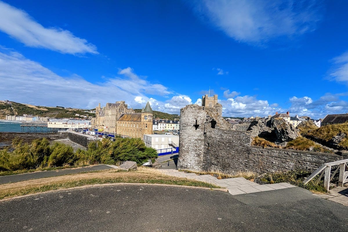
Aberystwyth Castle occupies a narrow, rocky promontory beside Cardigan Bay, north of the mouth of the Afon Rheidol and more than 1.5 kilometres north of the earlier Tan-y-Castell fortress. The sea bounded its western side, wet ground lay to the north, and the river estuary formed the southern boundary. Access was therefore concentrated on the east. The fortress had an irregular diamond-shaped plan, shaped by the rock and built in three phases, with a dry moat protecting the south, east, and north sides.
Outer and inner defences
The castle was an early concentric fortress, meaning that nested walls and wards forced an attacker who crossed one defensive circuit to face another farther inside. Double walls enclosed the main stronghold, with round or semicircular flanking towers and gate structures at the corners of the outer and inner circuits. A further enclosure occupied the northwest end of the promontory, although it has been lost partly through coastal erosion. The original design apparently lacked an inner curtain wall along the western side, and this wall was added after the fighting of 1282 and 1283.
Eastern approach
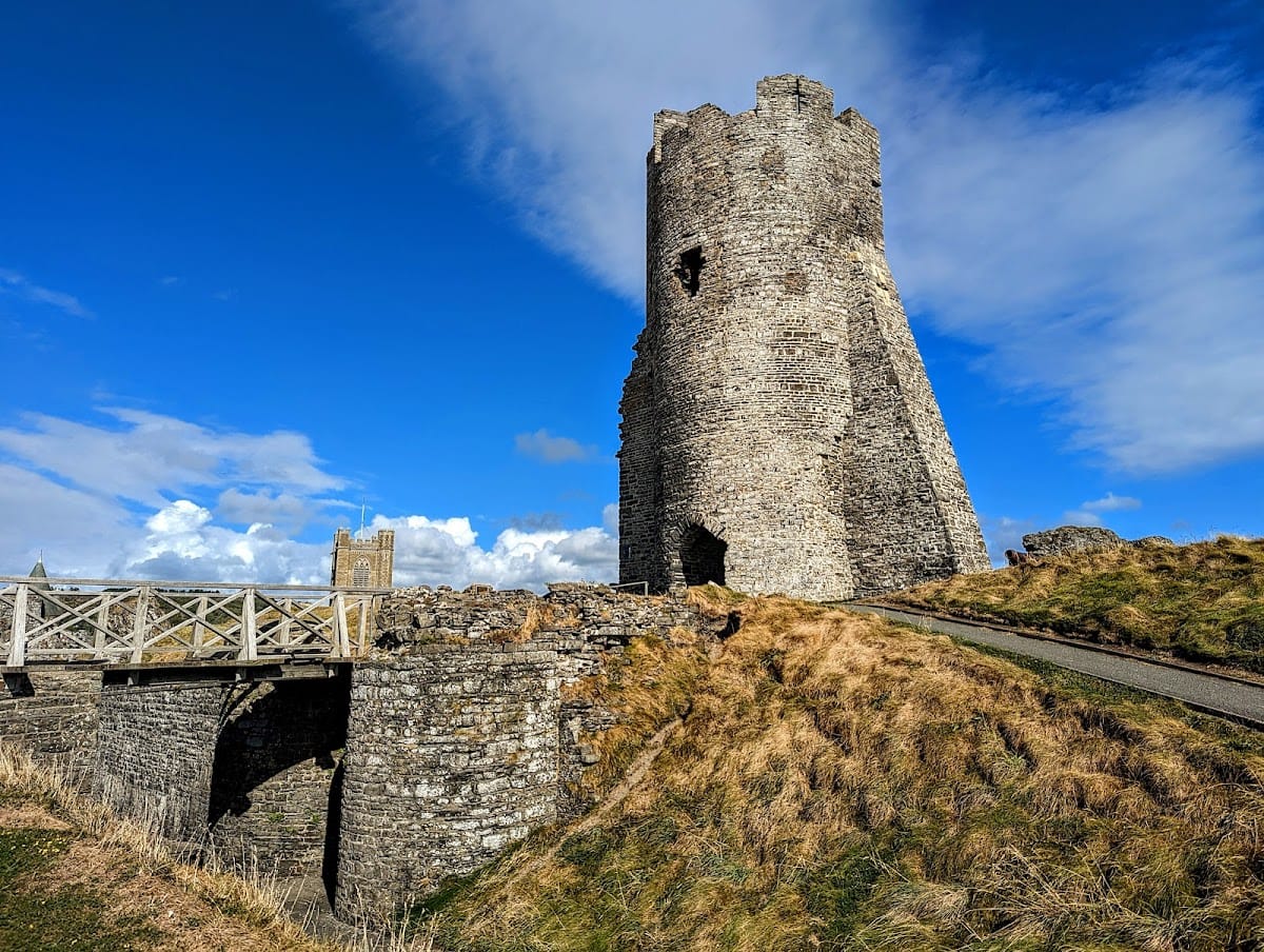
From the east, the approach passed through a projecting tower and an outer gatehouse defended by twin towers. Beyond it stood an inner gatehouse with two D-shaped towers. These structures formed the principal landward entrance to the fortress, whose rocky position and surrounding water and marshland supplied additional natural protection.
Northwestern landing gate
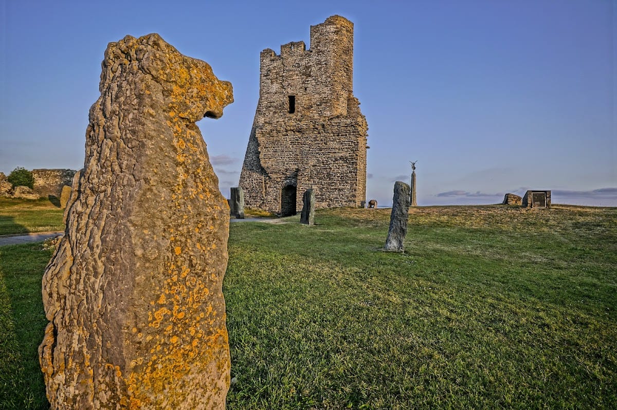
A gate tower at the northwest led through the outer wall to a landing place for ships. This maritime entrance allowed the garrison to receive supplies by sea, a function that proved especially important during the siege of 1294 and 1295. The northwestern inner gate tower is now the best-preserved major structure because it later served as a landmark for Aberystwyth harbour.
Inner ward and principal buildings
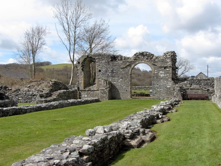
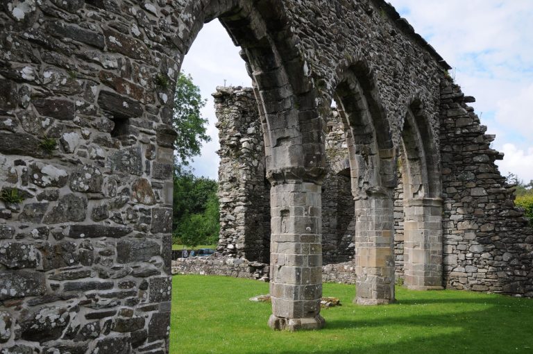
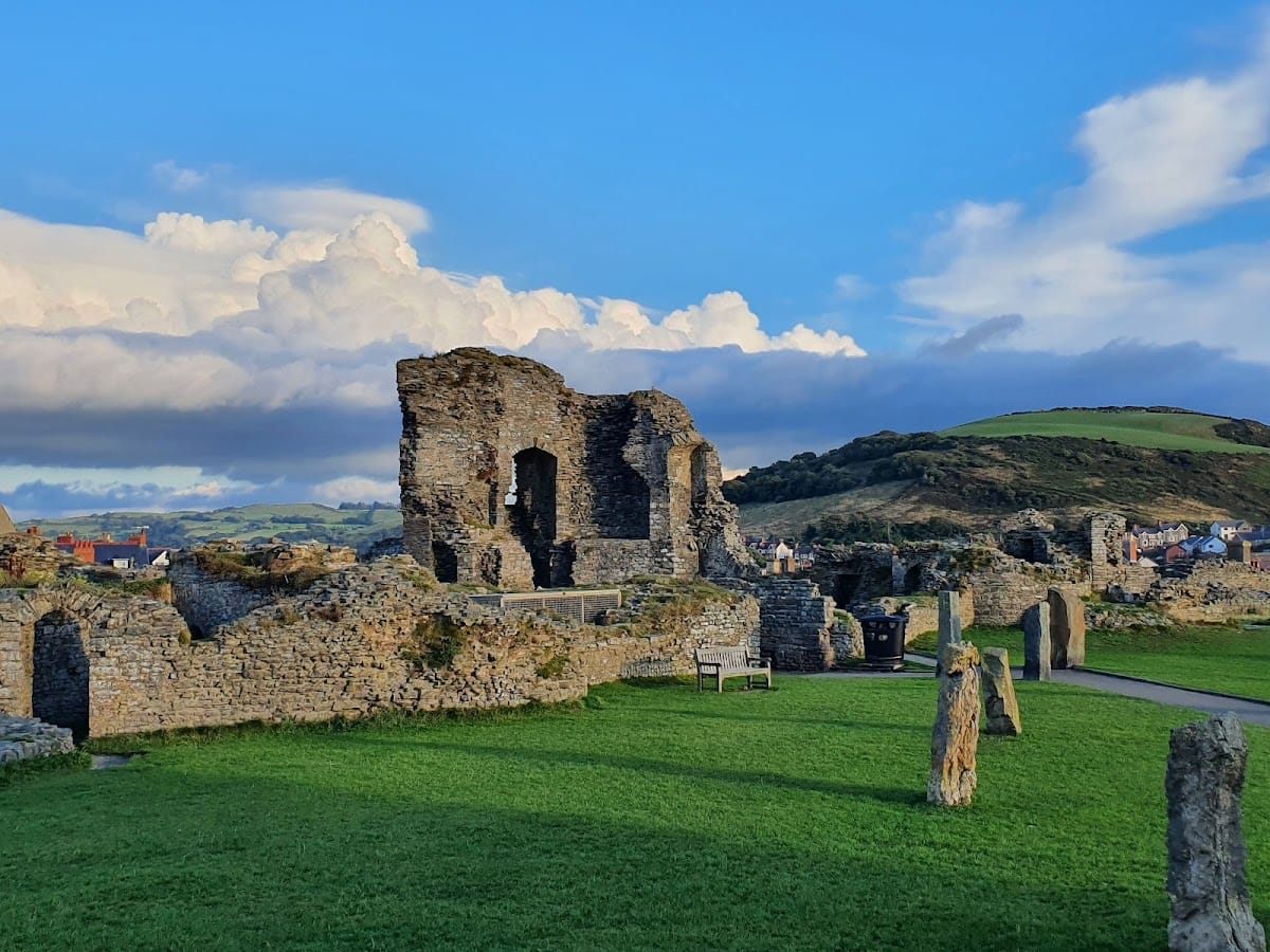
The inner ward was enclosed by a narrow outer ward, and the principal buildings stood within the inner circuit. The castle was built of siltstone, but extensive losses have left the surviving walls and foundations fragmented. The outer circuit remains in places, including the ruins of the northern and southern flanking towers. Only slight fragments of the inner wall survive, while the powerful main gate rises only to ground-floor height.
Residential building
The palas, the principal residential building of a medieval castle, occupied the southeastern side of the inner ward along the inner circuit and south of the main gate. It probably contained the royal apartments. Only its foundations remain.
Southwestern building
A rectangular building survives along the southwestern inner wall. Its remaining fabric forms part of the scattered foundations and wall fragments that cover much of the interior of the ruined fortress.
Later features within the grounds
Eisteddfod stone circle
A stone circle was added within the castle grounds in 1916 for an Eisteddfod, a Welsh cultural festival centred especially on poetry, music, and performance. Its thirteen stones represent the thirteen counties of Wales at that time.
First World War memorial
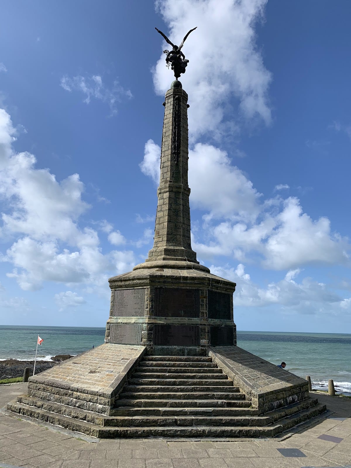
At the northwest end of the promontory stands a First World War memorial unveiled in 1923. It was created by the Italian sculptor Mario Rutelli and forms a later commemorative feature within the castle grounds.
The surviving ruin is substantially less complete than the Edwardian castles in north Wales that were later inscribed together as a World Heritage group. Stone robbing, coastal erosion, and the construction of the promenade account for much of the loss, while the remaining towers, gates, foundations, and wall fragments continue to show the fortress’s unusual coastal plan.