Weißenburg Roman Fort: A Cavalry Garrison on the Raetian Frontier
Site at a Glance
- Popularity
- High
- Country
- Germany
- Primary era
- Classical
- Eras represented
- Classical
- Civilizations
- Roman
- Site type
- Military
- Remains
- Fort
On this page16 sections
History
The Weißenburg Roman Fort, known in antiquity as Biriciana, was a Roman cavalry base at Weißenburg in Bavaria, Germany, near the Raetian Limes. Its first fort was probably built around AD 100, during the early years of Emperor Trajan’s reign, though construction under Domitian is also possible. The garrison helped secure territory north of the Danube that had recently become part of Raetia, a Roman province in the upper Danube and Alpine region. Occupation lasted until about AD 253, and had ended by 254.
Fort and garrison
The first installation was a timber-and-earth fort covering about 2.8 hectares, built for the ala, or auxiliary cavalry unit, called the Ala I Hispanorum Auriana. It probably served there for most of the fort’s history. An ala comprised 16 cavalry squadrons, each with roughly 30 to 33 riders. Around the middle of the second century, during Emperor Antoninus Pius’s wider strengthening of this frontier, a stone fort of about 3.1 hectares replaced the earlier enclosure.
A second unit, the Cohors IX Batavorum equitata milliaria exploratorum, is also linked with Biriciana. It was a nominally thousand-strong force of Batavians from the lower Rhine region, partly mounted and used for reconnaissance. Its base may instead have been the separate fort at Breitung. That installation may have housed the cohort when the Ala I Hispanorum Auriana was away on campaigns against the Parthian Empire under Lucius Verus, during the Marcomannic Wars on Rome’s Danubian frontier under Marcus Aurelius, or during both periods.
A military diploma, an official document recording privileges granted to a discharged auxiliary soldier, provides a glimpse of life in the garrison in AD 107. It records the discharge of Mogetissa, son of Comatullus, a member of the Celtic Boii who had served in the Ala. The document enabled him to marry his partner Verecunda and legally recognize their daughter, Matrulla. Marcus Insteius Coelenus commanded the Ala at the time.
Civilian settlement and the end of occupation
A civilian settlement, known as a vicus, grew beside the fort to serve soldiers’ families, traders, craftspeople and innkeepers. Veterans also settled there. At its largest, in the late second century, the settlement covered about 30 hectares and may have had roughly 2,500 residents.
The fort and settlement were probably destroyed by the Alamanni, a confederation of Germanic groups, around AD 253, and certainly by 254. Raetia had faced sustained Alamannic attacks since 233. The end of the garrison marked the close of Biriciana’s role as a Roman frontier base.
Rediscovery and archaeological work
The name Biriciana survives in the Tabula Peutingeriana, a medieval copy of a late Roman road map, but the fort’s location remained uncertain until the nineteenth century. In 1818, historian Andreas Buchner argued that it lay at Weißenburg, but placed it mistakenly at Alten Bürg, a medieval site about 2.5 kilometres east. A memorial stone was later set up at the western end of the Bürg during the reign of Maximilian II of Bavaria, from 1848 to 1864.
In 1884, Friedrich Ohlenschlager proposed Kesselfeld as the garrison site, although his excavations did not settle the question. Wilhelm Kohl’s work in 1890 provided archaeological proof of the auxiliary fort. Kohl continued investigations for the Reich Limes Commission, the body responsible for systematic study of the Roman frontier in Germany. By 1898, the principal stone buildings were known. Julius Tröltsch and Max Raab continued the Commission’s work until 1913. In 1914, Raab helped secure the site’s purchase by the regional government to prevent building development, and continued investigations through 1917.
Further work gradually clarified the wider Roman landscape. A smaller bath west of the fort was partly investigated in 1926. A timber-and-earth fort at Breitung was identified by aerial archaeology in 1976 and excavated in campaigns through 1991; a partial plan of another fort near Emetzheim was found in 1977. The Great Baths were discovered during building work that year. A coin hoard found near them in 1979 became the focus of the Roman Museum, developed from 1981 as a branch of the Bavarian State Archaeological Collection.
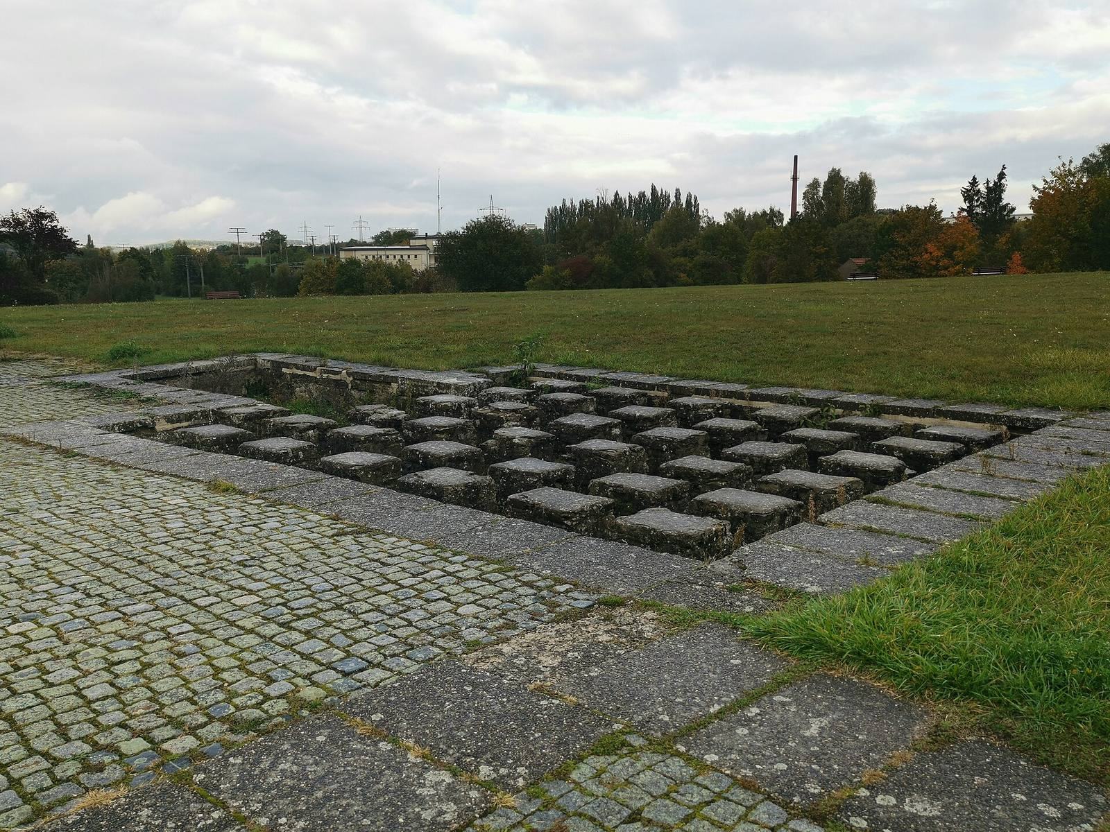
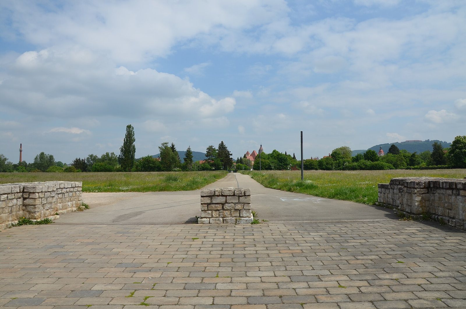
Conservation at the fort changed over time. Concrete applied to the tops of exposed walls in 1963–64 made their plans visible, but the foundations were reburied in 1965 after conservation methods proved unsuccessful. Excavations at the northern edge in 1986–87 confirmed the earlier timber-and-earth fort. A reconstruction of the north gate followed in 1989–90, and an archaeological park established in 1990 preserves the outlines of the defenses and headquarters. A magnetometer survey in 2006 produced some new and differing results from the plan published in 1906.
The fort forms part of the Upper Germanic-Raetian Limes, inscribed as a UNESCO World Heritage Site in 2005. It is also protected as a registered archaeological monument under Bavarian heritage law. After the World Heritage inscription, Weißenburg was selected for the Bavarian Limes Information Centre, which is integrated into the Roman Museum.
Remains
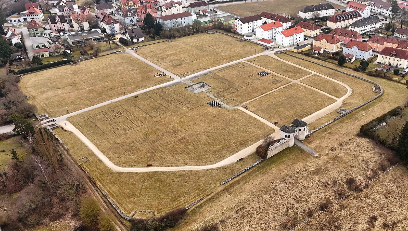
The fort occupies a rise at Kesselfeld on Weißenburg’s western edge, with the ground falling gently northwest toward the Swabian Rezat. Its final stone enclosure was nearly square, and its main gate faced south to southeast. The smaller rear gate faced north toward the Raetian Limes, about 5.5 kilometres away. The remains are partly buried and partly exposed; raised sections of the perimeter and stones marking buried building plans make parts of the layout visible.
Fortifications
Stone walls and ditches
The stone fort measured approximately 170 by 174 by 179 metres. Its rounded corners and perimeter wall were defended by towers. Each of the four gates had a pair of towers, with a smaller tower between each gate pair and the nearest corner towers. The principal gate and two side gates were similar in size, while the northern rear gate was smaller.
A double ditch surrounded the fort, with evidence for a third ditch along three sides. The ditches were interrupted only at the gates. At the north front, the outer ditch was 2.70 metres wide and 1.60 metres deep; the middle ditch was 4.50 metres wide and 1.40 metres deep. The middle ditch had a near-vertical face on the outward side and a sloping face toward the fort. The innermost ditch was 5.40 metres wide.
Earlier gate defenses
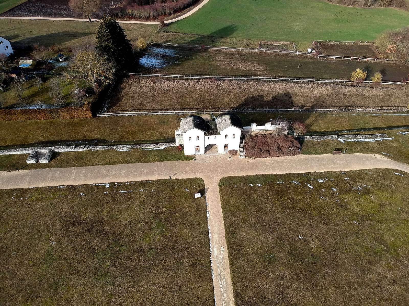
Excavation of the earlier northern gate revealed twelve postholes for two rectangular wooden gate towers, each measuring 3.20 by 3.60 metres. A palisade trench about 0.60 metres wide connected the gate with intermediate towers on either side, each supported by four posts. The later reconstruction of the north gate stands on its original foundations, though it is probably one storey lower than the ancient structure.
Interior buildings and barracks
Headquarters and service buildings
Stone-built administrative and supply buildings occupied the fort’s centre. The headquarters held a shrine for the military standards, armour stores and record offices, with a large hall in front. Nearby, a raised granary protected stored food from damp and pests. The commander’s residence was arranged around an open courtyard, and some rooms had underfloor heating.
Cavalry barracks
A geomagnetic survey identified 14 long, timber-framed barracks. Eight joined along their rear walls to form pairs. In the southern half of the fort, four stood on each side of the central north–south road; the two middle buildings on each side were paired. In the northern half, three stood on either side, with a paired barrack at the north end and a single building to its south on each side.
Each barrack housed a cavalry squadron. A wider head building toward the centre of the fort accommodated its decurion, the squadron commander. The other rooms were arranged in pairs: four riders shared a rear room, while their four horses occupied the adjoining room toward the front. Greenish traces of manure pits were found in the horse rooms.
Workshops
Workshops occupied the fort’s western sector. Their position distinguishes this activity area from the central administrative and supply buildings and the barracks arranged along the main road.
Civilian settlement and baths
Settlement and surrounding land
The vicus extended across about 30 hectares, although later development has obscured parts of its boundaries. It included a roadside stopping place and three bath buildings. Cemeteries and pasture for the garrison’s horses lay outside the settlement along the main roads. A modest rural estate found about 2.5 kilometres south of the fort, west of the road to Treuchtlingen, had six rooms and a walled courtyard of 240 square metres. Estates in the surrounding area probably helped supply the garrison with food.
Great Baths
The Great Baths developed through three building phases. The first, built around AD 90, arranged bathing rooms in a simple sequence. The complex was substantially enlarged around 130. Probably after damage during the Marcomannic Wars, a larger bath with a circuit layout was constructed around 180. This third phase measured 65 by 42.5 metres. Alamannic incursions badly damaged the baths around 230; some surviving rooms were then used for purposes other than bathing. The remains have been restored and are protected by a building.
Inscriptions and finds
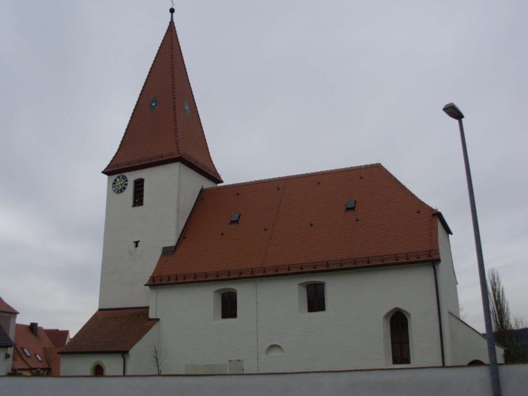
Several inscriptions and objects connect the fort and its settlement with named individuals and religious dedications. An altar to Jupiter naming Marcus Victorius Provincialis, commander of the Cohors IX Batavorum, was once built into Weißenburg’s Church of St Andrew and remained there until 1892. The church also formerly held a soldier’s tombstone naming Martinus. An inscription for Flavius Raeticus, an assistant cavalry officer, records a dedication to Mercury in AD 153, during the consulship of Praesens and Rufinus; it came from nearby Emetzheim. Primus Saturninus’s funerary inscription, part of a larger monument and measuring 1.22 by 0.50 metres, was found at Pförring’s parish church in 1903 and is now at the Chapel of St Sebastian. Fragments of an armoured statue from the fort area date to the first half of the third century and may once have belonged to a figure displayed in the standards shrine.
A hoard found during garden work near the baths in autumn 1979 contained coins dated to AD 251 and 253. It is associated with the fort’s right-hand main road and is regarded as one of the most important finds of its kind in southern Germany.