Warsaw Fortress: The Russian Imperial Defensive Complex in Poland


Site at a Glance
- Rating
- 4.5
- Popularity
- Medium
- Country
- Poland
- Primary era
- Modern
- External website
- Open
- Eras represented
- Modern
- Civilizations
- Russian
- Site type
- Military
- Remains
- Fort
On this page29 sections
History
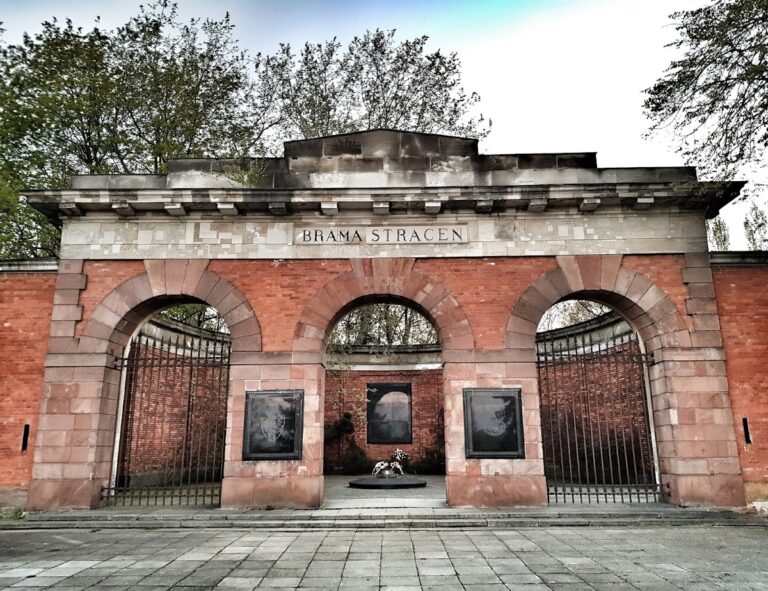
Warsaw Fortress was a Russian imperial fortress complex in Warsaw, Poland, built from 1832 to protect the western approaches to the Russian Empire. Centered on the Alexander Citadel, the system belonged to the first, Vistula-based line of Russian fortresses and reflected the political and military policies of Tsar Nicholas I, who began reorganizing Russia’s western frontier after 1825.
Foundation and the Alexander Citadel
The foundation of Warsaw Fortress is dated to 1832, with construction beginning on 19 May that year. The central Alexander Citadel was built between 1832 and 1834 and completed in 1835. A fortress commandant’s administration and garrison were organized between 1833 and 1835, establishing a permanent Russian military presence beside the Polish capital.
The citadel was created after the Polish independence movements of 1830 and 1831. Although it was a military stronghold, its role increasingly extended to police and political control. The same association continued during the Polish uprising of 1863 and 1864, when the citadel served as an instrument of Russian authority as well as a defensive work.
Fort Śliwickiego, a bridgehead fort protecting a river crossing and the opposite bank, was constructed on the eastern bank of the Vistula between 1833 and 1835. It faced east, opposite the citadel, and took its name from Staff Colonel Śliwicki, who had set fire to the Praga Bridge during the Russian capture of Warsaw in 1831.
Expansion around the citadel
Modernization and reinforcement began around 1840, when attached forts were added to the citadel. A separate group of forts followed between 1850 and 1861, including Włodzimierz, Aleksiej, Pawła, Gieorgija, and Siergieja. These works extended the defensive area beyond the central stronghold and created a more dispersed arrangement.
In 1871, Russian authorities decided to link the fortifications of Warsaw and Modlin with a new fortress at Zegrze and intervening artillery forts. The decision to transform Warsaw into a large modern fortress was taken in 1879, partly in response to the changing strategic situation in Europe after the Congress of Berlin and the formation of the Austro-German alliance. From this period, the name Warsaw Fortress was officially used between 1879 and 1913. The complex was also called the Alexander Citadel or Warsaw Alexander Citadel.
The expanded fortress was planned with two defensive rings. The inner ring was confined to the left bank of the Vistula, while the outer ring also extended across the river. The forts were generally placed several kilometres from the city’s outskirts to reduce the danger of bombardment. Their construction restricted Warsaw’s urban growth for several decades and gave the surrounding landscape a military character.
The Warsaw Fortified Region
Construction of the main outer and inner belts began in the early 1880s. Work on the outer forts started in 1882 and 1883, while the inner belt began in 1886. The principal construction phase ended around 1890, by which time 20 forts had been built. The system ultimately comprised 29 forts and major defensive positions, together with smaller earthworks, artillery batteries, roads, barracks, magazines, and other supporting facilities. It became part of the Warsaw Fortified Region, the larger Russian defensive system incorporating Warsaw and the connected fortifications toward Modlin and Zegrze.
Engineer Vernander directed the later fortification works. The outer and inner belts are described as lying approximately 6 to 12 kilometres and 4 to 10 kilometres from the citadel respectively, while initial intervals between forts reached 4 to 5 kilometres. Natural marshes, streams, and clay pits were incorporated into the defensive design, and fortress roads connected the separate positions.
Rapid advances in artillery soon made the earlier masonry defenses increasingly vulnerable. From 1890, brick structures were progressively reinforced or replaced with concrete. From 1895, many forts were rebuilt and rearmed. Works in the 1890s added seven supplementary defensive positions, two objects connected with the Warsaw to Zegrze line, concrete roofs and earth cover over casemates and magazines, and concrete replacements for brick caponiers. Further work, including new concrete caponiers, continued until about 1910 to 1913.
The modernization improved the forts’ resistance and fields of fire, but they remained technically behind contemporary German and French fortifications because they lacked armored elements and concealed observation posts. The complex nevertheless possessed an extensive military infrastructure, including roads, storehouses, barracks, and communications links.
Administration and military organization
Warsaw Fortress had its own headquarters and specialized administrations for engineering, artillery, quartermaster services, and military medicine. A fortress priest and clergy, gendarmerie, fire brigade, and economic committee supported the military establishment. Its forces included fortress artillery, engineering and sapper units, a military telegraph, and an aeronautical section that was later reorganized as a fortress aeronautical company.
A military pigeon station was established on 15 March 1888. It was temporarily disbanded for the duration of military operations on 23 March 1916. The Warsaw Fortress Infantry Brigade included four fortress infantry regiments. The artillery organization changed over time: the 1st Sortie Battery was disbanded in 1910, while the fortress artillery included companies numbered 1 to 24 in 1908 and six fortress artillery battalions, each with four companies, in 1914.
Abolition, rearmament, and the First World War
After Russia’s defeat in the Russo-Japanese War, the abolition of Warsaw Fortress was ordered in January 1909. The fortress formation was abolished in 1910, and its headquarters were disbanded on 26 February 1914. Demolition began with combat casemates and caponiers, but inadequate funding and local resistance slowed the process.
The worsening international situation soon reversed this policy. Russia restored Warsaw Fortress to a combat footing in 1913. Existing forts were hastily strengthened, damaged works were rebuilt, and new concrete caponiers were constructed. When the First World War began, dismantling stopped and the fortress formation was reconstituted.
In September 1914, Warsaw Fortress resisted German forces during the Warsaw to Ivangorod operation. During the subsequent siege, chemical weapons were used three times against the defenders and civilians. After the garrison’s combat supplies had been exhausted, Russian troops withdrew on 22 and 23 July 1915 according to the plans of the Russian high command. Warsaw was abandoned without a fight in August. Before the withdrawal, important fortifications, bridges, and railway infrastructure were destroyed, and German troops later demolished parts of the abandoned fortress.
Polish use and later transformation
After 1918, Polish authorities resumed dismantling the fortifications. Demolition was briefly suspended in the summer of 1920, when three eastern defensive lines were prepared partly with the old forts during the Polish-Soviet War. After the Treaty of Riga, some forts were dismantled and their land incorporated into Warsaw’s expanding urban fabric. Other sites were assigned to military units or arms factories.
Former fortress positions again contributed to Warsaw’s defense in 1939. Fort IX, also called Czerniaków, saw heavy fighting with German forces. On 26 September, German units captured Fort II, or Wawrzyszew. During the German occupation, the forts were used mainly as warehouses.
After the Second World War, the remaining forts acquired varied uses without a consistent urban-development policy. The Polish Army retained many positions before transferring some sites for allotment gardens, recreation, or commercial activity. Other locations deteriorated. A Warsaw municipal resolution of 2000 established planning rules for the nineteenth-century fortress system and listed 28 protected fortress-related objects.
The fortress badge was approved on 5 March 1914. It showed a gold diamond-shaped shield in the colors of the Russian fortress flag, the dates 1883 and 1913, and the crowned monograms of Alexander III and Nicholas II, the successive Russian emperors whose reigns preceded the badge’s adoption. A black-enamelled inscription read “Warsaw.”
Remains
Warsaw Fortress survives as a dispersed military landscape centered on the Alexander Citadel. Its physical components include the citadel, attached forts, two defensive rings, local earthworks, artillery batteries, roads, barracks, magazines, and railway infrastructure. Most of the system lay west of the Vistula, although Fort Śliwickiego and connected positions toward Zegrze extended the defenses onto the eastern bank and beyond the immediate city.
The citadel and attached forts
Alexander Citadel
The Alexander Citadel formed the fortified core of the system. It contained powder magazines, workshops, and casemated accommodation, meaning reinforced enclosed spaces used for soldiers, storage, artillery, or related military purposes. The surrounding complex also included an arsenal, churches, troop quarters, and quartermaster stores. The Nadbrzeżna artillery battery, also called Fort Rymkiewicza, formed part of the citadel’s defensive group.
Fort Siergieja and Fort Gieorgija
Fort Siergieja, also known as Fort Sokolnickiego, was begun in 1849 and reconstructed from 1864. Fort Gieorgija, also called Fort Hauke-Bosaka, was built in 1863. Its surviving connection with the citadel is represented by a tunnel, preserving a physical link between the attached position and the central stronghold.
Fort Pawła, Fort Aleksieja, and Fort Włodzimierza
Fort Pawła, also called Fort Mierosławskiego, was built in 1854 and later replaced by a school. Fort Aleksieja was also known as Fort Traugutta, while Fort Włodzimierza later took the name Fort Legionów. The attached defenses included the towers Aleksieja and Siergieja, which were later enclosed by lunettes, detached angular outworks strengthening a fort’s perimeter, as well as the lunettes Pawła and Gieorgija.
Fort Śliwickiego
Fort Śliwickiego, also known as Fort Jasińskiego, occupied the eastern bank of the Vistula as a bridgehead fort. Its defenses included a ravelin, an outwork placed in front of a fortress wall, with an interior dividing work; a casemated redoubt; ditches protected by caponiers; and gorge barracks enclosed by a defensive wall. Its escarps and counterscarps, the two opposing slopes or walls of the ditch, were faced with stone.
Inner defensive ring
Fort P and Fort W
Fort P, also called Bema or Parysów, survives in part, and its grounds were renovated as a recreational area in Bemowo. Fort W, or Wola, occupied a site now containing a shopping center and bus terminus. The auxiliary Fort W-Szcza, also known as Odolany, formerly stood on railway land and formed part of the inner system.
Fort Szcza and Fort Szcza-M
Fort Szcza, or Szczęśliwice, retains a water-filled ditch around whose outer area allotment gardens were established. Military structures probably built there after the Second World War were later demolished, leaving rubble within the interior. Fort Szcza-M, also called Rakowiec, retains recognizable earthworks in a park.
Fort M and Fort M-Cze
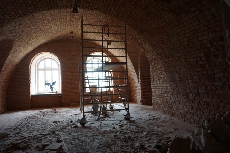
Fort M, or Mokotów, on Racławicka Street, preserves its barracks and both powder magazines. These spaces now contain pubs, restaurants, and other commercial premises. Fort M-Cze, also called Odyńca, formed another position in the inner ring, while Fort Cze, known as Piłsudskiego or Legionów Dąbrowskiego, remains in Polish Army possession and is not used.
Outer defensive ring
Fort I and Fort II
Fort I, or Bielany, retains recognizable sections of its ditch, infantry rampart, and artillery rampart. The right-front section was levelled, while a small portion of the throat-barracks roof and a faint remnant of a tunnel exit survive among the altered remains. Fort II, or Wawrzyszew, was surrounded by a water-filled ditch, and its former area now contains a riding center and allotment gardens.
Fort IIA and Fort III
Fort IIA, also called Babice or Radiowo, survives in relatively good condition near Boernerowo. Its water-filled ditch is incomplete, and the site remains in Polish Army possession. Fort III, or Blizne, retains its throat barracks, main rampart, and sections of the passage through the axial rampart. Its front and flank caponiers were blown up.
Fort IV and Fort V
Fort IV, or Chrzanów, has deteriorated, with approximately half of the barracks in the rampart area destroyed. Fort V, or Włochy, retains its throat barracks, ruined caponiers, and earthwork layout. Its earthworks underwent revitalization between 2015 and 2022, and the site became a public park with a football field, outdoor gym, dog park, and playground. Cemeteries occupy parts of the surrounding area.
Fort VI and Fort VII
Fort VI, or Okęcie, is almost completely surrounded by water and survives in moderate condition, with a small cemetery nearby. On 14 March 1980, a LOT Il-62 passenger aircraft named Mikołaj Kopernik crashed into the fort’s ditch during approach. The singer Anna Jantar was among those killed.
Fort VII, or Zbarż, retains flooded throat casemates. The site is unused, and allotment gardens occupy its outer area. Road construction beginning in 2011 exposed masonry foundations, revealing further elements of the former fortification.
Fort VIIA and Fort VIII
Fort VIIA, or Służewiec, lies between Lotników Avenue and Puławska Street and is used commercially. Historic fort buildings stand alongside office and storage buildings, most of them constructed after the Second World War. Fort VIII, or Służew, retains its throat barracks, main rampart, and remnants of caponiers. Former storage casemates served as residents’ garages until 2009, while allotment gardens surround the fort.
Fort IX and Fort X
Fort IX, or Czerniaków, lies in Sadyba near Powsińska Street. Its central area is occupied by a branch of the Polish Army Museum and the Katyń Museum, while other parts form public parks. Fort X, or Augustówka, was built entirely of earth and therefore had no barracks or other brick or concrete structures. Parts of its ditch survive, and the position is used as a shooting range.
Eastern and northern positions
Ground undulations in a wooded area mark the former Fort XII, or Antoninów. Fort XIII, or Lewicpol, lies within the Bródno woodland park and contains a military unit. At the former Fort XIIA, or Lewinów, in Zacisze, the site is occupied by allotment gardens. The former positions of Forts XI, Grochów, XIA, Grochów II, XIV, Marywil, and XIVA, Pelcowizna, formed part of the eastern defensive network and its later urban landscape.
Warsaw to Zegrze connections
Fort Wawer and Fort Kawęczyn
The Warsaw to Zegrze line included Fort Wawer and Fort Kawęczyn, both attached to Warsaw Fortress. At Wawer, ground depressions in present-day Matki Mojej Park mark the former throat barracks. Fort Kawęczyn was demolished after the First World War, and its site remains part of the history of the connected defensive line.
Fort Beniaminów
Fort Beniaminów was another related fort of the Zegrze system. Seven connecting forts were planned for the Warsaw to Modlin to Zegrze defensive system, four were realized, and Wawer and Kawęczyn were attached to Warsaw Fortress. Fort Beniaminów is privately owned.
Construction and surviving infrastructure
The principal forts were generally brick-and-earth works with separate artillery and infantry ramparts. Most followed regular polygonal layouts and were surrounded by ditches. Their defensive elements included caponiers, intermediate works, casemates, powder magazines, and barracks. Later concrete roofs, earth cover, reinforced magazines, and concrete caponiers altered many of the earlier brick structures.
The fortress was served by a station of the Vistula Railway and a railway bridge across the river. Roads designed for military movement linked the forts, while barracks and storage complexes supported the garrison. Together with the surviving ramparts, ditches, tunnels, foundations, and adapted buildings, these elements preserve the outline of a defensive system that once governed the military geography and urban development of Warsaw.
Nearby sites