Betthorus: A Roman Legionary Fortress in Jordan
Site at a Glance
- Country
- Jordan
- Primary era
- Classical
- Eras represented
- Classical, Medieval
- Civilizations
- Byzantine, Roman
- Site type
- Military
- Remains
- Fort
On this page25 sections
History
Betthorus was a Roman legionary fortress near modern Lejjun in Jordan, built around AD 300 on the empire’s eastern frontier. It formed part of the Limes Arabicus, the Roman frontier zone in Arabia, where forts and watch posts monitored movement and helped protect settled communities. The fortress was established on previously unoccupied ground, probably during Emperor Diocletian’s reign, as part of a programme to improve communications and strengthen frontier security.
Roman foundation and frontier service
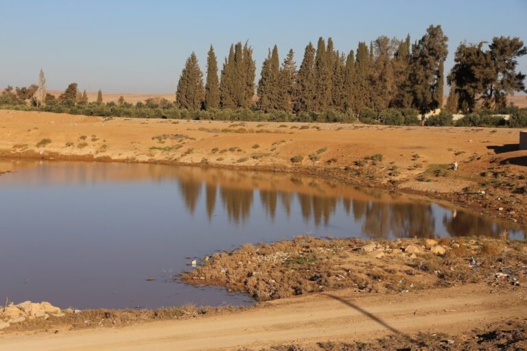
Betthorus guarded a region where military posts operated as a network rather than as a continuous wall. A watchtower at Rujm Beni Yasser stood about 1.5 kilometres to the east, while the smaller fort of Khirbet el-Fityan was about 1.5 kilometres to the west-northwest. These outposts could communicate with Betthorus through the neighbouring posts. The fortress also lay near Ain Lejjun, a spring about 500 metres to its west, likely an important factor in choosing the site.
The late Roman administrative and military register known as the Notitia Dignitatum lists the prefect of Legio IV Martia at Betthorus. The legion’s presence is not independently confirmed by finds from the fortress, and its inscriptions do not name the unit. The garrison has been estimated at roughly 1,000 to 3,000 soldiers, whose principal task was frontier security.
Earthquakes and changing garrison
The fortress’s main period of occupation is generally placed between about AD 300 and 530. Its force appears to have fallen by roughly half by the late fourth century. Possible explanations include the withdrawal of some frontier troops under Constantine, the movement of soldiers for Emperor Julian’s campaign against the Sasanian Empire in 363, and damage caused by the earthquake of that year. The Sasanian Empire was a Persian rival of Rome and the later Byzantine Empire.
The earthquake of 363 damaged Betthorus, including its barracks. Some buildings were repaired or rebuilt, but accommodation was reconstructed on a more limited scale. Earthquakes in 505 and 551 also damaged the site. Under Emperor Justinian, around 530, troops were apparently withdrawn from Betthorus and other garrisons as the Ghassanids, an Arab Christian confederation allied with the Byzantine Empire, took on frontier defence. The fortress had already been neglected in the early sixth century, and its final reuse ended with the earthquake of 551.
Later activity and archaeological study
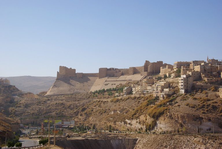
Activity returned intermittently in the late seventh and eighth centuries under the Umayyads, a caliphal dynasty that ruled from 661 to 750. Bedouin burials were also placed among the ruins. Much later, an Ottoman military post was established near the fortress shortly before or possibly during the First World War. It protected communications between the governor, the Kerak garrison, and troops guarding the Hejaz Railway station at el-Qatrana. Ottoman troops took building stone from the Roman ruins, and their military activity destroyed major remains of the associated settlement during the first half of the twentieth century.
After the 1967 Six-Day War, a Saudi Arabian tank unit was stationed at Lejjun for several years. The deployment appears to have caused little major disturbance to the fortress itself, although tank positions remain visible at the site.
The ruins drew scholarly attention in the nineteenth century. Ulrich Jasper Seetzen proposed that they might be the Roman Castra Arnonensia, though he did not visit. Charles Montagu Doughty made the first recorded research visit in 1876, and his account appeared in 1888. Siegfried Langer, who visited in 1881, instead interpreted the remains as a Moabite city and associated them with the biblical city of Ar. Frederick J. Bliss and Siméon Vailhé later recognized the site as a Roman military settlement and fortress. Detailed surveys, drawings, and photographs made by Alfred von Domaszewski and Rudolf Ernst Brünnow in the 1890s were published in 1905.
Samuel Thomas Parker surveyed Betthorus in 1975 and 1976, then returned to prepare the Limes Arabicus Project. The project investigated the fortress and its surroundings in 1980–85, 1987, and 1989; its final report appeared in 2006.
Remains
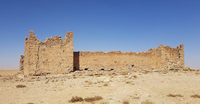
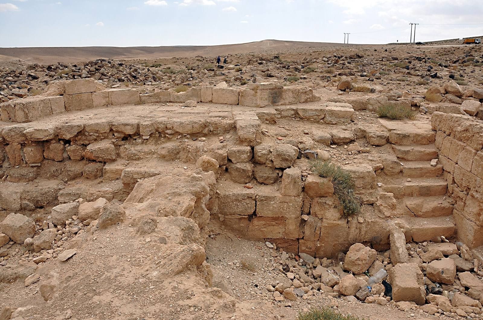
Betthorus occupies an east-facing rectangular enclosure on the Moab Plateau, immediately south of Wadi el-Lejjun, a tributary of the upper Wadi Mujib. The valley opens to the east and is bordered by low hills to the north and south, with the steeper edge of the Moab highlands to the west. The fortress lay about 14 kilometres east of the Via Nova Traiana, a Roman road across Arabia. Its inner sides measure about 238 metres north to south and 191 metres east to west, enclosing roughly 4.567 hectares. The plan resembles a rounded-corner playing card, although the corners depart from exact right angles by up to about two degrees. Today, most above-ground remains are foundations and heaps of stone, with short sections of the perimeter wall still standing.
Perimeter and gates
Perimeter wall
The perimeter wall was probably built in a single campaign between AD 284 and 324. Its foundation rested on gravel and earth within a trench about 2.5 metres wide and 2 metres deep. The wall averaged about 2.4 metres thick and had two outer stone faces with a rubble core. Roughly dressed chert and rubble formed the lower courses, while the upper courses used limestone blocks laid in mortar. The wall could support a walkway and a protective barrier along its top. Its original height is unknown; an estimate of about six metres to the walkway does not include the barrier.
Towers
Twenty U-shaped towers were built into the wall: four intermediate towers on each long side, two on each short side, and eight beside the gates. The intermediate towers were about 9.3 metres wide, projected roughly 11 metres beyond the wall, and stood about 35 metres apart. They had at least two storeys and may have had three. Ground-floor entrances are known, while access to the upper levels may have been from the wall walkway.
A projecting semicircular tower about 21 metres across occupied each corner. These towers probably had three storeys. An entrance from inside the fortress led through a corridor to three ground-floor rooms, while a stair wound around a central rectangular pier. The towers may have supported artillery; three bolts for a ballista, an ancient bolt-firing engine, were found inside the fortress.
Gates
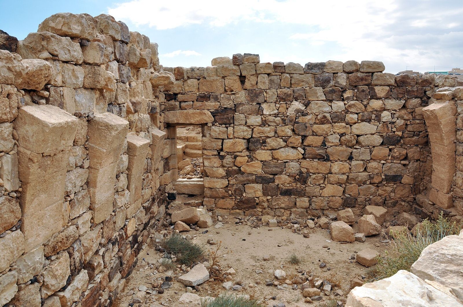
A gate stood at the centre of each wall. The main eastern gate and the northern gate each had a wide central passage flanked by two narrower passages. The southern and western gates had a single passage apiece. Fossil-bearing limestone blocks, each cut from a single piece of stone, formed the gates. Excavation of the northern entrance revealed inward-swinging wooden doors, stone paving, and stairs beside the side passages. This gate survives in better condition than the others. An early drawing shows arches above its smaller openings that helped transfer the weight of the masonry to the sides.
Roads and headquarters
Internal roads
The main roads met in a T-junction at the camp’s central surveying point. The widest ran west from the eastern gate to the headquarters, with covered, columned walkways along both sides. A cross-road connected the northern and southern gates. The main routes shaped the layout of the camp, though the existence of a road continuing through its rear remains uncertain because that area was not excavated.
Headquarters
The headquarters occupied a rectangle about 63 by 52.5 metres. Its eastern side included a monumental four-sided gateway, with three openings on each face: a broad central opening and two smaller ones. Attached quarter- and half-columns decorated the structure, and their capitals followed Nabataean forms. The building’s north and south sides faced the cross-road, its east front faced the main road, and its west side formed the principal entrance to the headquarters.
Behind the gateway was a central courtyard about 38 metres square, surrounded by arches resting on piers. Rooms opened onto its north and south sides. The easternmost of four rooms on the north was identified as a kitchen; others may have served as armouries or storerooms. A large hall crossed the building behind the courtyard. Offices stood at the rear, with a standards shrine at their centre, measuring 9.2 by 10.3 metres. Its limestone threshold had fittings for a hinged iron gate and holes that may have held bars. Lamp fragments made up about one fifth of the identified pottery from the shrine, including late Roman and Byzantine examples, suggesting that lamps lit the room.
Barracks
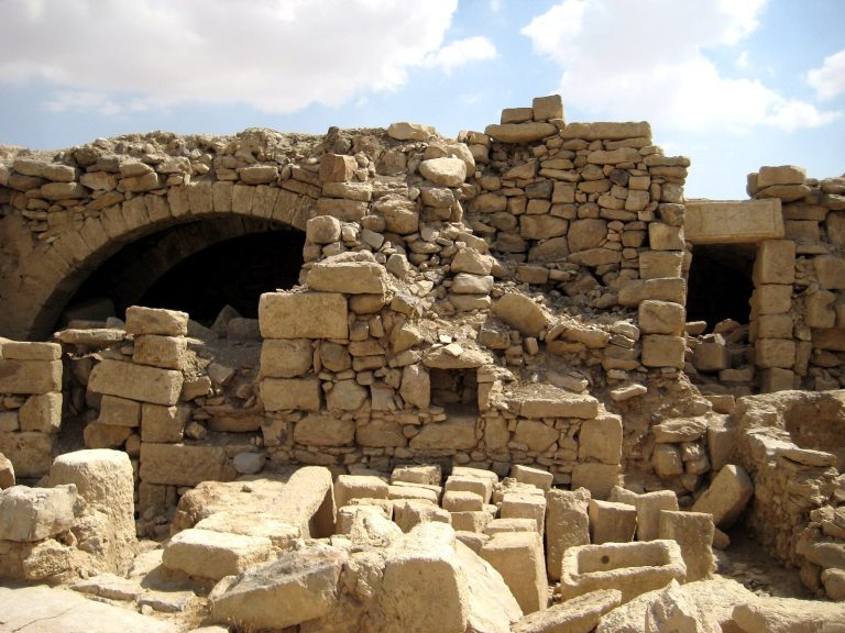
Soldiers’ accommodation occupied much of the fortress’s eastern half and parts of its western half. The original barracks were limestone buildings. After the earthquake of 363, four visible blocks of chert barracks replaced buildings in the front zone of the camp. The northeastern quarter, formerly occupied by eight limestone blocks in four pairs, was largely left open. Later barracks had rooms on both sides of a central lengthwise wall, usually eight or nine rooms to each side in the front zone and six in the central zone. Their long sides faced the main road. Limestone arches supported the room ceilings, with long basalt slabs laid above them; stairs at the ends of some buildings may have led to the roofs or to an upper storey. Evidence from the northeastern quarter also indicates that sheep and goats were kept there after 363.
Other buildings and installations
Military bath
The military bath stood inside the northern wall, east of the northern gate. Built of limestone soon after the perimeter wall, around AD 300, it measured about 9.7 by 23 metres and contained at least five rooms. It was altered and repaired after the earthquake of 363. One room may have been the heated bathing room.
Church
A three-aisled church was built around AD 500 in the northwestern part of the fortress, southwest of the northern gate. It measured about 24 by 13 metres, including its entrance hall, and covered an earlier structure. Columns separated its central nave from the side aisles. At the eastern end was a semicircular sanctuary, with a small service room at the northeast corner. The church was renovated in the early sixth century.
Granary
A limestone building in the southwestern corner has been interpreted as a granary. It measured about 27.5 by 25.66 metres, stood on the highest ground within the fortress, and joined the perimeter wall. Its entrance was on the east, and three long parallel chambers divided its interior. The surviving building was later than the wall and was rebuilt after 363 on the site of an earlier structure.
Water installations
A deep, circular structure lined with stone cut through earlier limestone remains in the northwestern rear quarter. It probably served as a reservoir between about 363 and 400. In the Ayyubid and Mamluk periods, successive medieval Muslim ruling houses, it was adapted as a kiln for making lime from stone taken from the Roman ruins. A stone-filled hollow near the eastern wall, south of the main gate, may also have been a cistern or reservoir.
Inscriptions
A fragment of a Latin inscription, painted in red on white plaster, remained attached to a limestone block displaced by the earthquake of 551. Only a few letters survive, in letter forms characteristic of the third or fourth century. A separate block from the bath bears a single Latin letter.
Civilian settlement and surrounding remains
Settlement layout
A civilian settlement associated with the fortress extended beyond its walls. Substantial remains included a building immediately west of the camp, a temple and other large structures to the southeast, and a large structure farther north. The finds and buildings around the fortress point to a mixture of military and civilian activity.
Western enclosure
The building immediately west of the fortress measured about 35 by 28 metres. Rough or dressed stone walls enclosed a central courtyard, with rooms on three sides: five on the west and three each on the north and south. A single entrance at the northeast was watched from a small guard room. Its worn threshold preserves pivot marks for a double-leaf door. The rooms had vaulted ceilings, and the building had an upper floor. Interior plaster indicates it was not designed for keeping livestock or storing rough equipment. Pottery, charcoal, and animal bones were recovered. Excavator P. Crawford interpreted the building as a stopping place for caravans or travellers, used for short stays at intervals.
Large courtyard building
The largest excavated building in the settlement measured about 62 by 47 metres. Ranges of rooms surrounded a large courtyard on every side except the east. It may have served as a forum and market. Its last identified use ended around the earthquake of 363, after which stone was taken from the structure.
Temple precinct
The southernmost large building in the southeastern settlement was a Roman temple raised on a high platform and surrounded by a sacred precinct with covered walkways. Built around the time of the fortress, about AD 300, it appears to have had only limited use before it was abandoned.
Mounds and tombs
Mounds on the north bank of Wadi Lejjun yielded Roman and Byzantine pottery from their surfaces. An excavation of one mound found two roughly built wall lines, and the date and purpose of the mounds remain uncertain. At least two rock-cut tombs in the wadi each had a central chamber opening into side chambers, with a burial niche cut into the floor of each. Both tombs had been emptied before being reused as animal stalls. At least three rock-cut shaft tombs on a hill southeast of the fortress had been damaged and reused for Bedouin burials.