Sanctuary of Poseidon at Kalaureia: A Greek Religious Center on Poros
Site at a Glance
- Popularity
- Low
- Country
- Greece
- Primary era
- Classical
- Eras represented
- Bronze Age, Iron Age, Classical
- Civilizations
- Ancient Greek, Mycenaean, Roman
- Site type
- Religious
- Remains
- Sanctuary
On this page25 sections
History
The Sanctuary of Poseidon at Kalaureia is an ancient Greek sanctuary on Poros, Greece, where worship of Poseidon, a major Greek god associated especially with the sea, centered on a league of neighboring communities. The sanctuary probably emerged in the late eighth century BC and became the religious center of the Kalaureian Amphictyony, an association that linked Athens, Aegina, Epidaurus, Hermione, Nauplia, Boeotian Orchomenus, and Prasiai through a shared sanctuary. Myth attributed its founding to Calaurus, a son of Zeus. Worship may have taken place there in the Mycenaean period, but the sanctuary is securely known by the Geometric period.
Early settlement and sanctuary
The earliest known settlers arrived around 1200 BC, during the Late Mycenaean period, the Late Bronze Age civilization of mainland Greece. They may have sought refuge in a period of unrest and probably supported themselves through farming and herding. Their settlement lasted only one or two generations. Later, from about 750 BC, a settlement developed again on the island.
A first temple, an enclosure wall, and an early form of the gateway were probably built around 650 BC, close to the time when the Amphictyony was established. A later Archaic temple followed around 520 BC. Building continued through the Classical and Hellenistic periods, successive phases of ancient Greek history, with stoas and other structures added to the sanctuary.
Political life and sanctuary asylum
Kalaureia usually came under the political leadership of Troezen, but in 322 BC it became an independent polis, or Greek city-state, and issued its own coins. The coins showed Poseidon on one side and his mythological son Triton on the other, alongside an abbreviated form of the city’s name. During the First Peloponnesian War, a cult of Poseidon of Kalaureia was established in Attica. Objects used in worship at the island sanctuary may have been transferred there.
The sanctuary offered asylum to people fleeing danger, including shipwreck survivors. In 322 BC, the Athenian orator and statesman Demosthenes took refuge there while escaping the forces of Antipater, a Macedonian general and regent. When Archias came to capture him, Demosthenes killed himself rather than be taken. Archias apparently ignored the sanctuary’s protection. Demosthenes was said to have been buried beside the temple enclosure wall; the grave remained visible in the time of Pausanias, a Greek travel writer of the second century AD. The people of Kalaureia later honored Demosthenes with a statue and offerings.
Decline and later history
Cilician pirates plundered the sanctuary during the Third Mithridatic War, Rome’s conflict with the kingdom of Pontus under Mithridates VI. The sanctuary was probably abandoned in the second century AD, although the city continued to exist until about the sixth or seventh century. In 396, the Goths plundered and destroyed the city.
By 1765, the English antiquarian Richard Chandler described the temple as a heap of rubble. Builders had taken stones for houses on Hydra, and further stones were intended for a monastery there. Swedish archaeologists Sam Wide and Lennart Kjellberg excavated the site in 1894, uncovering most of the area then known. Gabriel Welter remeasured the buildings in 1938. After limited work by the Greek Archaeological Service in 1979, the Swedish Institute at Athens resumed excavations in 1997. The work included projects between 2003 and 2005 and from 2007 to 2012; excavation also began about 200 metres southwest of the sanctuary in 2015.
Remains
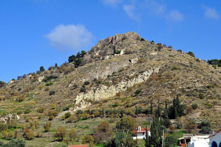
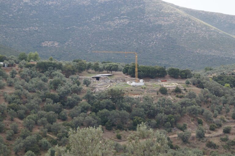
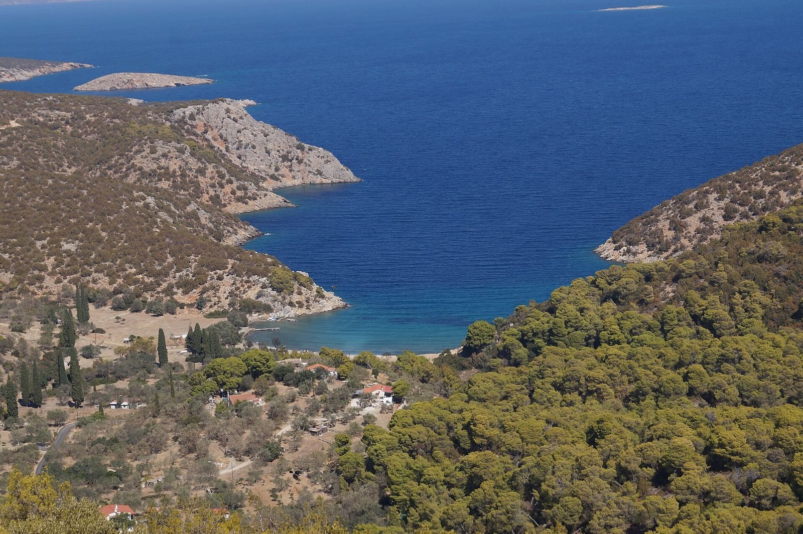
The site occupies the Palatia plateau, about 190 metres above sea level. Ancient Kalaureia lay south of the sanctuary, between the island’s two highest elevations, Vigla and Profitis Ilias, with views across the Saronic Gulf. Its harbor was about 900 metres north, at Vagionia beach. The sanctuary stood northeast of the city’s actual agora, or civic gathering place. The area long called the sanctuary agora is now understood as part of the sacred enclosure. A stoa, a roofed colonnade, was a recurring building type across the complex.
Settlement evidence and the precinct
Early settlement remains
Foundations of Mycenaean houses lie on a hill about 20 metres north of Stoa A, beneath a circular threshing floor. Finds associated with the houses include small round pieces of gold, steatite cones, a figure of Reshef, an ancient Near Eastern deity, and a miniature bronze axe. The threshing floor, about 12 metres across, has a square stone with a central hole. Grain continued to be threshed there until the nineteenth century.
Enclosure wall
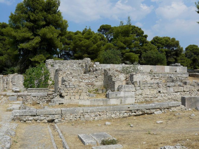
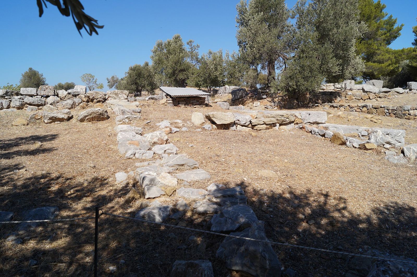
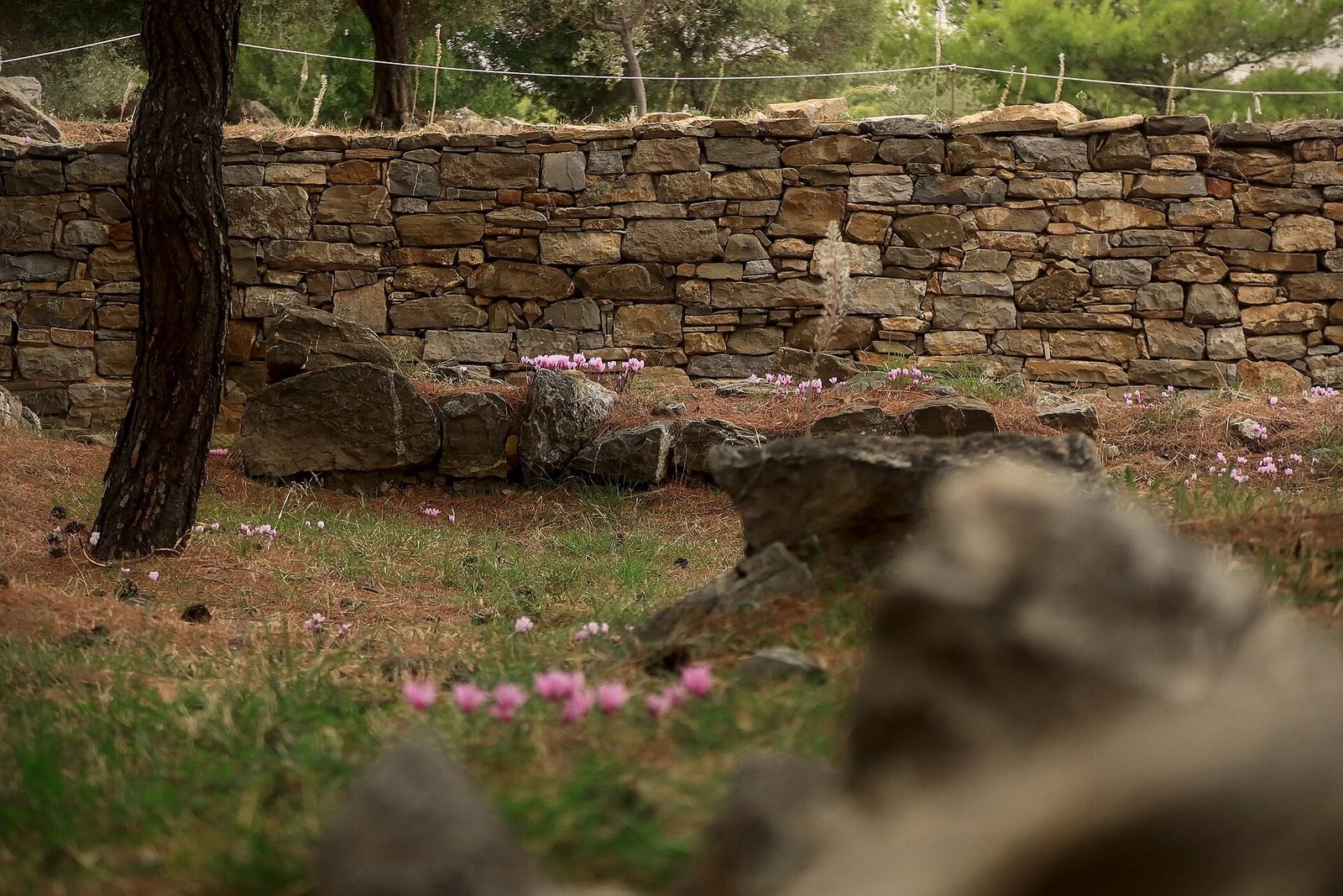
The sacred precinct was bounded by a wall measuring 27.60 by 55.30 metres, built mainly from grey-blue limestone. Its principal gateway stood midway along the east wall, with a smaller entrance to the south. A four-step foundation on the north side accommodated the slope. The wall was about a metre thick, with stones laid mostly in horizontal courses; irregular blocks and polygon-shaped masonry also appear, including at the southwest corner. Earth and rubble leveled the interior ground. Pottery in the fills ranges from Mycenaean and Geometric to Protocorinthian and Corinthian.
Temple
The Doric temple, built in one of the principal Greek architectural styles, stood on the same axis as the precinct’s eastern gateway. Its outer colonnade had six columns on each short side and twelve on each long side, estimated at about five metres high. Inside were an entrance porch with two columns between projecting side walls and a main chamber. The building’s reconstructed dimensions are about 24.802 by 12.166 metres, based on surviving frieze pieces and an estimate of three decorated panels per bay; its base is estimated at 27 by 14.50 metres.
The foundations of the outer colonnade were made from poros, a porous limestone, while the main chamber walls used hard grey-blue limestone and the floor was paved with poros slabs. Poros was also used for the columns and upper structural members. Iron Z-shaped clamps set in lead joined the stone blocks. Brown clay roof ornaments with red paint resemble examples from the Treasury of the Megarians at Olympia, dated 530–510 BC. The marble roof edge carried painted palmettes. A Doric capital with a broad curved molding and several blocks of volcanic trachyte were found near the temple. Older roof tiles point to an earlier building on the site.
Other precinct features
A later building, 16.50 by 3 metres, was attached to the inside of the precinct’s western wall. A grave found later was aligned with the temple’s main chamber wall. A base for an equestrian statue stood at the southern corner of the enclosure. West of the temple, a circular structure has been proposed as a possible monument to Demosthenes.
Gateway and gathering area
Gateway
The route from the harbor passed west of an ancient cemetery, reached the south end of the large building conventionally called the bouleuterion, then followed its front northeast to the gateway. The gateway, conventionally named Propylaion E, was built around 330 BC and measured 17.90 metres wide by 11.70 metres deep. Its asymmetrical southern section projected about 0.60 metres and contained a 5.30-metre-wide passage, framed by two columns between projecting side walls. A wall across the entrance had an opening about two metres wide. The northern section had a short colonnade facing the open area, with two rooms behind it. The structure may have served as a council building or as a meeting place for the Amphictyony. A small open seating recess of blue-grey limestone stood in front.
Open area and Stoa D
The trapezoidal open area conventionally called the agora was about 65 metres long, widening from roughly 20 metres near the gateway to 30 metres. Stoas flanked both its southeast and northwest sides. Stoa D, at the southern end of the gateway, was the oldest in this area. Dating to the late sixth century BC, it was 32 metres long and had eleven columns.
Building D
In the late fourth century BC, a five-room complex with a courtyard was added behind Stoa D. Its large central room probably had a column in the middle and benches along the walls; paving beside its western wall formed a hearth area. Large bossed blocks of blue-grey limestone made up the outer wall, and a stairway on the south led into the courtyard. An altar in one of the eastern rooms was used for sacrifice to an unidentified deity.
Altar and enclosed sacrificial area
An altar west of Building D was erected in the sixth century BC and remained in use until the second century BC. In the first half of the second century BC, a wall enclosed a small triangular area south of it. Pottery sherds, mammal bones, and fish bones from this area are associated with sacrificial ceremonies.
Stoa C
Stoa C stood about 3.50 metres northeast of Stoa D. Its double colonnade measured about 30.50 by 10.50 metres, with five inner Ionic columns and eleven outer Doric columns, all of poros limestone. Polygon-shaped masonry formed its outer wall. Architectural pieces date the building to the last quarter of the fourth century BC. Its Ionic capitals recall those of the Philippeion at Olympia, built in 338 BC, while other details indicate a later date. Stoa C probably served as an administrative building. An inscription found inside describes a gift of land and money and the use made of the donation.
Stoa A
Stoa A, northwest of Stoa C, measured 30.15 by 11 metres and was among the earliest double stoas in Greece. Its outer walls used carefully cut polygon-shaped blocks of blue-grey limestone, with close-fitting joints. Foundations of four inner Ionic columns made from trachyte survive. Sixteen outer Doric columns stood on a stone platform; both the columns and upper structure were made from poros limestone. The capitals recall those of the Parthenon, and the building served official purposes. A 10-by-10 game board was carved into one of the platform blocks in antiquity.
Stoa B
Stoa B stood beside Stoa A, separated from it by a gap of about 3.30 metres that was later paved with poros slabs. The building measured about 30.50 by 9.50 metres, with eleven columns along its front and five inside. Its remains are in poor condition, but polygon-shaped masonry survives on three sides, along with two inner-colonnade platforms.
Civic buildings and other structures
The large stoa called the bouleuterion
The Hellenistic building conventionally called the bouleuterion, meaning council building, was a large stoa 48.20 metres long, set southwest to northeast with its front facing southeast. Its double colonnade measured 32 by 10 metres and was flanked by projecting wings, each 8.20 metres wide and extending about 2.30 metres. Two rows of five columns supported the upper structure. A small cistern and a terracotta-pipe water channel lay beneath the northern wing, while three statue bases stood in front of its projection. The identification as a council building rests on its resemblance to a structure at Mantineia identified in the same way. At the western end of the area, a small rectangular building, about two metres square, was made from reused ancient stone and probably served as a well house.
Statues and votive column in Area H
In Area H, southeast of the precinct, four blocks from a base for a statue group of Queen Arsinoe II and King Ptolemy II were found in 2007–2008. Its inscription says that the city of Arsinoe in the Peloponnese dedicated the group to Poseidon. It is the city’s first known dedication. Three drums from an unfinished offering column were also found in Area H in 2007. Each carries an inscription read either as TV or TI followed by a numeral. Depending on the reading, they date to the second half of the sixth or the second half of the fifth century BC. The numerals may mark the drums’ positions from bottom to top, consistent with their decreasing diameters. A proposed reconstruction gives the column a lower diameter of about 1.05 metres and a height of roughly nine metres; it may have had grooves, an Ionic capital, and perhaps a sphinx above it.
Building I
Building I, beside the entrance to the excavation area, was a large private complex occupied from the fifth century BC to the second century AD and altered through at least four building phases. Around 150 BC, a two-storey house was laid out around a courtyard, with rooms on three sides and a wall on the east. Its central western room was probably a dining and guest room. The house was destroyed in the mid-first century BC and rebuilt in Roman times on a somewhat different plan. The former guest room was divided, a hearth was set against the west exterior wall, and some rooms stored food. The rebuilt house may also have supplied food for pilgrims. Finds include coins from Aegina, Hermione, Sicyon, and the Roman imperial period, as well as a coin of the Byzantine emperor Constans II, dating from about five centuries after the building’s final abandonment.
Building G and the hero shrine
Building G stood about 70 metres west of the sanctuary, at the foot of Profitis Ilias. Dating to the first half of the third century BC, it measured 21.10 by 20.80 metres. An eastern gateway, 4.40 metres wide, opened into a courtyard measuring 12 by 12 metres. Three small bases or altars stood against its north wall. The floors of two rooms beside the entrance were made from lime mortar and small pebbles. Two half-columns framed the entrance to the room opposite the gateway, where a bench ran along the walls. An Asklepios statue of Pentelic marble and a Roman dedicatory inscription were found in this room. It may have served as a meeting place for a cult association. A separate building to the southwest is identified as a heroon, a shrine or monument associated with a hero or honored person.
Houses in Area L
About 50 metres southwest of the excavation entrance, Area L contains houses dating from the Classical through Roman periods. The sheltered complex yielded cooking and fine pottery, large storage jars, and a stone from a press. Its scale and finds suggest communal rather than private use. New buildings were erected over earlier walls in the late first century BC or the first century AD.
Archaeological finds
In 1956, a boy found the right foot of an oversized Roman marble statue at the site. It probably belonged to a colossal statue of a Roman emperor. His teacher, Chr. Fourniades, took the piece to Poros town, where it became the first exhibit in his archaeological collection. Finds from the excavations are held at the Archaeological Museum of Poros.