Samshvilde: A Fortified City of Medieval Georgia
Site at a Glance
- Country
- Georgia
- Primary era
- Medieval
- Eras represented
- Bronze Age, Classical, Medieval
- Civilizations
- Georgian
- Site type
- City
On this page18 sections
History
Samshvilde is a ruined fortified city in Georgia that became a political and military center of Kartli, an ancient Georgian kingdom also called Iberia in Greek and Roman accounts. By the third century BC, it served as the center of an administrative district governed by an eristavi, a regional governor or duke. Tradition held that Parnavaz, regarded as an early king of Kartli, first assigned this office.
Early traditions and the kingdom of Kartli
Medieval Georgian tradition connected Samshvilde with an earlier fortress called Orbi. It attributed Orbi’s founding to Kartlos, a legendary ancestor of the people of Kartli, and said Alexander the Great captured it during a campaign in Georgian lands. The Georgian historian Vakhushti Bagrationi later identified Orbi with Samshvilde, although some modern scholars have instead proposed Orbeti Castle in the Algeti valley.
King Archil of Kartli, who ruled around 411-435, granted Samshvilde to his son Mihrdat, who later succeeded him. A medieval tradition credits Mihrdat’s Iranian wife, Sagdukht, with building the Sioni church after she converted to Christianity.
Contested rule in the early medieval period
The southern part of Samshvilde’s duchy became a point of contention between Kartli and neighboring Armenian rulers. A seventh-century Armenian geographical work named Samshvilde alongside Tbilisi and Mtskheta among the region’s three principal cities. An eighth-century inscription at Sioni refers to members of a local Iranian-style ruling family whose title was pitiakhsh, meaning a local ruler or governor. The surrounding territory also came under the influence of the Muslim emirate based at Tbilisi, as Georgian, Armenian, and Muslim powers competed for control.
Around 888, Smbat I of Armenia occupied Samshvilde and placed its government in the hands of the brothers Vasak and Ashot of the Gntuni family. When they rebelled, Smbat’s successor Ashot II restored Armenian royal control by force around 915. Vasak later changed allegiance, joining the Georgian prince Gurgen II of Tao around 921. Ashot besieged the fortress; after fighting there, Gurgen’s surviving soldiers were captured and mutilated. Samshvilde then again submitted to the Armenian king.
Medieval kingdoms and renewed growth
In the final decade of the tenth century, the Kuirikids, a collateral branch of the Armenian Bagratid dynasty, made Samshvilde the capital of the Tashir-Dzoraget kingdom. Its ruler David I was consequently known as Samshvildari, meaning “of Samshvilde.” In 1001, after David’s unsuccessful revolt against his uncle, Gagik I of Armenia, Gagik’s three-month campaign ravaged Tashir and Samshvilde.
In 1064, after Kvirike II was captured by Bagrat IV of Georgia, he surrendered Samshvilde to the Georgian kingdom and moved the Tashir-Dzoraget center to Lori. Bagrat’s son George II gave the city to his vassal Ivane I, duke of Kldekari, in 1073. The Seljuk forces of Sultan Malik-Shah I took Samshvilde around 1074 and held it as an outpost until 1110, when Bishop George of Chqondidi captured it for King David IV. The Seljuk withdrawal led to the evacuation of much of the surrounding area.
David IV granted Samshvilde to his commander Ivane Orbeli in 1123. The Orbeli family retained it until its revolt against George III failed. In 1178, the king’s forces stormed the fortress and returned it to the crown. During the twelfth and thirteenth centuries, Samshvilde’s political and military influence grew, and many fortresses in Lower Kartli recognized its primacy. Its position on a route between mountain and lowland districts also supported commercial and industrial activity. Workshops are thought to have produced pottery, faience, a type of glazed ceramic ware, glass vessels, and jewelry.
Conquest, sack, and decline
Mongol forces attacked Samshvilde in 1236 as they advanced toward Tbilisi. In March 1440, Jahan Shah, ruler of the Qara Qoyunlu, a Turkmen-led political confederation, captured and sacked the besieged city by deception on Pentecost. He ordered a minaret made from 1,664 severed heads at the city gate, took 9,400 captives, and destroyed the churches. Christian clergy, monks, and nobles who refused to renounce their faith were executed. Survivors fled to nearby forests. Samshvilde never regained its former importance and became a peripheral fortress.
Early modern rule and archaeological study
After the Georgian kingdom finally disintegrated in the 1490s, Samshvilde became part of the kingdom of Kartli. An Ottoman army under Lala Mustafa Pasha occupied the city in 1578, but King Simon I of Kartli recaptured it in 1583. In 1636, King Rostom granted Samshvilde to his treasurer, Shiosh Khmaladze. Heraclius I transferred it to the Baratashvili noble family in 1693.
In 1747, the Georgian Muslim prince Abdullah Beg strengthened the fortress and hired Lezgin mercenaries in an effort to challenge Teimuraz II’s control of Kartli. Teimuraz’s son Heraclius II defeated and captured him in 1749. Samshvilde then passed to Abdullah Beg’s younger brother, Husayn Beg, who surrendered it to Heraclius II in 1751 and resettled in Tbilisi. By the end of the eighteenth century, the city lay in ruins.
Archaeological study of the area began in 1948, followed by systematic conservation work from 1978. Pipeline construction in the region during the 2000s prompted further investigation, and the University of Georgia established an archaeological expedition in 2012. Its work at the St. George and Palati churches and among later medieval and early modern remains continued through 2015, when excavations began in the inner citadel. Samshvilde’s archaeological and architectural remains are included in Georgia’s national heritage listing as a city-site and are recognized as immovable cultural heritage of national significance.
Remains
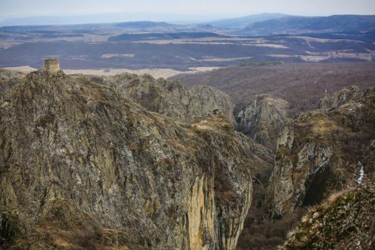
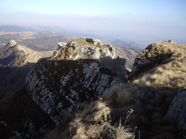
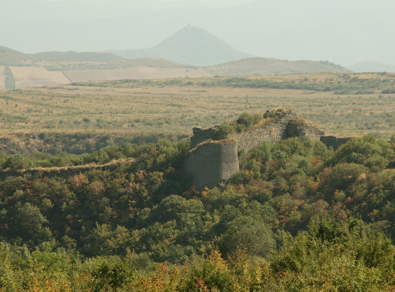
The ruined city occupies a naturally defensible rocky promontory where the Khrami and Chivchavi rivers meet. Steep ravines border two sides, while a wall closes the third. The nearly triangular archaeological area extends along the Khrami valley for about 2.5 kilometers, with a width of roughly 400 meters. Its citadel, the fortified core of a settlement, occupies the steep eastern end; the city lies to the west, with a walled fortress between them. The wider site includes churches, palaces, houses, a bridge over the Chivchavi, cisterns and other waterworks, bathhouses, a cemetery, and subsidiary buildings.
The citadel and inner fortress
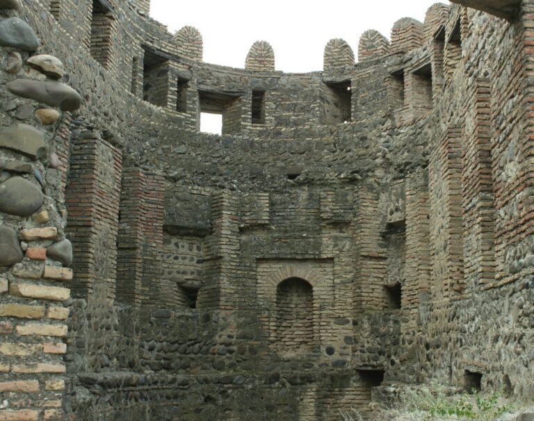
The citadel’s massive walls and towers enclose three larger churches. The inner citadel stands at the promontory’s narrowest point, between the two rivers, and protected the royal quarter from the west. Excavations southeast of a late-medieval bath revealed substantial walls running north to south. Later rooms reused these walls, and stone blocks and slabs paved the space between them. The later rooms occupied deposits containing earlier medieval material, a pattern thought to reflect clearance of the fortress during construction and the loss of later layers.
Finds from the inner citadel include locally made and imported ceramics, flakes of obsidian and flint, glass and metal objects, and abundant animal bone.
Churches
Samshvilde Sioni
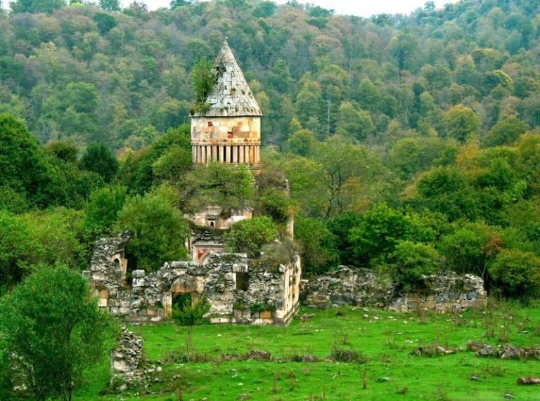
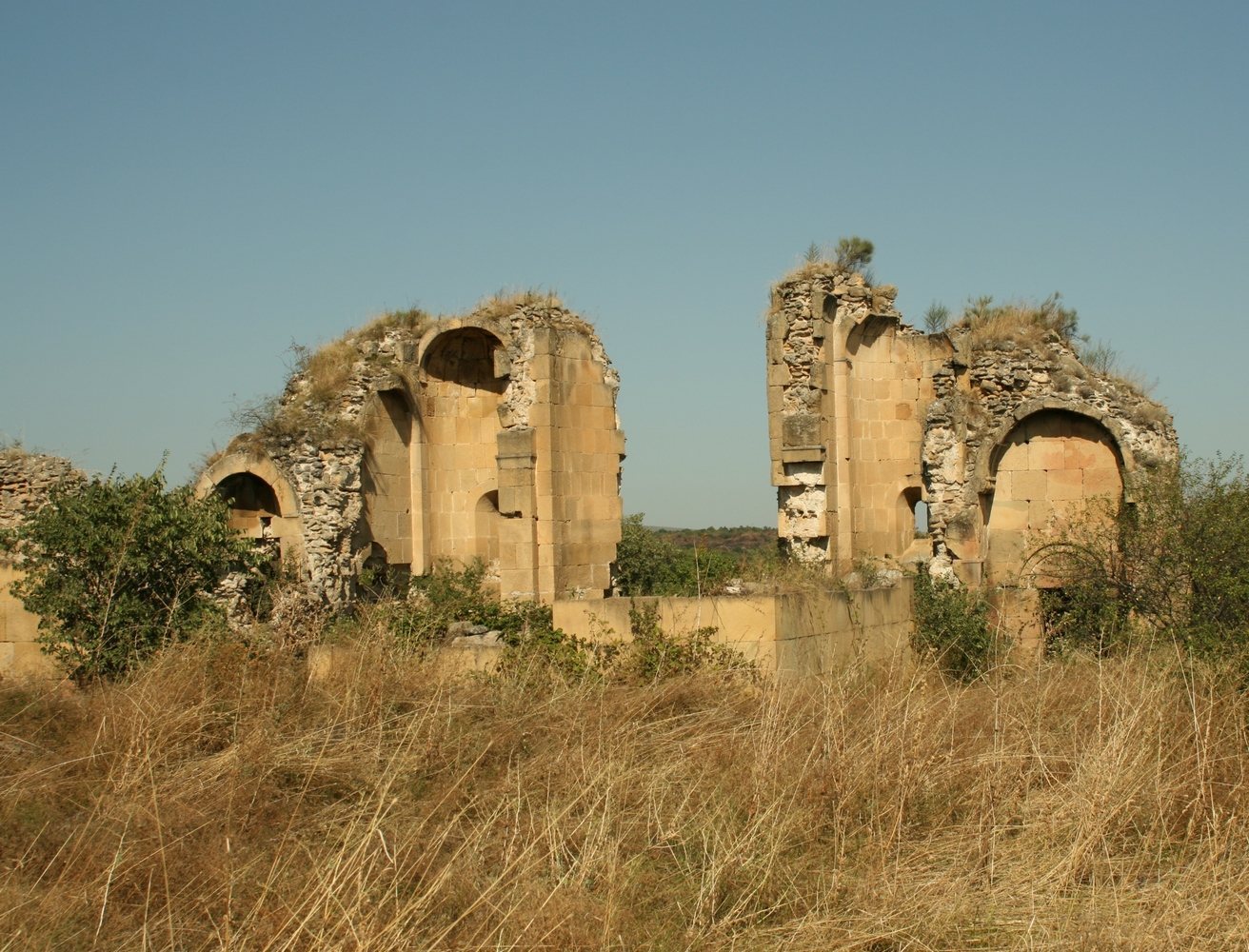
Samshvilde Sioni is a large, centrally domed episcopal church, meaning a church associated with a bishop, within the citadel. Its surviving building dates to 759-777. The better-preserved inscription on its eastern front names Byzantine emperors Constantine V and Leo IV. The eastern part of the church survives more fully than the rest, but the building is now in ruins. A damaged Georgian inscription on the southern front is accompanied by an Armenian fragment naming Gevorg III Loretsi, head of the Armenian Church from 1069 to 1072.
The church has an elongated rectangular plan aligned east to west. Its eastern end contains a sanctuary and two side rooms, each terminating in an apse, a projecting space often marking a church sanctuary. Four freestanding supports carried the dome. Long galleries ran along the northern and southern sides, each with a separate chapel at its eastern end. Niches flank the central window on the eastern front, with a second pair added beside them. The church’s strict forms, cut-stone wall surfaces, and restrained decoration connect it with Georgian architecture of the fourth through seventh centuries; its design particularly resembles the seventh-century church at Tsromi.
Other churches in the citadel
A medieval hall church, with one broad main space, stands east of Sioni, while a three-nave basilica, a church divided into three main spaces, stands to the west. Both reuse stones from Sioni. Built of dark basalt, the western basilica probably dates to the tenth or eleventh century and may have been an Armenian church. Another hall church has a projecting apse and a Georgian wall inscription that names King David IV.
St. George Church
The small hall church of St. George stands in the city proper and dates to the eleventh or twelfth century. Excavations revealed later burials, fragments of building ceramics, and an inner courtyard enclosed by a rough stone wall. Work at the church in 2014 recovered glazed ceramics from its construction period and other objects dating to the sixteenth and seventeenth centuries. The later material is linked to a rebuilding attributed to Zilikhan, formerly a caretaker of Queen Elena, wife of Vakhtang V of Kartli. A Georgian inscription dated 1672, now lost but published by Ekvtime Takaishvili, names Zilikhan as a renovator of the church.
Palati Church
Palati Church lies in the city’s central district; its original dedication is unknown. Excavation uncovered later-medieval material and large architectural fragments. A small tombstone bears a Georgian epitaph naming the buried child as Otari, son of Erasti. The art historian G. Gagoshidze considered Otari a member of the Kaphlanishvili-Orbelishvili family, buried in its own court church.
Church of the Dormition
A small stone church of the Dormition stands within the fortress walls. It contains a large prehistoric menhir, an upright stone, darkened by candle soot. A cross and an Armenian inscription from the eleventh century mark the stone; the inscription mentions Prince Smbat.
Theogenida Church
Theogenida Church overlooks the Khrami River and probably dates to the twelfth or thirteenth century. A tetralith, a structure formed from four large stones, stands nearby.
Prehistoric settlement and cemetery
Settlement and ritual building
Excavations on the southern slopes of Mount Karnkali in 1968-1970 revealed a settlement and a circular ritual building within two layers of the Kura-Araxes culture, an early Bronze Age culture of the South Caucasus. The earlier layer dates to the middle of the fourth millennium BC. Its collapsed building walls lay with simply shaped, archaic light-colored clay vessels and obsidian tools and flakes, some retouched and showing signs of use.
The later layer dates to the beginning of the third millennium BC. It contained the semicircular stone foundation of a circular ritual building with three walls, along with storage pits. Its pottery included dark and black vessels, some resembling examples from the earlier layer and cemetery, as well as vessels with hemispherical handles. Other finds included an obsidian arrowhead with a tang, used obsidian flakes, and hand-millstones.
Burials
The cemetery’s graves formed four rows and were aligned either east to west or north to south. Most were large rectangular family tombs built collectively in pits from stone slabs or boulders. The dead were placed with their limbs contracted. Two tombs associated with ritual attendants contained windowed obsidian vessels, vessels with astral symbols, and a bronze pin with a spiral head. Other grave goods included spiral temple rings and multi-coil pendants. Five graves from the feudal period were also identified.