Narikala: The Historic Fortress of Tbilisi
Site at a Glance
- Country
- Georgia
- Primary era
- Early Modern
- Eras represented
- Classical, Medieval, Early Modern
- Civilizations
- Georgian, Safavid, Sassanid, Umayyad
- Site type
- Military
- Remains
- Citadel
On this page10 sections
History
Narikala is a fortress on a long rocky ridge in southeastern Tbilisi, Georgia. Its origins are placed in the second half of the fourth century, during the reign of King Varaz-Bakur around AD 364. Georgian chronicles attribute its construction to an official of the Persian king, while another tradition credits King Vakhtang I Gorgasali.
Early fortress and Persian control
The earliest written notices of settlement at the site date to the latter half of the fourth century. One chronicle names the Persian official as Khram Khuar Borzard, and describes the fortress as his base for overseeing the king of Kartli from Mtskheta, the ancient capital of that historic Georgian kingdom. Persian forces controlled the fortress toward the end of the fourth century; Kartli’s kings had retaken it by the middle of the fifth.
Medieval stronghold
As Tbilisi grew during the second half of the sixth century, Narikala became more important to the city’s defense. It served as the principal defensive stronghold of the medieval city and suffered repeated destructive attacks. The Umayyads, an early Islamic ruling dynasty, enlarged it in the seventh century. King David the Builder, who ruled from 1089 to 1125, later strengthened and expanded the fortress.
Rebuilding and changing names
Reconstruction during the sixteenth and seventeenth centuries brought the fortress toward a form close to its later appearance. It was known by several names, including Kala, Rival Fortress, High Fortress, and Tbilisi Fortress. Narikala first appears as its name in the seventeenth century. The word, from Persian narin-kala, means citadel or inner fortress; it had also been used more generally for an inner stronghold before becoming attached specifically to the Tbilisi fortress.
During the rule of Rostom, a ruler of Kartli appointed by Iran’s Safavid dynasty, a wall built from the bridgehead to Kala separated the city from the fortress. Rostom ruled from 1632 to 1658, fortified the area around the stronghold, and transferred its control to the Iranians. The terms Lower Fortress and Upper Fortress arose in this period. The Ottoman traveler and writer Evliya Çelebi visited Tbilisi during Rostom’s reign and left a description of the fortress.
Damage and modern work
The fortress was badly damaged during the Battle of Krtsanisi in 1795. Parsadan and Stepane repaired walls destroyed in the fighting the following year. After the Russian Empire annexed the Kingdom of Kartli-Kakheti, Narikala lost its former strategic role and was used for a time to store Russian army ammunition.
An earthquake in 1827 damaged or brought down walls, bastions, and towers, including much of Istanbul Tower. In 1847, an explosion in a gunpowder store destroyed nearly all the fortress buildings, among them St Nicholas Church. Archaeological excavations took place in the 1960s through the 1980s, alongside restoration work in the 1970s and 1980s. Narikala received designation as a Cultural Heritage Monument of Georgia in 2007, a status recognizing it as a monument of national importance.
Remains
Ridge and layout
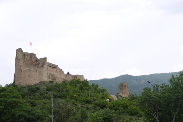
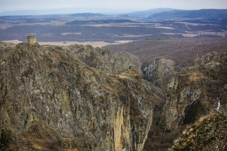
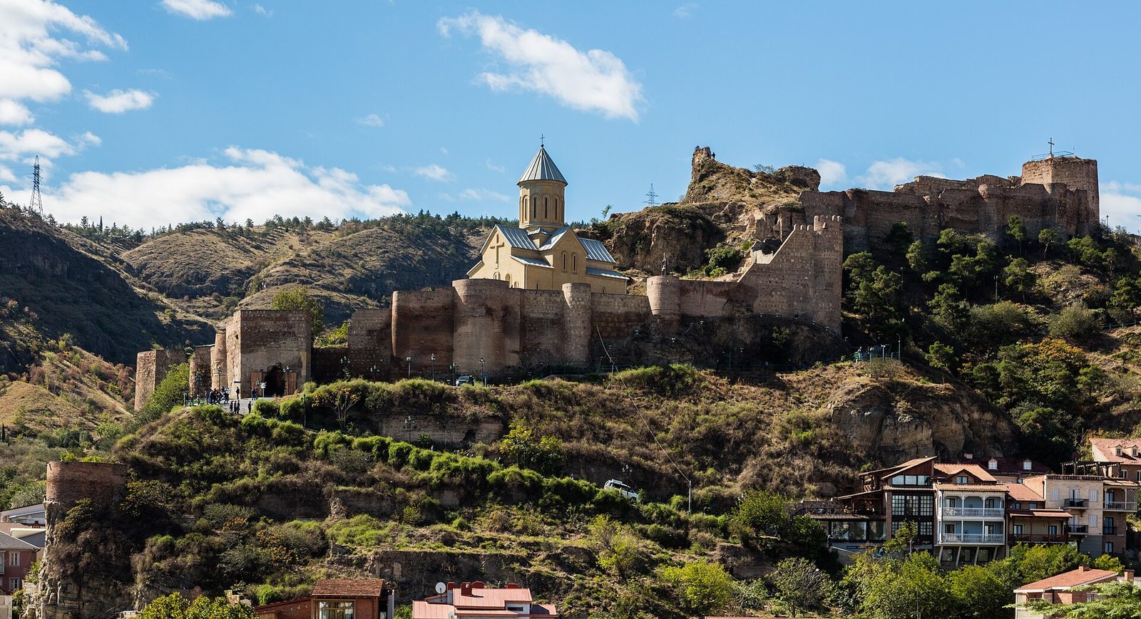
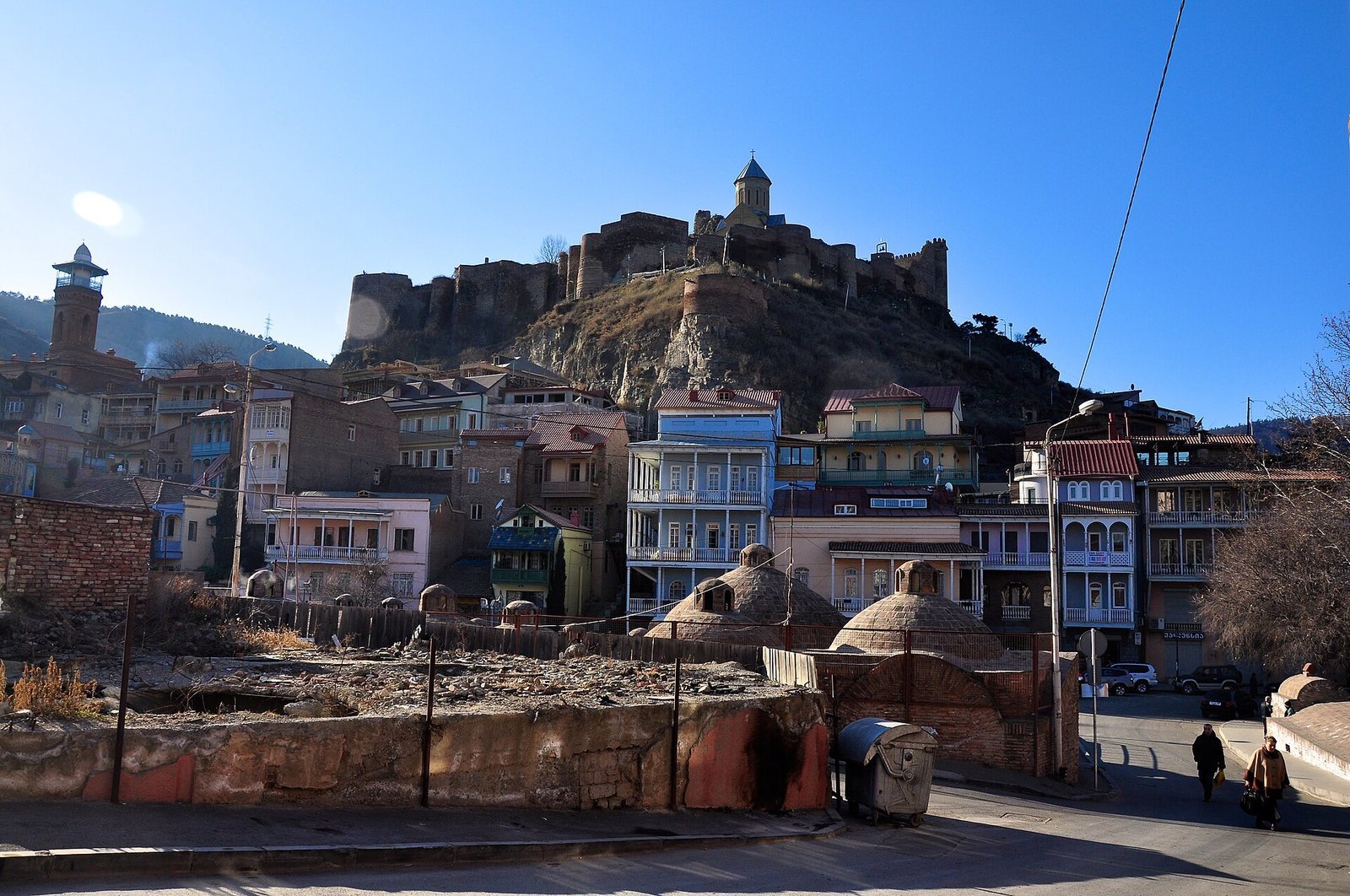
The fortress occupies a steep ridge between Tbilisi’s sulfur baths and Botanical Garden, overlooking the city and the Kura River. Two connected walled sections form its plan: a square eastern enclosure measuring 70 metres on each side and a western rectangle measuring 60 by 20 metres. The walls are 1.5 to 2 metres thick. The western approach was the easiest, so the citadel there received stronger defenses. Along the river, the walls descend in a line parallel to the water; together with Metekhi Fortress on the opposite bank, Narikala held a commanding position in the region.
Walls, gates, and towers
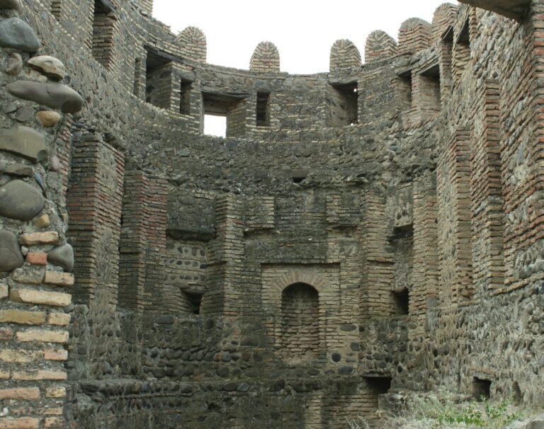
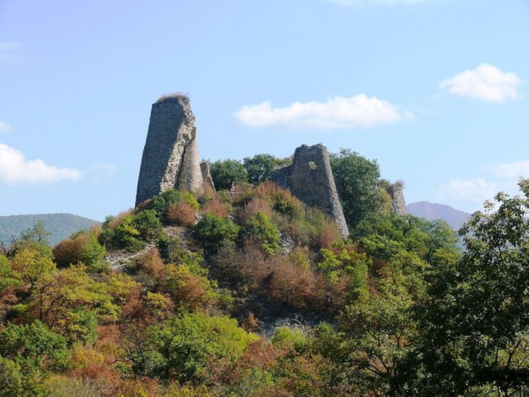
The surviving walls combine square Georgian bricks and rubble stone, bound with gypsum and lime mortar. Rebuilding over time left the wall and tower faces varied in appearance. Two gates remain: Ganja Gate faces the present botanical garden, while the larger entrance lies on the northeastern side. Near the larger gate is a substantial stretch of the oldest wall, built in the early medieval period from dressed stone blocks cut into regular shapes. Istanbul Tower, a four-sided structure built in the sixteenth century, stands at the western section’s highest point. Part of it survived into the 1980s, and it was relatively well preserved compared with other parts of the fortress. The massive outer shell of Shakhtakhti tower-fort also survived into that decade. The walls were additionally reinforced with round and rectangular towers and bastions, projecting defensive platforms.
Water system and historical descriptions
A channel and aqueduct carried water to the fortress; the aqueduct appears in a 1701 drawing of Tbilisi by Joseph Pitton de Tournefort. Vakhushti Bagrationi’s 1735 plans and Chuyko’s 1800 plans mark the fortress church. Vakhushti described a domed St Nicholas Church, a royal palace, and large, finely made halls. Evliya Çelebi’s account, which was somewhat exaggerated, gave the perimeter as 6,000 paces and the walls’ height as 60 cubits, a measure based approximately on forearm length that varied by standard. He also claimed there were 70 towers, 3,000 merlons (raised solid sections of a battlement), and 600 flat-roofed houses within the walls. His description included a ruler’s palace, a mosque, a caravanserai (an inn for traveling merchants), a bathhouse, a small market, and a water tower whose single opening faced the Kura and supplied drinking water during sieges. He also noted a natural hot spring east of the fortress.
Church and excavated finds
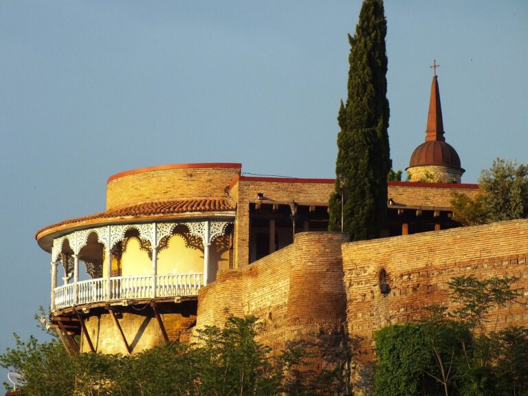
St Nicholas Church stands in the lower court, rebuilt on the foundations of an earlier church dated to the twelfth or thirteenth century. Its ruins were found in 1967, and the church was reconstructed in 1996–1997. The building has a cross-shaped plan, doors on three sides, and interior wall paintings depicting scenes from the Bible and Georgian history. Excavations in the fortress area uncovered remains of medieval buildings with different functions, the earlier church’s foundations, ceramics, glass, and coins. A Bronze Age dagger, dated to the thirteenth or twelfth century BC, was also found at the site.