Elosua-Plazentzia Megalithic Station: A Prehistoric Monument Complex in Gipuzkoa
Site at a Glance
- Popularity
- Low
- Country
- Spain
- Primary era
- Stone Age
- Eras represented
- Stone Age, Bronze Age, Modern
- Civilizations
- Spanish
- Site type
- Burial
- Remains
- Necropolis
On this page21 sections
History
The Elosua-Plazentzia Megalithic Station, popularly known as the Ruta de los Dólmenes, is a prehistoric monument complex on the Mazelaegi ridge in western Gipuzkoa, Spain. Its 19 megalithic monuments belong to periods ranging from the Neolithic through the Copper Age, also called the Chalcolithic, and the Bronze Age. The ridge connects the Deba and Urola valleys and served as a route between them over a long period.
Prehistoric use
The monuments reflect changing burial and settlement customs. Excavations found Bronze Age domestic features close to older funerary monuments, and in some places habitation activity extended into burial structures. This pattern suggests that people who had used the tombs for burial later established homes nearby, perhaps on a seasonal basis. Charred seeds, storage vessels, and tools for processing food point to the importance of plants and to farming and herding ways of life.
At Aizpuruko Zabala, an excavated Bronze Age dwelling stood beside a dolmen used for burial in an earlier period. The contrast between the older tomb and later domestic occupation suggests a change in how people regarded the monument and the surrounding landscape.
Research and protection
José Miguel de Barandiarán identified monuments in 1920 and 1921. He, Telesforo Aranzadi, and Enrique Eguren studied the area in 1921 and 1922. The number of known monuments grew from 16 in 1921 to 17 in 2010 and 19 in 2020. Looting took place both in the search for legendary treasure and to obtain stone, particularly slabs from burial chambers.
Later work included further studies of individual monuments and excavations by the Aranzadi Science Society. In the 2010s, local municipalities and the Debabarrena Economic Development Society began a programme to record, conserve, monitor, and explain the monuments alongside the area’s natural and ethnographic heritage. In 2014, Aranzadi proposed additional excavations and test trenches around Karakate and Pagobakar. The complex received Spain’s Asset of Cultural Interest designation as a Monumental Complex in 2003; regional planning also recognizes the area for its natural and archaeological value.
Local traditions
Crosses at Irukurutzeta and Pagobedeinkatua were associated with pilgrimages and masses held on the Sunday after 3 September. At dusk, a local resident was said to ride a horse three times around the crosses to prevent hail and protect the harvest. Treasure stories also attached to the ridge. One described twelve chests of gold between Irukurutzeta and Elgoibar, with eleven hidden in stone mounds. Another told of a horned, human-shaped creature and a bell filled with gold between Pagobedeinkatua and Elgoibar.
Remains
The monuments follow the crest of the Mazelaegi ridge between Karakate and Irukurutzeta, at about 800 metres above sea level. The wider route extends for roughly 20 kilometres, including 11 kilometres along the ridge. Its high points include Karakate, Akelarre, Atxolin, and Irukurutzeta. The landscape combines farmed land, conifer plantations, beech woods, grassland, bracken, gorse, and heather. Local volcanic rock includes pillow lavas, rounded forms created as lava cools underwater; sandy limestone, marl, and marly limestone also occur, especially to the west. The monuments include dolmens, prehistoric tombs formed from upright stones and a covering slab; tumuli, burial mounds; smaller stone burial chambers called cists; and a menhir, a large standing stone.
Karakate to Kurutzebakar
Gizaburuaga
Gizaburuaga, also known as Gizaburua, is an 11-metre-wide mound, 0.5 metres high, surrounding a chamber measuring 1.7 by 1.6 metres. Two chamber slabs survive, one reset during later work. Excavations in 2016 and 2017 found pottery from at least four vessels, flint tools and fragments, human bone, ash, charcoal, metal ornaments, stone beads, quartz crystals, a sharpening stone, and a component from a bow. The chamber’s history includes activity in both Neolithic and Bronze Age periods.
Idoia
Beside the summit of Idoia, the monument has a mound 9 metres across and 0.75 metres high. A surviving chamber slab measures 1.8 metres high and 1.7 metres wide. Excavation recovered three handmade pottery fragments. The surrounding terrain includes woodland, water, and an open area.
Sabua
This Bronze Age cist stands on a clearing between Atxolin and Idoia. Its irregular mound, made from soil, slabs, and basalt blocks, measures 7.5 by 6.2 metres and reaches 0.5 metres in height. Excavation in 2019 identified a collapsed chamber at the centre, about 1.5 by 1 metre and 0.5 metres high, with an east–west orientation. It was built against a natural rock outcrop. Finds included a flint flake and a boat-shaped hand mill made of sandstone.
Atxolin and Atxolintxiki
On Atxolin’s summit, the dolmen has a basalt mound 7 metres across and 0.8 metres high, with one surviving chamber slab measuring 1 by 0.6 metres. About 150 metres from the summit, Atxolintxiki I is an 11-metre-wide basalt mound, 0.95 metres high, with a 0.6-metre-deep hollow at its centre. Nearby, Atxolintxiki II has a 5-metre-wide mound and a small chamber measuring 1 by 0.6 metres. A beech tree has grown over that chamber.
Azkoin, Pagobedeinkatua, Nasikogoena, and Kurutzebakar
On Atxolin’s southeastern slope, Azkoin has a basalt mound 16 metres across and 1.2 metres high. A hollow at its centre measures 3 metres across and 0.7 metres deep; an early investigation recovered a flint piece. Pagobedeinkatua, at the pass between Atxolin and Kurutzebakar, has an 8.5-metre-wide mound, 0.8 metres high, with a central hollow. Flint pieces were recovered beside it. Between the pass and Kurutzebakar, Nasikogoena has a mound 9 metres across and 1.5 metres high, with a depression measuring 7.5 by 2 metres.
Beside the summit of Kurutzebakar, the mound measures 10 metres across and 0.8 metres high. A central crater, 3 metres across and 0.9 metres deep, marks the chamber area. Finds include a prehistoric quartz crystal, a gunflint, and a modern bullet.
Irukurutzeta and its southern slopes
Arribiribilleta
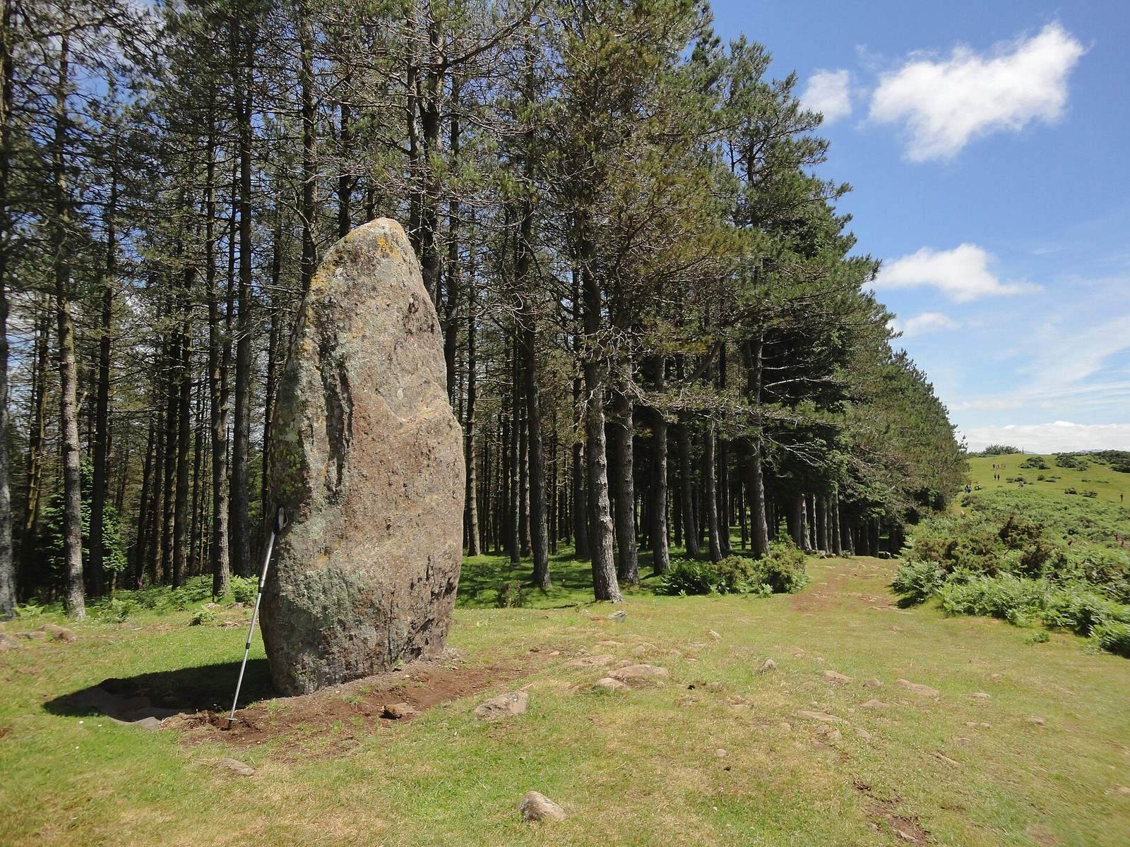
At the summit of Kurutzezarra on Mount Irukurutzeta, the Arribiribilleta menhir is a basalt monolith measuring 3.6 metres long, 1.7 metres wide, and 0.4 metres thick. It lies on a northwest–southeast axis and was brought from an estimated distance of 2 to 3 kilometres. Its original socket measures 1.9 by 1.3 metres and is 0.6 metres deep. After being found fallen, the stone was raised again at its original location in April 2014. It also served as a boundary marker between Elgoibar and Bergara. Nearby charcoal and roof-tile fragments are consistent with ceremonies marking the boundary.
Irukurutzeta dolmen
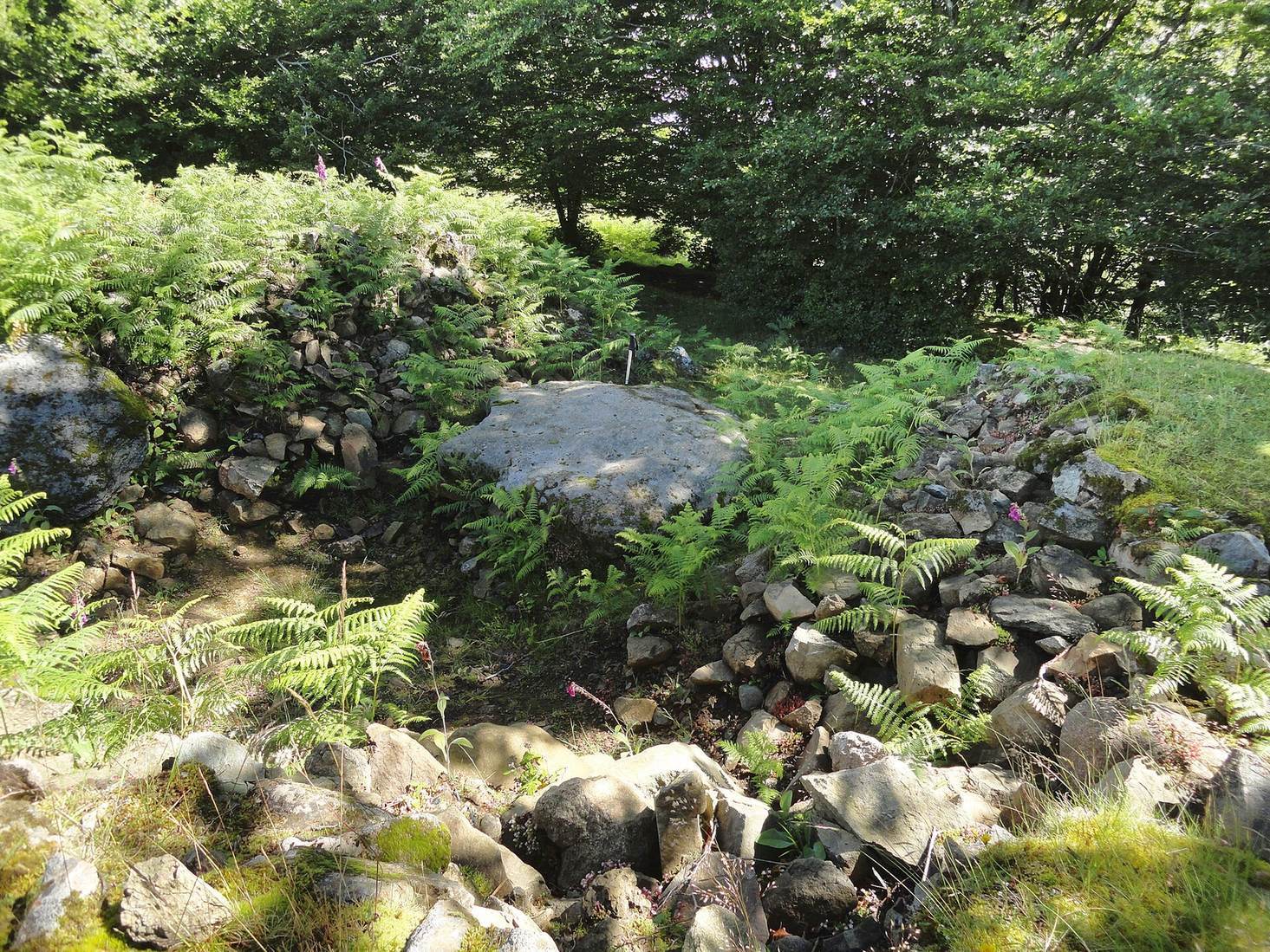
The dolmen has a local-basalt mound 19 metres across and 1.8 metres high. Its chamber is set off-centre, and a central crater measures 5.5 by 4 metres and 0.65 metres deep. In 2019, workers raised the surviving chamber slab and filled excavation hollows with soil. Finds from different investigations include flint tools, a barbed arrowhead, rock-crystal and pottery fragments, and a stone necklace bead. Later material includes glass, earthenware and porcelain, fragments of clay pipes, and lead bullets.
Aizpuruko Zabala
On the southern slope of Kurutzebakar, this dolmen has a basalt mound 15 metres across and between 0.4 and 1.5 metres high. Its stones are arranged in crosswise and radiating layers, with overlaps that help stabilize the mound. A central hollow measures 3.5 metres across and 0.5 metres deep. Earlier investigations described an east–west chamber about 2 metres long, with slabs along its southern, eastern, and northeastern sides.
At the mound’s northeastern edge, excavations in 2020 and 2021 uncovered a semi-subterranean Bronze Age dwelling oriented northwest–southeast. It extended at least 4 by 1.5 metres, and its floor lay 0.4 metres below ground. A basin-shaped hearth at its southeastern end contained charcoal and carbonized acorns. Finds from the dolmen and dwelling area include handmade pottery, flint and volcanic-silica tools, a sandstone polisher, stone necklace beads, a limonite pendant, and tools for processing food. Some pottery carries impressions, applied clay decoration, or incisions.
Kerexeta
At Kerexeta pass on Irukurutzeta’s southern slope, the surviving basalt mound measures 17 metres across and 0.3 metres high. A central hollow reaches 0.5 metres deep, and a nearby slab may have formed part of the chamber. The mound was recorded at a greater height in 1921. Finds include a prehistoric flint blade and flint splinter, as well as lead, slag, animal remains, and modern pottery fragments.
Leiopago and the Elosua area
Kerexetaegia North and South
Kerexetaegia North stands on a plain on Mount Leiopago. Its basalt mound measures 9 to 11 metres across and 0.8 metres high, with a central hollow 0.7 metres deep. A bone necklace was recovered during the 1921 excavation. Nearby, Kerexetaegia South has a local-basalt mound 17 metres across and 1.8 metres high, enclosing a chamber about 2 by 1.5 metres. A large crater and a trench extend eastward across the mound. Excavations identified chamber slabs, and restoration work in 1980 and 2018 shaped the monument’s present form. Finds include a polished stone axe, an arrowhead, flint, pottery, rock crystal, and abrasive stones.
Maurketa
At Maurketa pass, the basalt mound measures 16.5 metres across and 1.6 metres high. Its central hollow is 5 metres across and 1.3 metres deep. Excavation recovered three necklaces, one made of bone and two of stone, together with worked flint and a quartz crystal.
Frantsesbasoa
Discovered in 2011 and excavated in 2019, this cist has a damaged mound about 6 metres across and 0.4 metres high, built from basalt blocks and cobbles over natural ground. Three chamber slabs define a space 1.5 metres long and 0.6 metres wide. Two slabs were reset during excavation. Finds include flint flakes and blade fragments, a volcanic-glass flake, and rock-crystal prisms.
Agerreburu
Agerreburu is the complex’s fully restored monument. Its mound, made of local basalt and marly limestone, is 11.5 metres across and 0.75 metres high. The trapezoidal chamber measures about 1.8 by 1.2 metres and is 1.2 metres high. Three of its five slabs remain in their original positions, defining the north, south, and west sides; the chamber’s long axis runs northwest–southeast. Excavations in 2019 recovered human and animal bone, pottery, ochre, rock crystal, a polished stone axe, necklace beads, and flint flakes. The original slabs were returned to position in 2021. The reconstructed cover slab is held together with rods and resin and rests on a steel frame.