Roman Bridge: The Roman Crossing of the Moselle at Trier
Site at a Glance
- Popularity
- Very High
- Country
- Germany
- Primary era
- Classical
- Eras represented
- Classical, Medieval, Early Modern, Modern
- Civilizations
- German, Holy Roman Empire, Roman
- Site type
- Infrastructure
- Remains
- Bridge
On this page8 sections
History
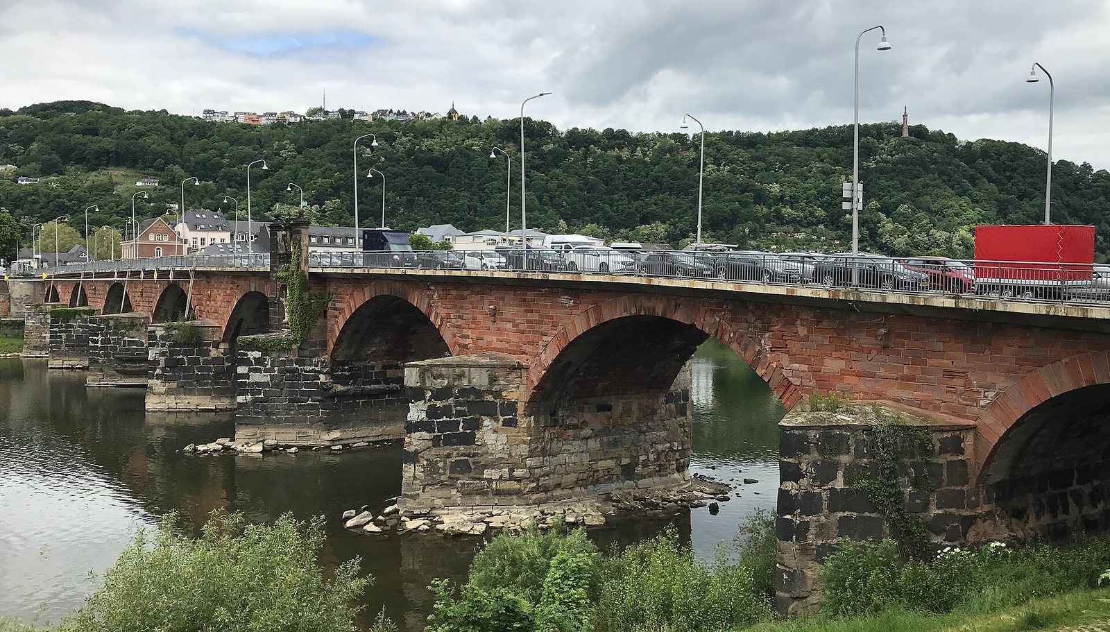
The Roman Bridge, also known as the Old Moselle Bridge, crosses the Moselle in Trier, Germany, at the site of the Roman city of Augusta Treverorum. Its surviving Roman piers date to the mid-second century AD, and the bridge is regarded as Germany’s oldest surviving bridge and the oldest Roman bridge north of the Alps.
Roman crossings
A wooden bridge stood here by about 18–17 BC. Tree-ring analysis of its timber piles, carried out in 1963, established their date. A stone bridge was built slightly downstream in the first century AD. The piers of the present Roman bridge, the third crossing at this location since the city’s foundation, were built in the mid-second century.
In Roman times, people threw coins from the bridge into the Moselle as good-luck offerings. About one million coins may still lie concealed in the riverbed.
Medieval and early modern changes
Stone arches were added sometime between 1190 and 1490, possibly during the tenure of Baldwin of Luxembourg (1307–1354), the Archbishop-Elector of Trier. An elector was a prince entitled to take part in choosing the Holy Roman Emperor. French troops destroyed the bridge in 1689. Its arches were rebuilt between 1716 and 1718 by Johann Georg Judas, a carpenter at the Elector of Trier’s court. The western gate was removed in 1806 and the eastern gate in 1869.
Modern history
The bridge was widened in 1931. On 2 March 1945, American troops crossed it intact to reach western Trier. German troops had not demolished it, for reasons that remain unclear. One eyewitness thought debris may have damaged the cables meant to set off the explosives. Extensive archaeological investigations followed the Second World War during work to canalize the Moselle. Since 1986, the bridge has formed part of the UNESCO World Heritage property “Roman Monuments, Cathedral of St Peter and Church of Our Lady in Trier.”
Remains
Roman piers and timber crossing
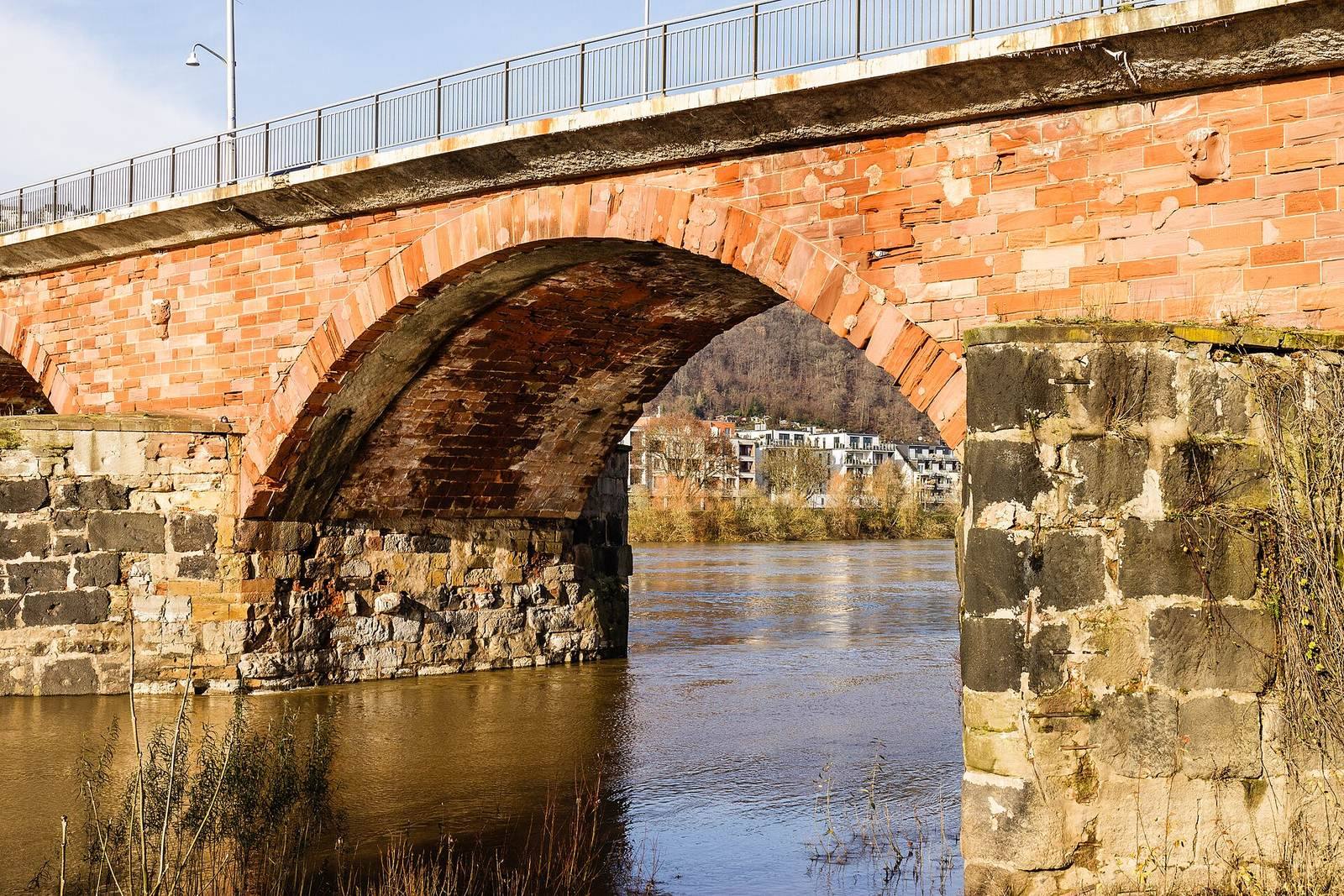
The bridge is 198 metres long and 13 metres wide. Nine Roman stone piers survive; the two nearest the city are buried beneath the bank embankment, following an alteration in Roman times. Builders founded the piers in the riverbed using watertight enclosures made from interlocking piles. The piers are formed from basalt and bluestone blocks, some quarried around the former Hohe Buche volcano in the eastern Eifel. Pointed projections on their upstream faces split the current and helped protect the piers from floods and ice. The piers once carried a timber structure braced with tie rods, with each span supported roughly like a trestle. Its roadway was about 10 metres wide and stood around 14 metres above the river at normal water level. That clearance allowed downstream vessels to keep their masts raised, while boats heading upstream had to be hauled against the current.
Earlier bridge and later arches
The first stone bridge stood slightly downstream of the present crossing. The upper ends of its piles can be seen when the river is low. The arches that now connect the Roman piers belong to the medieval and later bridge. A gate called Porta Inclyta was also part of the bridge; it was demolished in the Middle Ages. Its position on one bank or the other remains unresolved. It was described as resembling Trier’s Porta Nigra, a surviving Roman city gate. A crucifix and a statue of Saint Nicholas, a Christian bishop venerated as a saint, were placed on the fifth pier from the west in 1716–1718.
Widened roadway
The 1931 widening added projecting walkways for pedestrians, which remain a defining part of the bridge’s structure.