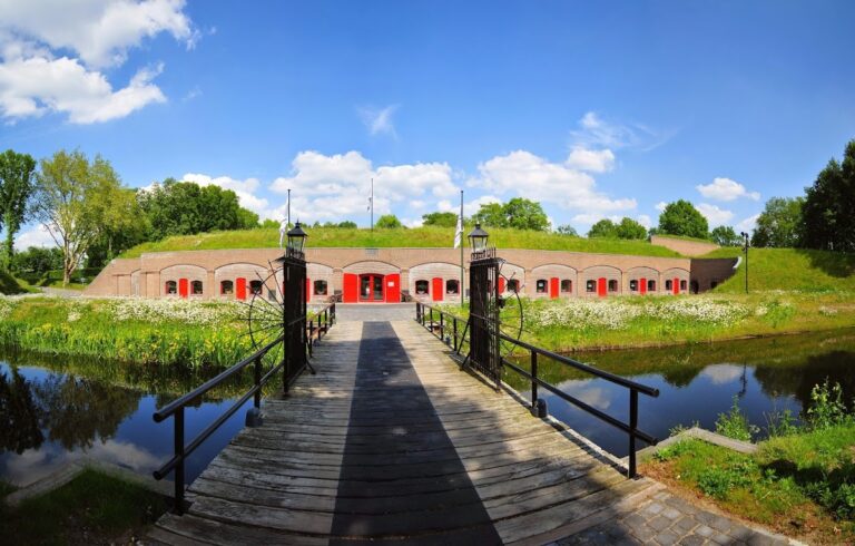
Rijnauwen Fort: An Advanced Dutch Waterline Fort near Utrecht


Site at a Glance
- Rating
- 4.4
- Popularity
- Low
- Country
- Netherlands
- Primary era
- Modern
- External website
- Open
- Eras represented
- Modern
- Civilizations
- Dutch
- Site type
- Military
- Remains
- Fort
On this page14 sections
History
Rijnauwen Fort is a Dutch fort in Bunnik, Netherlands, built in 1867–1869 as part of the Nieuwe Hollandse Waterlinie, a defense line that combined forts with controlled flooding. It was one of the advanced forts east of Utrecht and was designed in the modern polygonal system. Its principal task was to close the Houtense Vlakte, an area of higher ground that could not be completely inundated, while shielding the defenses behind it and Utrecht from artillery fire.
Construction and defensive purpose
The fort also guarded the main route through the inundation line across the Houtense Vlakte. Its position was intended to make an attacking army place its artillery farther from Utrecht and expand the area required for a siege. The fort could support troops in the forefield, cover retreating soldiers while they regrouped, and fire toward and behind the woodland west of De Bilt. It was also meant to hinder attacks on the forts at the Biltstraat and Voordorpschendijk, protect the flank of Fort Vechten and the work at Hoofddijk, and help Dutch forces cross the Kromme Rijn while obstructing enemy crossings north of the Rhine Railway. Fort Vechten had a comparable role, and Rijnauwen was specifically positioned to protect its flank.
The construction contract was signed in December 1868 with P.J. Lienders of Middelburg. Building the fort cost 766,242 guilders, and acquiring the land added 142,338 guilders. The permanent garrison comprised 19 officers, 32 non-commissioned officers, 515 corporals and soldiers, and one laundress. Supplies included emergency rations for 17 days for both the fort and its inner stronghold, the reduit.
Modernization before the Second World War
The Franco-Prussian War of 1870–1871, fought between France and Prussia and its German allies, prompted changes to Dutch fortifications. At Rijnauwen, a large bombproof barracks was built in 1877 between Flank Batteries 3 and 4. In 1879, the two protected entrance passages, or poternes, were converted into guard buildings. These improvements cost approximately 337,141 guilders.
During the mobilization of 1914–1918, concrete group shelters were constructed between Rijnauwen and Fort Vechten. A further modernization in 1939 added a Type G cupola casemate, a fortified gun chamber protected by an armored dome, together with several pyramid-type group shelters.
Wartime use and later management
German forces used the fort as an ammunition store during the Second World War. From 1942, Dutch and Belgian resistance fighters were executed there, including eleven members of the Erkens organization, a Dutch and Belgian resistance group, on 9 October 1943. The total number of victims is uncertain, with estimates ranging from 250 to 500, while the names of 54 victims have been established.
Canadian forces liberated the fort and its surroundings in May 1945. German ammunition and weapons remained on the site, and experiments by Canadian soldiers caused an explosion in the right rear bastion of the reduit. For many years, this blast was thought to have caused the bastion’s major roof and floor cracks. Research in 2018 and correspondence between two engineering departments instead linked the damage to settlement and subsidence, probably associated with an old water-bearing meander of the Rhine. The bastion had begun to sink and crack only two years after construction. Measures taken at the time included placing fascines in the moat, removing part of its earth cover, and lowering the crest by about one metre.
After the Canadians left, the fort continued in military use as an ammunition store. The 421 Regional Ammunition Workshop made ammunition safe before it was carried by truck to an inland vessel at Utrecht’s Kernkade. On 12 June 1967, a fire in an ammunition case aboard the vessel caused a major explosion. Two civilians died and about 140 people were injured. The ship and nearby buildings sustained extensive damage. An investigation concluded that procedures had been followed and that a defective incendiary grenade probably started the fire during transport.
Staatsbosbeheer took over management of the grounds in 1975. The fort is now used mainly as a nature area, while parts of the complex serve offices, storage, meetings, and conferences. It has protected-monument status under monument number 531112.
Remains
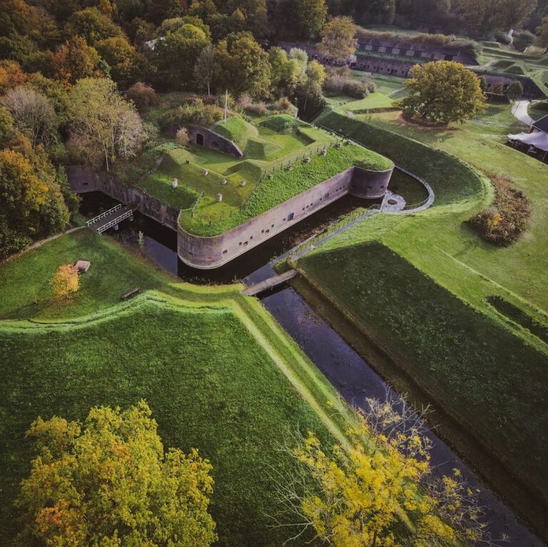
Rijnauwen Fort covers 32 hectares and is the largest fort in the Nieuwe Hollandse Waterlinie. Its front extends 360 metres along the side facing the road between Zeist and De Bilt. The right flank is 240 metres long, the left flank 195 metres, and the rear, or gorge front, 420 metres long with a recessed angle. Moats surround the fort, while flank batteries and a caponnière, a fortified position beside a moat, provided fire along the water defenses.
Inner stronghold and moat defenses
Reduit
The reduit is a pentagonal inner stronghold built of brick masonry and surrounded by its own moat. Loopholes pierce its outer walls, and a broad central passage runs through the structure. Its thick walls were designed to protect the garrison if other parts of the fort were captured, while guns could fire at an enemy inside the wider fort. The reduit had its own kitchen, drinking-water supply, accommodation rooms, and magazines, allowing it to continue resisting for an extended period.
The fort’s moat defenses included flank batteries and a caponnière. These positions allowed defenders to sweep the moats with canister shot from 15-centimetre smooth-bore howitzers. Guns in the reduit covered the gorge moat. The rear-right bastion of the reduit retains the effects of settlement and subsidence in its roof and floors, and the earlier measures to reduce the pressure on the structure shaped its later form.
Entrances and covered military buildings
Entrance guard buildings
Rijnauwen originally had two entrance poternes, protected passages through the fortification. Both were converted into guard buildings during the modernization of 1879, changing the arrangement of the entrances while retaining their role within the defended complex.
Bombproof barracks
The large bombproof barracks built in 1877 was designed to protect people and supplies from artillery fire. It could accommodate five officers, ten non-commissioned officers, and 197 enlisted men. The building also held 35,200 kilograms of gunpowder and 15 square metres of projectile storage. Magazines and gun remises occupied the first and second floors. The buildings were made of brick and largely covered with earth, while later additions used lime-trass concrete, a material more resistant to shell impacts.
Twentieth-century shelters and commemorative features
Group shelters and cupola casemate
The concrete group shelters built between Rijnauwen and Fort Vechten during the 1914–1918 mobilization remain visible in the landscape between De Uithof and Bunnik. The 1939 modernization added a Type G cupola casemate. One pyramid-type group shelter stands on the fort behind and to the left of the casemate, while other shelters lie on the glacis, the sloping outer earthwork covering the approaches. One of these still lacks a roof.
Execution memorial
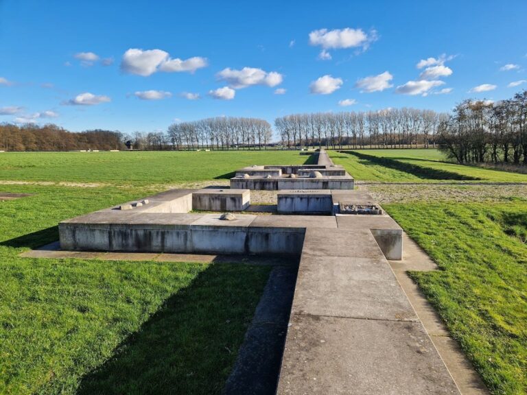
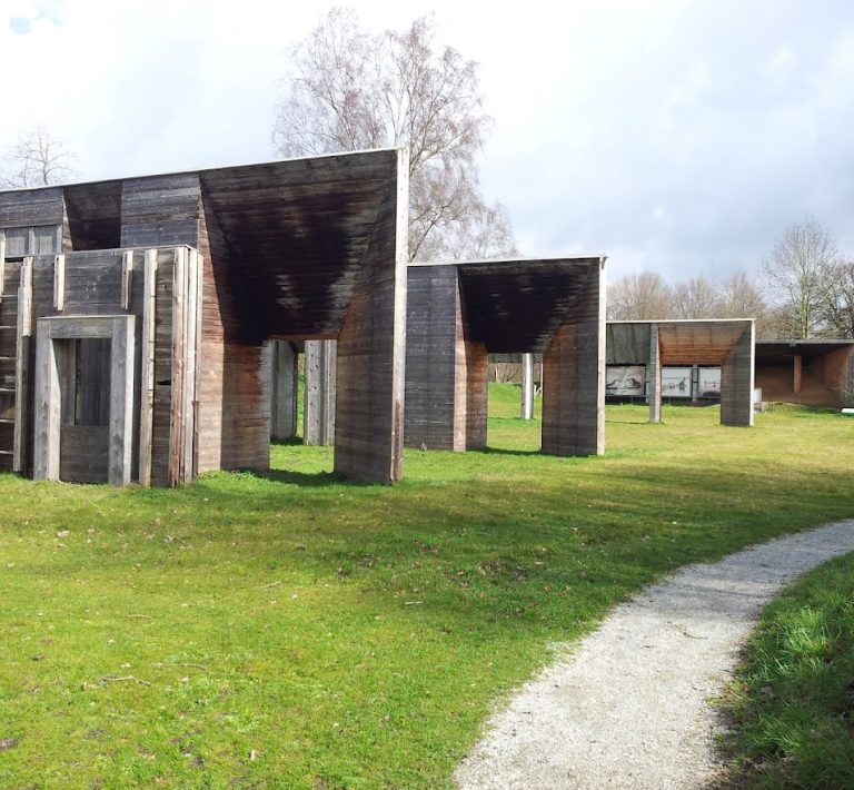
The memorial to the executed resistance fighters includes 54 commemorative stones for identified victims and a bell mounted in a bell stand. The stand’s four corner posts have different lengths, representing the different ages of those executed. Their rough ends symbolize the harsh endings of their lives. During the annual 4 May remembrance, a silent procession travels from the Ridderhofstad, a historic fortified manor house, to the memorial as its bell rings.
Rhijnauwen Tea House
The nearby Rhijnauwen Tea House, also called the Pancake House, is entirely wooden because it was built within the fort’s prohibited zones.
Nearby sites