Qasr Ibrim: A Multiperiod Fortress and Religious Center in Egypt
Site at a Glance
- Rating
- 4.6
- Popularity
- Very Low
- Country
- Egypt
- Primary era
- Medieval
- Eras represented
- Bronze Age, Iron Age, Classical, Medieval, Early Modern
- Civilizations
- Christian Nubian Kingdoms, Egyptian, Kushite, Ottoman, Roman
- Site type
- City
On this page18 sections
History
Qasr Ibrim is an archaeological site in Lower Nubia, in Aswan Governorate, Egypt, whose occupation developed through Egyptian, Kushite, Roman, Christian Nubian, Islamic, and Ottoman phases. New Kingdom installations appeared around the site, while settled occupation lasted from at least the Late Period, possibly as early as the eighth century BC, until the settlement was abandoned in 1812–1813. Its successive roles as an administrative settlement, religious and political center, frontier fortress, episcopal city, and military garrison reflect the changing power of the Nile region between Egypt and the Kushite kingdoms.
Egyptian and Kushite foundations
During the New Kingdom, Egyptian officials established chapels and shrines in the cliffs around Qasr Ibrim. These installations were associated with Hatshepsut, Thutmose III, Amenhotep III, and Ramesses II. The earliest inscription found at the site is a stela from the reign of Amenhotep I. It was later reused in a cathedral crypt and is now held by the British Museum. A cartouche of Thutmose II and an inscription naming Amenemope were also found at Qasr Ibrim.
Fortifications were added during the late New Kingdom or the Third Intermediate Period. They may have been connected with the civil war initiated by Panehesy, the viceroy of Nubia, during the reign of Ramesses XI. By the Twenty-fifth Dynasty, Qasr Ibrim was a fortified settlement known in Meroitic contexts as Pedeme. Around 680 BC, King Taharqa built a mud-brick temple dedicated to Amun. A stela naming Queen Amanishakheto and Prince Akinidad was probably intended as a donation to that temple.
A fortified urban settlement was probably established by local Nubians in the second century BC. Under Kushite rule, Qasr Ibrim became a major religious center and pilgrimage destination, with temples, religious officials, oracles, and burials for religious dignitaries. It also served as the capital of a small autonomous state that emerged after the collapse of the Meroitic kingdom. This state maintained both conflicts and diplomatic relations with neighboring powers and Roman Egypt.
Roman occupation and post-Kushite kingdoms
Rome occupied Qasr Ibrim during its conflict with Meroe in the late first century BC. After Gaius Cornelius Gallus defeated the Kushites, a Roman garrison was installed around 30 BC. Kushite attacks in 24 BC led Petronius to reinforce the garrison to approximately 400 men. The Romans called the settlement Primis, incorporated it into Roman Egypt, and used it to defend the southern frontier. The fortress was probably held until approximately AD 100 or later.
After Roman withdrawal and the collapse of Kushite power in the fourth century, Blemmyes and Nobates contested control of the region. King Silko of Nobatia defeated his rivals in the first half of the fifth century, and the Nobates made Qasr Ibrim their capital before transferring the capital to Faras. Christianity reached the settlement in the sixth century, when temples began to be converted into churches. Qasr Ibrim became a major Christian center in Lower Nubia, first as the capital of Nobatia and later as the seat of the Eparch of Nobatia, the province’s senior governor, within the kingdom of Makuria.
The city was an episcopal center from the seventh century. Its bishops maintained their cathedral there until the fourteenth century, while the settlement also served as a religious center, pilgrimage destination, administrative center, and residence of the Eparch. Several churches occupied the fortified area, including one associated with a small monastic complex. Domestic activity may have been concentrated outside the fortifications.
Military occupation and abandonment
In 1172–1173, Saladin, founder of the Ayyubid dynasty in Egypt and Syria, sent an army commanded by his brother Turan-Shah against Nubia after Nubian forces attacked Upper Egypt. Turan-Shah occupied Qasr Ibrim, seized supplies, weapons, and ammunition, and used the fortress to imprison captives. His forces also attacked Faras and killed its bishop. During the following two years, the cathedral was converted into a mosque, and Muslim forces used Qasr Ibrim as a base for raids before withdrawing to Egypt.
Qasr Ibrim was temporarily granted as a fief to Ibrahim al-Kurdi, who occupied it with a Kurdish contingent. The Kurds withdrew in 1175, after which Nubians reoccupied the city, rebuilt its fortifications, and restored its administrative role. The arrival and settlement of the Banu Kanz contributed to the spread of Islam and Arabic in the region, while Makurian control over Nobatia weakened. Christian communities continued at Qasr Ibrim. Two writings dated 1372 by Bishop Timotheos, one in Coptic and one in Arabic, were found with his cross-staff in his tomb. From the fourteenth century, fortified houses were built inside the settlement, probably reflecting growing regional insecurity.
During the sixteenth century, Ottoman forces under General Özdémir Pasha captured Qasr Ibrim. A Bosnian garrison was installed, the cathedral became a mosque, and the walls were strengthened. The settlement became the capital of an Ottoman-administered province. Bosnian soldiers remained until 1811, when Mamluk forces expelled them. Ibrahim Pasha expelled the Mamluks in 1812, after which Qasr Ibrim was abandoned.
Flooding and archaeological investigation
Ugo Monneret de Villard described Qasr Ibrim in the early twentieth century, and the site was first studied in 1908. David Randall-MacIver and Leonard Woolley then conducted excavations for the University of Pennsylvania between 1908 and 1911. The Egypt Exploration Society began sustained excavation in 1963 as part of the international Nubian salvage campaign associated with the Aswan High Dam. Work led by J. Martin Plumley and Herbert Thomson continued under William Y. Adams from 1976 and was later directed by John Alexander, Mark Horton, and Pamela J. Rose. Archaeological work continued until 2006, while the discovery and study of texts continued afterward. A University of Würzburg project worked from 1964 on deciphering Meroitic texts.
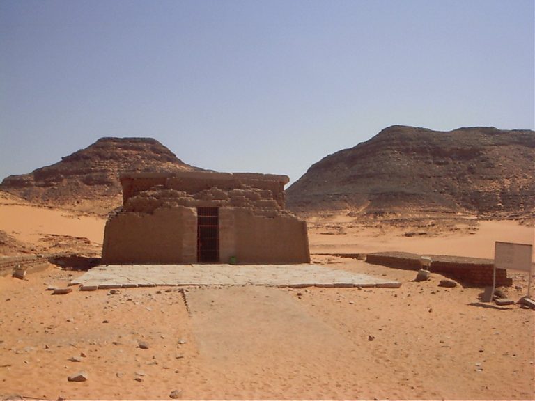
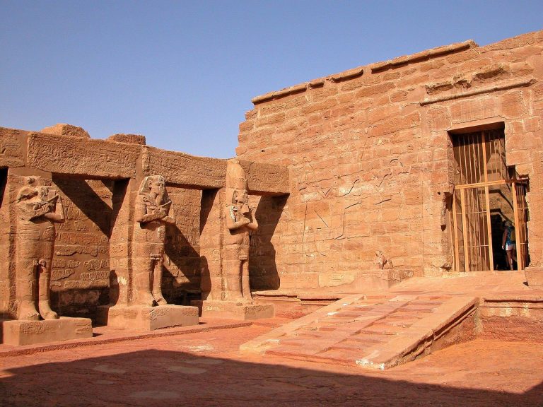
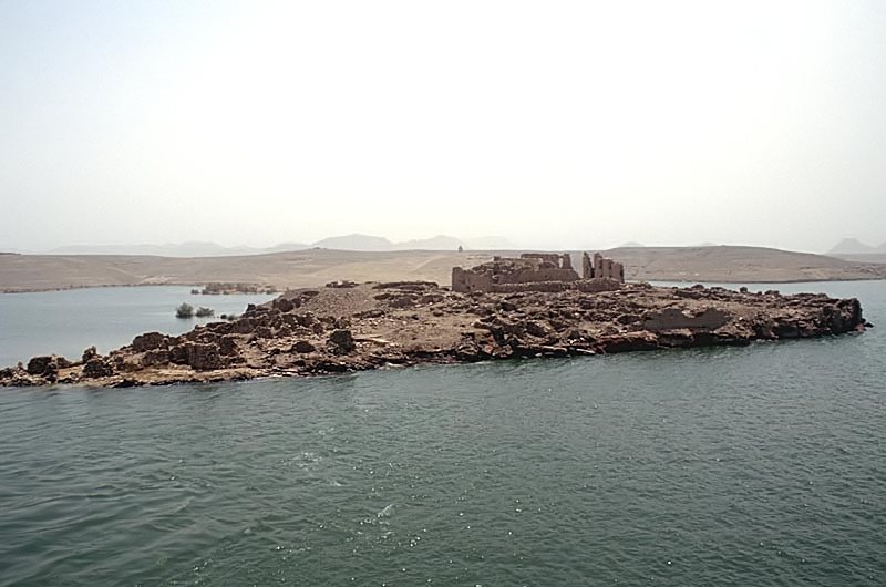
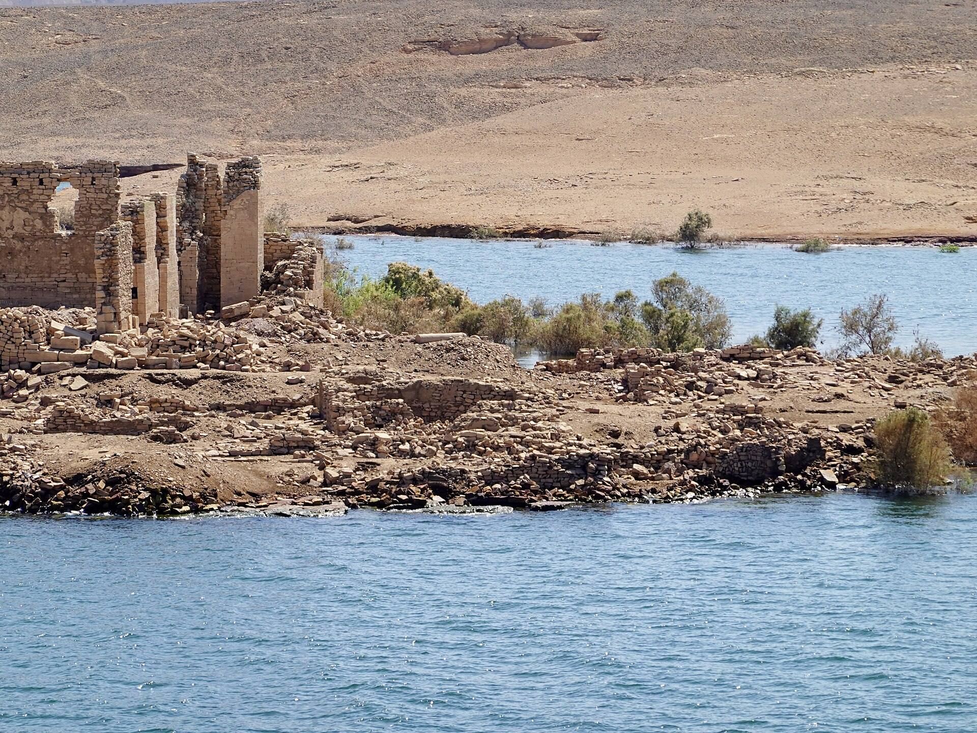
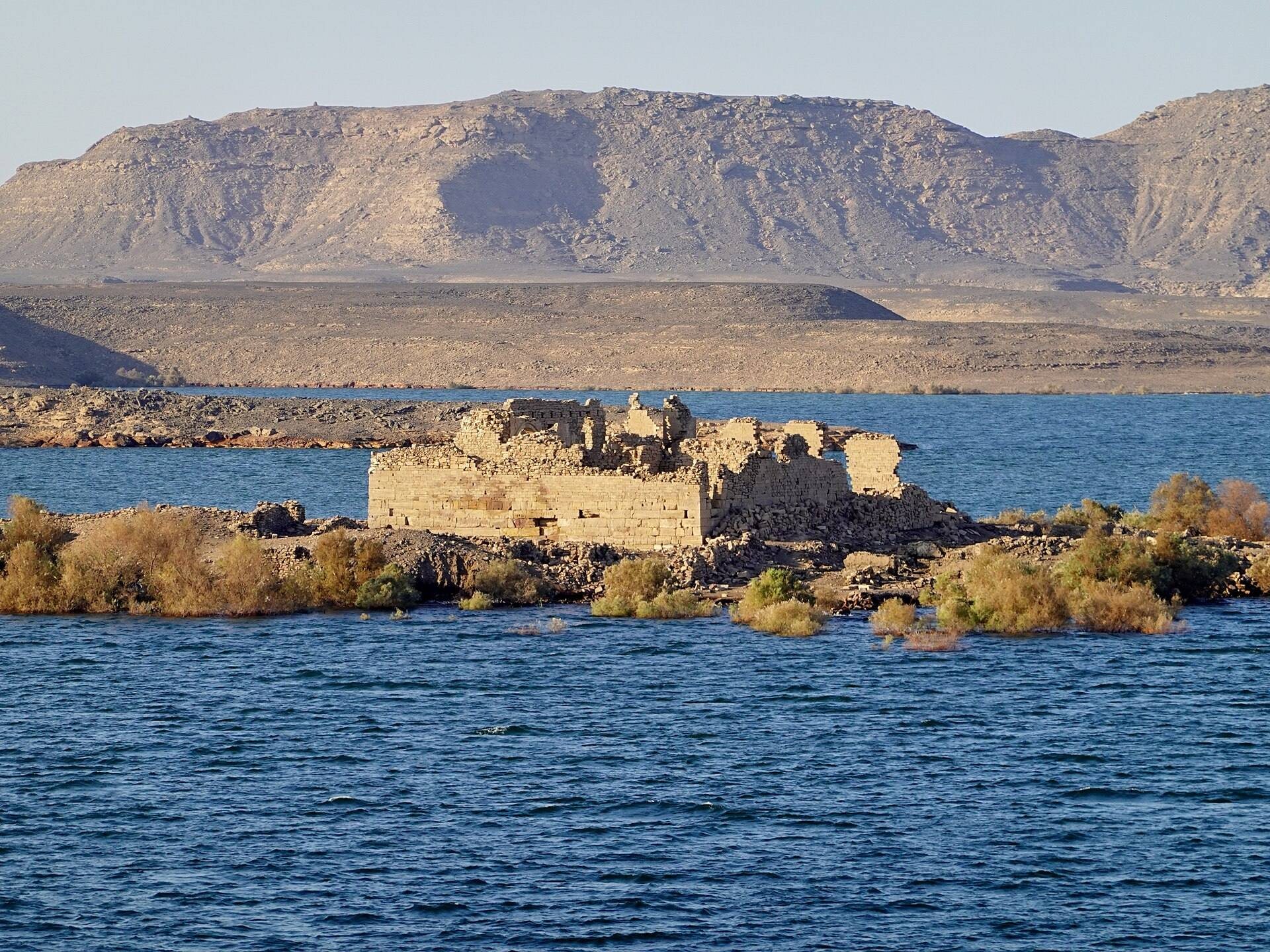
The Aswan High Dam and the filling of Lake Nasser flooded lower areas, cemeteries, and surrounding archaeological remains, transforming Qasr Ibrim into an island. It is the only major archaeological site in Lower Nubia to survive the dam floods, although parts of the outer fortifications and areas near the river were later submerged, including after a further rise in the lake in 2000. Several commemorative chapels on the western slope were dismantled during the salvage campaign and transferred to Wadi es-Sebua.
The site’s elevation and exceptionally dry climate preserved architecture, textiles, leather, papyri, wooden writing boards, parchment, and other organic materials. Excavations recovered texts in Egyptian hieroglyphic and Demotic, Meroitic, Greek, Latin, Coptic, Old Nubian, Arabic, and Turkish. Approximately 700 Meroitic texts were written on papyrus, wood, leather, clay, and stone. Administrative, commercial, personal, and religious documents show Qasr Ibrim’s role as a frontier settlement and trade center. Agricultural and animal remains, including sorghum from approximately 800 BC to AD 1800, wheat, barley, millet, flax, cotton, palm products, sheep, goats, cattle, and a ritually deposited chicken, also trace changing economies and practices over more than two millennia.
Remains
Fortified hilltop settlement
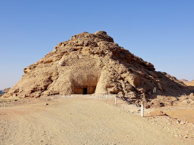
Before Lake Nasser flooded the surrounding landscape, Qasr Ibrim occupied a rocky promontory rising approximately 60–70 metres above the Nile plain. Cliffs surrounded the hill, and the fortified settlement overlooked the river valley and the opposite bank, where Aniba stood. The enclosed urban area measured approximately 250 metres from north to south and 175 metres from east to west. Walls reached about 9 metres in places and surrounded a densely built settlement entered through a single gate. The surviving hilltop is now an island, while lower outer areas and some defensive works lie beneath the reservoir.
The remains combine Egyptian, Kushite, Roman, Christian Nubian, Islamic, and Ottoman construction. The elevated position, arid climate, and limited disturbance after abandonment preserved substantial architectural fabric. Excavated materials include catapult projectiles, belts, sandals, clothing, painted wooden panels, amulets, figurines, an Osiris statuette, and a papyrus showing an oracle scene. Greek inscriptions left by pilgrims and an excerpt from the Odyssey add evidence for the settlement’s religious and cultural connections.
Temples and early churches
New Kingdom chapels
Rock-cut chapels and shrines were made in the cliffs surrounding the settlement during the New Kingdom. A large sandstone stela dedicated by Seti I to his viceroy of Kush, Amenemopet, originally stood south of the fortress and was later transferred to the vicinity of Aswan. These monuments formed part of the Egyptian religious landscape established around the hill before the later fortified city developed.
Taharqa’s temple
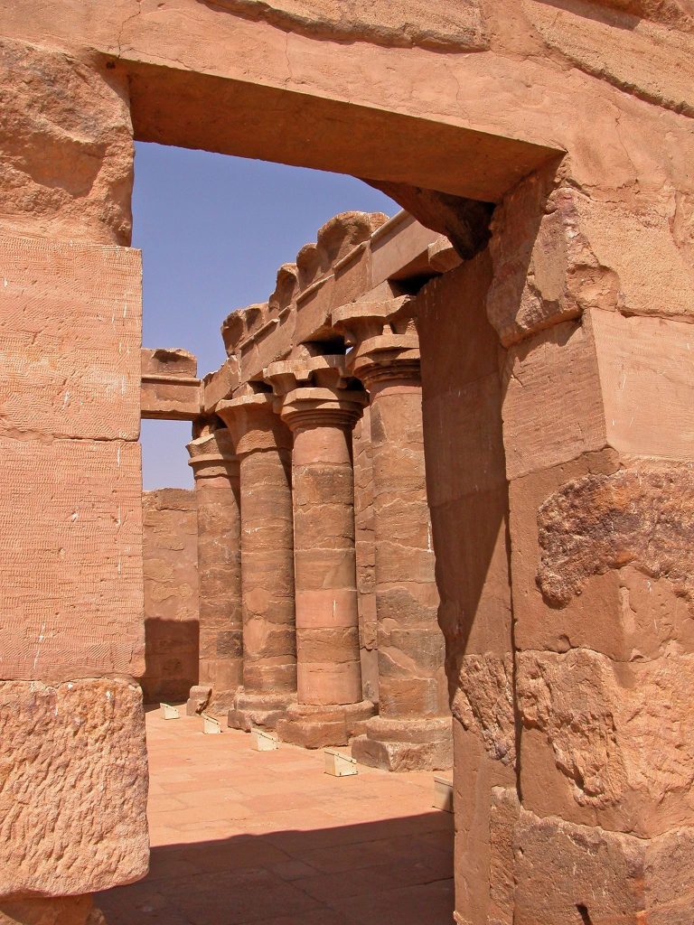
Taharqa’s temple was a mud-brick building dedicated to Amun. The king’s name appeared on the lintel, door jambs, and four columns supporting the roof. Two wall paintings showed Taharqa in the sanctuary. Flooding destroyed one in 2000, while the other is preserved in the Nubian Museum at Aswan. The temple was later converted into a church, and much of its decoration disappeared.
Kushite temples
The Kushite settlement contained seven temples, mainly dating from the fourth to third centuries BC. One stood beside the Taharqa temple and was dedicated to Amun of Primis. Fragments of wall paintings survived, and two lion statues commissioned by King Yesbokhe Amani stood at its entrance. Another temple, later destroyed during the Christian period, contained painted wooden panels. Six mud-brick temples remained in religious use into the early centuries AD. Temple 1 was a sandstone building of the fourth century, while Temple 289 was a smaller temple of the same period and may have become a church during the sixth or seventh century.
Roman temple
A Roman temple, probably built under Petronius, used carefully layered masonry attributed to craftsmen from Egypt. Its remains belong to the phase when Qasr Ibrim functioned as the Roman fortress of Primis and formed part of the southern defense of Roman Egypt.
First church
A small temple complex formed by the Taharqa temple and Temples 4 and 5 was transformed into Qasr Ibrim’s first church, probably in the early or middle sixth century. An east-facing apse, the rounded or polygonal eastern end containing the altar, was inserted into the temple. The remaining space was filled with rubble, and a narthex, or entrance vestibule, was added along the west side. Pottery in the fill belongs to the X-Group period and helped date the conversion.
Cathedral and later churches
Great Church
The Great Church, also called the Marian Cathedral, stood at the center of the fortified settlement. Its surviving structure is a five-aisled basilica, a church plan with a central aisle flanked by side aisles, and wide arcades. Reused stone blocks from an earlier temple appear in its lower courses. The core is dated to the seventh century, although another interpretation places its construction in the first half of the eighth century. During the Ottoman period, the cathedral was converted into a mosque.
Two crypts lay beneath the cathedral, where several Nubian bishops were buried. The stela of Amenhotep I was reused in one crypt. Bishop Timotheos was also buried there, with two written scrolls and his cross-staff. These finds connect the cathedral’s surviving structure with the episcopal history of Qasr Ibrim.
Northern Church
The Northern Church stood beside the river in an area now flooded by the reservoir. It was a three-aisled, slightly irregular building measuring approximately 10 metres along its north side, 9 metres along its south side, and about 7 metres in width. Two pillars divided the main room and created a slightly wider central aisle. The rectangular eastern sanctuary was flanked by two smaller chambers with asymmetrical entrances. The northern chamber could be entered only from the sanctuary, while the southern chamber opened directly from the side aisle.
The church had a high central dome carried on transverse arches between the pillars and the altar wall. Diagonal brick rings formed the squinches, structural transitions supporting the dome over the corners. In 1960 the central dome still survived, with windows on all four sides, while other roof structures had collapsed. Flat half-domes covered the sanctuary and western central area, and barrel vaults, continuous curved ceilings, covered the side aisles. The outer walls had high rubble-stone bases, and small windows used round arches, pointed arches, or narrow slit forms. Each altar space contained a small eastern niche. The church is dated to the late twelfth or early thirteenth century.
Southern Church
The Southern Church, numbered 294, stood south of the cathedral. It dates from the twelfth or thirteenth century, although an earlier building may have preceded it. Its position formed part of the group of Christian buildings within the fortified settlement during the later medieval period.
Domestic, commercial, and funerary remains
Christian-period domestic architecture included numerous multi-storey houses whose ground floors may have served commercial purposes. Some houses had large cellars containing pottery, heaps of lablab stems, and chicken bones. Fortified houses appeared within the settlement from the fourteenth century. A substantial stone-built house known archaeologically as the “tavern” contained amphorae, drinking vessels, grape remains, and imported amphorae from northern Nubia, many bearing Demotic inscriptions. Reliefs of amphorae and grapes decorated the walls of a related drinking establishment.
After the Roman withdrawal, cemeteries lay in the plain on the eastern bank of the Nile, while a cemetery on the opposite bank was reserved for priests of the Amun temple. The surrounding cemeteries and lower settlement areas were later submerged by Lake Nasser. Within the preserved settlement, organic remains and food-processing evidence include vessels containing plant residues, sorghum, wheat, barley, millet, flax, cotton, palm products, and animal bones. Roman wool and leather, Meroitic cotton, and later locally sourced cotton and wool fabrics preserve evidence of changing production, trade, clothing, and daily life.