Otrar: A Silk Road City in Kazakhstan
Site at a Glance
- Popularity
- Very High
- Country
- Kazakhstan
- Primary era
- Medieval
- Eras represented
- Classical, Medieval
- Civilizations
- Unclassified
- Site type
- Settlement
- Remains
- City
On this page16 sections
History
Otrar is the archaeological site of a historic city in Kazakhstan. Its oasis was inhabited from the 2nd century BC, while the oldest excavated layers of the settlement date to the 1st century AD. Otrar became a major political, cultural, and commercial center, flourishing especially from the 9th to the 12th centuries.
Early settlement and changing rule
The region’s early history was associated with Kangju, a state centered on the Syr Darya that existed from the 1st century BC to the 5th century AD, before breaking apart after successive invasions. In the 6th to 8th centuries, a local Kangar dynasty ruled the Turkic state of Kangu Tarban. Its capital, known as Tarban or Turarband, later came to be called Otrar. Persian-era names included Parab and Farab, meaning land irrigated with diverted river water. By the 13th century, Farab on the Jaxartes was known as Otrar.
During the 9th and 10th centuries, Otrar was counted among the towns of Ispidjab, a regional center. This may reflect its subjection first to the Caliphate, the early Islamic state and its successors, and later to the Samanids, a Muslim dynasty ruling parts of Central Asia. Otrar remained the center of a district said to extend about a day’s journey in every direction, and it issued its own coins. The Karakhanid dynasty, a Turkic Muslim ruling house, later maintained a mint there under the authority of the Qara Khitai, a Central Asian empire also known as the Western Liao.
A regional center of trade and learning
Otrar’s position made it a junction in the Silk Road, a network of routes connecting East Asia with Central and western Asia and other regions. Caravans linked Kazakhstan with China, Europe, the Middle East, Siberia, and the Urals. Routes followed the Arys toward Taraz, Balasagun, and Xinjiang; tracked the Syr Darya toward Shash, Sogdia, Merv, and Nishapur, or north toward the Pre-Aral and Ural regions; and crossed the Kyzylkum westward toward Khorezm, the Volga region, the Black Sea, and the Caucasus. The city also served a productive farming region and provided a stronghold for steppe nomads near the Karatau foothills.
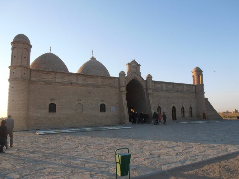
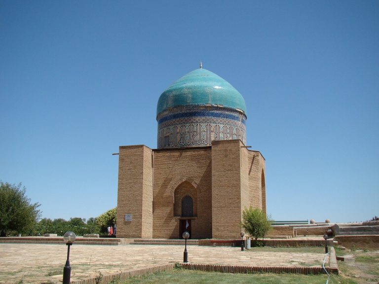
Otrar is identified as the birthplace of the philosopher and mathematician Abu Nasr al-Farabi, the astronomer and mathematician Abbas al-Jawhari, and the linguist and geographer Ishaq al-Farabi. The Sufi preacher Aristan-Bab, a Muslim associated with Islam’s mystical tradition, lived and preached there; his mausoleum stands near the archaeological site.
Population estimates vary. In the 10th century, the geographer al-Muqaddasi estimated that Otrar could accommodate 70,000 people. A later estimate based on housing density places its population in the 9th to 12th centuries at 15,500 to 17,460, with a midpoint of about 16,000. That reconstruction estimates 8,000 to 9,960 people in the central area during the 6th to 8th centuries and about 7,500 in later suburbs. The wider Farab district is estimated to have had roughly 29,000 urban residents.
Khwarazmian rule and the Mongol siege
In 1204, Otrar’s ruler, Taj ad-Din Bilge Khan, led troops to assist Muhammad II, ruler of the Khwarazmian Empire, against the Ghurids, a dynasty based in Ghur in present-day Afghanistan. As the Qara Khitai weakened, Kuchlug, a defeated Naiman prince, seized its throne in 1211. Muhammad expanded into Transoxiana, the region between the Amu Darya and Syr Darya, in 1210–1212 and brought Otrar under his control, replacing local governors with his own supporters. Taj was arrested, sent to Nesa, and killed.
In 1218, Otrar’s governor Inalchuq, also known as Qair Khan and an uncle of Muhammad II, detained a Mongol trade caravan of about 450 people, including an envoy of Genghis Khan, on suspicion of espionage. Muhammad approved the execution of the caravan. When Genghis Khan demanded punishment for Inalchuq, Muhammad instead ordered the Mongol envoy beheaded and the beards of two accompanying diplomats shaved.
Mongol forces besieged Otrar in 1219 for about five months before breaching the city. Inalchuq was executed. A resident named Karaja opened a gate to the besiegers and was put to death by Jochi, Genghis Khan’s son. Qair Khan continued fighting to the end, and Genghis Khan ordered silver poured into his eyes and mouth. The city was burned and devastated; many residents were killed and those who survived were enslaved.
Revival, decline, and abandonment
Although many towns in the oasis were abandoned and never recovered, Otrar regained political and economic importance during the civil wars that followed Genghis Khan’s death. By the middle of the 13th century it was again a major center for trade between east and west. Southern Kazakhstan entered Timur’s sphere of power in the second half of the 14th century. In early 1405, while assembling troops for a campaign toward China, Timur died at Otrar, apparently after catching a cold. After his death, Abu’l-Khayr Khan united several tribes and established a new Uzbek Khanate.
In the 16th and 17th centuries, the Kazakh Khanate and Dzungar lords contested control of the steppe and Syr Darya valley. Dzungar forces destroyed Otrar among other cities in 1723–1727. The city’s decline was also linked to reduced Silk Road traffic and the gradual disuse of irrigation from the 17th through the 18th centuries. An estimated 5,000 to 7,000 people had lived there during the 14th to 17th centuries, but by the late 18th century only about 40 families remained. Drought in the 19th century drove them away, and the city was abandoned in the early 19th century.
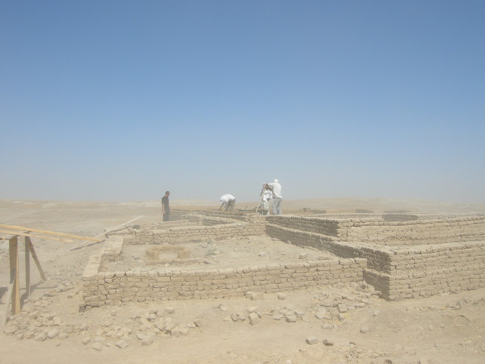
Excavations began after 1969. A conservation project ran from 2001 to 2004, and a state program to revive ancient Otrar began in 2004. The archaeological site is on UNESCO’s Tentative List as part of the Archaeological Sites of the Otrar Oasis. Stories of buried treasure have drawn attention to the ruins since the Golden Horde period; finds of coins and jewelry have provided some material basis for those tales.
Remains
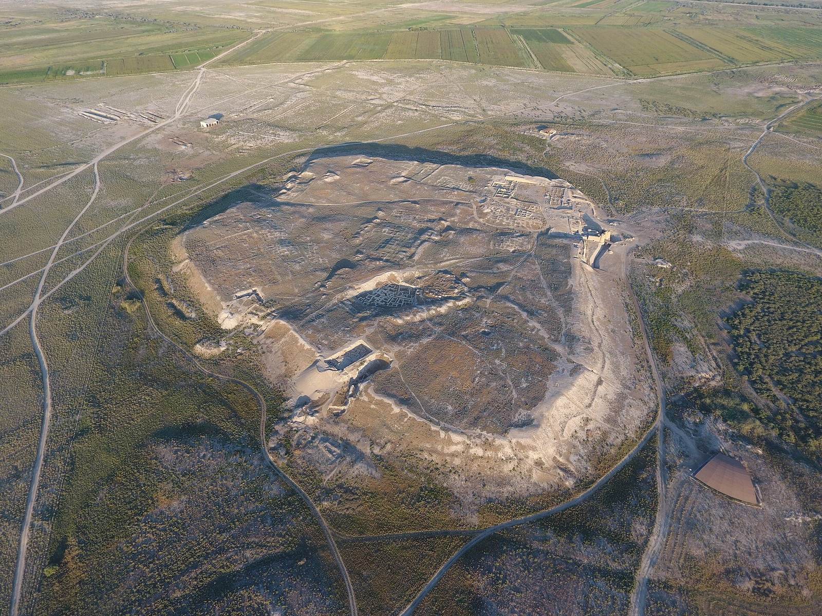
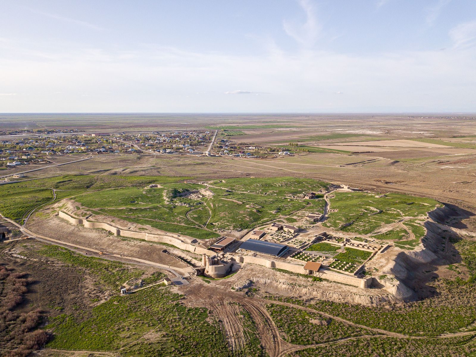
The settlement covers about 2 km² within an irrigated oasis of roughly 200 km². Its central area was organized around a raised fortress, a walled inner city, and suburbs that developed beyond the walls. Otrar formed part of a wider landscape of settlement mounds, including Altyntobe, Dzhalpak-tobe, Kuyuk-Mardan-tobe, and Pchakchi-tobe, as well as the archaeological settlements of Kuyuktobe, Kokmardan, Altyntobe, and Mardan-Kuik.
Fortress, inner city, and suburbs
Central fortress and walled city
The central fortress, or Ark, and the fortified inner city, the Shahristan, occupied a five-sided mound that rose about 18 m and covered roughly 200,000 m². The citadel stood on raised ground as a final defensive position. The Shahristan contained residences and principal buildings within a rectangular enclosure about 480 by 520 m. Its walls were 15–20 m high. Estimates place the inner city’s area at about 20 hectares or, in another measurement, about 25 hectares. The city moat also survives.
Outer suburbs and oasis
The rabad, or suburb beyond the walls, developed later and spread across roughly 150–170 hectares. The wider oasis contained ten walled towns and fifty villages. Water from the Arys and Syr Darya rivers supplied its extensive irrigation network, which supported the settlements and agricultural land.
Urban quarters and public buildings
Public, religious, and commercial buildings
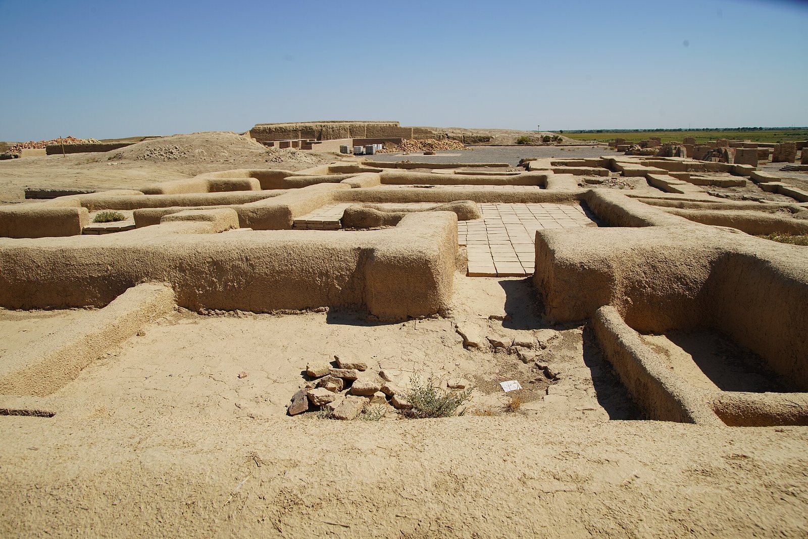
Buildings stood close together in densely occupied blocks. The city included a large madrasa, an Islamic school, along with a bazaar, a forge, a wine-drinking house, mosques, shops, and warehouses. Gardens and a large library were also part of urban life; scholars, scientists, and musicians gathered at the library.
Bathhouses
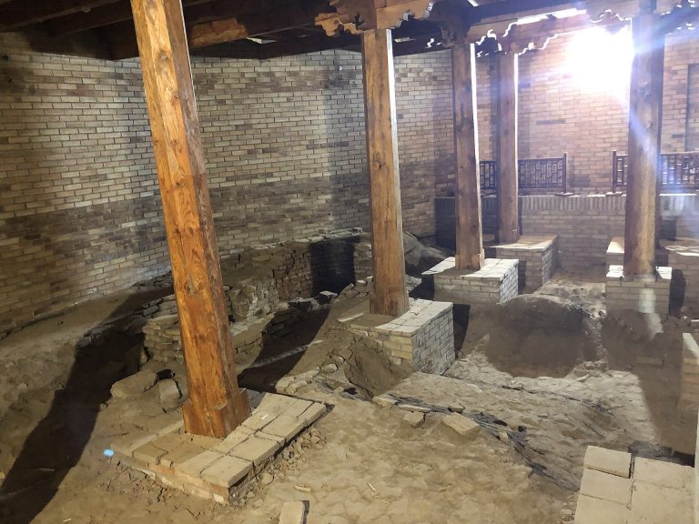
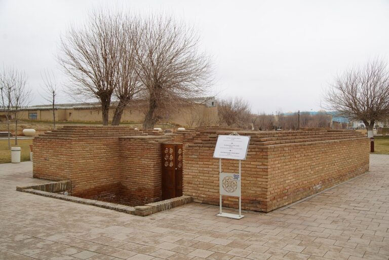
Two bathhouses dating from the 9th to 12th centuries lay in suburbs outside the city wall. Each had a central bathing and massage hall, changing rooms, washrooms, and a prayer room. Their arrangements included systems for supplying hot water.
Pottery, coins, and recovered objects
Ceramics
Dishes found near two furnaces point to pottery production at Otrar, whose ceramics included decorative elements. A notable recovered figure represents a water carrier as a camel with a woman’s head and a cradle on its back.
Coins and inscriptions
Coins from Otrar and elsewhere in the oasis include a type with a bow on one face and a lion on the other, associated with the Turgesh, a Turkic people and ruling power in Central Asia. Another type bears an X on one face and may have been issued by a local ruler’s mint; it has been tentatively linked to rulers of Kangu Tarban. Copper dirhams, a coin denomination, made at Otrar for Muhammad II in 1210–1211 carry the name Farab. His coins of 1216–1218 use Otrar, preceded by a word meaning city or region.
Present condition
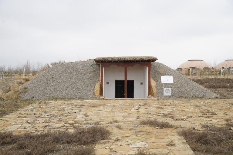
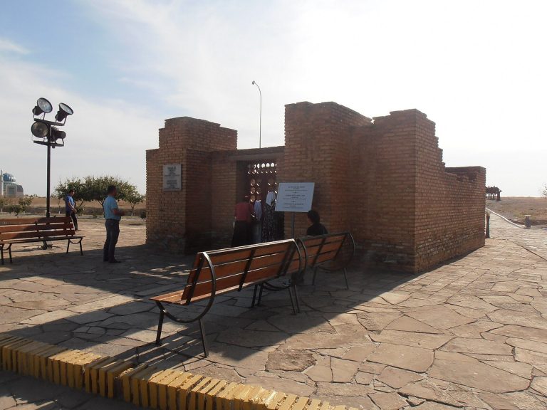
Much of Otrar’s built fabric is now in ruins, and grass covers parts of the remains. The main mound rises as much as 18 m from its base. Old irrigation channels cross dry fields, their cracked beds having been without water for centuries. Seasonal temperature extremes and relatively high precipitation threaten the archaeological remains.