Oppidum of Corent: An Arvernian Political and Religious Center in France


Site at a Glance
- Rating
- 4.4
- Popularity
- Low
- Country
- France
- Primary era
- Iron Age
- Eras represented
- Stone Age, Bronze Age, Iron Age, Classical
- Civilizations
- Roman
- Site type
- City
On this page25 sections
History
The Oppidum of Corent is a Gallic fortified settlement in France, extending across Corent and Veyre-Monton in the Auvergne region. Founded by the Arverni, a powerful Gallic people whose territory centered on Auvergne, it developed during the later Iron Age, especially from the third quarter of the second century BC. Occupying about 50 hectares, the settlement became a major political and religious center and is currently regarded as the most probable capital of the Arverni during their period of independence.
Earlier occupation
The plateau was used intermittently from the Middle Neolithic onward, although these prehistoric occupations were not directly continuous with the later Iron Age oppidum. A Middle Neolithic enclosure dates to approximately 4200–3700 BC, while activity during the Late Neolithic, around 3000–2400 BC, included a collective burial. Early and Middle Bronze Age evidence indicates further occupation, followed by a substantial fortified settlement during the Late Bronze Age, approximately 1300–800 BC, mainly on the lower part of the plateau. That settlement was later abandoned.
Activity during the Hallstatt period was more limited. A presence in the sixth century BC is known, but the plateau does not appear to have held a structured settlement comparable to the Late Bronze Age community or the later oppidum. Hallstatt and earlier La Tène phases include intervals of slight or interrupted occupation before the late La Tène center developed.
Arvernian foundation and development
The late La Tène settlement grew around its sanctuary from the third quarter of the second century BC, particularly during the La Tène D1 period. The sanctuary may have originated as early as the third century BC, but its foundation can be securely placed no later than the last quarter of the second century BC. Circumstantial evidence has led to the proposal that the Arvernian king Luernos or his son Bituitos sponsored the foundation, although this remains uncertain.
Residential and craft quarters appeared at approximately the same time as the sanctuary, apparently within a planned urban layout. Around 100 BC, a partial reconstruction altered the settlement’s orientation while retaining its general extent. This phase is known as the classical horizon of Corent and may have been connected with the Cimbrian War of 109–105 BC, a conflict involving migrating Cimbrian forces and Rome.
A further rebuilding between approximately 80 and 70 BC brought Mediterranean construction techniques and a greater use of stone. This stone-built phase coincided with the rise and death of Celtillos and the youth of Vercingetorix, the Arvernian leader who headed the major Gallic revolt against Julius Caesar in 52 BC. It also marked the beginning of Corent’s gradual decline as political power shifted elsewhere.
Political role and Roman transition
Corent has been proposed as the Arvernian city called Nemossos by Strabo, the Greek geographer and historian. The political center may previously have been at Aulnat-Gandaillat and may later have moved to Gergovie before being transferred to Augustonemetum, the future Clermont-Ferrand. This final reorganization is associated with Marcus Vipsanius Agrippa, the Roman general and statesman who helped organize Gaul under Augustus, around 30 BC. The exact timing of these transfers remains uncertain.
After the Gallic War, Corent declined as political authority moved toward Gergovie and then Augustonemetum. Earlier interpretations treated the Roman conquest as bringing complete abandonment, but excavations since 2013 have shown that structured Gallo-Roman occupation continued. Residential and craft activity survived, while the sanctuary was rebuilt and associated with a small theatre at the center of a secondary settlement. The settlement continued at least into the third century AD, and the sanctuary remained in use until the third century or possibly the beginning of the fourth.
The relationship between Corent, Gergovie, and Gondole remains unresolved. One interpretation regards the three centers as a loosely organized regional system, or “meta-oppidum,” in which Corent held political and religious functions, Gondole served commercial and artisanal purposes, and Gergovie had a military role. Another proposal identifies Corent with Caesar’s Gergovie, but this interpretation is not accepted by the scientific community. The three centers appear to have been connected by a monumental road network, parts of which may survive within the modern road system.
Corent’s regional connections included the Gallo-Roman necropolis at Les Martres-de-Veyre, the contemporary port at Le Bay on the Allier, and an Iron Age storage complex discovered in 2015. That complex contained approximately 1,000 grain silos, each holding between 0.5 and 1.5 tonnes.
Archaeological investigation
Cultivation in the nineteenth century brought small artefacts to the surface and prompted archaeological interest. Jean-Baptiste Bouillet was the first recorded excavator, followed by Grange and Fabre in 1856. Research resumed under Dr Bruyère in 1935, with further investigations by Jean-Raymond Terrisse and Pierre-François Fournier between 1937 and 1939. A collective Neolithic burial was excavated in 1969.
Prospection in 1988 and test excavations in 1991 were directed by Vincent Guichard and John Collis. Geophysical and field surveys by the University of Sheffield between 1987 and 1990 helped identify buried structures and focus subsequent work on the richest areas. Excavations in 1992–1993 revealed the Gallo-Roman sanctuary and established that Corent was a monumental center rather than simply a fortified settlement.
Matthieu Poux directed excavations from 2001 to 2008, exposing most of the sanctuary and clarifying its chronology. Work beyond the sanctuary between 2004 and 2008 revealed aristocratic and artisanal quarters. Excavations resumed in 2010, investigated the area east of the sanctuary between 2010 and 2013, and continued west of it from 2013 onward.
After the Puy-de-Dôme Department acquired the site in 2007, enhancement work led to the accidental discovery of a military trophy near the sanctuary’s northern perimeter. Excavations in 2018 examined the rampart and areas near the plateau depression known as the lake of Puy. A campaign begun in summer 2024 uncovered a minting workshop, described as the first discovery of its kind in Europe, offering evidence for Arvernian coin production and its political, social, and economic setting. The archaeological plateau does not have complete classification as a historic monument, a circumstance that has prompted discussion about the long-term protection of Arvernian sites.
Remains
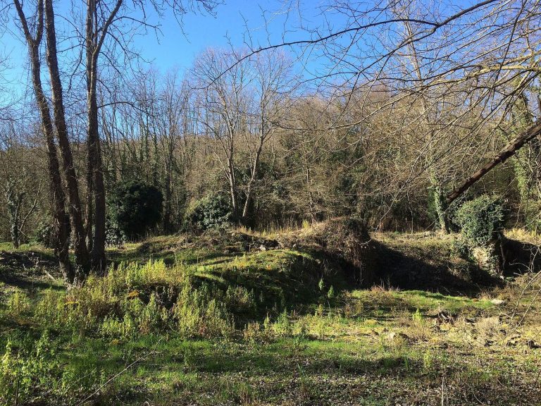
The Oppidum of Corent occupies a broad basalt plateau formed by a volcanic flow approximately three million years ago. Oriented southwest to northeast, the geological landform covers about 60–70 hectares and lies between approximately 570 and 610 metres above sea level. Steep southern and eastern slopes, exposed bedrock, and springs emerging around the basalt provided natural defensive advantages. Rainwater collects in an internal depression called the lake of Puy, while differences in substratum thickness and erosion have produced varying levels of archaeological preservation.
Prehistoric and Iron Age features
Neolithic enclosure and burial
The Middle Neolithic enclosure was protected by a palisade and produced polished stone axes and pottery. A collective Late Neolithic burial lay on one of the plateau’s summits. These remains represent separate episodes of prehistoric use before the later urban settlement.
Bronze Age settlement
Bronze Age deposits include axe blades, Rhône-type daggers with metal handles, and Middle Bronze Age ceramic and metal objects. The Late Bronze Age settlement occupied mainly the lower plateau and possessed fortifications. Its remains reflect a major highland community that preceded the Arvernian oppidum.
Sanctuary and public center
Early sacred enclosure
The oldest identified La Tène structure within the oppidum is a quadrangular sacred enclosure measuring approximately 45 by 42 metres. It had an eastern entrance, probably fitted with a monumental porch. A palisade set into the bottom of a ditch bounded the earliest enclosure. The ditch may have marked and sacralized the area, although a small number of finds suggesting a foundation as early as the third century BC do not confirm that date.
Covered galleries and ritual buildings
Around 80 BC, the palisade was replaced by four monumental covered galleries forming a four-sided portico, a roofed passage running along all sides of the enclosure. Staggered wooden posts and wattle and daub formed the outer supports, while inner colonnades created a covered passage more than six metres wide. The proportions followed a Greek-derived measuring system, and the enclosure was enlarged until one side approached 50 metres.
Two small cult buildings, each approximately 10 by 8 metres, stood on opposite sides of the sanctuary’s east–west axis from the earliest phase. The northern building was associated with animal sacrifice, while the southern building was used for cutting the necks from amphorae as a ritual act. Libation basins received offerings of wine. A hearth cooked the meat of sacrificed animals, with selected portions offered to the gods and better cuts consumed during communal banquets. Smoke from the cooking was understood as an offering to celestial deities, while wine poured into the ground may have been intended for deities associated with the underworld.
Roman rebuilding
After the Gallic War, the wooden gallery was replaced by a limestone masonry gallery and the surrounding ditch was filled. The internal arrangement remained broadly similar, but the sanctuary was reconstructed in stone. At the end of the second century AD, the masonry perimeter was demolished and replaced in stages by a monumental portico. The two cult buildings were combined into a single fanum, a Gallo-Roman temple with a central enclosed room called a cella and a surrounding gallery, positioned opposite the entrance.
Ritual and minting evidence
The sanctuary carried decorations made from the skulls of sacrificed animals and military trophies, including weapons. These practices were already declining elsewhere in the Gallic world when Corent was founded, while the sanctuary placed greater emphasis on communal sacrificial feasting. Near the entrance, dies and manufacturing failures identify a coin-minting workshop. Arvernian bronze coins known as “fox coins” may have been made there, and the workshop uncovered in 2024 provides additional physical evidence for minting activity.
Esplanade and commercial buildings
Public esplanade
East of the sanctuary, a trapezoidal public esplanade covers approximately 4,000 square metres, about twice the sanctuary’s area. It was largely open and had a portico along its eastern end, echoing the sanctuary’s monumental porch. The ground was terraced over a natural rise in the bedrock. Its arrangement was comparable to a Greek agora or Roman forum, providing space for commercial and artisanal activity and for large religious and political gatherings.
Habitat A
Habitat A lay immediately north of the sanctuary, beyond a communication route running alongside its perimeter. It was the first secular structure excavated outside the sacred enclosure. Existing from the foundation of the oppidum, it was remodelled around 80 BC and contained finds associated with an aristocratic residence. Later material reflects strong Roman influence, including two gold brooches possibly linked to a Roman army officer and a late Republican Roman seal box.
Habitat B
North of Habitat A, Habitat B covered more than 240 square metres and included a small dependency on its southern facade, an enclosed courtyard, residential rooms, and craft areas. Finds indicate the manufacture of beads and bone dice, together with especially extensive butchery activity. The building was destroyed around 80 BC and replaced by two lighter structures.
Complex C
Complex C stood east of Habitats A and B and north of the sanctuary esplanade. Its buildings surrounded a central courtyard of about 120 square metres. Four halls, each 20 metres long and fitted with porticos, enclosed a market area containing workshops and merchants’ shops. Coins, accounting tokens, and parts of balances, including weights and beams, were found there. Activities included bronze-working, woodworking, butchery, and the production of personal ornaments using a furnace and a small anvil fixed to a wooden block.
Tavern and market complex
A building over a cellar near Complex C is interpreted as a tavern or wine seller. Its fill contained wine amphorae and a Gallic ceramic drinking set composed of a large vessel, jugs, cups, and bowls. The complex was completely refounded during the first quarter of the first century BC, and its central market space with individual shops resembled a Roman macellum, a market building arranged around a courtyard.
Building K
Farther east along the edge of the esplanade, Building K combined evidence for aristocratic occupation with craft production. Tools found there point to leatherworking, possibly by a shoemaker or glove-maker specializing in the preparation of hides.
Theatre and Gallo-Roman settlement
Political assembly and theatre
A horseshoe-shaped Gallo-Roman theatre was discovered in September 2011. Beneath it lay a wooden structure with a similar form, dating from the period of Arvernian independence. Its precise function is uncertain, but it may have served as a political assembly space capable of holding nearly 200 people. Ceramic material and Roman coins indicate two construction phases. The first extended from the middle of the first century AD to the beginning of the second, while the second continued until the end of the second century.
Roman houses and pottery workshop
West of the sanctuary, the Roman settlement included several masonry houses built over cellars and a pottery workshop. Excavations in 2013 and 2014 identified these remains across several hectares, demonstrating that residential and craft activity continued after the Roman conquest.
Military trophy
The military trophy found immediately north of the sanctuary consisted of four shields with central bosses, a mail shirt, a sword, and a bronze-sheet military standard shaped as a boar. Three gold rings were discovered nearby. Together, these objects form a distinct group of martial remains beside the sacred center.