The Iberian Oppidum of Puente Tablas: A Fortified Settlement in Jaén, Spain
Site at a Glance
- Popularity
- Medium
- Country
- Spain
- Primary era
- Iron Age
- Eras represented
- Bronze Age, Iron Age
- Civilizations
- Iberian
- Site type
- Military
- Remains
- Fortified Town
On this page11 sections
History
The Iberian oppidum of Puente Tablas, a fortified settlement often serving as a center for its surrounding territory, lies in Jaén, Spain. Occupation began in the Late Bronze Age and continued into the Islamic period, with final abandonment placed in the 7th century AD. The site is regarded as one of Spain’s most important archaeological sites of the Iberian period, when Iberian peoples inhabited parts of the peninsula during the Iron Age.
Bronze Age and Iberian phases
In the mid-4th century BC, the settlement was abandoned for a time. Its inhabitants probably moved to Cerro de Santa Catalina. The interruption coincided with a sharp fall in cereal pollen, indicating that cultivation on the Guadalbullón floodplains had also ceased.
People returned in the 3rd century BC. The settlement’s last Iberian phase ended amid social and territorial changes associated with Romanization, the spread of Roman political and cultural influence in regions brought under Roman rule.
Later occupation and archaeological work
Although the Iberian settlement came to an end, occupation at Puente Tablas continued into later periods. Its final abandonment is placed in the 7th century AD.
Systematic investigations by Spanish archaeologist Maluquer de Motes took place in the 1970s and in 1983. From 1985, a University of Jaén team undertook successive campaigns through its project “Iberian Settlement in the Jaén Countryside.” Discoveries on a hill to the southeast led archaeologists to reconsider the extent of the site and the boundaries set for its protection. In 2007, Puente Tablas was designated a Spanish Asset of Cultural Interest as an archaeological zone.
Remains
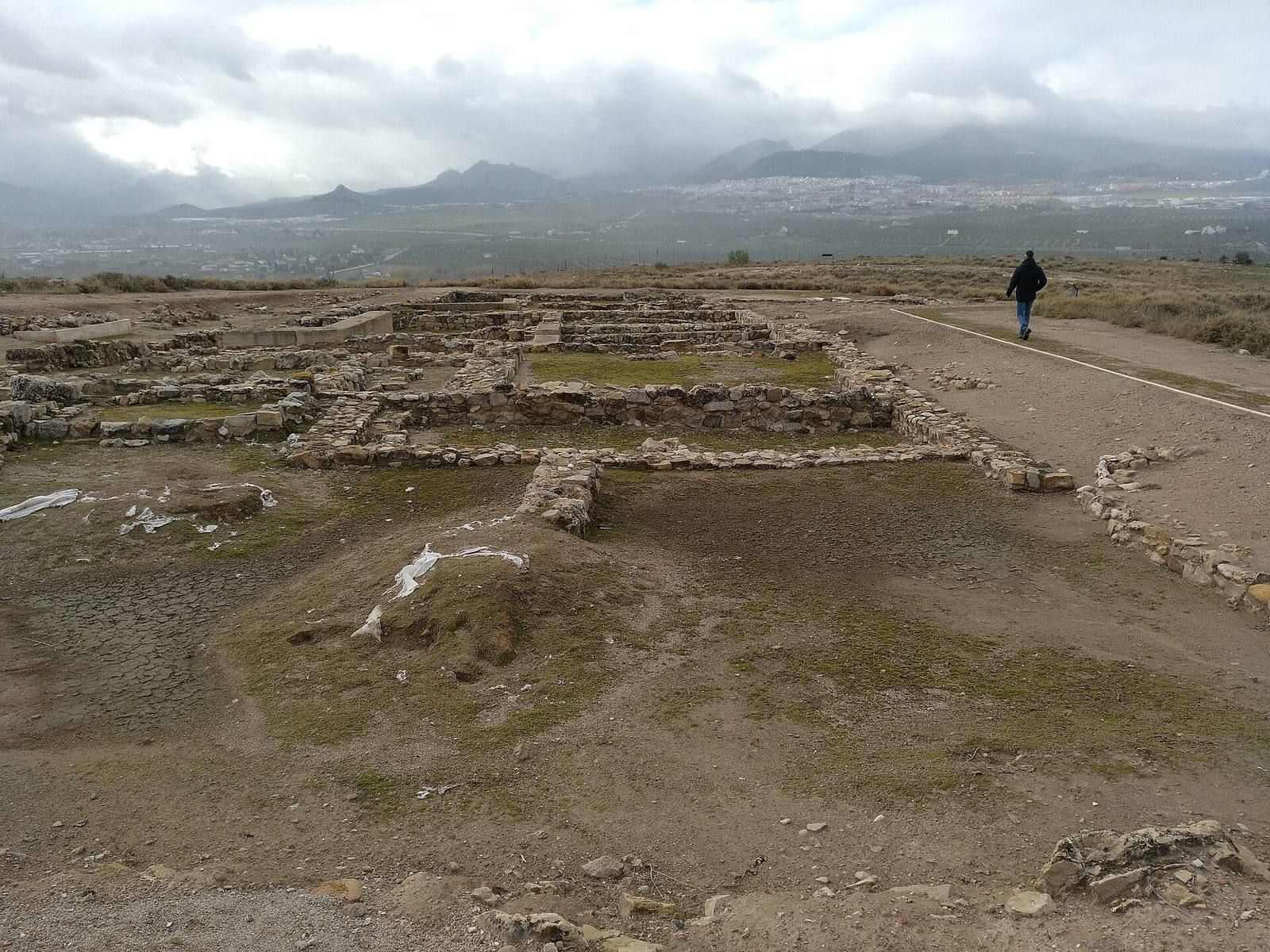
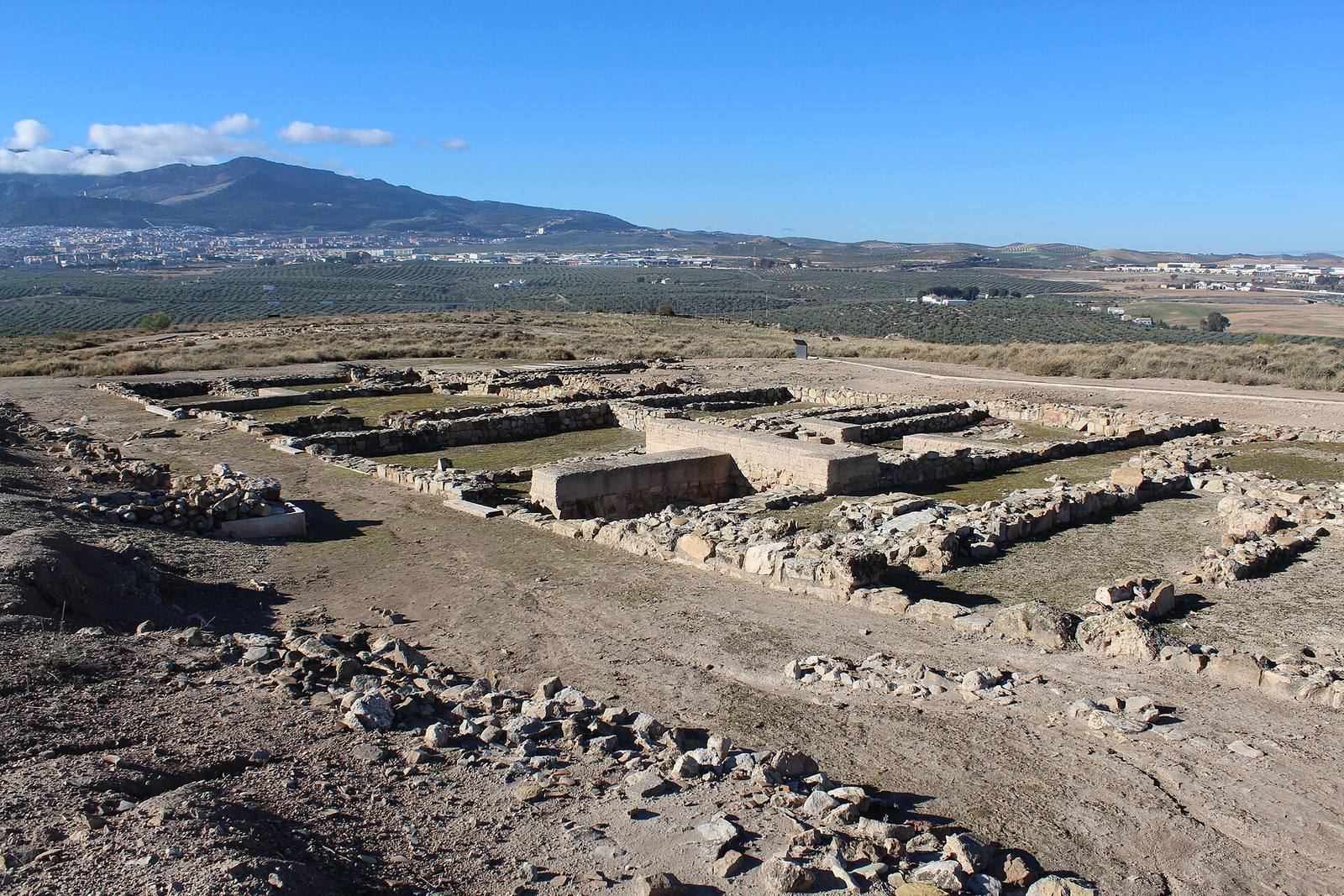
The settlement extends across two hills on the right bank of the Guadalbullón River. Its remains include a fortification shaped to the uneven terrain, traces of Bronze Age occupation, houses arranged along streets, and a large building with a portico.
Bronze Age traces
Hut floors and postholes, holes left by upright supports, occur across both hills. Their distribution suggests that settlement spread gradually rather than covering the entire plateau from the outset. Finds on a hill to the southeast point to a wider area of Bronze Age occupation.
Fortified enclosure
Position and boundaries
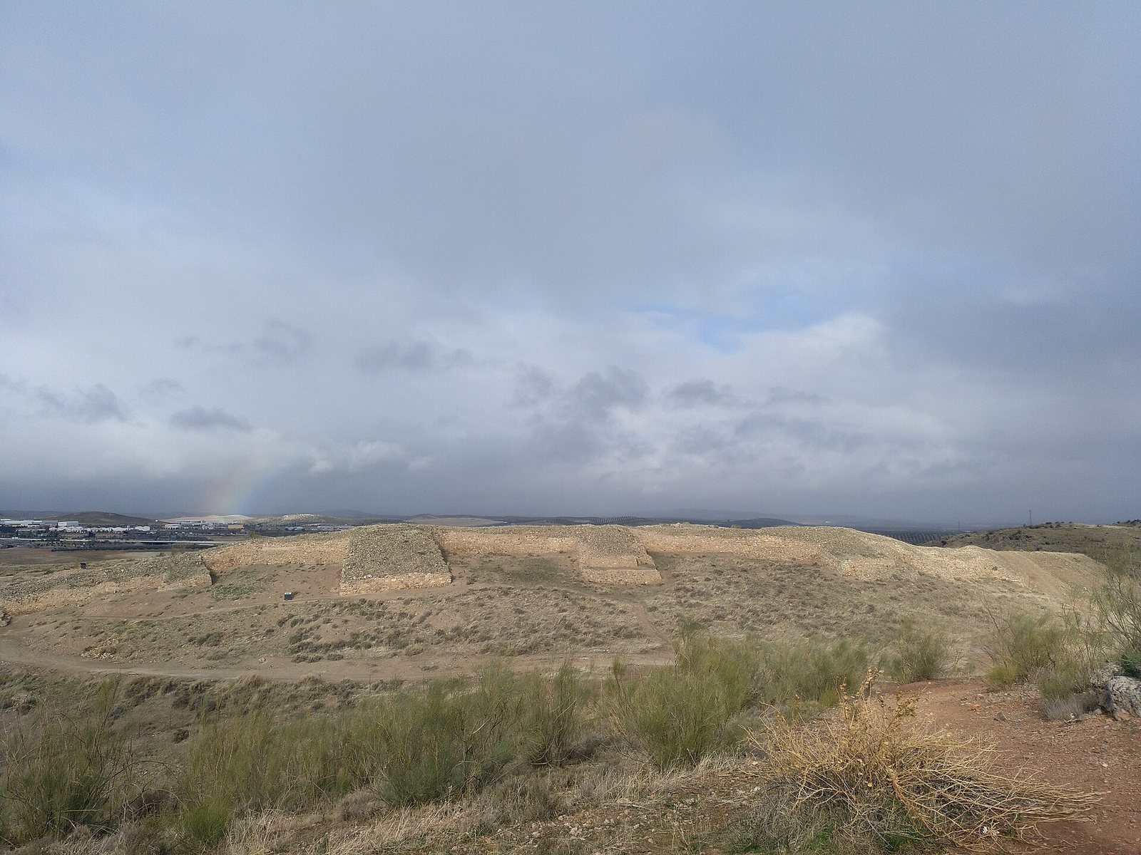
The site projects toward a bend in the Guadalbullón. To the northeast, San Juan de Dios hill blocks the line of sight; the fortification is also concealed from natural approaches to the northeast and southeast. On the western side, cliffs provide a natural boundary where the site faces its dominant line of sight. Its most prestigious architecture was placed in this western area. Over time, accumulated fill made the two hills appear to form a single landform.
Wall and entrance
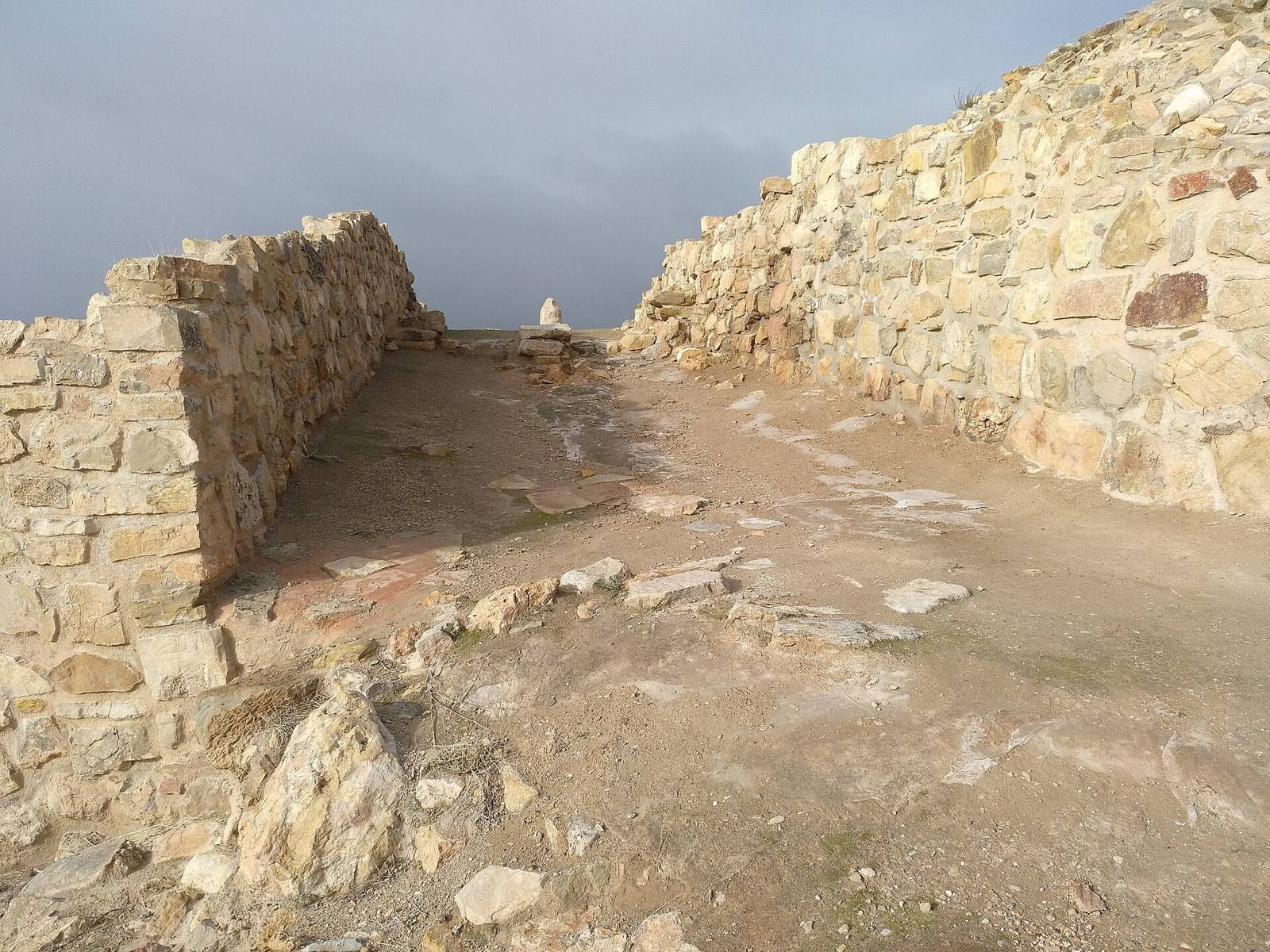
In the proto-Iberian phase, an early stage in the development of Iberian society and material culture, builders raised a dry-stone wall, fitting stones together without mortar. They followed the contours of the hills and used material from San Juan de Dios. The wall had a sloping face backed by a very thick vertical section, rectangular buttress-like projections, and a complex network of internal passages. Excavation exposed a stretch about 200 metres long and eight projections; the wall still reaches five metres in height in some places. The known entrance lies to the southwest, where two buttresses narrow into a funnel-shaped passage that controlled access.
During the 4th century BC, the projections were coated with whitewash, and some sections used alternating stones laid end-on and lengthwise. In the 3rd century BC, the final Iberian phase brought a lighter form of fortification: smaller projections were built over earlier ones or on deposits that had accumulated around them.
Houses and other buildings
Houses
The settlement’s streets reached their greatest complexity in the 4th century BC, with square-plan houses attached along both sides. In a representative house, the entrance area was reshaped into a partly open communal space. The first two rooms were joined, with continuous benches along their sides and a central pillar. The pillar suggests that part of the space had a roof spanning across it. Its floor was made of compacted earth or gypsum. A grinding area and hearth occupied the front, with space for eating beside the doorway.
Behind this front area, rooms were arranged lengthwise, sometimes with further cross-divisions. A shared wall had previously separated the rear of the house from the dwellings opposite. Floors in the inner rooms were made of limestone slabs, except for one unpaved area that may have had a wooden floor or another perishable covering. In the partly roofed room of one house, the surviving base of a step faces toward the inner rooms and indicates an upper storey.
Western porticoed building
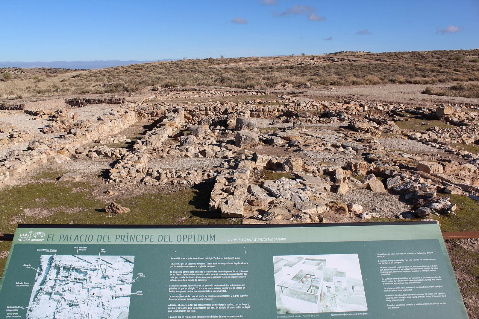
A large building identified in the western part of the site during the 1990 campaign differs markedly in both scale and structure from the houses in the central area. It had a portico, a roofed entrance or walkway, and stands apart from the settlement’s domestic buildings.