Old Sarum: A Prehistoric Hillfort and Medieval Cathedral Settlement
Site at a Glance
- Rating
- 4.5
- Popularity
- Medium
- Country
- United Kingdom
- Primary era
- Medieval
- External website
- Open
- Eras represented
- Iron Age, Medieval
- Civilizations
- English, Norman
- Site type
- City
On this page9 sections
History
Old Sarum is a prehistoric and medieval fortified settlement in the United Kingdom, near Salisbury, whose hillfort was established by local communities around 400 BC and later incorporated into a Norman castle. Occupation of the hill began around 3000 BC, first among hunting communities and later among farming communities. During the Iron Age, its inhabitants fortified the site and created the settlement known as Sorviodunum.
Prehistoric, Roman, and Saxon Sarum
The Iron Age settlement controlled the meeting point of two trade routes and the River Avon. It remained occupied during the Roman period, when the routes became roads, and the area appears to have belonged to the territory of the Atrebates, an Iron Age British tribal polity in southern Britain. In 552, Cynric, king of Wessex, captured the hill. The Saxons later used it as a stronghold against Viking attacks. Egbert of Wessex frequently stayed there in the early ninth century, and King Edgar held a council at Old Sarum in 960 to plan resistance to the Danes.
In 1003, Sweyn Forkbeard, the Danish-Norwegian king, sacked and burned Old Sarum and nearby Wilton. The settlement was later used as the location of Wilton’s mint, linking the site to the production of currency in the surrounding area.
Norman castle and cathedral
After the Norman Conquest, a motte-and-bailey castle was built at Old Sarum in 1069. This type of castle combined a raised mound carrying a stronghold with an enclosed courtyard. The castle belonged directly to the Norman kings, and its castellan, or castle governor, was generally also the sheriff of Wiltshire.
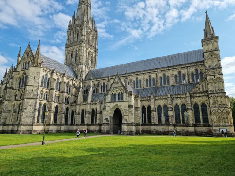
In 1075, Herman became the first bishop of Salisbury after the former sees of Sherborne and Ramsbury were united. Herman and Osmund, a Norman-appointed bishop and royal chancellor, began the first Salisbury Cathedral, which was consecrated in 1092. Old Sarum also hosted important royal gatherings. William the Conqueror probably received the Domesday Book there in 1086. This was his survey of landholding and resources. He also gathered prelates, nobles, sheriffs, and knights to swear the Oath of Salisbury, a collective declaration of loyalty to the king. William Rufus held a national council at Old Sarum in 1096, and Henry I held another in 1116, sometimes described as the first English Parliament.
Bishop Roger of Salisbury, a powerful churchman and royal administrator under Henry I, enlarged the cathedral during the 1110s, ultimately doubling its length. The work required extensive levelling in the northwestern part of the settlement. Roger began a royal palace in the 1130s, but Henry’s successor, Stephen, arrested him before construction was complete. The sheriff and castellan then continued to administer the castle for the king, while the site was subsequently allowed to deteriorate.
Relocation to Salisbury
Old Sarum combined residential, industrial, religious, and military functions. Kilns and furnaces operated within the settlement, while the principal residential areas lay in its southern parts beside the ditch that protected the inner bailey and Norman castle. Henry II imprisoned his wife, Eleanor of Aquitaine, at Old Sarum after suppressing the rebellion led by their sons. In the 1190s, Richard I designated the plain between Old Sarum and Wilton as one of five areas for English tournaments.
Relations between the royal garrison and the cathedral clergy became increasingly difficult. The cathedral’s relocation was associated with the costly and sometimes restricted water supply, limited housing for the clergy, strong winds that damaged the roof and disrupted services, and soldiers who restricted access to the cathedral precinct during religious observances. Bishop Herbert received permission from Richard I to move the cathedral, but the plan was delayed when John became king.
In 1217 or 1218, Pope Honorius III authorized the relocation after an investigation by Cardinal Gualo. The cathedral chapter agreed to finance the move through deductions from its prebends, the incomes assigned to cathedral clerics. A wooden chapel dedicated to the Virgin Mary was begun beside the Hampshire Avon on Easter Monday in 1219. Bishop Richard Poore celebrated Mass there and consecrated a cemetery on Trinity Sunday. Construction of the new stone cathedral began on 28 April 1220.
The settlement around the new cathedral became New Salisbury, also formally called New Sarum, and eventually Salisbury. The former cathedral at Old Sarum was dissolved in 1226. Residents dismantled buildings and reused their stone in Salisbury, causing the old settlement to decline. Quarrying continued into the fourteenth century.
Abandonment, representation, and protection
Edward II ordered the castle demolished and abandoned in 1322. In 1331, Edward III authorized the removal of stone from the former cathedral and clerical houses and permitted the rebuilding of the Chapel of St Mary associated with the cathedral. The chapel continued as a chantry chapel, where prayers and services were maintained for the dead, for a time. It was repaired between 1529 and 1531 and ceased to be used before 1550.
Henry VIII sold the castle grounds in 1514. Although Old Sarum was effectively uninhabited by the seventeenth century, it continued to return two Members of Parliament. In 1831, its eleven electors were all landowners living elsewhere, making Old Sarum one of the most notorious rotten boroughs, constituencies with very few resident voters but disproportionate parliamentary representation. The Reform Act of 1832 transferred the area into the enlarged borough of Wilton.
The fortified site became a civil parish in 1858, but that parish was abolished in 1894 and merged with Stratford sub Castle. The area is now within Salisbury civil parish. Old Sarum was among the English monuments protected under the Ancient Monuments Protection Act of 1882. Its protected area was later expanded, and the site was listed at Grade I in 1972. English Heritage administers the monument.
Excavations took place between 1909 and 1915 under W. H. St J. Hope, W. Hawley, and D. H. Montgomerie, followed by further work in the 1950s under John W. G. Musty and Philip Rahtz. In 2014, a University of Southampton geophysical survey revealed the royal palace and the street plan of the medieval city without excavation.
Remains
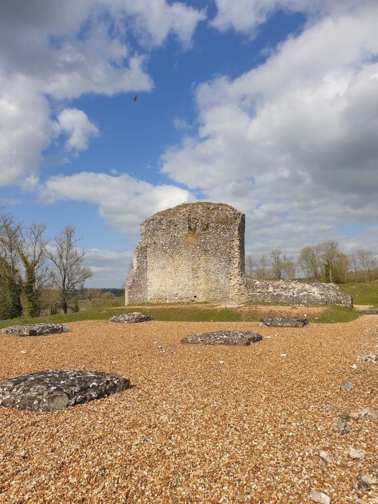
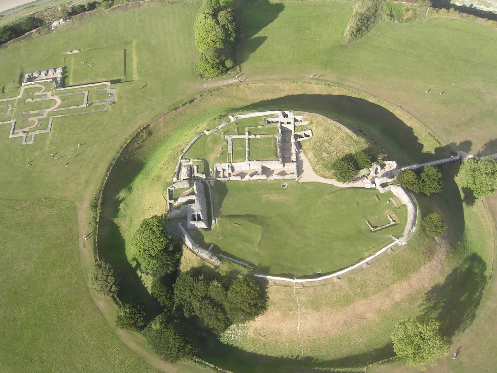
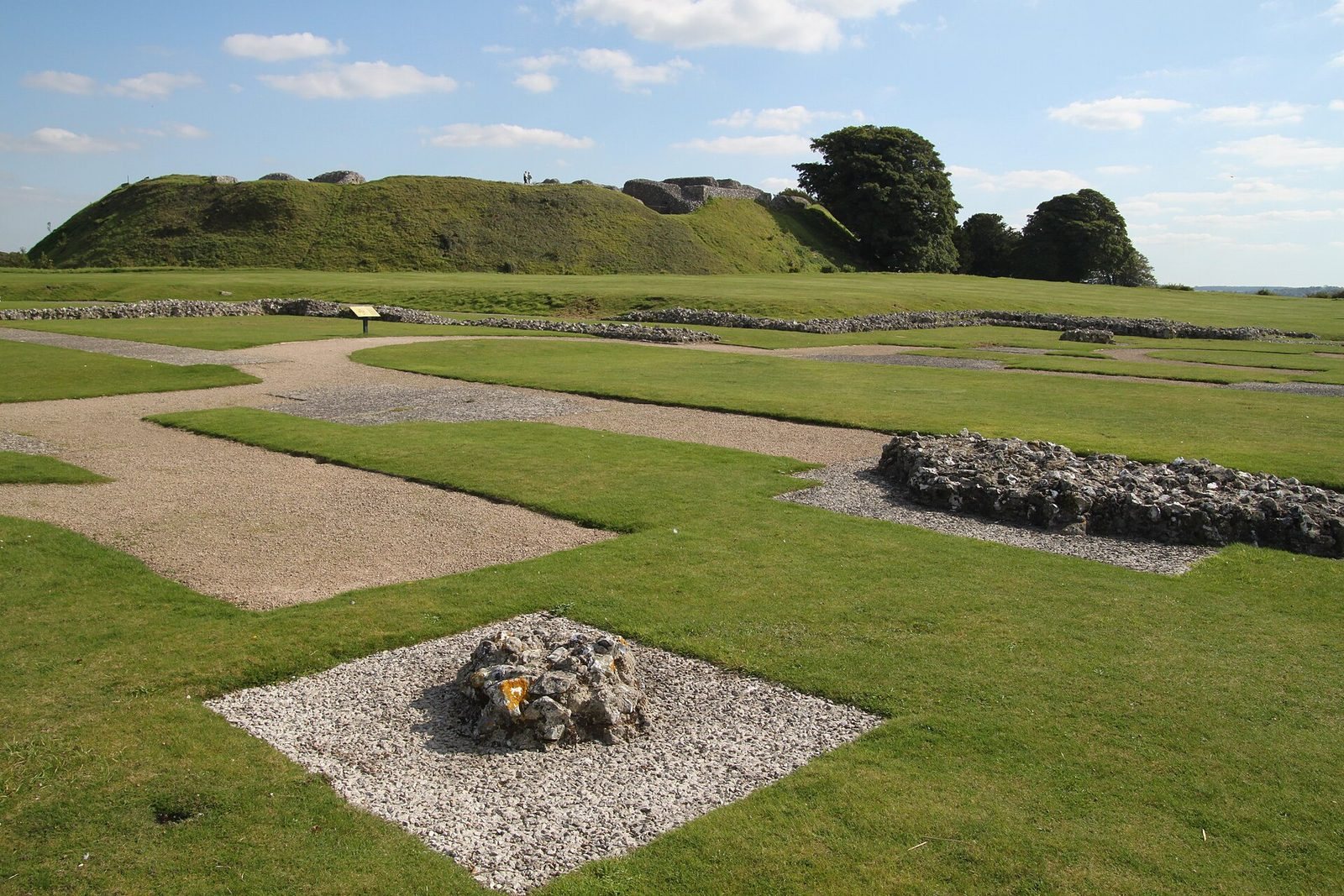
Old Sarum occupies a broadly oval hillfort measuring about 400 by 360 metres. Its surviving physical character combines prehistoric banks and ditches with Norman defenses, the foundations of the cathedral and palace, and buried remains of the medieval settlement. The site is organized around an inner bailey containing the castle and a larger outer bailey that held the cathedral, palace, residences, industrial installations, and streets.
Hillfort and Norman defenses
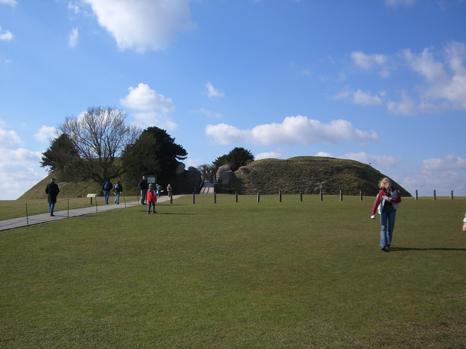
The prehistoric fortification consists of two substantial banks with a ditch between them and an entrance on the eastern side. The Norman settlement reused these earlier defenses and added a stone curtain wall, a defensive wall enclosing the castle and settlement. The motte-and-bailey castle included a central motte, or raised mound, with the castle remains, an inner bailey, and a deep dry moat. The exposed foundations and surviving fragments of the curtain wall, banks, ditches, and castle form the principal visible defensive remains.
Cathedral and royal palace
The first Salisbury Cathedral stood within the settlement’s ecclesiastical district. Bishop Roger’s enlargement in the 1110s doubled its length, and its foundations remain exposed within the site. The royal palace begun by Roger may have occupied the small central structure traditionally identified as the palace, but the 2014 survey indicated that a much larger complex may instead have occupied the southeastern quadrant of the outer bailey. This larger palace measured approximately 170 by 65 metres, enclosed a broad central courtyard, and had walls up to 3 metres thick. A room about 60 metres long was probably a great hall, and the complex appears to have included a large tower.
Medieval town and buried archaeology
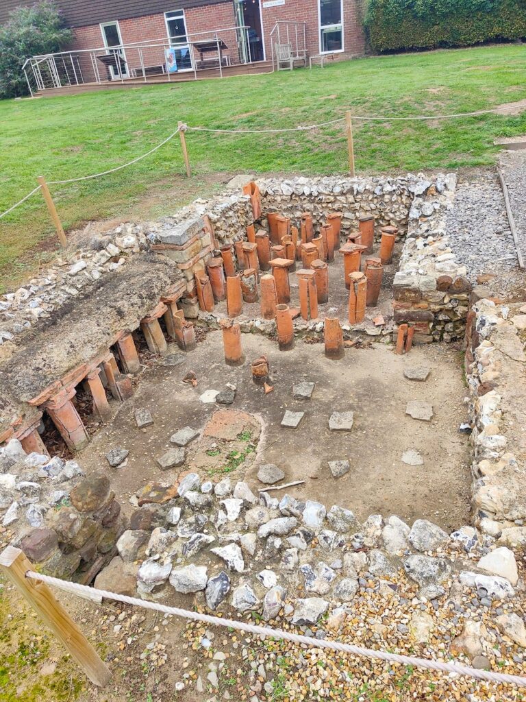
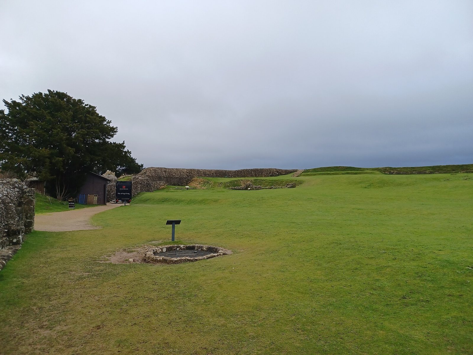
The medieval town included kilns and furnaces, while residential buildings were concentrated mainly in the two southern quadrants beside the ditch around the inner bailey and castle. Numerous wells were found during excavation, including one within the Norman keep. These wells were deep, and drawing water from them may have been more difficult than carrying water uphill from the rivers. The 2014 survey used soil resistivity, electrical resistivity tomography, magnetometry, and ground-penetrating radar to locate buried parts of the palace and the medieval street layout within the inner and outer baileys.