Nilometer in Rhoda Island: An Abbasid Nile-Measuring Monument in Cairo
Site at a Glance
- Rating
- 4.4
- Popularity
- Low
- Country
- Egypt
- Primary era
- Medieval
- External website
- Open
- Eras represented
- Medieval
- Civilizations
- Abbasid
- Site type
- Infrastructure
- Remains
- Cistern
On this page7 sections
History
The Nilometer in Rhoda Island is an Abbasid water-measuring monument at the southern end of Rhoda Island in Cairo, Egypt. Built to measure the annual Nile flood, it supported irrigation planning and helped determine taxation and state revenue for the following agricultural year. The surviving structure belongs to the ninth-century Abbasid period and is regarded as one of Egypt’s oldest surviving Islamic monuments, second only to the remains of the Mosque of Amr ibn al-As.
Before and During the Umayyad Period
A Nilometer existed near Babylon Fortress before the Muslim conquest of Egypt. Other measuring devices also operated in the Cairo area before 715, including one probably on the western bank of the Nile near Rhoda Island and another within a Roman fortress on the eastern bank. After the conquest, Coptic Christians continued for some time to serve as water-level readers, an office known as the qayas.
The first Islamic-period Nilometer on Rhoda Island was established in 715 by Usama ibn Zayd, a tax official serving the Umayyad caliph al-Walid ibn Abd al-Malik. It was re-established the following year during the caliphate of Sulayman ibn Abd al-Malik. The earlier structure was later destroyed by a flood, leading to the rebuilding that produced the present monument.
The Abbasid Rebuilding
The present Nilometer was rebuilt or renewed in 861 by order of the Abbasid caliph al-Mutawakkil. The Abbasids were the caliphal dynasty that ruled Egypt during the ninth century. A tradition associates the monument with the Abbasid caliph al-Ma’mun, but an inscription around the shaft names al-Mutawakkil and gives the date Rajab 247 AH. It also identifies Ahmad ibn Muhammad al-Hasib as the builder.
The rebuilding also established the long administration of the monument. The office of qayas, responsible for reading and maintaining a Nilometer, was assigned to Abdallah ibn al-Raddad. It remained hereditary in his family until the twentieth century. The qayas maintained the building, cleared its channels, and took regular readings of the Nile.
Readings, Ritual, and Later Preservation
During the rule of the Fatimid caliph al-Mu’izz, public announcements of the Nile level were prohibited in 973 because officials feared unrest, hoarding, and rising prices. The qayas instead reported privately to the caliph and vizier. Public notification resumed when the river reached a level at which famine was no longer expected.
A flood reaching 16 cubits brought ceremonial observances. The caliph went in procession to the Nilometer and prayed beside the shaft. Saffron and musk were mixed and used by the qayas to anoint the measuring column. On the following day, the caliph presented the qayas with a gold-embroidered robe, after which he returned to the Nilometer in a procession accompanied by drummers, trumpeters, and relatives.
The Ministry of Public Works repaired and maintained the monument in 1927, helping preserve it in good condition. The Nilometer was placed on Egypt’s tentative UNESCO World Heritage list in 2003 under criteria (i) and (iv).
Remains
Water-Measuring Structure
The monument is built around a deep stone shaft set within a square construction pit measuring at least 10 metres on each side and reaching at least 12 metres in depth. Excavating it required the removal of at least 1,200 cubic metres of soil and mud. The shaft has a circular lower section and two square sections above it, with each upper section larger than the one beneath. Dressed-stone walls become thicker lower down, where the surrounding earth exerted greater horizontal pressure.
A graduated marble column with an octagonal section stands at the centre of the shaft. It is 19 cubits long, carries water-level markings, and is topped by a Roman capital. A staircase runs around the interior and descends to the bottom, allowing access to the measuring apparatus. The central column rests on a sycamore-wood base, chosen because it is not affected by water, and is held above by a transverse tie beam.
Channels and Upper Structure
Three tunnels connect the shaft with the Nile. Water enters through three openings on the eastern side, allowing the water inside the shaft to remain relatively still despite the river’s south-to-north current. Pointed arches rise above the openings. They rest on columns incorporated into the walls, which have capitals and bell-shaped bases.
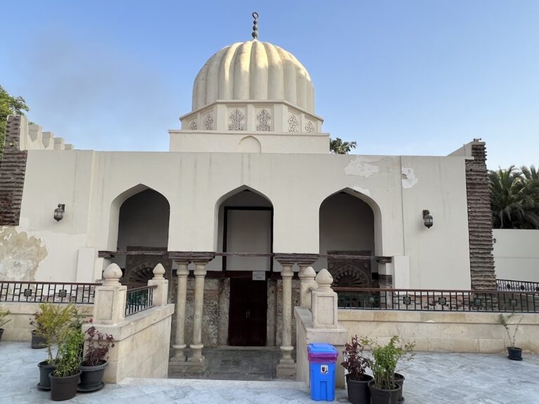
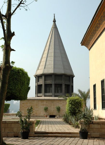
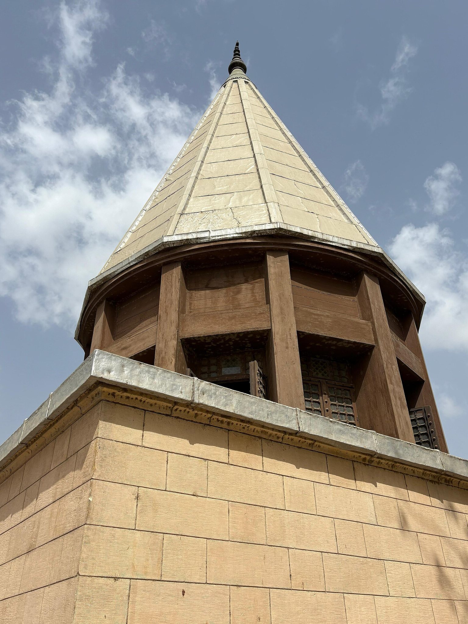
A dome covers the shaft. The central column and its supporting structure carry a Quranic verse in Kufic script, an angular form of Arabic calligraphy widely used for early religious and monumental inscriptions. Kufic inscriptions also appear on the northern and eastern sides. Inscriptions on the southern and western sides commemorate the period of Ahmad ibn Tulun, the founder of the Tulunid dynasty, and bear the date 259 AH.
The shaft, tunnels, walls, and measuring column were produced through carefully organized stages of excavation and construction. The surviving arrangement preserves the relationship between the Nile channels, the stilling shaft, the internal staircase, and the central graduated column that made the monument useful for reading the river’s annual rise.