Muslim Walls of Madrid: An Early Islamic Defensive Enclosure
Site at a Glance
- Popularity
- High
- Country
- Spain
- Primary era
- Medieval
- Eras represented
- Medieval
- Civilizations
- Umayyad
- Site type
- Military
- Remains
- Wall
On this page15 sections
History
Foundation and role under the Emirate of Córdoba
The Muslim Walls of Madrid are an early Islamic defensive enclosure in Spain, built by order of Muhammad I, emir of Córdoba, between 860 and 880. The medieval geographer and historian al-Himyari gives this date, and the walls’ construction is traditionally linked to Madrid’s foundation. They belonged to the Emirate of Córdoba, the Muslim regime then governing al-Andalus, the Muslim-ruled parts of the Iberian Peninsula.
The walls defended the citadel of Mayrit, the city’s earliest known name, and guarded a route along the Manzanares River between the Guadarrama mountain passes and Toledo. The fortified complex functioned as a ribat, a community with both religious and military roles. It formed part of a wider defensive network that included Talamanca de Jarama, Alcalá de Henares and Villaviciosa de Odón. Mayrit was one of several regional centres, rather than the core of a larger political power.
The enclosure also helped organize the city. It protected the central area against outside attack and possible unrest in the suburbs, separated urban districts, and regulated movement and tax collection through three gates. The religious and commercial centre lay within the walls, while populous neighbourhoods stood outside. The wall’s route and its gates later influenced the development of nearby streets and neighbourhoods.
Reinforcement and military use
In the tenth century, Abd al-Rahman III, the ruler of Córdoba who became its caliph, ordered the walls reinforced. A threat came in 932, when Ramiro II, the Christian king of León, advanced on Mayrit. The fabric may have been altered after Ramiro’s siege, but the enclosure was not wholly rebuilt. In 977, Almanzor, a leading military commander of the Caliphate of Córdoba, selected Mayrit’s fortress as the starting point for a campaign.
Christian conquest and later tradition
After Christians conquered Mayrit in the eleventh century, the original walled area was expanded with a broader enclosure known as the Christian Walls of Madrid. The centre of the city therefore continued to serve a defensive purpose.
A local tradition links the Virgin of Almudena, a title of the Virgin Mary, with the old walls. According to the story, Christians had hidden the image about three centuries earlier. It was found in 1085, during Alfonso VI’s conquest, in a tower near the Puerta de la Vega. The image was then placed in the former mosque for veneration by the royal court and Madrid’s population.
Archaeology and protection
Archaeological study of the walls began in the late eighteenth or early nineteenth century. They were declared a Historic-Artistic Monument in 1954. In the 1960s and 1970s, Madrid’s archaeological institute carried out protective work on the city’s first and second enclosures. Excavations included work at Cuesta de la Vega in 1972–1975 and at Calle Mayor. Construction of a housing block at Calle Bailén 12 in the 1970s destroyed two wall stretches and a tower.
Work at Cuesta de la Vega resumed in 1985, the year Madrid’s General Plan placed the walls in its highest archaeological-protection category. That protection covered both exposed remains and those found later. In 1987, demolition of a nineteenth-century building above the Cuesta de la Vega section exposed more of the wall. Restoration and presentation work brought the principal surviving stretch into view and led to the creation of Muhammad I Park. The 1996 remodelling of Plaza de Oriente also brought wall remains, including the base of the Tower of the Bones, to light. Spain classifies the walls as an Asset of Cultural Interest in the monument category.
Remains
Enclosure and setting
The enclosure extended about 980 metres around roughly four hectares. It began at the southern side of the citadel’s fortified palace. The site’s steep terrain, escarpments above the Manzanares valley to the west, and ravines and narrow gullies of the Arenal stream to the north and east formed part of its natural defences. An external ditch ran along the eastern section, where the ground stood higher than the wall. The protected complex included the palace, a mosque and the emir’s or governor’s residence. Outside the walls were public grounds used for recreation and equestrian games, a Muslim neighbourhood and a Christian suburb that included Mozarabs, Christians living under Muslim rule.
Gates and towers
The three gates
All three gates had direct entrances without bends. The Puerta de la Vega, at the present Cuesta de la Vega, linked the military enclosure with the Manzanares plains and routes towards Castile and Extremadura. Its exact position is uncertain, though it may have stood where the external niche of the Virgin of Almudena is now located, beside the cathedral crypt. Excavation identified the foundation of a flanking tower and an opening about 4.5 by 3.5 metres. The narrow gate lay between two towers, and its surviving foundations have been displaced from their original position. The Puerta de la Mezquita, also called the Arco de Santa María, led towards the civic district by way of present-day Calle Mayor. The Puerta de la Sagra opened towards gardens near today’s Calle de Bailén and Plaza de Oriente.
Square wall towers
The wall’s square towers measured about 2.4 to 3.3 metres across and stood roughly 20 metres apart. Their bases projected from the wall, while the towers themselves extended only slightly beyond its face. Their masonry combined flint and limestone. Six towers are recorded in the best-preserved section in Muhammad I Park, with one represented by its base. The square form has been interpreted as evidence of Islamic construction, in contrast to the semicircular towers generally used by Christian builders.
Detached towers
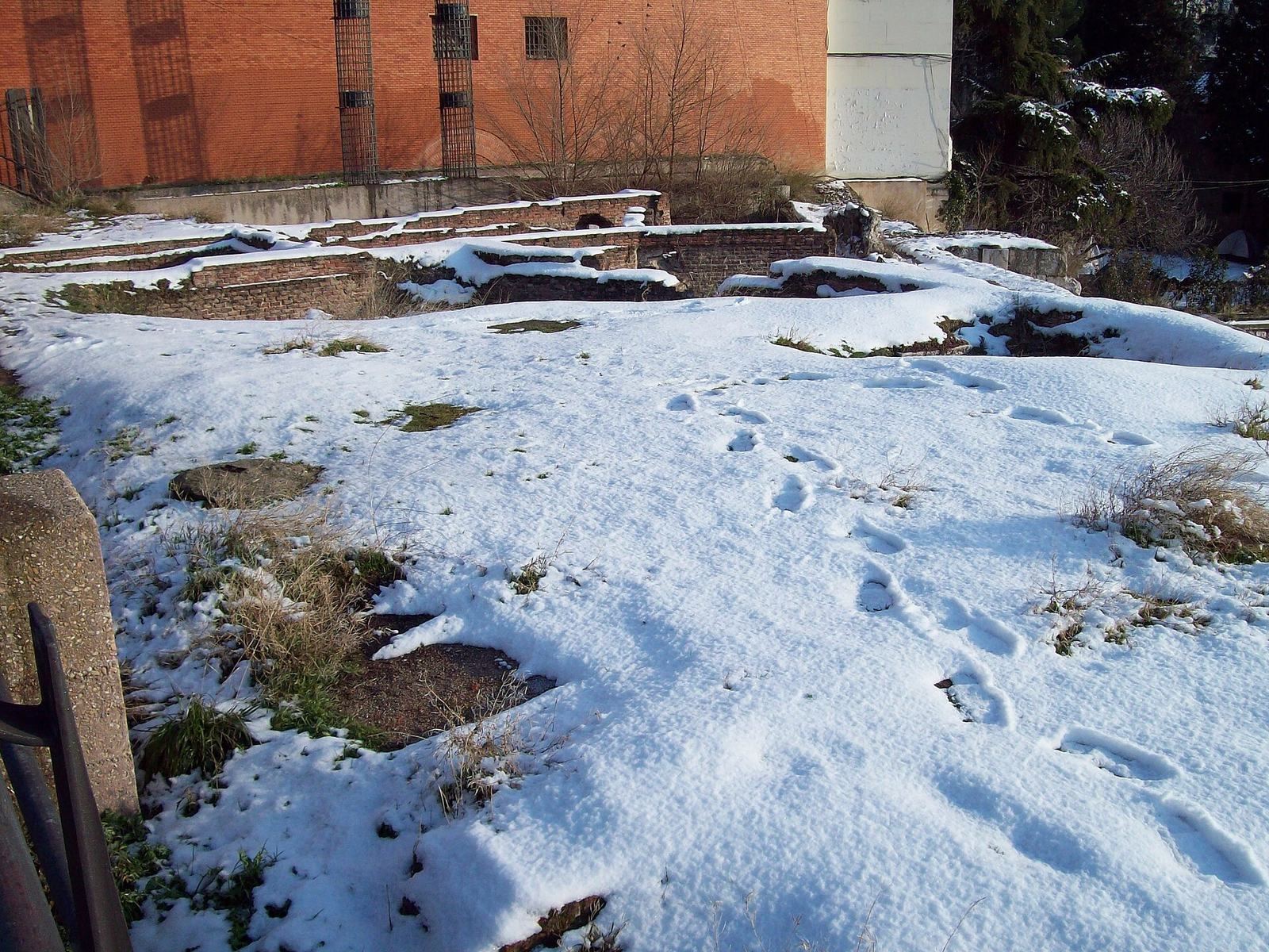
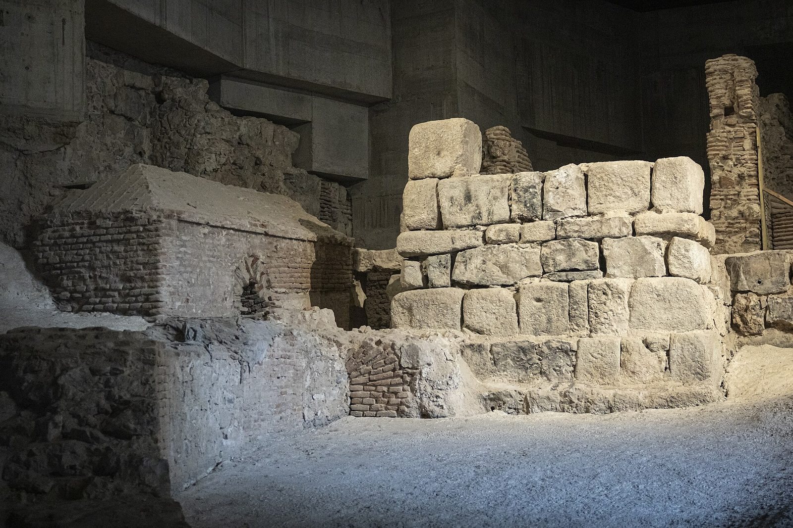
The ruined Tower of Narigües stands at Calle Mayor 83, beside the viaduct over Calle de Segovia. It was probably a lookout tower set apart from the main wall and joined to it by a smaller wall. The Tower of the Bones was built in the eleventh century, before Alfonso VI’s conquest, and was named for its proximity to a cemetery. It was later incorporated into the Christian Walls as a detached tower. Its base is displayed in the underground car park at Plaza de Oriente.
Surviving wall sections
Cuesta de la Vega and Muhammad I Park
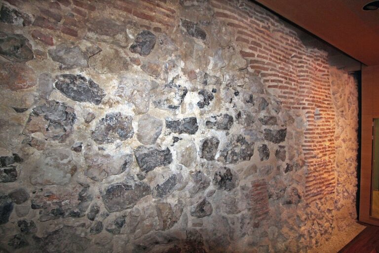
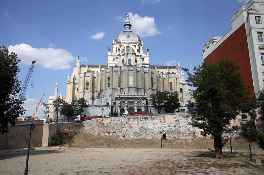
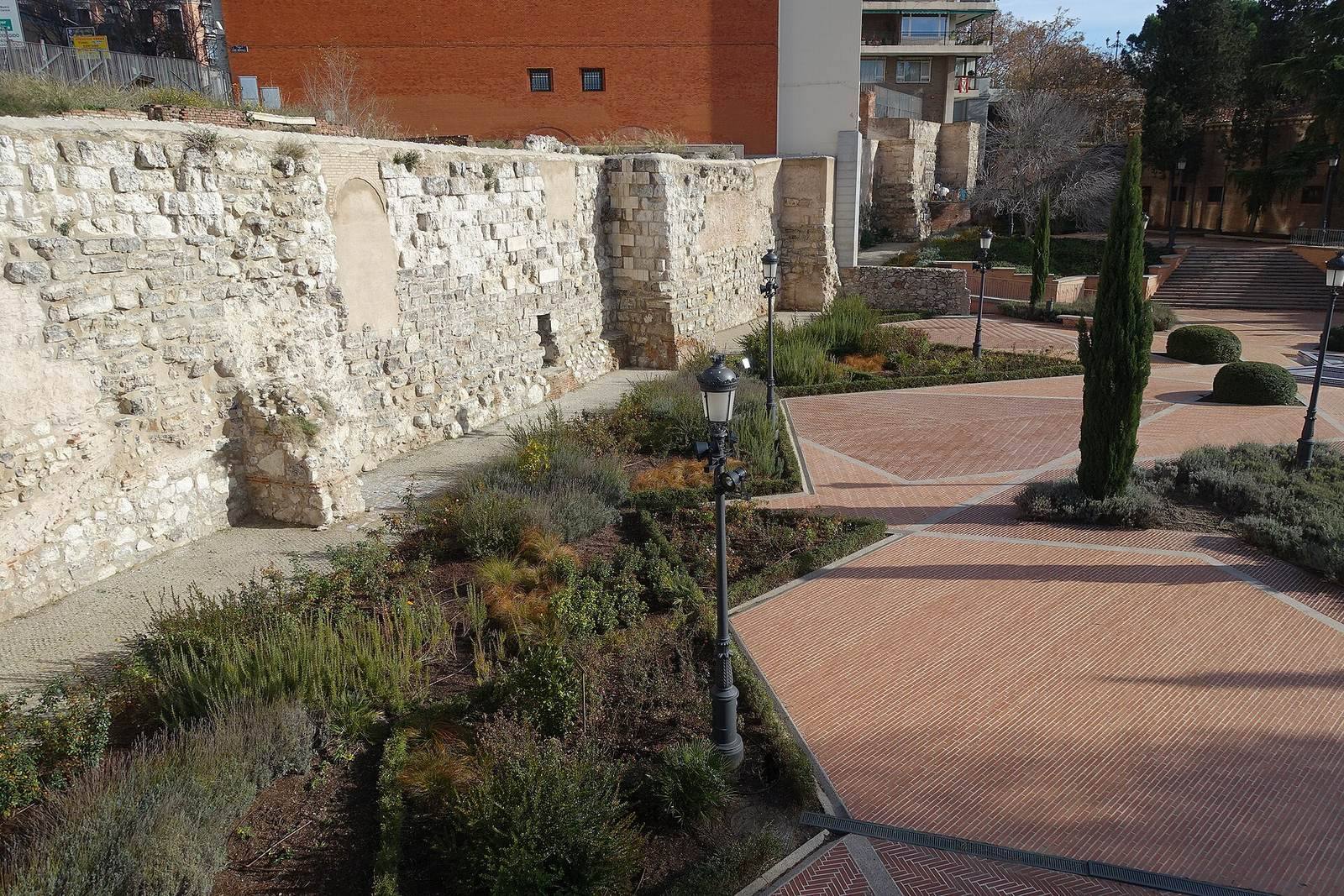
About 120 metres of wall are visible at Cuesta de la Vega in Muhammad I Park, the principal surviving stretch. Its survival is attributed to its later use as a load-bearing wall; other sections may also have served as building foundations. The wall is about 2.6 metres thick, with two outer faces and a rubble core bound with lime mortar. Its materials came from areas relatively close to the city. The lower courses consist of large flint blocks, dressed on the outer face and lightly trimmed on the inner face. Limestone blocks above them follow the Cordoban pattern: one block shows its long face outward, followed by two or three showing their short faces. Age makes this arrangement harder to see, and a white coating applied in the late 1980s to conceal repairs also obscures some original details.
A small blocked arch in this section may have served as a drain; a small stream passed through the area in later times. A slight slope beside the wall was recreated to evoke the earlier terrain.
Calle Bailén 12
Wall remains at Calle Bailén 12 continue the line of the park section. Some of the fabric became part of the lower structure of the 1970s building above it. The surviving portions are in poor condition and form part of a private garage. They are about 2.5 metres thick and have a rubble core bound with lime mortar.
Plaza de la Armería
Investigations beneath Plaza de la Armería identified two Islamic-period wall stretches with a combined length of about 70 metres. The plaza lies opposite Almudena Cathedral, between it and the Royal Palace. The stretches use the same materials and construction technique as the other described sections, and their average thickness is more than 3.2 metres. One section reached about 7 metres in height. The route was traced with radioelectric detectors without lifting the pavement, and the remains may correspond to the Puerta de la Sagra.