Kleinkastell Oberranna: A Late Roman Quadriburgus in Austria
Site at a Glance
- Rating
- 4.5
- Popularity
- Low
- Country
- Austria
- Primary era
- Classical
- External website
- Open
- Eras represented
- Classical
- Civilizations
- Roman
- Site type
- Military
- Remains
- Fort
On this page13 sections
History
Kleinkastell Oberranna, also called Burgus Oberranna, is a Roman fortification in Austria at Oberranna, a locality of Engelhartszell. Built during late antiquity, probably in the fourth century, it formed part of the Noric Limes, the Roman frontier zone along the Danube in the province of Noricum. The compact fort belonged to the defensive system of Noricum ripense, the later administrative province covering the Danubian part of Noricum, and remained occupied from the late third century into the fifth century.
Road station and frontier post
Oberranna is probably the site called Stanacum in the Itinerarium Antonini, a Roman route handbook listing roads, stations, and distances. Stanacum was placed 20 Roman miles, about 29.6 kilometres, from Boiodurum at Passau and 18 Roman miles, about 26.7 kilometres, from Iovacum at Schlögen. Both distances correspond closely with Oberranna. The site does not appear in the Notitia Dignitatum or the Tabula Peutingeriana, two other important records of the Roman administrative and road networks.
The fort probably served as an auxiliary troop post. Auxiliary units were non-legionary Roman military formations, and the garrison at Oberranna may have numbered about 30 men, although its identity is unknown. The installation stood beside the Danube road, generally identified as the via iuxta Danuvium, and probably controlled the mouth of the Ranna and the neighbouring floodplains. A protected side channel about 100 metres upstream may have provided a landing place for ships. The fort may also have protected the western flank of Iovacum at Schlögen.
A Roman milestone found near Jochenstein connects the local road system with the reign of Caracalla, the commonly used name of the emperor Marcus Aurelius Antoninus, who ruled from AD 211 to 217. The inscription named Boiodurum at Passau as the road’s starting point and referred to a destination 15 Roman miles, approximately 22.5 kilometres, away. It indicates that the Danube road was repaired or improved in preparation for Caracalla’s campaign against the Alamanni in AD 213. The Alamanni were a confederation of Germanic groups that came into conflict with Rome along the northern frontier. The road ran through Stanacum, Iovacum, Ad Mauros, and Ovilavis at Wels.
Late-antique construction and destruction
Recent evidence identifies Oberranna as a quadriburgus, a late-antique small fort with a compact enclosure and four corner towers. The known fortification was probably constructed in the fourth century, although an earlier, multi-phase building lay beneath it. That predecessor had an unclear function and dimensions, but sparse finds indicate activity before AD 300. It was probably substantially built or modernized during late antiquity.
The construction of small forts such as Oberranna accompanied the rebuilding and strengthening of the Danube frontier under Constantine I and, especially, Valentinian I. These installations were inserted between established forts, but many had short lifespans. Oberranna was destroyed by fire during the late Roman period, although the cause is unknown, and its final date of use remains uncertain. The interpretation of the remains was disputed until 2017, when excavation and geophysical work supported their identification as a military installation rather than a bath complex attached to a nearby fort.
Discovery, reuse, and conservation
The Roman remains were discovered in 1840 by the Schlögen Excavation Association. Josef Gaisberger exposed them between 1840 and 1842, but the excavations were not recorded in detail. Two contemporary pen-and-ink drawings of the southern front survive. Finds made in 1842 included pottery, metal objects, fragments of iron spurs, red earthenware, and pieces of wall facing.
A later building covered the exposed area around 1500. Its foundations incorporated the surviving lower storey of the northern tower, unintentionally preserving much of the Roman masonry. The building operated as an inn until the twentieth century, while the tower cellar was used as a wine cellar. Further discoveries included a cellar, tiles, and pottery reported in 1953. Rudolf Noll catalogued the recovered material in 1958.
Road widening in 1960 led to a hurried rescue excavation that exposed part of the southwest outer wall. Pottery and tiles were recovered, although some objects were older than the late Roman fort. Construction machinery severely damaged three towers during work on a filling station, removing about one metre of masonry from the southern tower and parts of the western tower. Surviving masonry was subsequently investigated and conserved.
The derelict inn was demolished between 2006 and 2007. By 2016 the area was overgrown and partly used as a scrap yard. Vegetation was removed in 2017 because its roots threatened the Roman walls, and geophysical surveys then demonstrated the exceptional preservation of the fortification. From March 2017, Archeonova excavated and conserved the burgus for the Upper Austrian Landesmuseum. The nearby federal road was shifted slightly westward to allow the work to proceed.
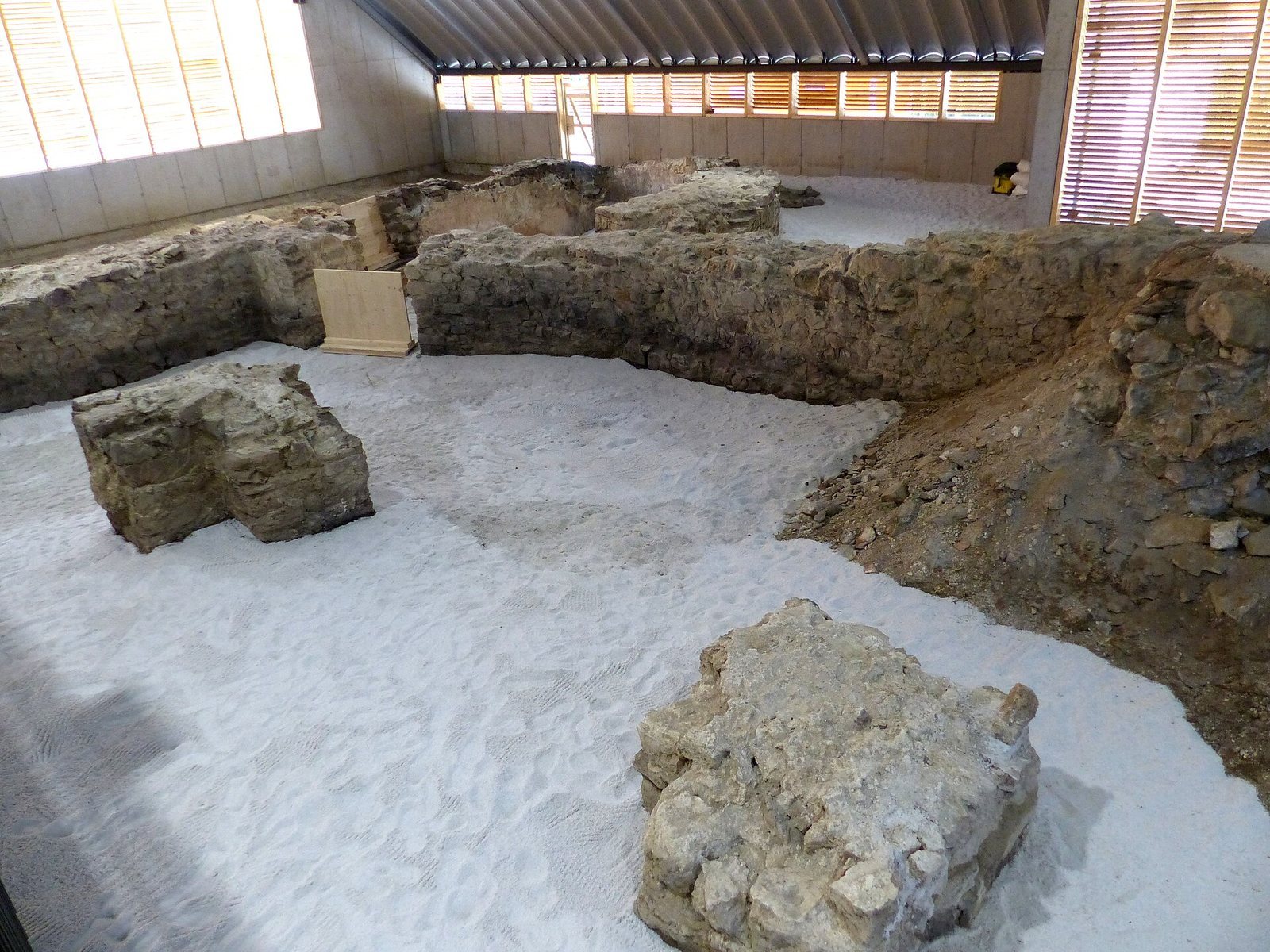
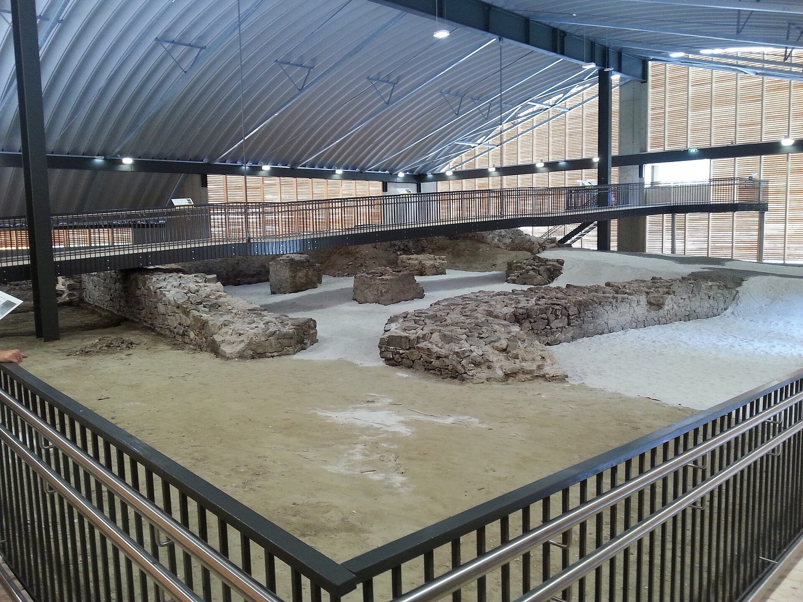
A timber-and-steel protective building covering about 1,000 square metres was erected over the excavated remains in 2018. The site is now a branch of the Upper Austrian Landesmuseum. It has been protected as an archaeological monument under the Austrian Monument Protection Act since 1985 and has formed part of the UNESCO World Heritage property of the Danube Limes since 2021.
Remains
Kleinkastell Oberranna is a compact rectangular stone fortification with four round corner towers. Its short axis runs from northeast to southwest, and it stood directly beside the Roman frontier road on the right bank of the Danube, opposite the mouth of the Ranna. Published dimensions give the fort as 12.5 by 17 metres, while the excavated plan indicates a central area of about 15 by 17 metres within overall external dimensions of approximately 28 by 29 metres. The foundations reached as much as 1.5 metres deep, and surviving wall sections rise more than two metres above them.
Outer fortification
Northern and eastern towers
The corner towers were generally about eight to ten metres in diameter and probably had three storeys, perhaps reaching approximately ten metres in height. Entry was through a gate between the northern and eastern towers, and one gate jamb was exposed during the 2018 excavations.
The northeastern tower survives to a height of up to 2.5 metres above foundations 1.5 metres deep. Its Roman lower storey was incorporated into the cellar of the later inn. A second medieval wall ring was built directly against the Roman masonry and supports the present cellar vault. Part of the Roman fabric was destroyed when another cellar entrance was made in the twentieth century. The southeastern tower, partly exposed in 1840, remains underground as an archaeological reserve. It has a stated diameter of 4.8 metres and walls 1.6 metres thick. Its position and extent are marked by a layer of grey gravel.
Southwest wall and tower
The southwest wall exposed during the 1960s is approximately 9.75 metres long, about 1.6 metres high, and around 1.5 metres thick at its centre. It consists of rubble stone set in hot mortar. The southwestern tower was almost completely destroyed during construction of the filling station in 1960 and was exposed again in 2018. A 1.5-metre-wide opening on its northern side led into the lower storey. Waterproof mortar in the room suggests that it may have contained a sweat bath, known in Roman architecture as a laconicum or sudatorium.
Northwestern tower and bath
Heated and cold rooms
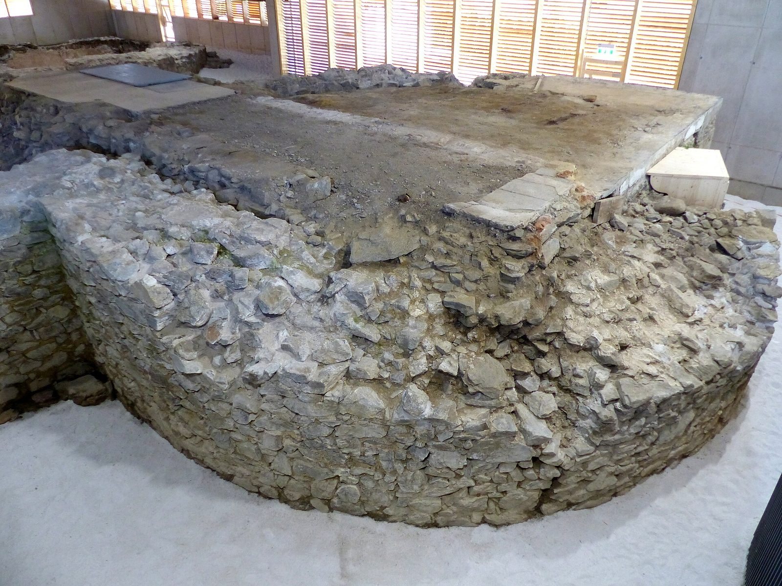
The northwestern tower was larger because it contained a bath. A partition wall 7.8 metres long and 0.75 metres thick divided the tower into two rooms. The heated room, or caldarium, had a hypocaust, a heating system that circulated hot air beneath floors and through walls, together with hollow-brick walls. The adjoining cold room, or frigidarium, contained a bathing basin, or piscina, that survives largely intact.
The bath’s unusually hard, waterproof wall plaster remains in place and still carries visible fingerprints. Three stone benches stood in the cold room. The basin was built directly into the tower’s enclosing wall, showing that the bath was incorporated into the fort from the beginning rather than added later. Its water was probably heated in a cauldron outside the tower.
Heating and drainage
A surviving lead pipe carried wastewater away from the bath. The floors were made from bricks of different sizes, probably reused from a demolished building. A partly brick-lined channel led to the praefurnium, the furnace or heating room outside the southern side of the tower. Two short sections of its furnace walls survive, while the remainder was destroyed in 1960.
The two bath rooms were joined by a doorway 1.5 metres wide. A heating channel directed hot air into the hypocaust beneath the heated room and basin, and through hollow bricks in their walls. The warm air probably rose into upper rooms and escaped through openings near the roof. A niche 1.5 metres wide in the southwest wall may have held an imperial or divine statue, or may instead have accommodated hollow bricks belonging to the heating system.
Internal accommodation
Troop quarters and courtyard
The troop accommodation, or contubernia, was built directly against the inner rear sides of the fortification walls. Contubernia were small shared living units for Roman soldiers. A small central courtyard improved lighting and ventilation. The front of the accommodation rested on four pillars with square foundations identified during excavation. It remains uncertain whether the quarters were partly built of stone or entirely constructed from timber.
A projecting foundation section survives along the western wall. Beneath the protective building, the excavated remains include the lower storey of the northwestern tower, the foundations of the southwestern tower, the marked position of the unexcavated southeastern tower, other wall foundations, and surviving courses of rising masonry.