Kızkalesi: A Medieval Island Fortress in Türkiye
Site at a Glance
- Rating
- 4.4
- Popularity
- Medium
- Country
- Turkey
- Primary era
- Medieval
- External website
- Open
- Eras represented
- Medieval
- Civilizations
- Byzantine, Kingdom of Cilicia
- Site type
- Military
- Remains
- Castle
On this page12 sections
History
Kızkalesi is a medieval fortress on an island off the Cilician coast of Türkiye, whose earliest fortifications belong to the Byzantine period. The island fortress formed part of the fortified settlement of Korykos and was later rebuilt under the Armenian Kingdom of Cilicia. Its history also includes periods of Cypriot protection, Genoese commercial activity, Karamanid conquest, and Ottoman control.
Byzantine and Armenian Foundations
In antiquity, the island was known as Krambusa or Krambus and was reportedly used as a base by Mediterranean pirates. The first fortifications are associated with the Byzantine Empire, the medieval eastern Roman state centered on Constantinople. One interpretation places the strengthening of the Korykos defenses in the ninth century, when Byzantine authorities responded to Arab attacks. Another view assigns the main development of the island fortress to the twelfth century.
A further tradition connects the fortress’s initial construction with Eustathios Kiminian, a Byzantine official who led a fleet in 1104. Emperor Alexios I Komnenos reportedly sent him to restore and fortify the ruined settlement of Korykos against a possible attack by Bohemond of Antioch, a major leader of the First Crusade and ruler of the Crusader principality of Antioch. A Byzantine garrison commanded by a stratigos, a military governor or commander, was then stationed at the restored settlement. The attribution of the island fortress to Eustathios remains disputed.
Korykos and Krambus briefly came under the authority of Constantine I, an Armenian ruler, before returning to Byzantine control in 1137. In 1163, Prince Thoros II incorporated them into the Armenian Kingdom of Cilicia, a medieval Armenian state that ruled parts of southeastern Asia Minor and developed fortified coastal settlements. The island fortress was then restored and strengthened, probably at the same time as the mainland fortress.
An inscription dated 1199 states that King Levon I built the island fortress, although the wording may refer more accurately to its completion or restoration. Other rebuilding phases belong to the twelfth and thirteenth centuries. Inscriptions dated 1206 and 1251 refer respectively to Levon II and Hethum I. The island fortress and Korykos probably formed a separate feudal holding under the king of Cilicia.
Trade, Pilgrimage, and Political Change
Korykos became a transit point for pilgrims travelling from Constantinople to the Holy Land. King Philip II of France passed through Korykos on his return from the Third Crusade in 1191. In 1267, Korykos and Krambus entered the commercial system of the Republic of Genoa, a major Mediterranean maritime power, probably serving as transshipment points. From 1275, they also participated in the saffron trade with Mamluk Egypt, which was ruled by the Mamluk Sultanate.
After Oshin II, the last prince of Korykos, died in 1329, the fortresses passed into the domain of King Levon IV. Military pressure from the Anatolian Turkish beyliks, the regional principalities that expanded across Asia Minor, increasingly isolated Korykos from the rest of the Cilician kingdom. In 1360 and 1361, at the request of the Armenian population, King Peter I of Cyprus placed Korykos and the island fortress under Cypriot protection. They remained under the Kingdom of Cyprus until 1448.
In March 1367, the fortress and Korykos resisted an assault by forces of Alaeddin Karamanid, led by the Lusignan commander Jean de Lusignan. Ibrahim Bey, Alaeddin’s son, captured the fortress in 1448. Korykos and Krambus were incorporated into the Ottoman Empire during the 1470s, after which the island fortress remained under Turkish state control.
Ottoman Period and Later Interpretation
Around 1481 or 1482, Cem, son of Sultan Mehmed II, briefly took refuge at the fortress while fleeing his brother Bayezid II. He later departed for Rhodes. The site subsequently became associated with the story of a princess confined on the island after a prophecy that she would die from a snakebite. The name Kızkalesi, meaning “Maiden’s Fortress,” derives from this tradition, although similar stories are attached to other fortresses.
Modern investigation has clarified the fortress’s successive phases. Research published in 1982 and 1987 distinguished surviving Byzantine and Armenian features, while a photographic survey of the two Korykos fortresses took place between 1973 and 1981. Restoration of the towers in 2001 led to the discovery of more than a dozen skeletons. Investigations concluded that they belonged to victims of a violent crime approximately 45 years earlier. Restoration and archaeological work have continued in recent decades, and excavations by the Mersin Museum revealed the complexity of the buildings that once occupied the interior.
Remains
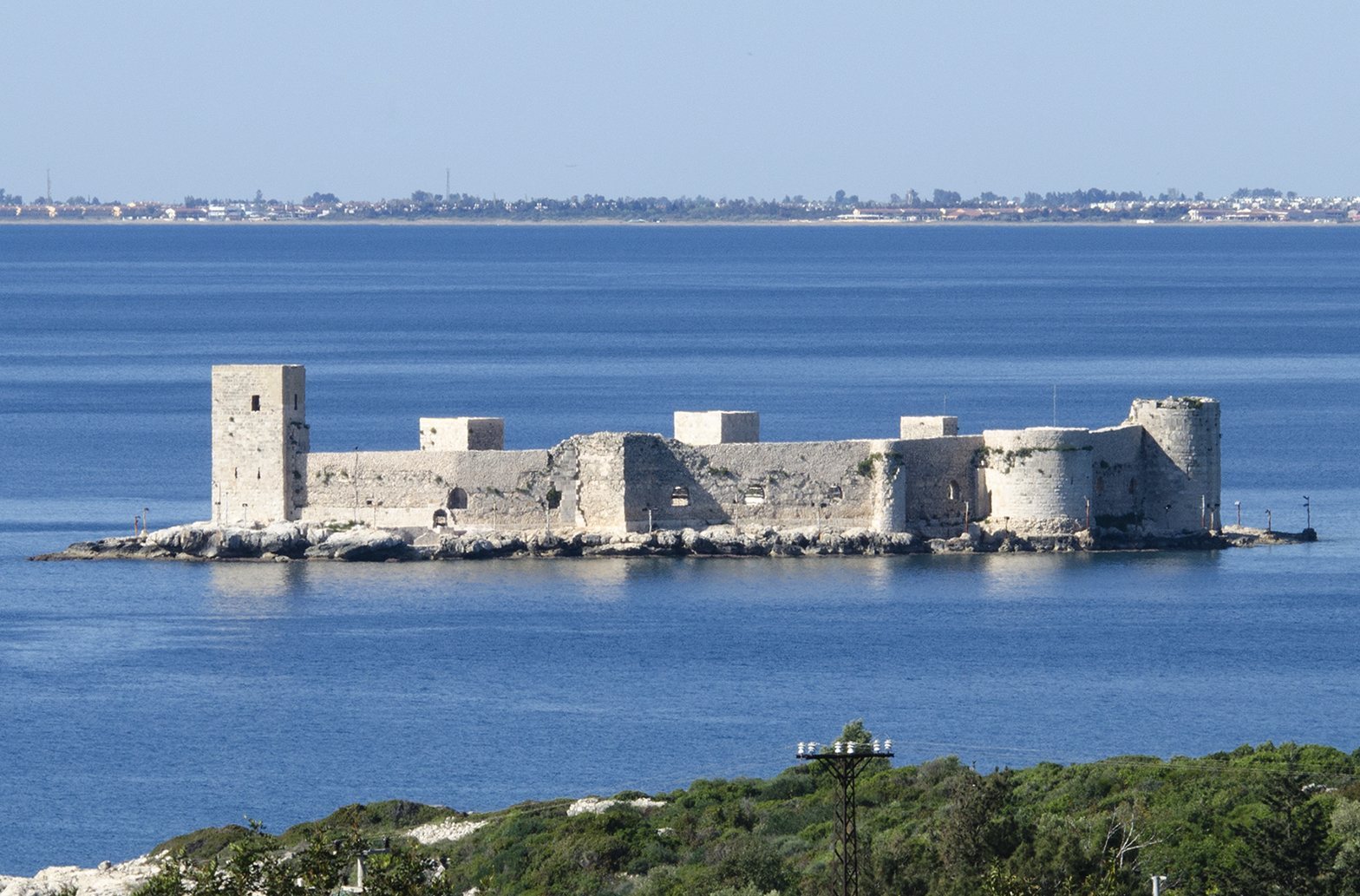
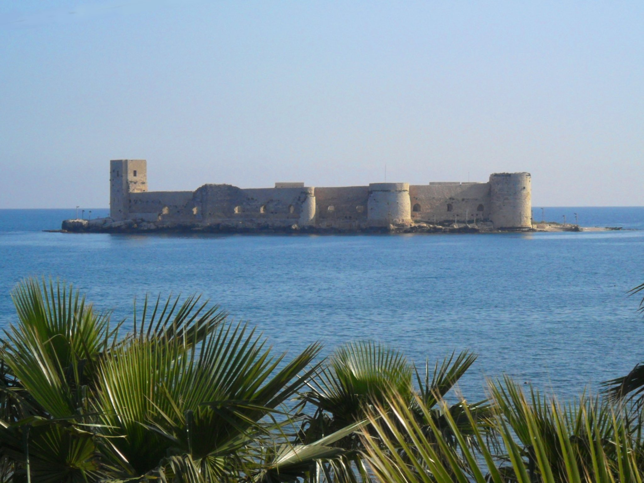
Kızkalesi occupies most of a small island of approximately 15,000 square metres, located several hundred metres offshore and about 600 metres from the mainland fortress of Korykos. The irregular polygonal enclosure has eight towers joined by walls measuring approximately 192 metres in total. Its greatest east to west width is about 75 metres. The southern and western walls meet at approximately right angles, while curved walls enclose the northern and eastern sides.
Walls and Towers
Southern and Western Defences
The southern wall has three rectangular towers, including the highest tower at its eastern end. This tower rises through three storeys. The western wall has a semicircular projection at its centre and a round tower at the northwestern corner. Defensive loopholes, narrow openings through which defenders could observe or fire outward, pierce the walls.
The masonry combines dressed and bossed ashlar, undressed blocks, reused stones from ancient buildings, and smaller masonry associated with Armenian construction. Armenian rebuilding introduced distinctive rusticated ashlar on the northern and western sides and added new facing stones across much of the earlier structure. These differences preserve the changing character of the Byzantine and Armenian building phases.
Eastern Bastion and Inscriptions
A three-storey main bastion occupies the eastern end of the fortress. Building inscriptions in Armenian were once placed above the inner entrance of the eastern corner tower. One remains above the restored doorway, while another has disappeared. The surviving inscriptions include the references dated 1206 and 1251, linking the eastern defences with the reigns of Levon II and Hethum I.
Entrances and Internal Gallery
The principal entrance opens on the northern side. A smaller sea exit lies on the western side beside a well-preserved covered stone gallery running along the inner face of the western wall. The gallery opens inward through arches and formed part of the fortress’s protected circulation and defence system.
Interior Buildings and Water Storage
Chapel and Courtyard
The interior formerly contained a chapel, workshops, cisterns, and other buildings. The chapel was rebuilt several times and had a barrel-vaulted roof. Its floors, like those of some other interior buildings, carried partially preserved mosaics. Remains of the chapel survive in the courtyard together with a cistern, a purpose-built reservoir for storing water.
Harbour Works and Submerged Ridge
Local tradition holds that a causeway or mole once connected the island with the mainland fortress. Navigation charts show a submerged ridge extending from a coastal projection toward the island, and remains of a mole have been reported on the western beach and near the mainland fortress. Whether this ridge formed the southern boundary of the ancient harbour and actually joined the two fortresses remains uncertain.
In 1811 and 1812, the British captain Francis Beaufort recorded that the mole from the mainland fortress extended approximately 100 metres into the sea and ended in a platform for a lighthouse. The island fortress now survives as a ruined or partially standing monument, with restored elements, walls and towers, the internal gallery, archaeological remains of its buildings, mosaics, and inscriptions.