Kanlıdivane: An Ancient Olban Sacred Settlement
Site at a Glance
- Popularity
- High
- Country
- Turkey
- Primary era
- Medieval
- Eras represented
- Classical, Medieval
- Civilizations
- Byzantine, Roman
- Site type
- City
On this page20 sections
History
Kanlıdivane, the site of ancient Kanytelis, is an Olban sacred settlement near Erdemli in Mersin Province, Türkiye. Its occupation began during the Hellenistic period, probably by the third century BCE, although its precise foundation date is unknown. The Olba Kingdom was an ancient realm in Cilicia, the region of southeastern Anatolia that includes Mersin. Its priest-kings held both political and religious authority.
Hellenistic and Roman settlement
The earliest settlement developed at the bottom of the sinkhole. Over time, activity shifted to the surrounding ground and spread farther outward. An inscription on the Tower of Zeus Olbios names Teukros, son of the Olban priest-king Tarkyaris, as the tower’s builder and as its dedicator to Zeus Olbios, a local form of the Greek god.
Olba became a Roman vassal in the first century CE. Kanytelis prospered in the third and fourth centuries CE, when it was probably an outlying extension of Elaiussa Sebaste, an ancient city on the Cilician coast. In the fifth century, inscriptions linked Kanytelis with Elaiussa Sebaste.
Christian Neapolis
During the reign of the Roman emperor Theodosius II, a Christian religious center was established at Kanytelis, the settlement was enlarged, and its name changed to Neapolis, meaning “new city.” Its large rectangular churches, or basilicas, reflect a gradual change from worship of Zeus to Christian practice. Neapolis continued as a religious center into the sixth century.
After the earthquake of 526, Neapolis began to lose inhabitants and decline. The Byzantine emperor Justinian I directed building and defensive efforts toward cities considered more strategically important, including nearby Corycos. The city’s decline continued amid the advance of Muslim forces.
Abandonment and later interpretation
The Seljuk conquests of Anatolia in the eleventh century brought the settlement’s occupation to an end. The Seljuks gave it the name Kanlıdivane, often translated as “bloody madness,” but the name’s origin is uncertain. Proposed explanations connect it with Kanytelis, the sinkhole’s reddish appearance, or gatherings held by Turkmen communities. A tradition links the name to crimes said to have taken place at a cursed site. A story that Roman criminals were thrown into the sinkhole for wild animals to devour is unsubstantiated and may have shaped later interpretations.
A sacred tree at the site reflects its continuing association with mystical beliefs among local people. In the mid-nineteenth century, the French orientalist and traveler Victor Langlois examined the ruins and identified them as Byzantine Neapolis. Semavi Eyice led research there in 1970, and investigations resumed in 2006 under archaeologist Hatice Pamir of Mustafa Kemal University in Antakya.
Remains
The sinkhole and its reliefs
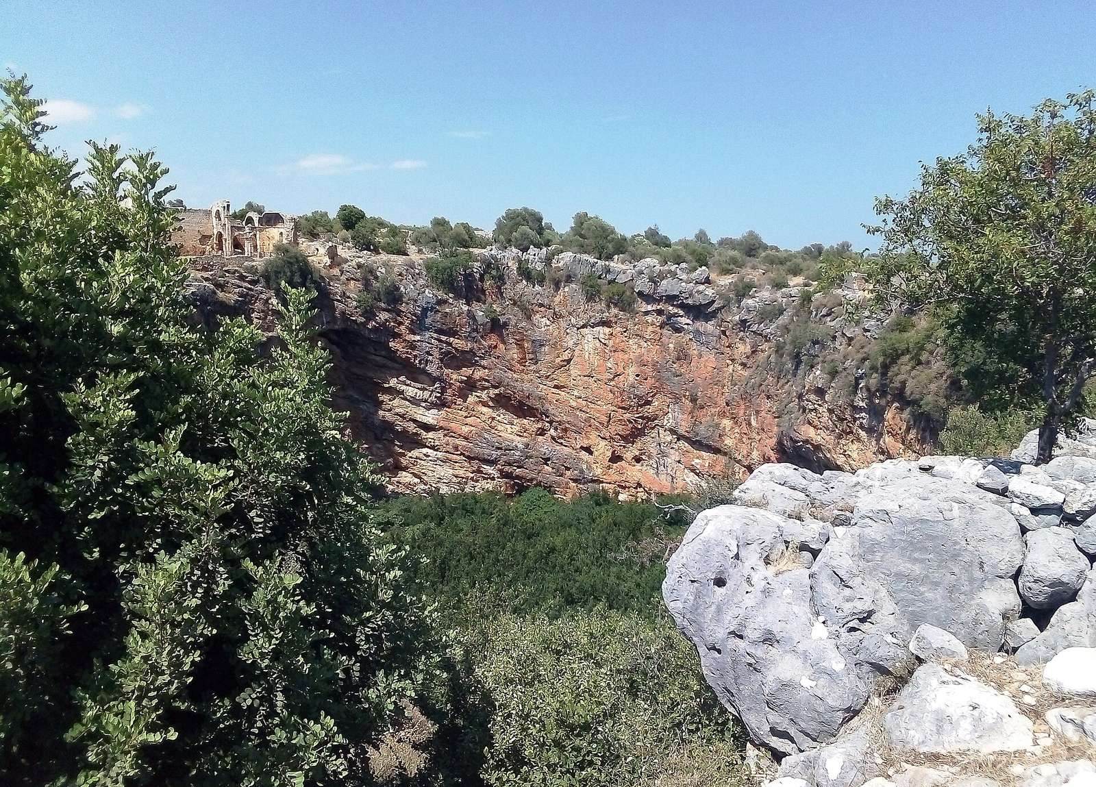
The settlement is arranged around a natural sinkhole, perhaps created by the collapse of a cave eroded by groundwater or by an earthquake. It measures about 70 metres across, reaches 60 to 70 metres deep, and extends as much as 130 metres along its longest dimension. Its sides are steep, with some sheer sections. A rock-cut path on the southern side and ancient stairs to the southeast descend to the bottom. Another stairway once linked a cave at the base with the Church of Papylos at the northwestern rim. Iron-rich clay gives the walls and floor their reddish color; rain carries clay particles down the sides, leaving streaks.
The Armaronxas family carving
Near the bottom of the southern side, below the tower, a rock carving occupies a rectangular niche. About four metres wide and two metres high, it shows six members of the Armaronxas family, a father, mother, son, and three daughters, at a funerary banquet. A five-line inscription beside the figures gives the family name. The carving dates to the early Roman period.
The soldier carving
A separate carving on the western wall at the bottom of the sinkhole depicts a Roman soldier, probably from Cilicia. He holds a spear in his right hand and rests his left hand on a sword hilt at heart level. A badly worn inscription identifies the warrior.
Tower of Zeus Olbios
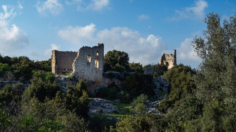
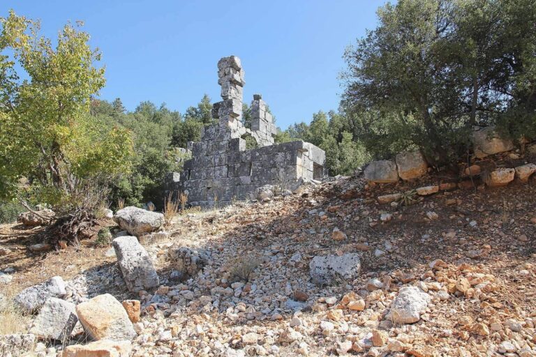
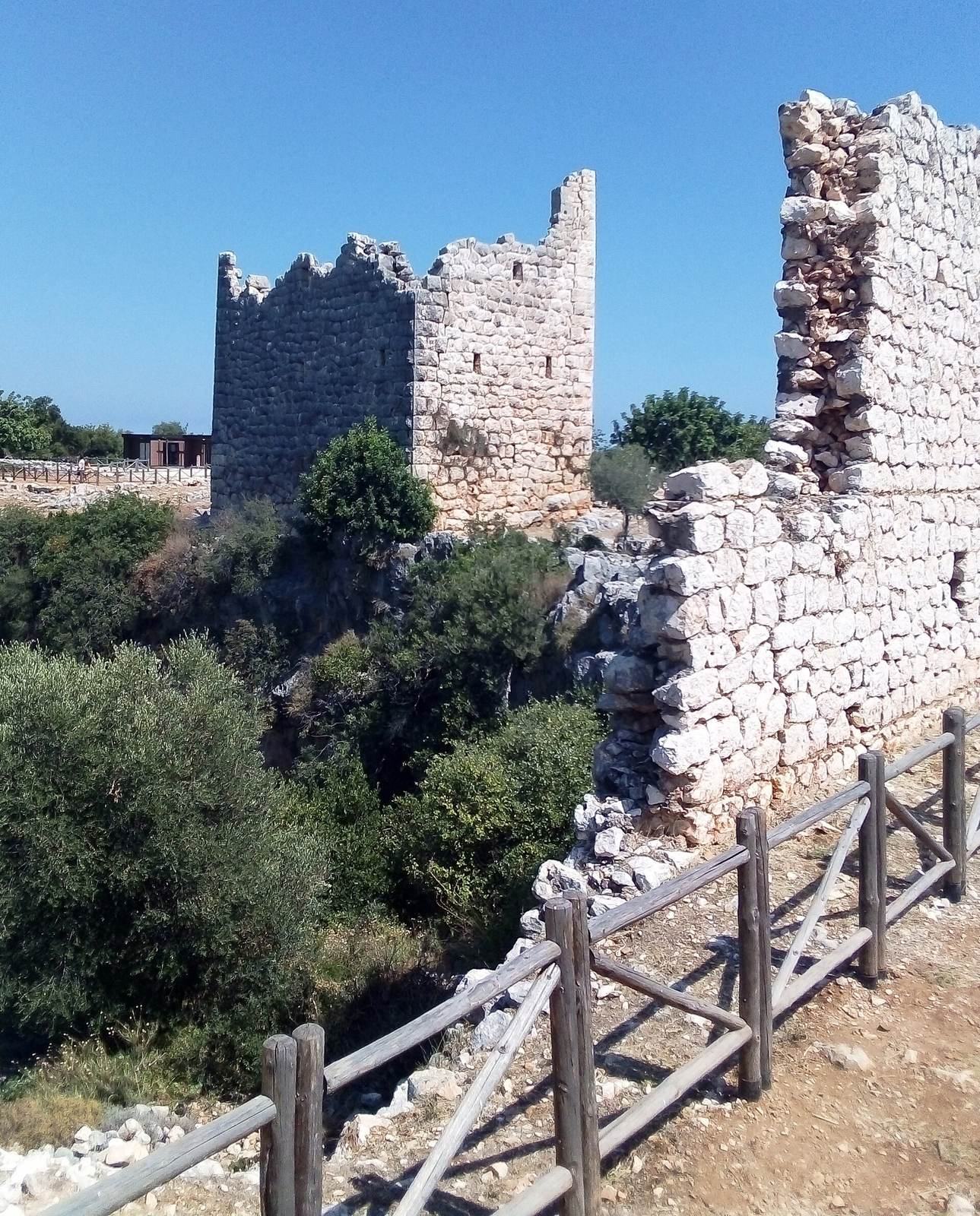
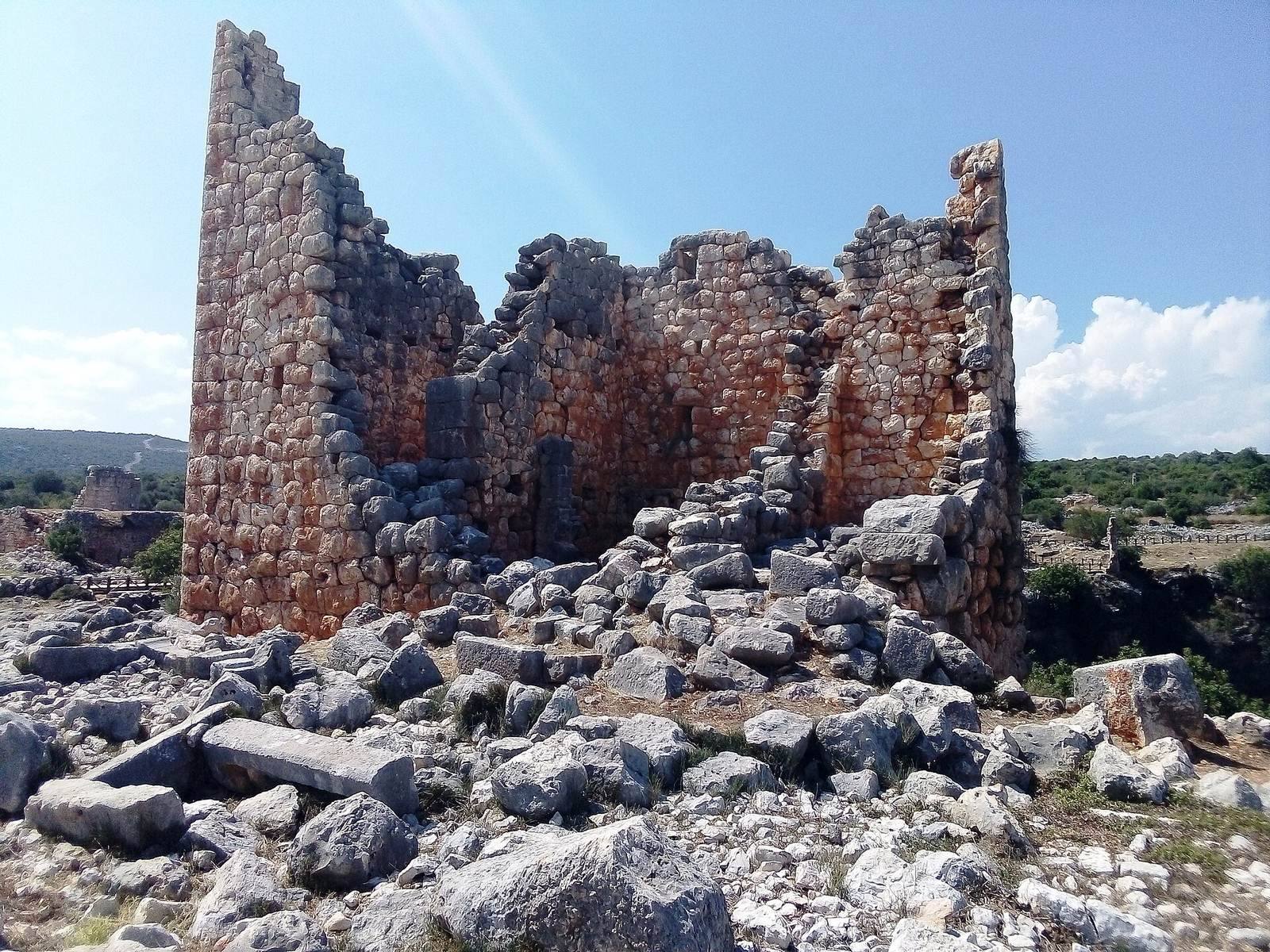
On the sinkhole’s southwestern side stands the oldest surviving structure at the site, a Hellenistic tower dating to about 200 BCE. Built entirely of stone without mortar, it measures roughly 15 metres long by 9.2 metres wide and now stands 17 metres high. It is partly collapsed and was once taller. The windowless ground floor is surmounted by two upper floors, each with three rooms.
The small eastern entrance is about 90 centimetres high, with an arch made from seven large stone blocks. Two inscriptions are set into blocks at the southwestern corner. A triskelion, a symbol of three legs arranged like a wheel, is carved on the tenth block up from the bottom; the emblem also appeared on coins of the Olba Kingdom.
Churches
Five churches were built between the late fourth and mid-sixth centuries, and remains of four survive. Three stand away from the sinkhole rim, two to the east and one to the northeast; the fourth is at the northwestern edge. All are oriented from west to east and follow a basilica plan. Each had a narthex, or entrance area, a nave, the main interior space, and two narrower side aisles, with an apse, the usually rounded end, beyond the nave. Surviving decoration includes crosses above door lintels and carved stone capitals, the shaped tops of columns.
First Basilica
The First Basilica, closest to the Tower of Zeus Olbios, is distinguished by a façade with three arches.
Fourth Basilica, or Church of Papylos
At the sinkhole’s northwestern rim, the Church of Papylos has an entrance to an underground storeroom opposite its three-arched narthex. On the west, three arches, each supported by two columns, open toward a courtyard surrounded by an atrium, or courtyard space. Stone supports along the top of the western wall may have carried a second wooden floor above the narthex. Its capitals are more finely worked than those of the other churches and have forms resembling fern fronds. A paired window lit the apse, which was once painted with the four Evangelists. Papylos, a religious figure, built the church as an act of devotion. An inscription above the main entrance reads, “This is the door that leads to God. Those who enter are saved. May God help me.”
Cemeteries and tombs
Northern cemetery
The northern cemetery covers about 4.5 hectares on high ground. It contains numerous stone coffins, some with lower burial compartments beneath them and raised bases, as well as three temple-shaped tombs and an exedra, a recessed or semicircular architectural space. Queen Aba’s mausoleum stands at the cemetery’s highest point. The structure measures about five metres in length, width, and height. An inscription on its front identifies those buried there. Aba built it for her husband and two sons, who may have died in a plague.
Northwestern slope and roadside burials
Another cemetery on the northwestern slope includes stone coffins with lower burial compartments and small temple-shaped tombs. Cemetery remains also occur on both sides of a road branching off from the coastal highway.
Çanakçı rock-cut cemetery
Less than a kilometre west of the sinkhole, at Çanakçı, a shallow ravine contains numerous tombs cut into the rock, stone coffins, carved human figures, and inscriptions. The tombs date to the Roman period. Some inscriptions threaten potential tomb robbers.
Houses and production areas
Homes and streets
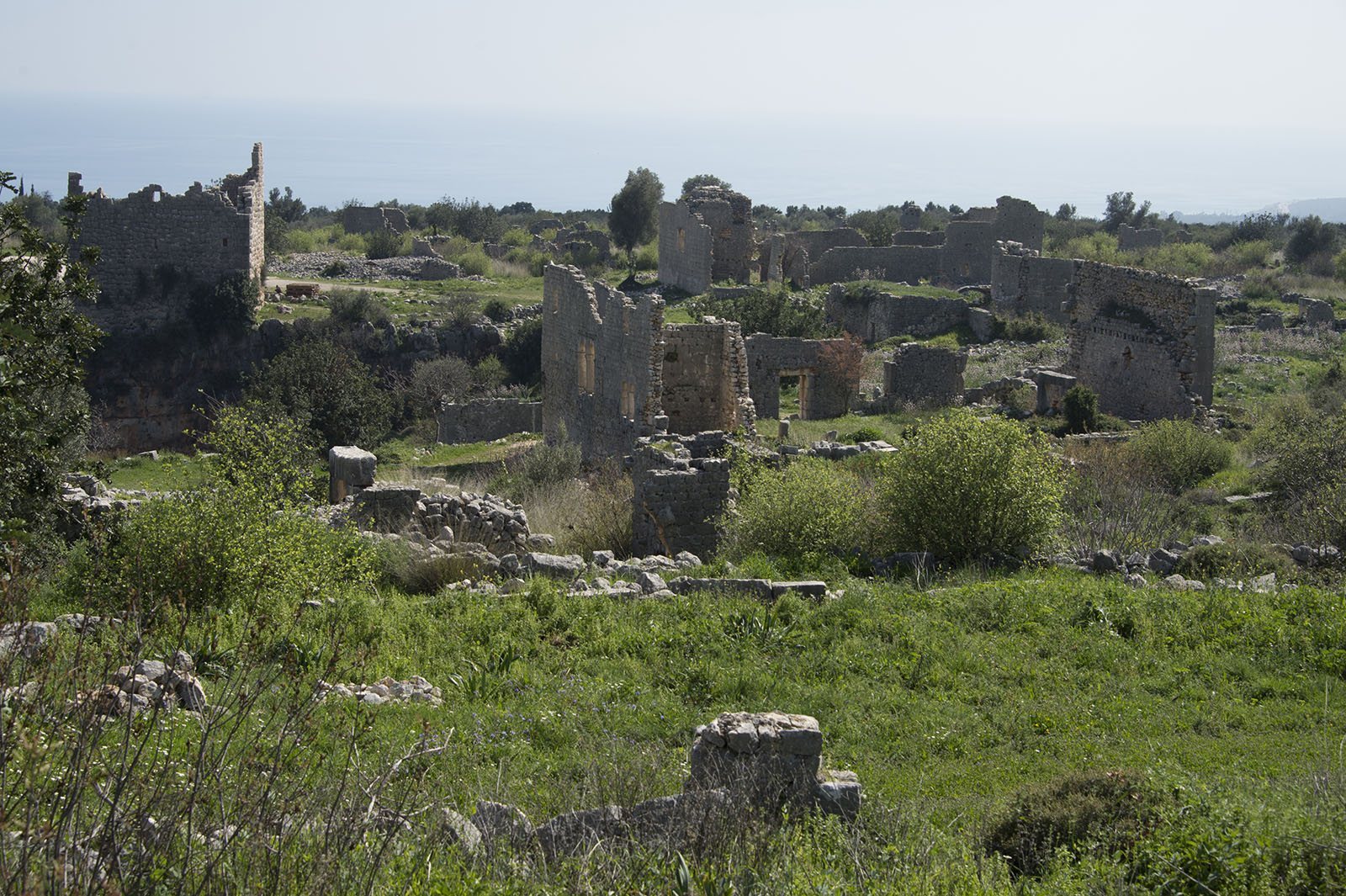
Remains of about 80 houses, most dating to the later Byzantine centuries, lie south and east of the sinkhole. Elsewhere, traces of streets, houses, and workshops survive. A mill retains its millstone, and a press cut into the rock was probably used to produce olive oil.
Olive-oil production
Surface surveys identified 15 workshops and equipment associated with production, including presses, press beds, weights, crushing vats, and grinding stones. Together, these remains indicate that the city was an important olive-oil production center in Late Antiquity, the transition from the classical Roman world to the early medieval era.
Water and drainage
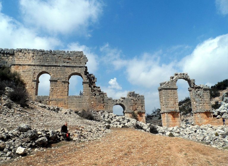
An aqueduct, a built channel for carrying water, ran along the coast through the province, and scattered remains survive. Large reservoirs stored water for distribution to smaller tanks across the settlement. Remains of a drainage or sewer system have also been identified.