Kara-Tobe Castle: A Greco-Scythian Fortified Settlement in Ukraine


Site at a Glance
- Rating
- 4.5
- Popularity
- Very Low
- Country
- Ukraine
- Primary era
- Classical
- External website
- Open
- Eras represented
- Classical
- Civilizations
- Kingdom of Pontus, Scythian
- Site type
- Military
- Remains
- Fortified Town
On this page17 sections
History
Kara-Tobe Castle is a Greco-Scythian fortified settlement in Ukraine, near Saky, occupied from approximately the fourth century BCE to the beginning of the second century CE. Its name comes from the hill on which it stands and means “black hill” in Turkic. The settlement developed through successive Greek, Pontic, Scythian, and Roman phases at a strategically placed coastal site.
Greek Settlement and Scythian Expansion
The earliest settlement emerged during the fourth century BCE, when the northwestern Crimean coastal zone, including Kerkinitis, became part of the state of Chersonesus. Chersonesus was a Greek city-state and colonial power whose agricultural territory included settlements and farmland across the northwestern peninsula. The surrounding land was actively cultivated, and grain from the region was sent to Chersonesus and then onward to other Greek centres.
In the first half of the second century BCE, the Scythians conquered the area and established a settlement at the foot of Kara-Tobe. The Scythians were an Iranian-speaking people whose communities in Crimea developed from mobile pastoral groups into settled societies with agriculture, fortified sites, and regional political structures. Kara-Tobe stood at a crossroads between routes connecting Kerkinitis with Scythian Neapolis and Chersonesus. Its elevated position also provided observation over the roads, lake shores, and Kalamita Bay.
The early Scythian settlement existed for about 70 years and was not fully fortified before it was lost. Later inhabitants dismantled its stone structures and reused the material, leaving the earliest phase poorly preserved.
The Greco-Pontic Fortress
During the conflicts between Chersonesus and the Scythians, Chersonesus appealed to Mithridates VI Eupator, ruler of the Pontic Kingdom. This Hellenistic state occupied territory on the southern and eastern shores of the Black Sea and was involved in major conflicts with Rome and neighbouring powers. Mithridates’ commander Diophantus defeated the Scythians and established a fortress at Kara-Tobe, probably the place called Eupatorion in ancient geographical writings.
A Greco-Pontic garrison was stationed at the fortress to control the surrounding roads. A stone victory stele or inscription found at the site records a victory by Pontic troops led by Aristonikos and is associated with the fortress’s establishment. A separate limestone slab discovered in 1987 bears part of a Greek inscription. It has been interpreted as a victory monument erected by troops under Diophantus, although that attribution remains an interpretation.
The Greeks later abandoned the fortress amid the political and military upheavals that followed Mithridates VI’s death in 63 BCE. From the middle of the first century BCE, Scythians reoccupied the abandoned stronghold and rebuilt the settlement.
Scythian Prosperity and Destruction
Kara-Tobe reached its greatest prosperity from the end of the first century BCE to the beginning of the first century CE. Its inhabitants combined agriculture, livestock raising, fishing, crafts, and metalworking. The settlement covered up to two hectares and consisted of a fortified central area with an adjoining unfortified settlement.
Around 20 CE, the army of Aspurgus, king of the Bosporan Kingdom, destroyed the settlement in a raid. The Bosporan Kingdom was a Hellenistic and later Roman-client state centred on the northern Black Sea region and eastern Crimea. The attack left a sudden destruction layer containing fire debris, ash, broken vessels, household objects, and weapons.
The Scythians partly restored and reoccupied Kara-Tobe after the raid, but the settlement did not recover its former prosperity. Renewed conflict with Chersonesus in the third quarter of the first century CE brought Roman intervention. Tiberius Plautius Silvanus Aelianus, the Roman legate of Moesia, led Roman forces into the region. Moesia was a Roman province in the lower Danube area, and a legate was a senior provincial military and administrative commander. The inhabitants abandoned Kara-Tobe without resistance, and Roman troops occupied it briefly.
After the Roman withdrawal, part of the Scythian population returned during the last third of the first century CE. A small settlement continued on the hilltop until the beginning of the second century CE, when Kara-Tobe was finally abandoned. The decline of Greek colonies and trade, weakening Scythian political authority, the difficulty of defending small settlements, and the growing threat of Sarmatian raids all contributed to the site’s end.
Rediscovery and Archaeological Research
Kara-Tobe was recognized as an ancient settlement by the beginning of the nineteenth century. The first recorded excavations took place in 1934 under Pavlo Mykolayovych Shults, after workers at a nearby brickworks exposed archaeological objects while extracting clay from the hill. Finds from this work were transferred to the Yevpatoria Museum of Local History, and research then stopped for a period.
Road reconstruction in 1982 cut into the southern slope and exposed a one-metre-wide section of cultural deposits extending for 140 metres. A cultural layer is an archaeological deposit formed by successive occupation, construction, destruction, and abandonment. Detailed research resumed in 1983 under Sergei Yuryevich Vnukov, and annual excavations have continued through the Karatobe archaeological expedition.
By 2007, approximately one-tenth of the settlement’s total area had been investigated. In 2000, the Museum of Antiquities of Northwestern Crimea and the International Centre for Experimental Archaeology and Innovative Pedagogy were established at the site. The excavated settlement and museum support archaeological research, educational work, and scholarly conferences.
Remains
Kara-Tobe occupies a high coastal remnant beside Lake Sasyk, near the modern village of Pryberezhne and west of Saki. The elevated ground overlooks the surrounding lake shores, ancient roads, and Kalamita Bay. The settlement’s physical remains preserve a fortified central area, associated rooms, an adjoining settlement, burial evidence, and successive occupation layers that provide a secure sequence for its ancient phases.
Fortress and Central Settlement
Greco-Pontic Fortress
The Greco-Pontic fortress, probably Eupatorion, was established in the late second century BCE over earlier structures. Those earlier buildings were dismantled during construction. The fortress occupied an approximately square area measuring about 100 by 100 metres, or roughly one hectare. It was probably enclosed by a stone defensive wall with towers at the corners. Inside were a central tower, two courtyards, and two rows of rooms arranged around the perimeter.
Central Tower and Scythian Settlement
During the later Scythian occupation, a smaller fortification remained in the central area and the tower continued in use. Narrow streets and small dwellings were built along the tower walls, while an unfortified settlement extended beside the defended centre. Excavated remains include the central fortress tower, or donjon, a principal fortified tower used as a strong defensive or residential element, several adjoining rooms, and part of the eastern defensive wall.
The settlement’s well-stratified layers provide a secure chronological sequence. Excavated material includes amphorae, lacquered vessels, bowls, jugs, cups, imported Greek pottery, locally made Scythian handmade pottery, tools, coins, personal ornaments, and iron slag from metalworking. Thirteen bronze coins were recovered, including six minted at Chersonesus.
Destruction Deposits
The destruction associated with the attack around 20 CE contains several dozen iron arrowheads, a dart or javelin point, two spearheads, broken pottery, and numerous household objects. Together with the fire and ash, these remains preserve the violent character of the settlement’s destruction and the material conditions of the buildings at the time of the raid.
Burials and Religious Features
Scythian Necropolis
A Scythian necropolis was excavated approximately 200 metres north of the settlement. Its burials belong to the period when Kara-Tobe was flourishing. Lamps and ritual censers were placed with the dead. Female burials contained necklaces, bronze rings, earrings, bracelets, and fibulae, ancient brooches used to fasten clothing.
The burial ground also contained subterranean family crypts. One excavated crypt held the remains of 20 people, providing evidence for collective burial within the settlement’s wider landscape.
Sanctuary near Lake Saki
A separate sanctuary dating from the first to the third century BCE was found approximately 1.5 kilometres south of Kara-Tobe, near Lake Saki. Its location places a religious feature within the broader landscape associated with the settlement.
Inscriptions, Hoards, and Later Evidence
The site’s inscriptions connect the fortress with Pontic military activity. A fragment of a stone victory monument names the victory of troops led by Aristonikos, a commander associated with Pontic forces. The limestone slab found in 1987 has been interpreted as another victory monument linked to Diophantus’s troops, though that identification is not certain.
A hoard of silver Roman coins was found in 1956 on the land between the lakes. It was interpreted as the property of a Roman legionary. Occasional remains from later populations also occur in the upper layers, including pottery belonging to the Saltovo-Mayaki period, an early medieval archaeological culture of the Pontic-Caspian steppe and adjacent regions.
Reconstructed and Museum Structures
Scythian Dwelling
A reconstructed Scythian dwelling was built near the fortress to illustrate the settlement’s lost domestic architecture. The museum exhibition draws largely on excavated tools, household vessels, ornaments, and other archaeological material from Kara-Tobe.
Twentieth-Century Coastal Defences
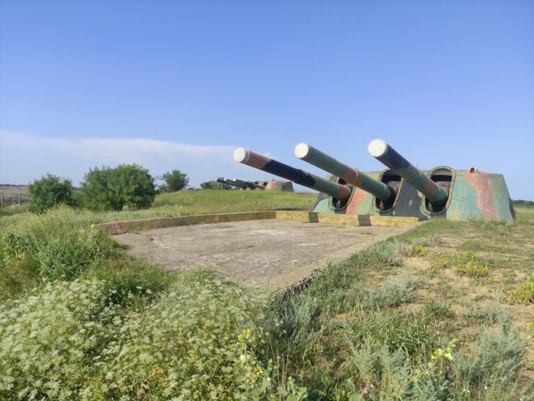
The museum occupies restored coastal-defence buildings constructed in the mid-twentieth century. They were formerly long-term firing positions used by sailors of the Black Sea Fleet. The upper floor includes an observation platform from which Kalamita Bay and the outline of the Chatyr-Dag mountain massif can be seen.
Nearby sites