Harfenburg: A High-Medieval Castle above Heddesbach
Site at a Glance
- Popularity
- Low
- Country
- Germany
- Primary era
- Medieval
- Eras represented
- Medieval
- Civilizations
- Holy Roman Empire
- Site type
- Military
- Remains
- Castle
On this page11 sections
History
Foundation and the Lords of Harfenberg
Harfenburg, also known as Harpfenberg, is a hilltop castle ruin above Heddesbach in northwestern Baden-Württemberg, Germany. It was probably established in the 12th century during the High Middle Ages, the central medieval period from the 11th to the 13th centuries. Together with Hundheim Castle near Neckarhausen, it is regarded as the oldest castle complex in the southern Odenwald.
The Lords of Harfenberg took their name from the castle, which served as their ancestral seat and held sway over the villages of Heddesbach, Brombach, and Langenthal. Bligger von Harpfenberg, a nobleman of the Steinach family, is first recorded in 1200.
Palatine control and decline
As the Harfenberg family declined, the castle passed to the Electoral Palatinate around 1300. This territory of the Holy Roman Empire was ruled by the counts palatine of the Rhine, whose ruler held the rank of imperial elector. In 1314, the Palatinate pledged the castle as security to the Lords of Hirschhorn. In 1340, the Count Palatine called on Engelhard von Hirschhorn to repair damage he had caused there. Whether repairs were completed is unknown.
Later history and archaeological investigation
From the 15th century onward, Harfenburg appears only as a field name. The State Office for Monument Preservation excavated the site in 1963–64, recovering finds that date mainly to the 13th century. Heddesbach’s municipal coat of arms, created in the 20th century, includes a harp recalling older arms associated with the Harfenbergers or the Steinachers.
Remains
Setting and layout
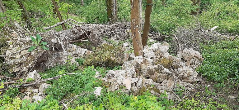
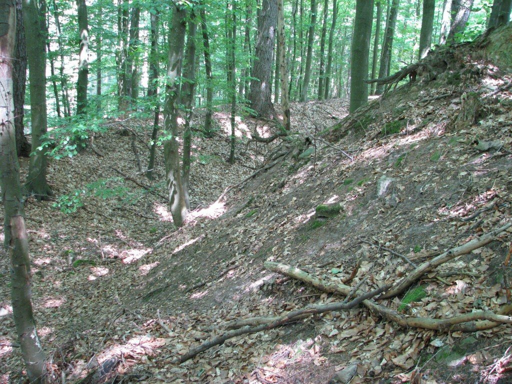
The ruin stands about 315 metres above sea level on a spur of the Schlossbuckel in the Odenwald, overlooking the Laxbach valley. Heddesbach lies about one kilometre to the south, down in the valley. Though little built fabric survives, the artificial shaping of the ground is still clear. The castle complex extends approximately 120 metres from north to south and 70 metres from east to west; relief measurements indicate an area of about 6,900 square metres.
Enclosures and defenses
Inner ward
The tree-covered inner ward, the castle’s main fortified enclosure, measures about 34 by 24 metres and is encircled by a ditch. A rubble mound toward the slope marks the probable position of a round keep, the castle’s principal fortified tower.
Outer bailey
A narrower, nearly square outer bailey, an additional fortified enclosure, lies directly south of the inner ward. It measures about 22 by 24 metres and adjoins the inner ward’s raised defensive bank and ditch system.
Entrance and northern approach
The former entrance probably stood on the west, where the corners of the inner ward and outer bailey meet. A small rise farther west may mark another defensive structure. Two further ditches cut across the northern approach toward the Schlossbuckel massif.
Road
An old road running north to south passes east of the castle. It survives as a sunken lane that branches several times above and below the site.