Archaeological Site of Grand: The Gallo-Roman City of Andesina


Site at a Glance
- Rating
- 4.4
- Popularity
- Low
- Country
- France
- Primary era
- Classical
- Eras represented
- Classical, Medieval, Early Modern
- Civilizations
- French, Roman
- Site type
- City
On this page17 sections
History
The Archaeological Site of Grand in France preserves the remains of a Gallo-Roman settlement, probably the city of Andesina, near the village of Grand in the Vosges. Strongly Romanized from the first century, it grew across about 60 hectares and may have supported roughly 20,000 inhabitants. Its scale and prosperity were probably connected with pilgrimage, water-related religious activity, and its position on the Roman road between Lugdunum, modern Lyon, and Durocortorum, modern Reims.
Andesina in Roman Gaul
Andesina lay within the territory of the Leuques, a Gaulish people whose lands occupied part of what is now northeastern France. During the High Empire, the period of greatest imperial stability and expansion in the first and second centuries AD, Grand stood near the boundary between Belgic Gaul and Germania. The territory of the Lingones was less than 20 kilometres away. Its exact institutional character remains uncertain, although the settlement’s location on the Roman road network helped connect it with wider regional activity.
A pre-Roman cult associated with Grannus, a healing and spring deity, has been proposed for the site. Another possibility is the development of a Gallo-Roman cult of Apollo Grannus, a healing deity formed through the association of Roman Apollo with the Celtic god Grannus. The existence and location of a sanctuary dedicated to Apollo Grannus at Grand remain unproven. Investigations have repeatedly sought such a sanctuary since the nineteenth century, with renewed research beginning in 2007 under Thierry Dechezleprêtre and a scientific council chaired by John Scheid.
Uncertain imperial associations
Earlier interpretations linked Grand with the sanctuary visited by the emperor Caracalla in 213 during the Germanic war. They also associated the settlement with the place where Constantine supposedly saw Apollo accompanied by Victory in 309. Both identifications are now uncertain. Caracalla may instead have visited the Apollo Grannus sanctuary at Faimingen in Raetia, a Roman province in the Alpine and upper Danube region, while Constantine’s vision may have occurred elsewhere.
Medieval contraction and Christian traditions
The settlement declined and probably contracted from the early Middle Ages. Five cemeteries of the Merovingian period, the early medieval era associated with the Merovingian dynasty in Gaul, show that activity continued during the sixth and seventh centuries. These burial grounds lay outside the ancient settlement, mainly in the eastern half of the commune and generally near roads. The Bréhaut cemetery was excavated by Jean-Baptiste Prosper Jollois between 1820 and 1822.
During the medieval period, much of Grand belonged to the County of Champagne, while nearby villages depended on the duchies of Lorraine and Bar. Medieval passion narratives about the martyrs Eliphius and Libaire connected the Christian history of Grand with the earlier pagan sanctuary. The Gothic parish church of Sainte-Libaire was later built above the former sacred pond, giving the area a new religious setting.
Archaeological rediscovery and protection
Knowledge of the ancient remains was preserved in eighteenth-century writings, including those of Augustin Calmet and the Comte de Caylus. In 1820, Jean-Baptiste Prosper Jollois began studying the amphitheater and produced the first archaeological map of the site, followed by a second study. Research continued through the conservators of the departmental museum of the Vosges, first Jules Laurent and later Félix Voulot. Voulot discovered the building traditionally called the “basilica” and its mosaic in 1883.
Methodical excavation remained limited between 1884 and 1936, although Maurice Toussaint made discoveries shortly before the Second World War. Camille Jullian and Albert Grenier also examined Grand in the early twentieth century. Édouard Salin revived research in the 1960s, and Jean-Paul and Chantal Bertaux, working under Roger Billoret, carried out systematic investigations of the amphitheater and established the unusual character of its semi-amphitheater plan.
The amphitheater was designated a historic monument in 1846. The building traditionally called the “basilica,” together with its mosaic, received the same protection in 1884. Following Salin’s initiative, the amphitheater was systematically cleared from 1963 under Roger Billoret. About 50,000 cubic metres of earth were removed by 1981. Wooden seating installed between 1993 and 1995 helped reconstruct the building’s form and protect the limestone, although the seating later deteriorated and no longer supports large spectacles.
Later archaeological work included preventive excavations by the National Institute for Preventive Archaeological Research, aerial surveys, and investigations of the ancient territory of the Leuques. These studies located the Fontainotte domus, the Violette villa, residential quarters, four Roman bath complexes, and numerous water installations. The site is administered by the departmental council of the Vosges.
Remains
Grand occupied a forest clearing on a limestone plateau at more than approximately 350 metres above sea level, between the Ognon to the west and the Maldite to the east, and between the upper valleys of the Marne and Meuse. The surrounding Mesozoic formations include compact, coral, and oolitic limestone with clay-rich marls. This stone supplied building material, although it was vulnerable to frost. At its greatest extent, the settlement covered about 60 hectares and combined a roughly circular cadastral pattern with streets radiating towards the surrounding countryside.
Settlement layout and water system
Urban enclosure
The circular organization is marked by the encircling route known as the Voie close, which follows an area approximately 880 metres in diameter. Most housing lay outside a monumental inner enclosure, while the principal public buildings were concentrated within it. The enclosure had an irregular six-sided plan, a perimeter of about 1,760 metres, and an interior area of approximately 18 hectares. Its walls were chiefly built in small masonry and measured about 2.70 to 2.80 metres thick. They probably rose to roughly 6 metres and carried a crenellated parapet. Gates and towers appeared at intervals of about 80 metres, with eighteen towers in all. The structure was an honorific enclosure rather than a defensive late-Roman city wall. It was progressively dismantled and had disappeared by the nineteenth century; Chantal Bertaux investigated its remains extensively during the 1960s and 1970s.
Underground water galleries
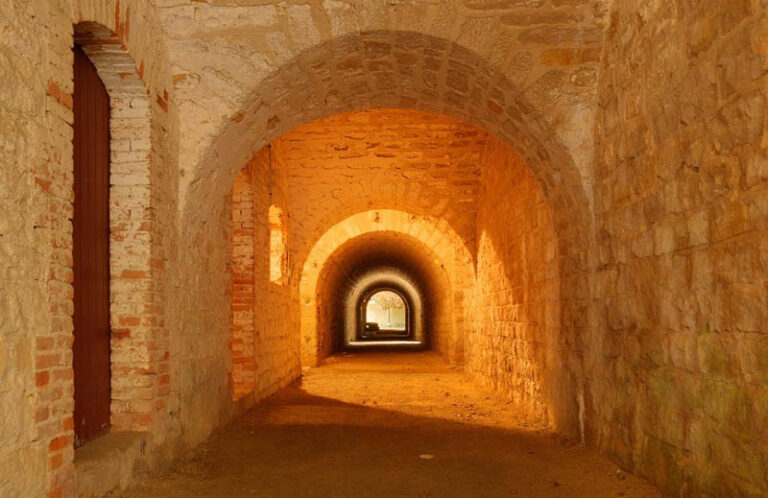
About 15 kilometres of underground galleries extend through the karstic limestone plateau, generally at depths of 4 to 12 metres. Karstic terrain is shaped by the dissolution and underground movement of water. The galleries regulated underground water associated with an ancient spring or pond, while a resurgence lay beneath the present Sainte-Libaire church. The system has been digitally modelled because the galleries are no longer freely visitable.
Approximately 307 wells have been recorded across the settlement. Their contents included grape pips, apple and pear seeds, and many other cultivated and wild plant seeds and fruits. These remains provide environmental evidence for the Gallo-Roman period. A spring-fed pond or karst resurgence formerly lay at the centre of the site. Water that reached the surface on the plateau later disappeared underground and re-emerged about 3.5 kilometres to the north as the Maldite, an upper course of the Ornain. The spring was intermittent and could dry up completely.
Sainte-Libaire church
The Gothic parish church of Sainte-Libaire was built between the late fifteenth and first half of the sixteenth century and substantially altered during an eighteenth-century restoration. It stands above the former sacred pond, which was filled and later covered by a Christian church. Underground water movement beneath the building, recognized in the 1990s, destabilized its foundations, and the church is in critical condition.
Amphitheater
The amphitheater was probably constructed at the end of the first century and could accommodate approximately 17,000 spectators. Its incomplete oval seating plan retains only the lower section, the ima cavea, giving the building its classification as a semi-amphitheater. The corridor measures about 148 metres in length and 65 metres in width, while the original height probably approached 25 metres. The structure was largely buried until systematic clearance began in 1963.
The building has an unusual hybrid plan. One interpretation holds that it began as a Gallo-Roman semi-oval theater and was later adapted into an arena by doubling the orchestra, the level area between the audience and the stage or arena. Monumental corridors stood to the east and west, and cells for gladiators and animals replaced a conventional stage building. Late-first-century construction used small rubble concrete, while large stone blocks were added in repairs to the western section during the early third century. After abandonment in the fourth century, sections of the outer walls and several arcades remained.
Monumental buildings and possible sanctuary
The building called the “basilica”
The structure discovered by Félix Voulot in 1883 is conventionally called the “basilica,” although it does not have a true basilical plan and its original function is unknown. It has been interpreted both as an exceptionally luxurious meeting place and as a public building for assemblies, judicial activity, and commerce.
Its mosaic covers 232 square metres, making it the largest known mosaic in Lorraine. It was long dated to the middle of the third century, although some specialists now place it in the second half of the second century. Only about one third of the central emblema, the pictorial panel at the centre of a mosaic, survives. The scene may come from Phasma by the Greek comic playwright Menander, or it may show a pilgrim and a priest of Apollo Grannus. A panther, tiger, wild boar, and bear frame the central scene. The apse also contained luxurious opus sectile, a decoration made from fitted pieces of cut stone, especially marble, while geometric pelta shield motifs decorated its apse section.
Proposed central sanctuary
A proposed sanctuary complex included a rectangular colonnade about 6 metres wide around a sacred core. The core has been associated with the spring or sacred pond, a possible temple of Apollo, and the building called the “basilica.” The colonnade was described with marble and stucco walls and a polished terrazzo floor. Because the sanctuary itself has not been conclusively identified, this reconstruction remains uncertain.
The proposed Apollo temple has been assigned to the late first or early second century. Its suggested footprint measures approximately 31 by 62 metres on a platform about 3 metres high. Heavy destruction left few traces. Excavated fragments include figures or parts of a lioness, griffin, Silenus or satyr, maenad, faun, panther, ram, horse, Mercury, Asclepius, Hygieia, and Marsyas. They also include a child’s head possibly identified as Caracalla and part of a large imperial statue. The proposed construction used about eighty types of marble from across the Roman Empire.
Objects, inscriptions, and ritual evidence
Ivory tablets
Four ivory tablets found in 1967 and 1968 in the Jean Duvaux well formed two diptychs, each a hinged pair of panels. They had apparently been deliberately broken into 188 pieces. One diptych is held by the departmental museum of the Vosges in Epinal and the other by the Museum of National Antiquities at Saint-Germain-en-Laye.
The tablets reflect Egyptian traditions of the late Ptolemaic period or early Roman rule, together with eastern influences that spread in Gaul, particularly from the late second century. The names of the decans, subdivisions of ancient zodiacal astrology, were written in an ancient Coptic language using Greek characters. Astrologers used the tablets to prepare horoscopes and medical astrology, and they also served in magical rites.
Stele and religious inscriptions
A stone stele found in 1841 beside the road to the amphitheater measures 62 centimetres high, 42 centimetres wide, and 6.5 to 8.5 centimetres thick. Félix Voulot identified it as the goddess Meditrina, a Roman healing divinity associated by him with Asclepius. Other interpretations connect the image with the production of soap, cakes, cheese, or, more convincingly, beer. The stele is held by the departmental museum of the Vosges.
A votive inscription found during excavations in 1935 contains the phrase somno iussus. It has been interpreted as evidence for incubation, a healing ritual in which a worshipper slept in a sacred place and awaited a dream or divine appearance that might bring a cure or instruction. Associated purification and water rites have also been proposed. Other Roman finds from Grand include an inscription honoring Apollo and an equestrian statue of Jupiter, which is held by the Musée lorrain.